Severe Weather Potential in the Southeastern US

Top Stories
27 Jan 2021 6:35 AM
After Monday night's severe storms produced a deadly and destructive tornado in Alabama, we're still monitoring the frontal boundary that produced these storms that will continue to bring heavy rain, a wind threat, and a tornado threat to the Southeastern United States through Wednesday.
 For the latest updates on the severe weather potential be sure to tune into WeatherNation.
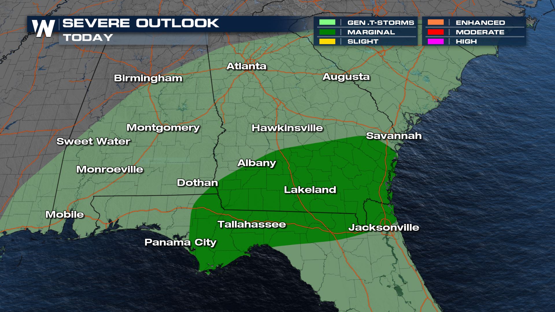
Severe Outlook
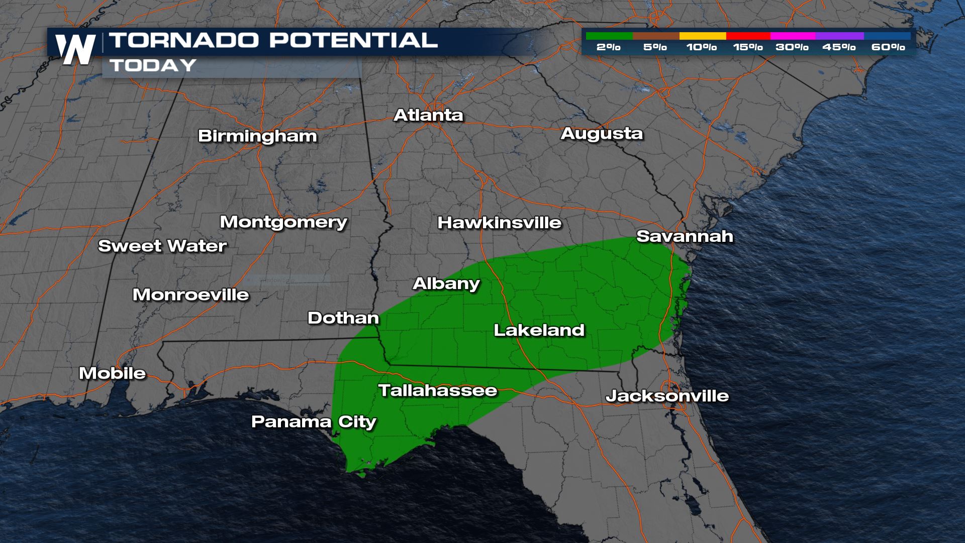
Wednesday
As we track this system into Wednesday, there is an additional risk for thunderstorms across the Southeast, with potential for severe storms around the Big Bend of Florida into Southeast Georgia . This is a marginal risk (level 1, on a scale of 1 to 5) in the warm sector of our frontal boundary. We may see some isolated damaging wind gusts and the possibility of a tornado or two.
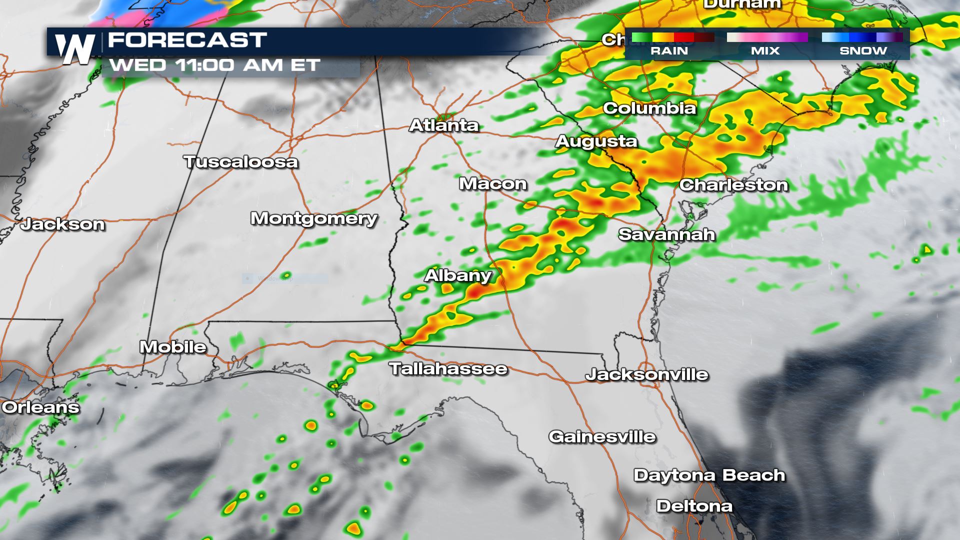
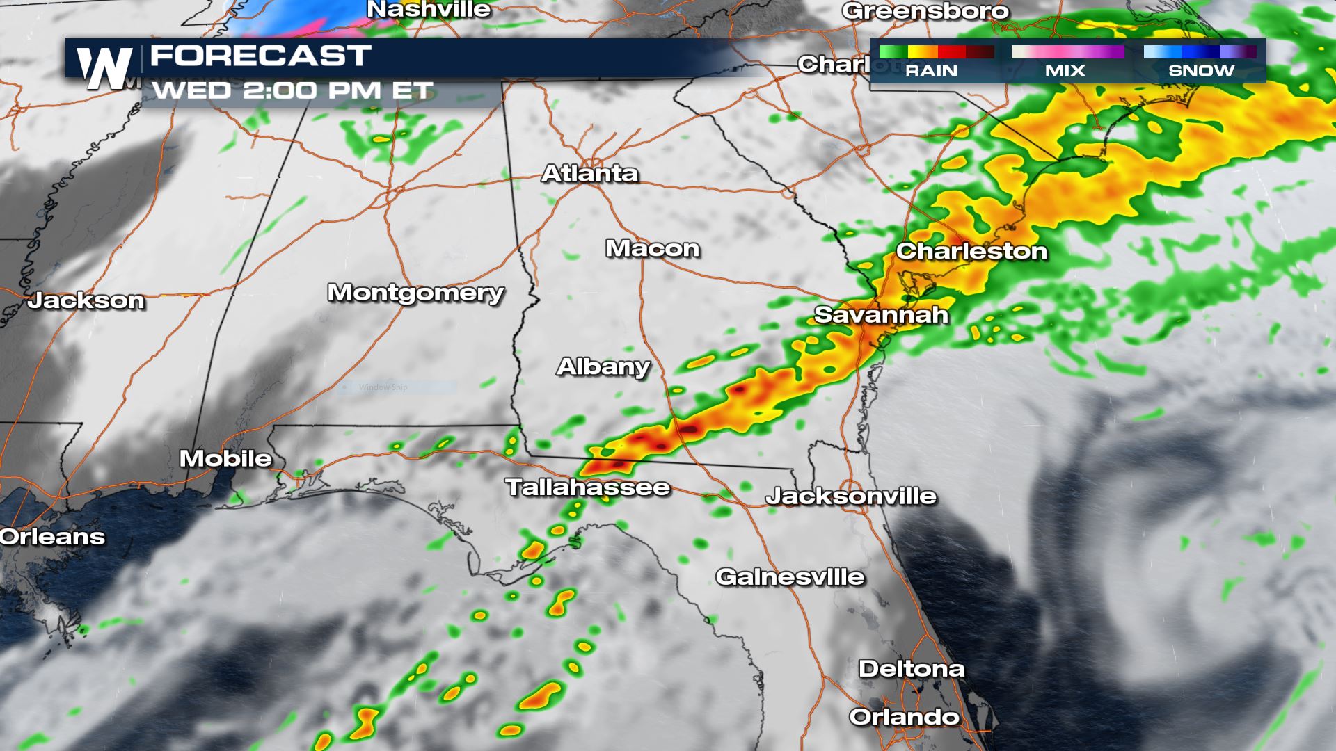
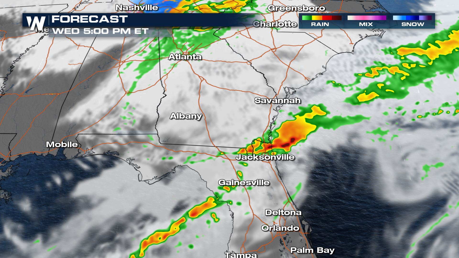
Forecast
A frontal-boundary moving to the southeast across the region will provide somewhat limited energy in a environment with good wind shear. This should lead to a line of storms with a few isolated severe cells. The I-10 and I-75 corridors could be impacted earlier in the day, while areas closer to I-95 will likely see potential impacts in the middle to late afternoon.
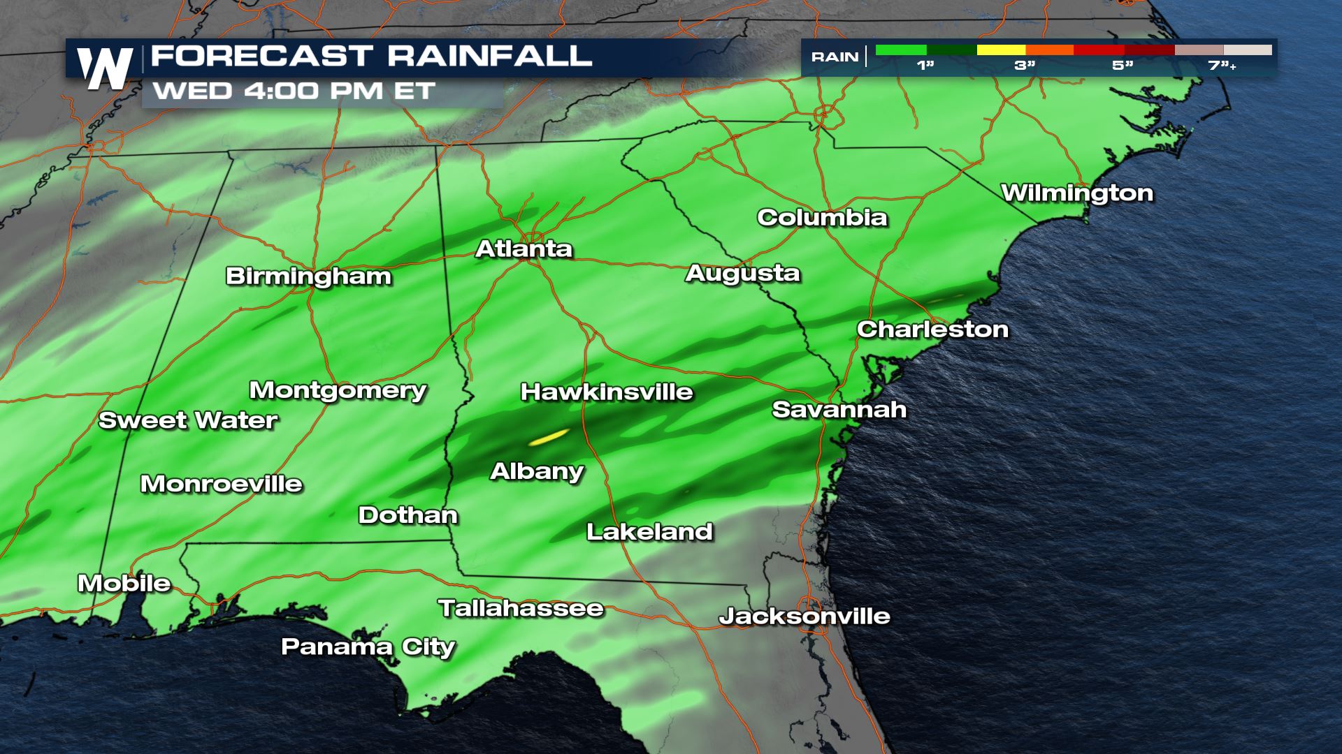
Forecast Accumulation
Rainfall totals have already been impressive along the Gulf Coast of Florida, some already topping off at 3-4" and an additional 1-2" is still possible across the Southeast.
For the latest updates on the severe weather potential be sure to tune into WeatherNation.All Weather News
More
East Gears Up for Stormy, Wet Weekend
A low pressure system crashing through the Mi
1 Aug 2026 11:35 PM


Flooding, Severe Storms Target the Midwest Again
After an active week of storms across the nor
1 Aug 2026 1:40 AM

After Reaching Category 5, Genevieve Weakens in the Pacific
PacificFausto is now a post-tropical cyclone.
31 Jul 2026 1:30 AM

Flooding Risk Increases as Heavy Rain Targets the Tri-State Area
Tuesday, heavy rainfall moved across the Nort
30 Jul 2026 12:25 AM

Severe Weather: Energy From the Midwest Now in the Southeast
UPPER MIDWEST - Through Monday, dangerous tor
29 Jul 2026 10:30 PM