Severe Weather Remains in the Northern Plains
Special Stories
18 Sep 2019 11:54 AM
A few waves of energy will roll through areas of the northern and central plains over the next many days. This will keep the chance of severe weather in the forecast for Thursday and Friday.
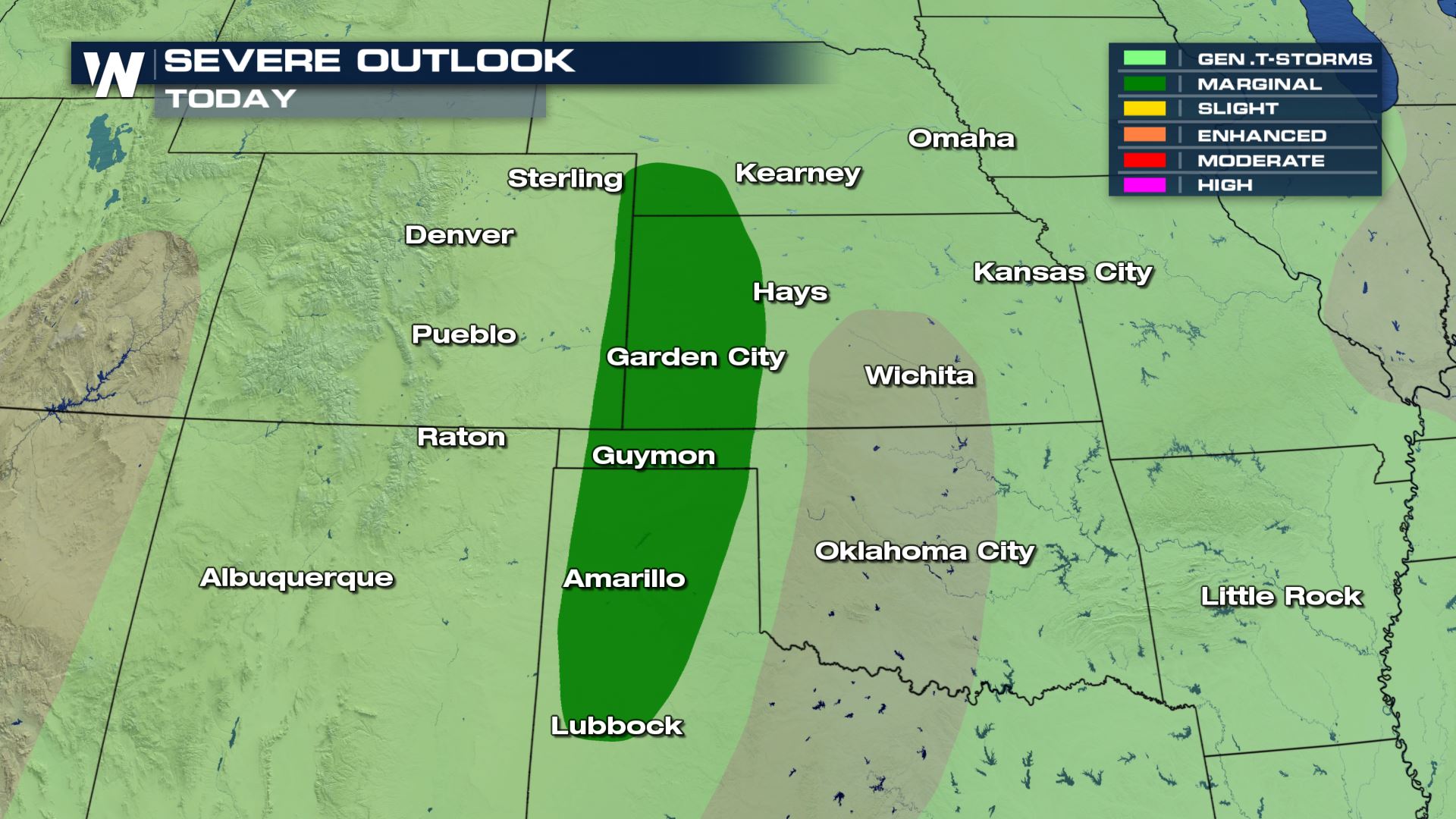
On Thursday, the risk of severe weather will become a bit more widespread. Areas from eastern Montana & Wyoming and through the Dakotas will all see a Marginal risk as storms move into the region. The main threats will be gusty outflow winds that may exceed 50 MPH.
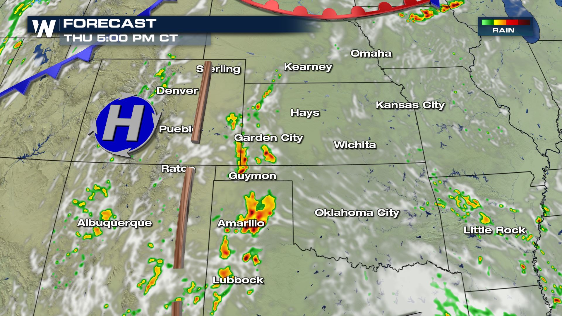
 Here's the expected timing of storms to develop on Thursday afternoon. Storm movement will remain to the north and east through the day and into the evening.
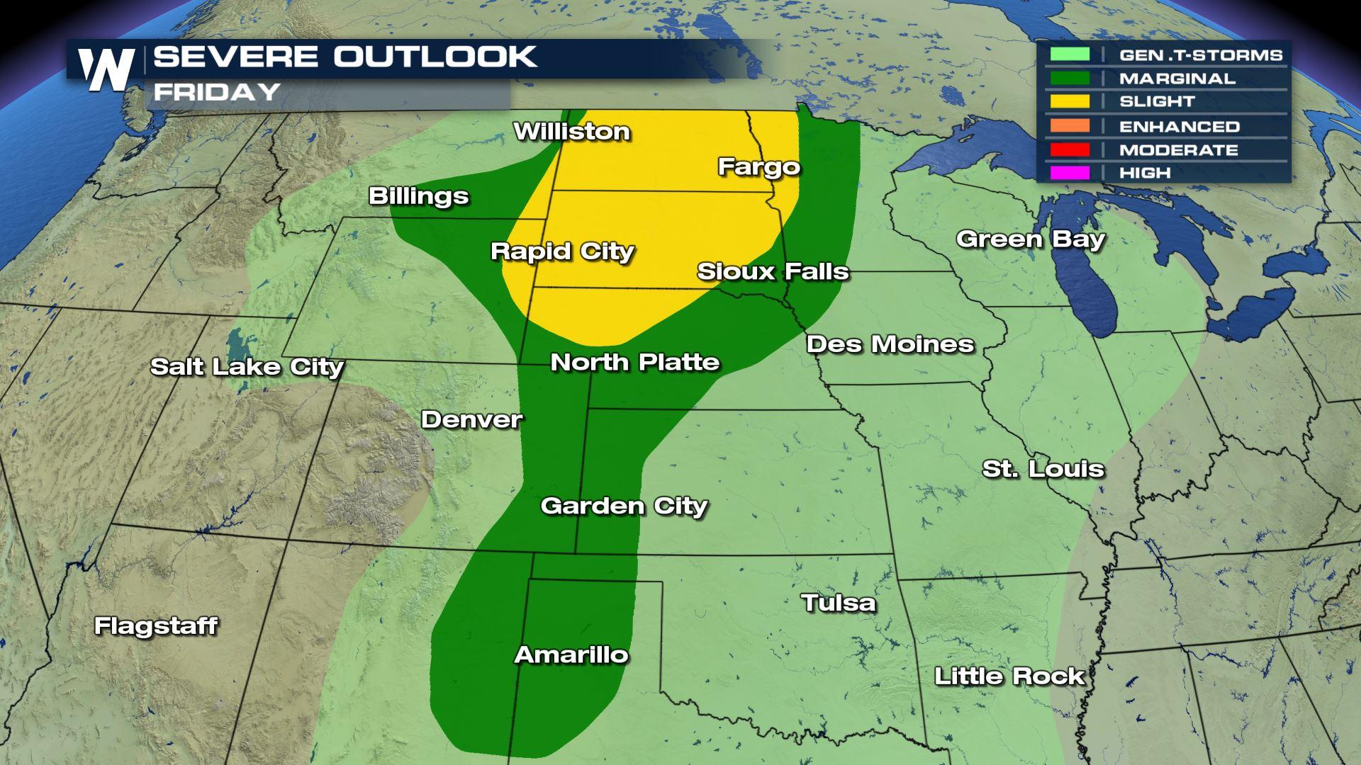
 As we end off the work week, Friday looks to have the highest probability of severe storms. The SPC has issued a Slight chance for the development of severe weather for areas in Nebraska and through the Dakotas. The largest threats will be gusty winds and small hail.
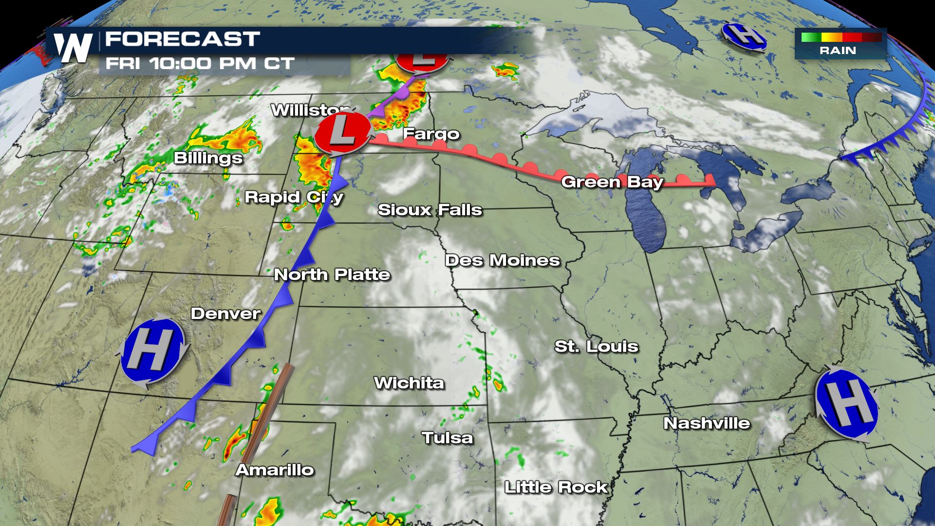
 As a more potent frontal boundary moves into the region, showers and thunderstorms will once again develop during the late afternoon and evening hours.
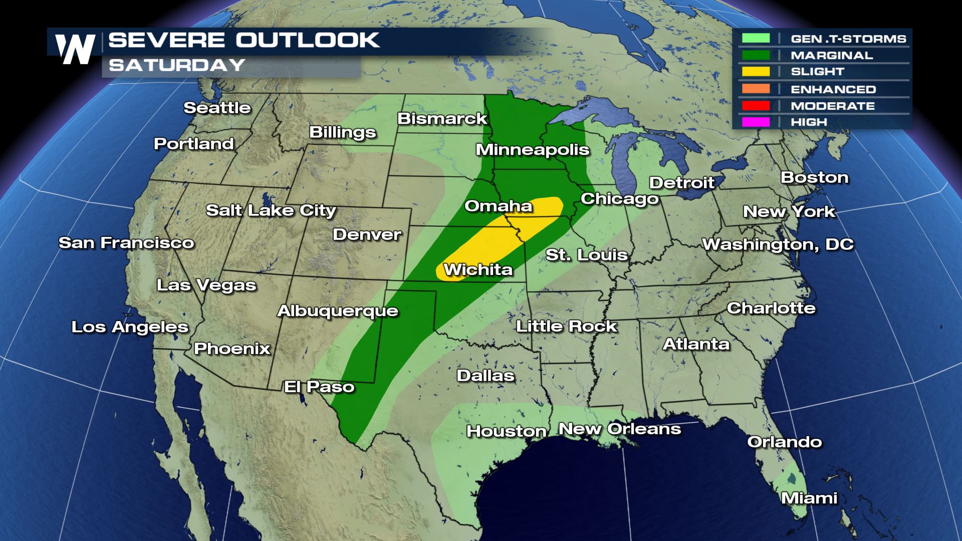
 The risk of severe weather will then shift to the central plains in areas of Kansas, Missouri and into Iowa. The largest threats will likely be damaging winds and small hail.
 As always, forecasts are subject to change, so stay tuned to WeatherNation for any updates to the forecast.
Here's the expected timing of storms to develop on Thursday afternoon. Storm movement will remain to the north and east through the day and into the evening.
As we end off the work week, Friday looks to have the highest probability of severe storms. The SPC has issued a Slight chance for the development of severe weather for areas in Nebraska and through the Dakotas. The largest threats will be gusty winds and small hail.
As a more potent frontal boundary moves into the region, showers and thunderstorms will once again develop during the late afternoon and evening hours.
The risk of severe weather will then shift to the central plains in areas of Kansas, Missouri and into Iowa. The largest threats will likely be damaging winds and small hail.
As always, forecasts are subject to change, so stay tuned to WeatherNation for any updates to the forecast.
All Weather News
More
Severe Threat Marches East This Afternoon
UPPER MIDWEST - Through Monday, dangerous tor
28 Jul 2026 4:25 PM

Tropics: Fausto Heads towards Hawaii; Genevieve Cat 4 Hurricane
PacificTropical Storm Fausto continues to tra
28 Jul 2026 4:20 PM


Southeast Flood Risk Lingers Near Stalled Front
A stalled boundary over the Southeast will ke
25 Jul 2026 10:55 AM

Another Round of Storms Targets the Northeast
Tuesday brought severe weather again across p
23 Jul 2026 1:15 AM

Another Round of Severe Weather for the Upper Midwest and Great Lakes
The upper-level low train continues to keep t
21 Jul 2026 1:45 AM