Storms Continue in the South

We're waking up to a stormy sky across the Southeast this morning as a line of intense weather passes through the region. An ongoing tornado watch remains in effect until 11 a.m. CT for parts of Mississippi, Tennessee, Louisiana, and Arkansas. Additional severe weather alerts should be expected across the Southeast through this afternoon. It's all associated with a coast-to-coast storm system moves across the country later this week, the north side of the storm system will bring brutally cold air from the Northwest to the Great Lakes.
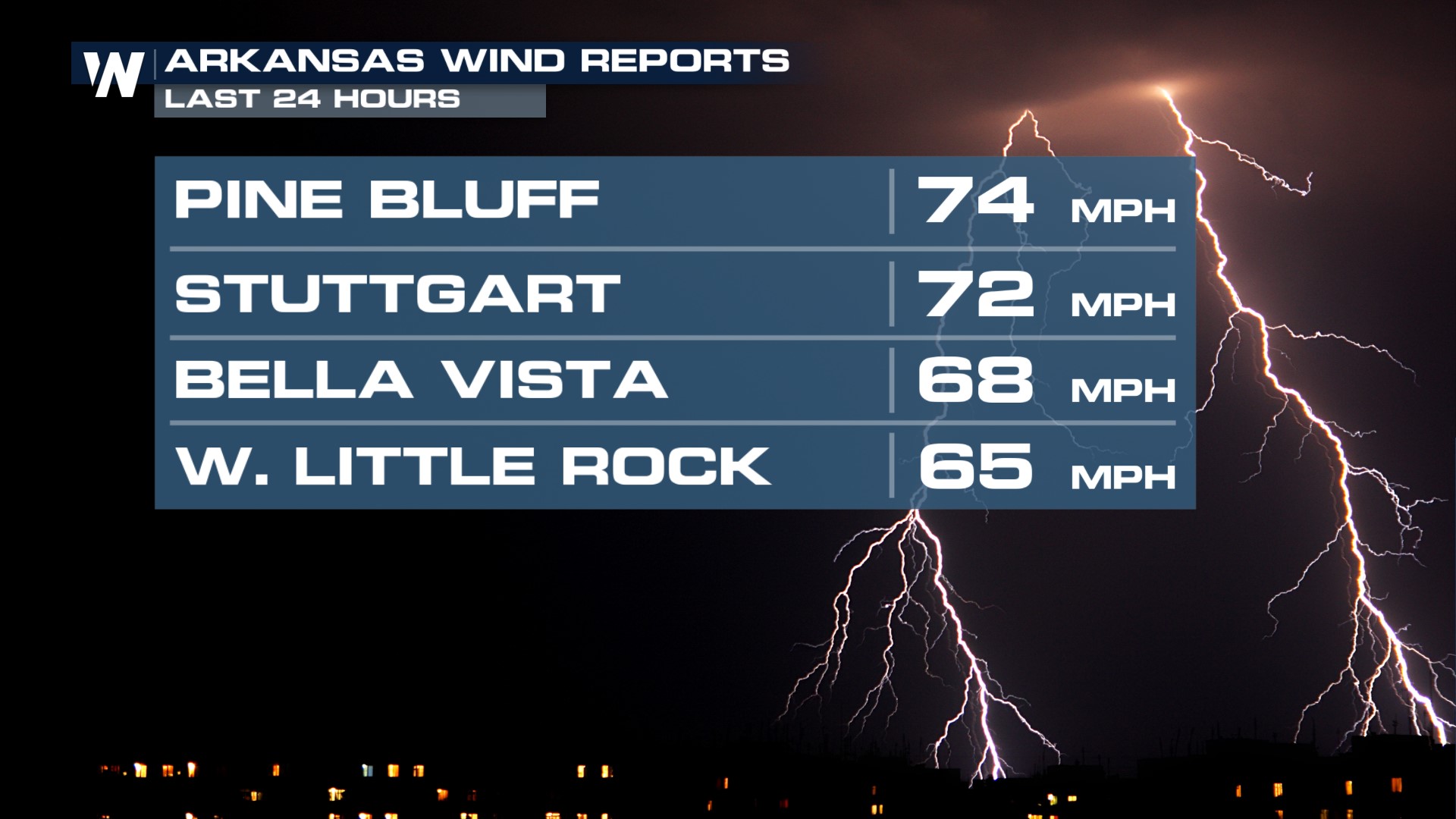 Top winds last night peaked at nearly 75 miles per hour across the Natural State of Arkansas. These powerful winds were mostly straight-line, but several tornado warnings have been issued within these strong gusts. These wind gusts are enough to produce damage, so take severe thunderstorms very seriously for the remainder of the day today! For the remainder of the morning hours on Friday, January 12 expect strong winds to race across the Mississippi River Delta, including much of northern Mississippi.
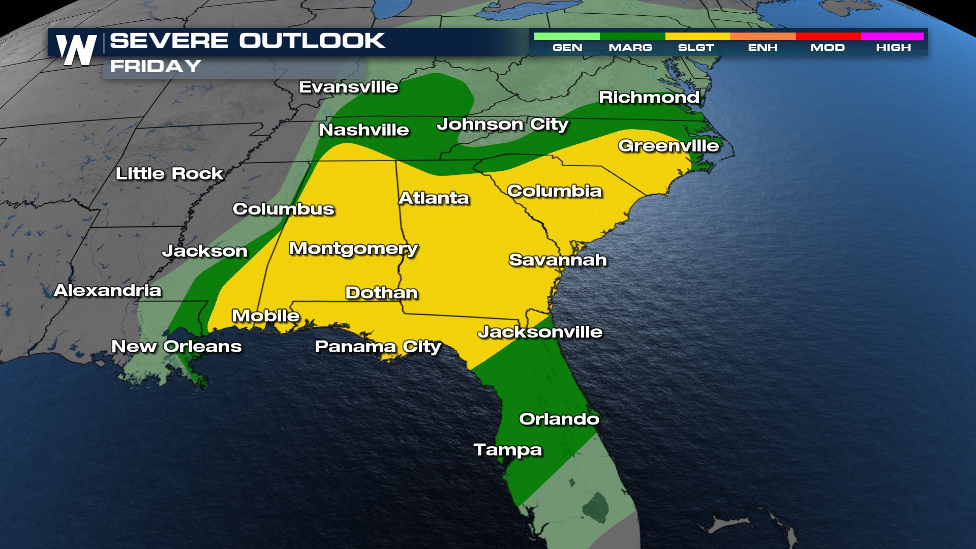 Severe storms will still be possible, but probably not as likely as they were this morning in Mississippi. Still, stay weather ready and weather aware across Kentucky, Tennessee, Alabama, Georgia, Florida, and the Carolinas through tonight. The main threat will be damaging wind.
Severe weather in January is not unheard of and tends to favor the Deep South, with a few tornadoes per month from Florida to Texas. Mississippi and Texas see the most number of tornadoes on average in January, about 7-8/year.


