Severe Threat in the Mississippi and Tennessee Valleys
Top Stories
8 Apr 2020 8:28 AM
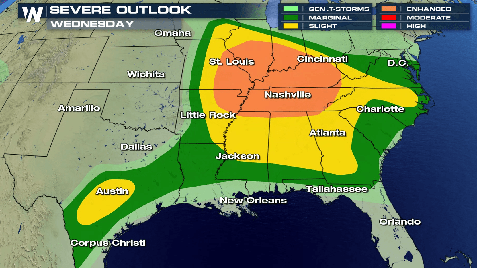
April is typically one of the peak months for severe weather across the United States, and in turn, this week will feature several chances for strong-to-severe thunderstorms moving forward. Today's (Wednesday) storms could also carry an overnight threat with them into early Thursday morning. The areas of concern include the mid and lower Mississippi Valley to the Gulf of Mexico coastline.
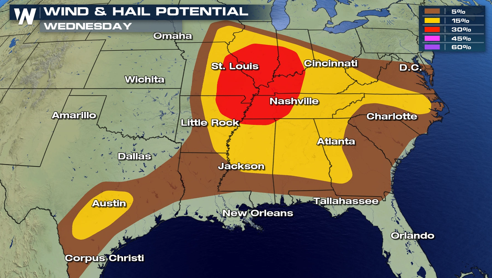 The main threat with Wednesday's storms is expected to be the potential for large hail and damaging winds, similar to Tuesday's threat. Isolated tornadoes could also target parts of the mid-South, including the cities of Memphis and Nashville in Tennessee and Paducah, Kentucky. This will probably be greatest in the evening as the storms first fire up.
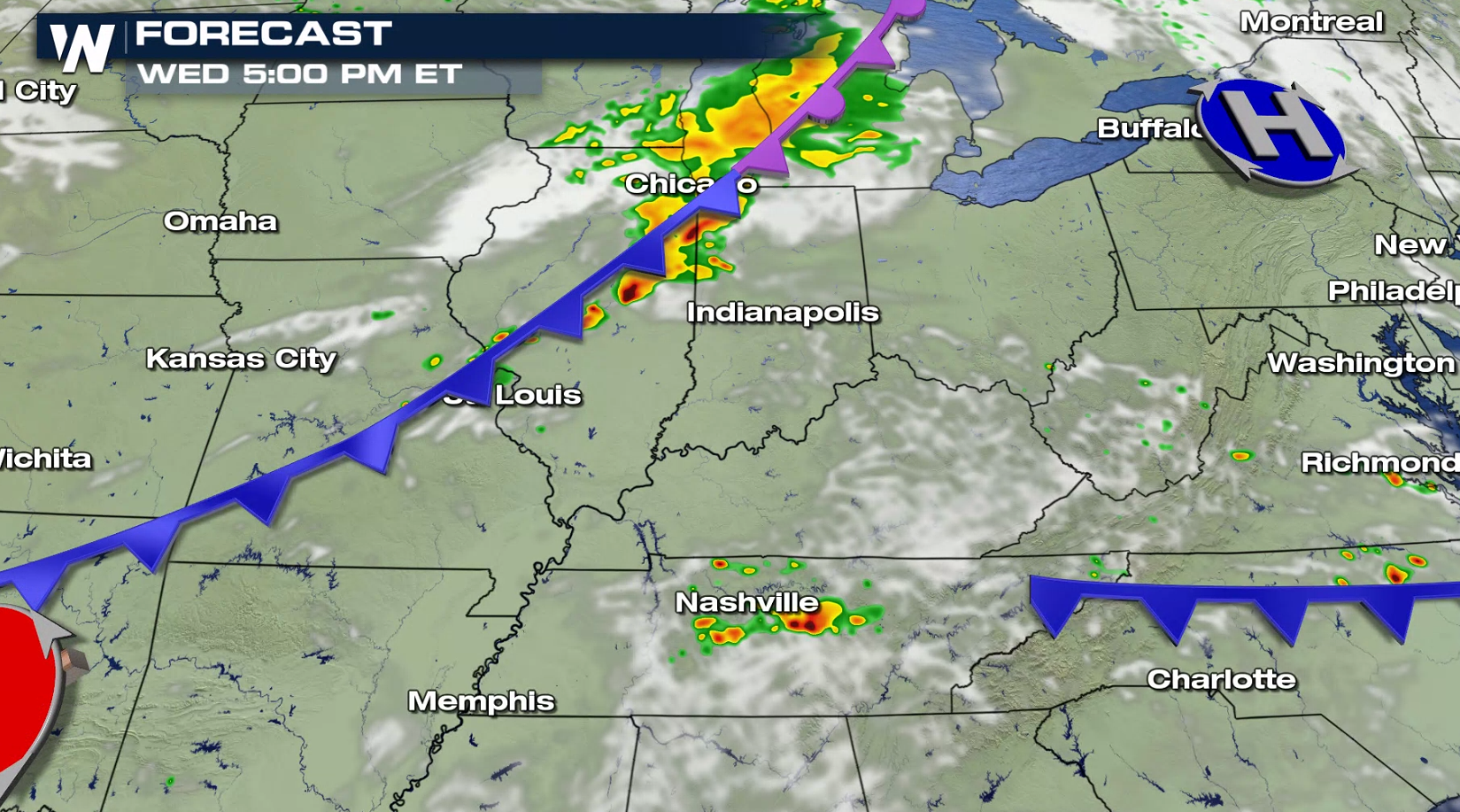
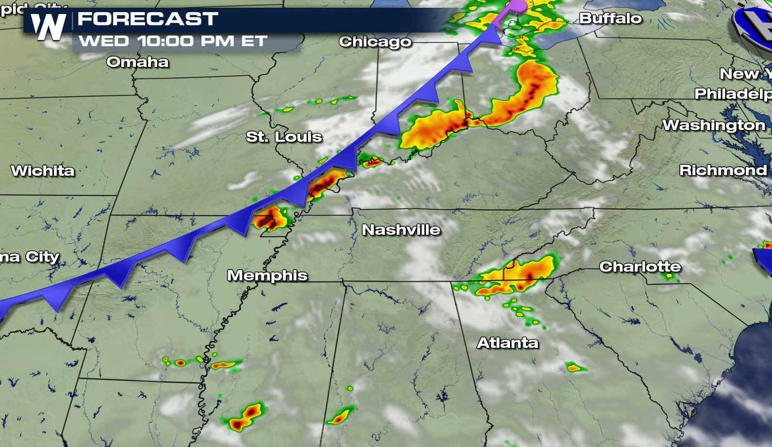
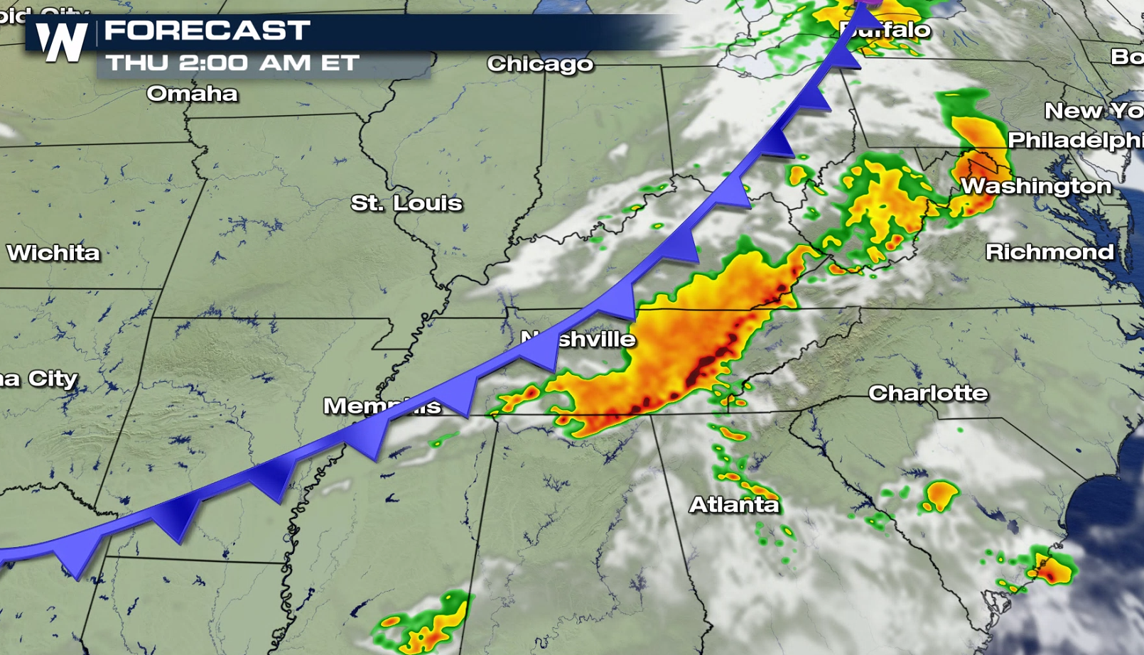
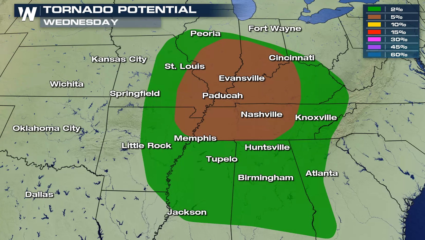 The first severe storms aren't expected to develop for until the late afternoon and into the early evening. Initially, large hail, damaging winds and even a few tornadoes will be the main threats with these storms. Later into the evening, Storms will then cluster into a big line, leading to a damaging wind threat for much of Kentucky, Tennessee and perhaps into northern Mississippi and Alabama.
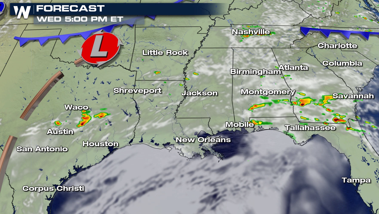
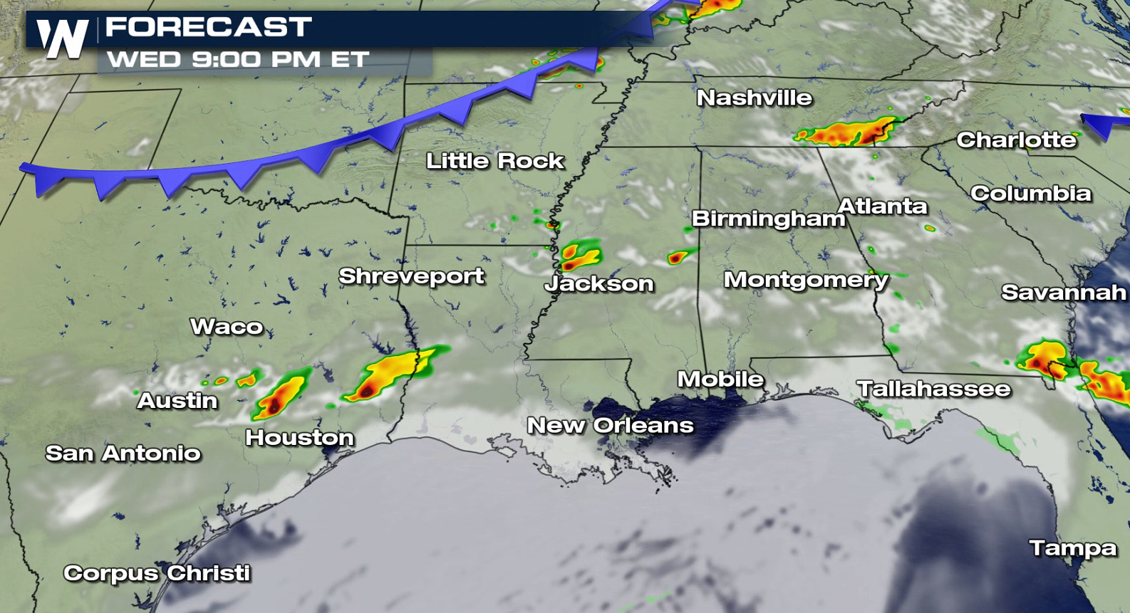
 Texas could also see a few strong to severe storms develop in the mid-afternoon through evening hours. A few supercells may form, capable of large hail and strong winds.
 We will have continued updates on the severe weather threat. For now, stay weather aware and continue to check back in for the latest forecast. Also, the SPC has new information to help keep you and your family safe, and for more on some of those important changes for the spring season, give this a read.
The main threat with Wednesday's storms is expected to be the potential for large hail and damaging winds, similar to Tuesday's threat. Isolated tornadoes could also target parts of the mid-South, including the cities of Memphis and Nashville in Tennessee and Paducah, Kentucky. This will probably be greatest in the evening as the storms first fire up.
The first severe storms aren't expected to develop for until the late afternoon and into the early evening. Initially, large hail, damaging winds and even a few tornadoes will be the main threats with these storms. Later into the evening, Storms will then cluster into a big line, leading to a damaging wind threat for much of Kentucky, Tennessee and perhaps into northern Mississippi and Alabama.
Texas could also see a few strong to severe storms develop in the mid-afternoon through evening hours. A few supercells may form, capable of large hail and strong winds.
We will have continued updates on the severe weather threat. For now, stay weather aware and continue to check back in for the latest forecast. Also, the SPC has new information to help keep you and your family safe, and for more on some of those important changes for the spring season, give this a read.All Weather News
More
Wildfire Outbreak in the Pacific Northwest
SPOKANE, WA - On Saturday, August 1st, the Ol
2 Aug 2026 7:20 PM

More Storms for the East Through Monday
A low-pressure system that moved through the
2 Aug 2026 7:20 PM


After Reaching Category 5, Genevieve Weakens in the Pacific
PacificGenevieve formed on last Friday south
2 Aug 2026 6:25 PM

Flooding, Severe Storms Target the Midwest Again
After an active week of storms across the nor
1 Aug 2026 1:40 AM

Flooding Risk Increases as Heavy Rain Targets the Tri-State Area
Tuesday, heavy rainfall moved across the Nort
30 Jul 2026 12:25 AM

Severe Weather: Energy From the Midwest Now in the Southeast
UPPER MIDWEST - Through Monday, dangerous tor
29 Jul 2026 10:30 PM