Severe Weather Threat in the Plains
Special Stories
16 Aug 2018 9:34 AM
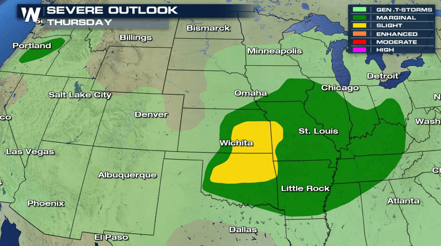
A storm system moving across the central Plains today (Thursday) will bring a chance for severe thunderstorms in the late afternoon and early evening. Strong wind gusts greater than 60 mph and hail larger than a quarter are the biggest threats, along with a low tornado risk.
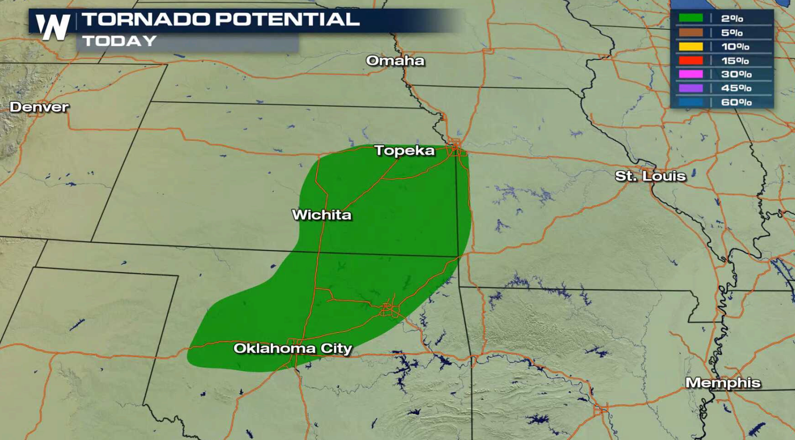
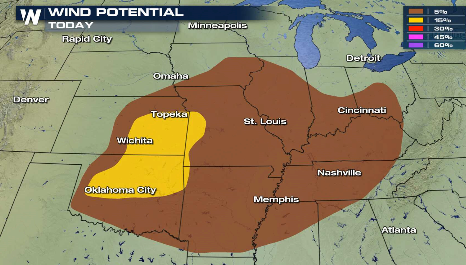
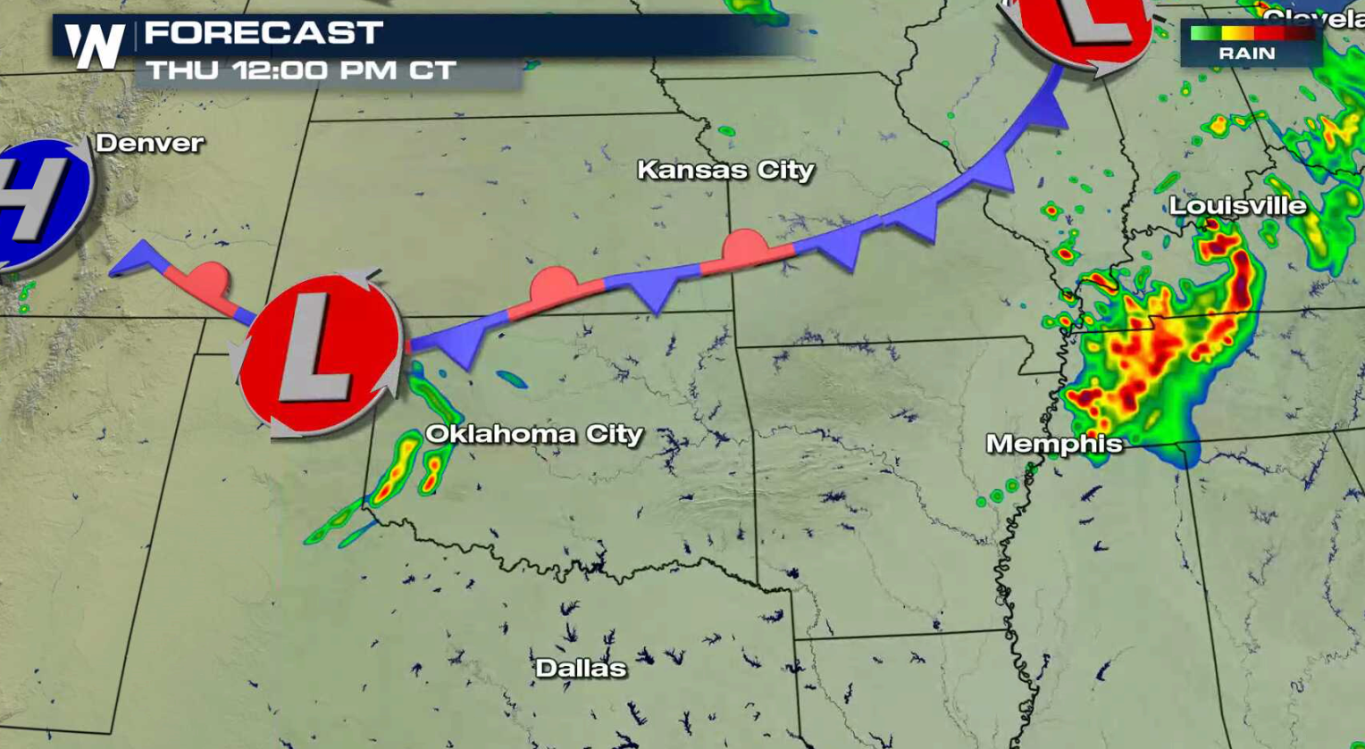
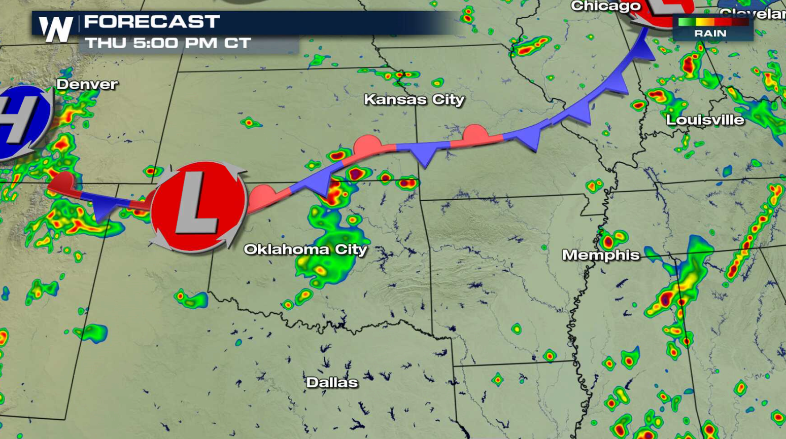
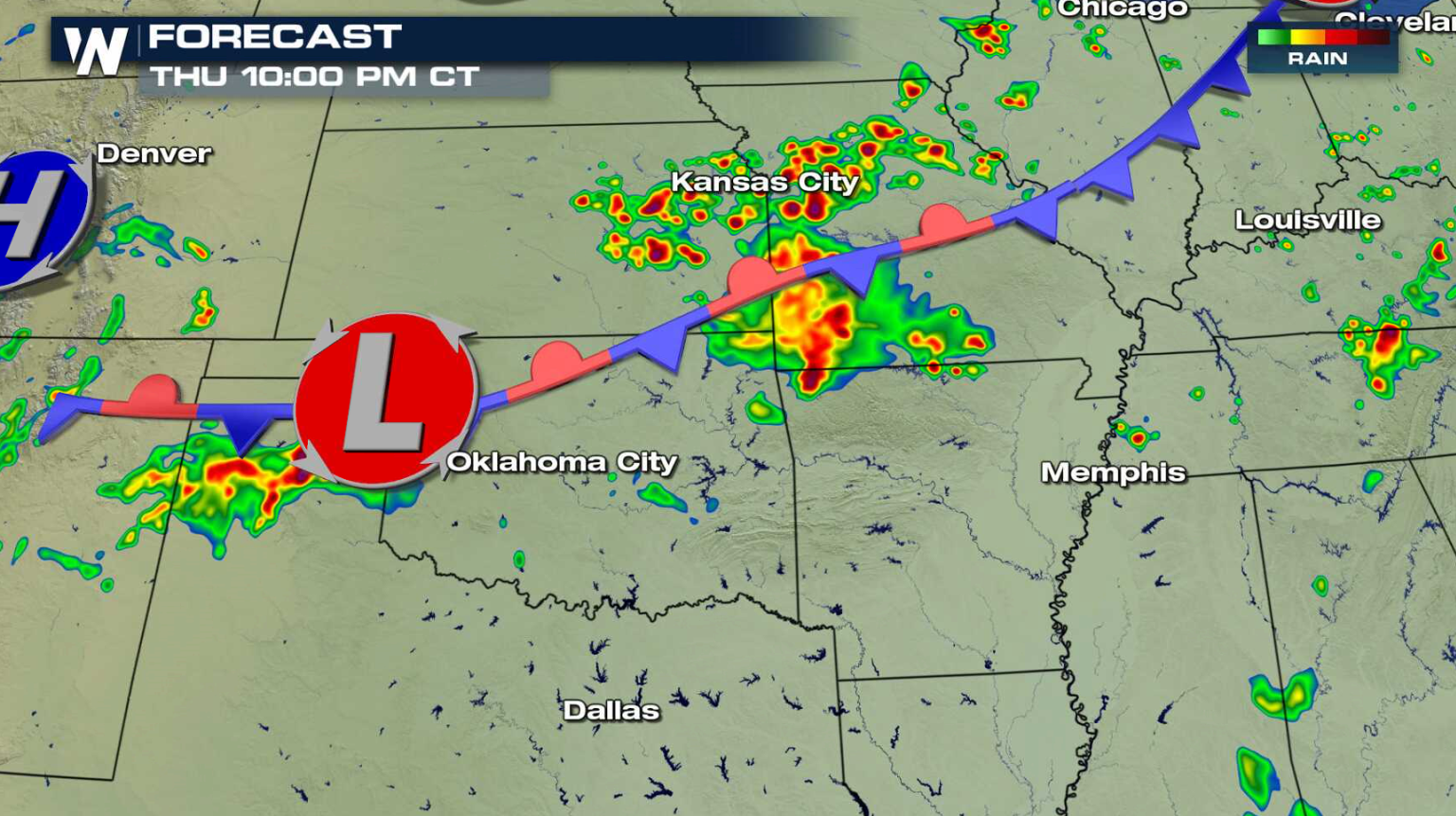
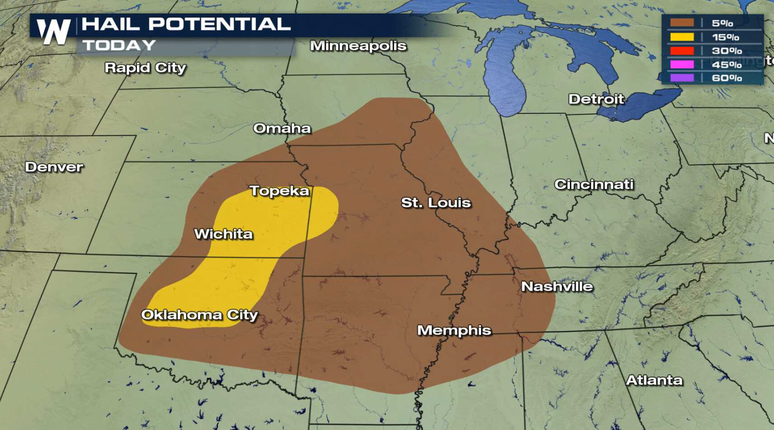 A hot and humid air mass is located along a slow moving cold front and low pressure center. Storms will develop along the front into this evening, with some likely to become severe. Areas from near Oklahoma City to Kansas City may see intense storms.
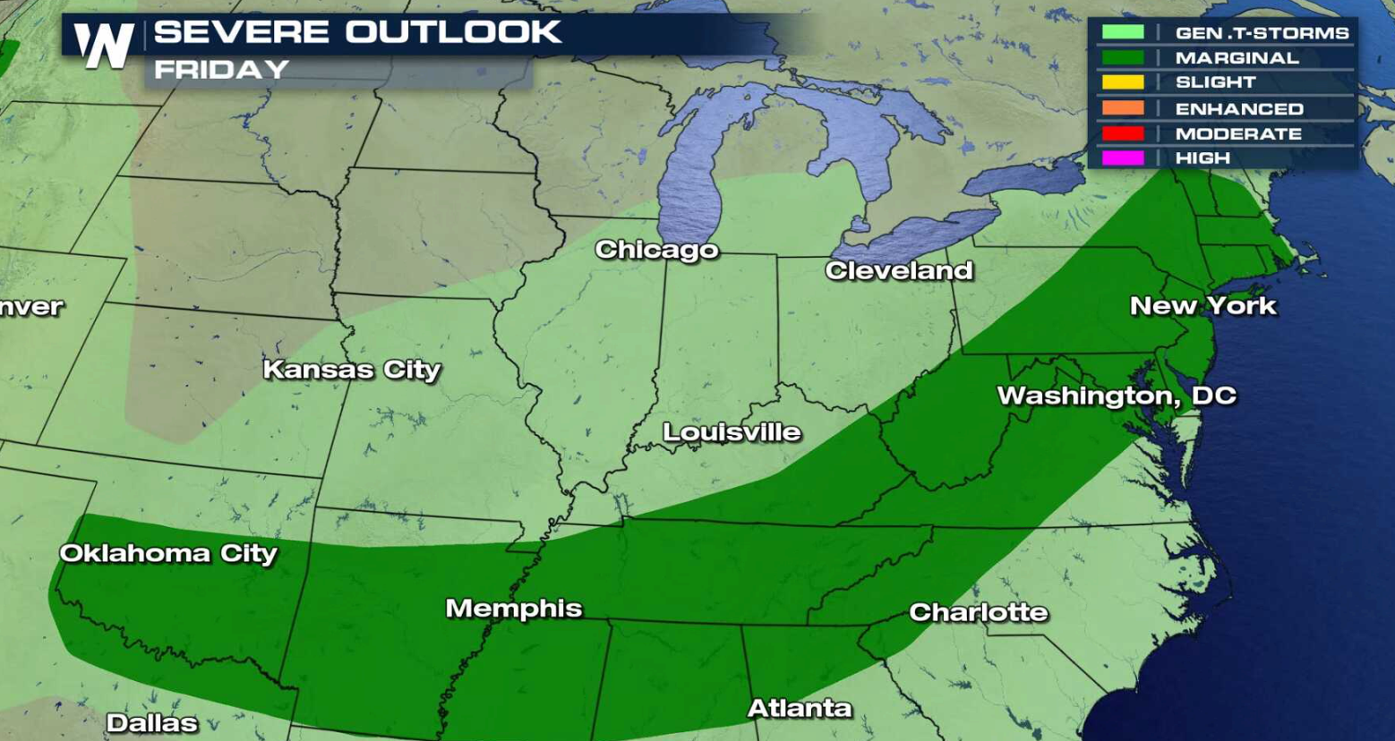
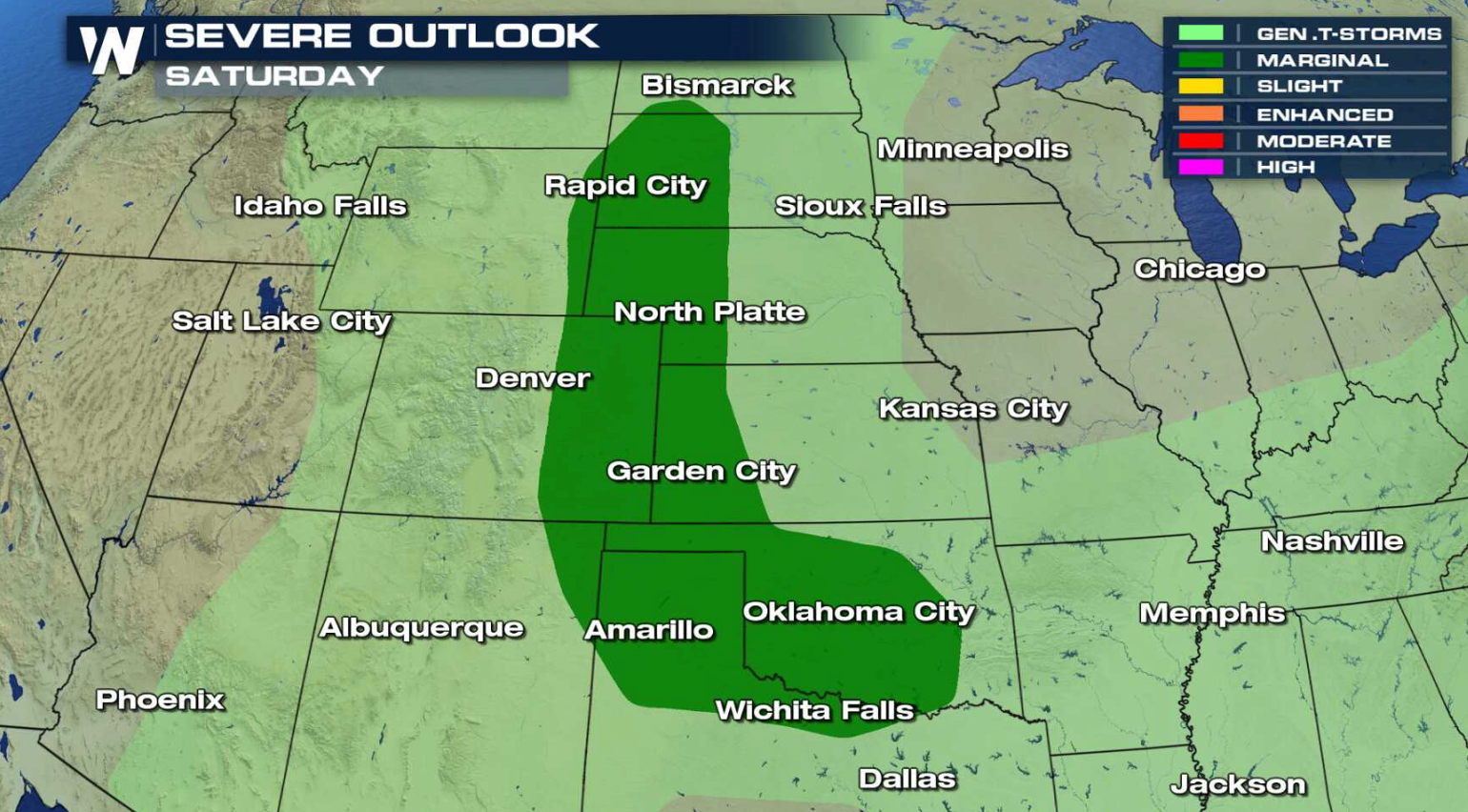
 There is a marginal risk for severe thunderstorms for Friday and Saturday from the Atlantic Ocean to the Plains.
 For WeatherNation: Meteorologist Mace Michaels
A hot and humid air mass is located along a slow moving cold front and low pressure center. Storms will develop along the front into this evening, with some likely to become severe. Areas from near Oklahoma City to Kansas City may see intense storms.
There is a marginal risk for severe thunderstorms for Friday and Saturday from the Atlantic Ocean to the Plains.
For WeatherNation: Meteorologist Mace MichaelsAll Weather News
More

More Storms for the East Through Monday
A low-pressure system that moved through the
3 Aug 2026 12:20 PM


After Reaching Category 5, Genevieve Weakens in the Pacific
PacificGenevieve formed last Friday south of
3 Aug 2026 12:30 AM

Flooding, Severe Storms Target the Midwest Again
After an active week of storms across the nor
1 Aug 2026 1:40 AM

Flooding Risk Increases as Heavy Rain Targets the Tri-State Area
Tuesday, heavy rainfall moved across the Nort
30 Jul 2026 12:25 AM