Severe Weather Threat Returns to the Central U.S.

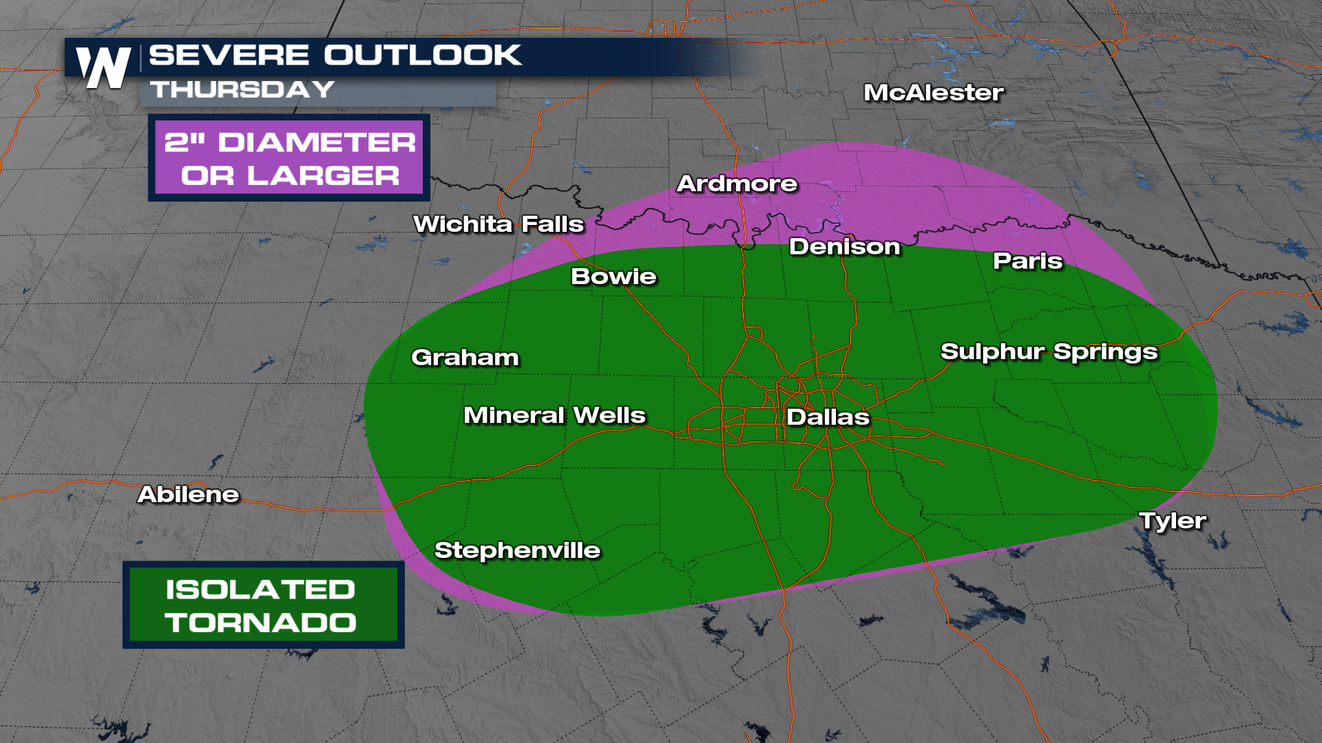
RED RIVER VALLEY - After a very active start to the week, severe chances are back in the forecast for the Red River Valley, the Arklatex, and central Texas. The Storm Prediction Center has issued a SLIGHT (level 2 out of 5) risk for severe storms on Thursday across these areas. This risk includes cities such as Dallas, Texas.
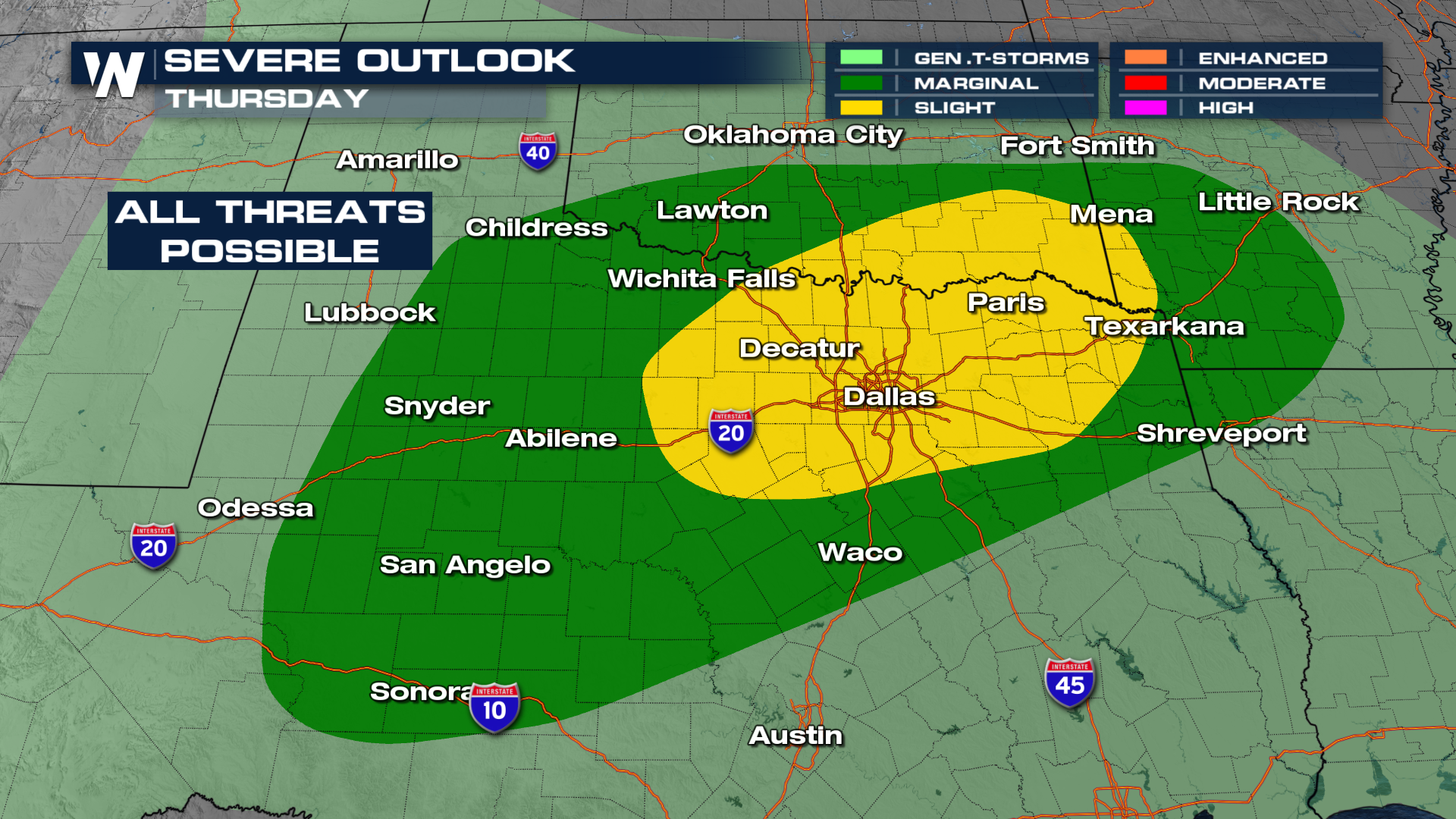 Conditions will be favorable for intense storms, with warm, humid air (upper 60s to low 70s dewpoints) and strong winds at different levels of the atmosphere. This setup could lead to supercell thunderstorms, which are capable of producing large to very large hail as well as a chance for a tornado.
Strong storms are likely to form in central Oklahoma on Thursday, starting north of the Red River. These storms will move south into northern Texas during the day.
Friday - Saturday
On Friday, moist air returns ahead of our next system that is expected to form over the High Plains. This will lead to thunderstorms in the central nd southern Plains, some of which could turn strong to severe. The SPC has issued a MARGINAL (level 1 out of 5) risk for severe storms on Friday for Nebraska, Kansas, Oklahoma, Missouri, Arkansas, and into western Texas. West Texas's storms will be driven by a dryline.
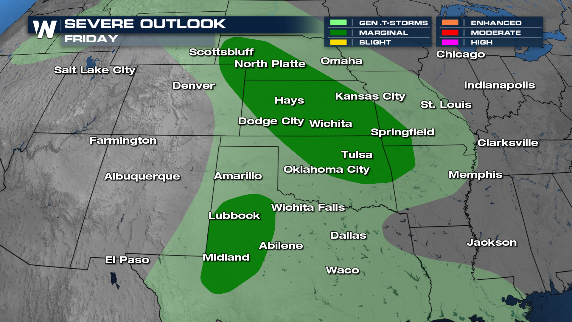
Strong storms, including supercells with hail, may form in the afternoon and evening, especially in Colorado and surrounding areas.
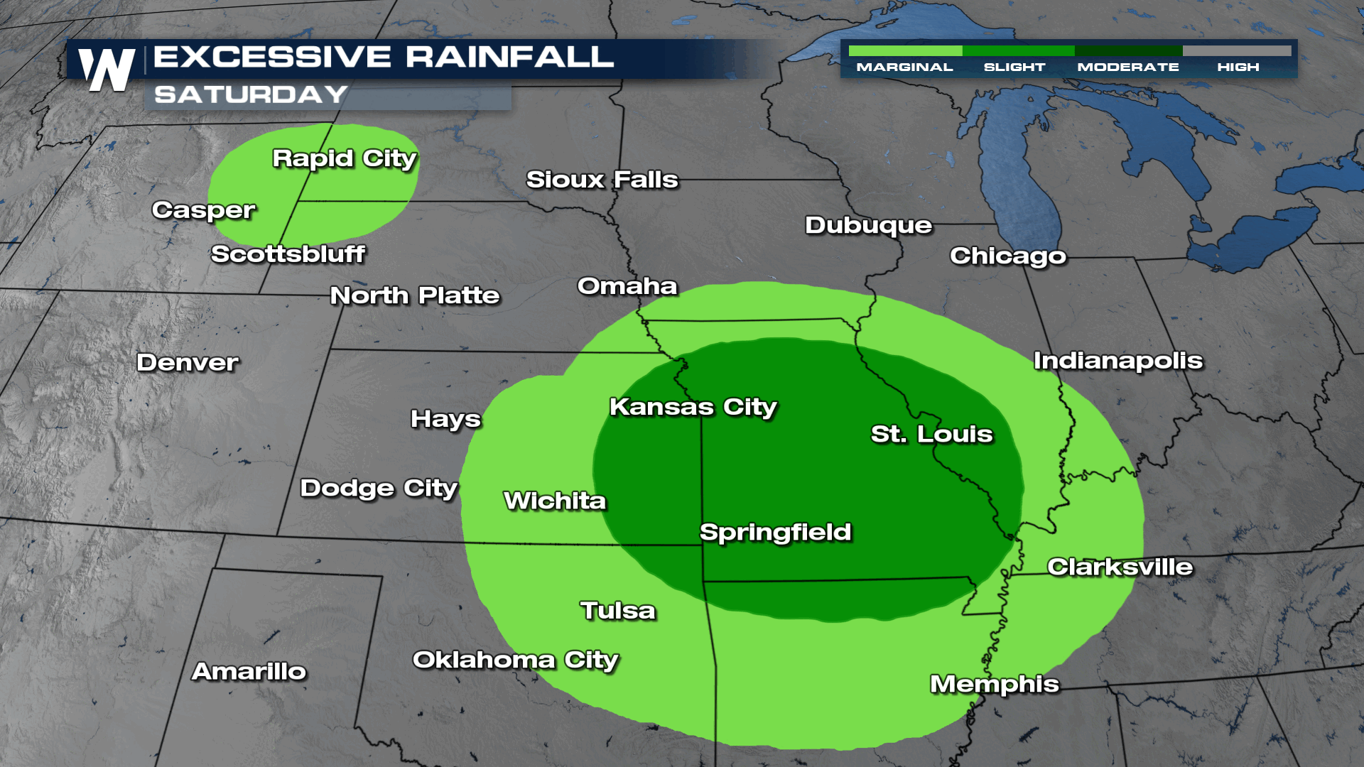
There is a flooding risk with this weekend's storms as well. The WPC has issued SLIGHT (level 2 out of 5) risks for flash flooding across the Plains for Saturday and Sunday. On Saturday, flash flooding is possible in the Ozarks and north-central High Plains. On Sunday, a larger area from northeast Texas to the Mississippi Valley is at risk for heavy rain and flooding. More storms could develop in the southern Plains and Lower Mississippi Valley.
 For the latest on this story, be sure to join us on WeatherNation!


