Severe Weather Threat Shifts into the Northeast Today
Special Stories
4 May 2018 8:40 AM
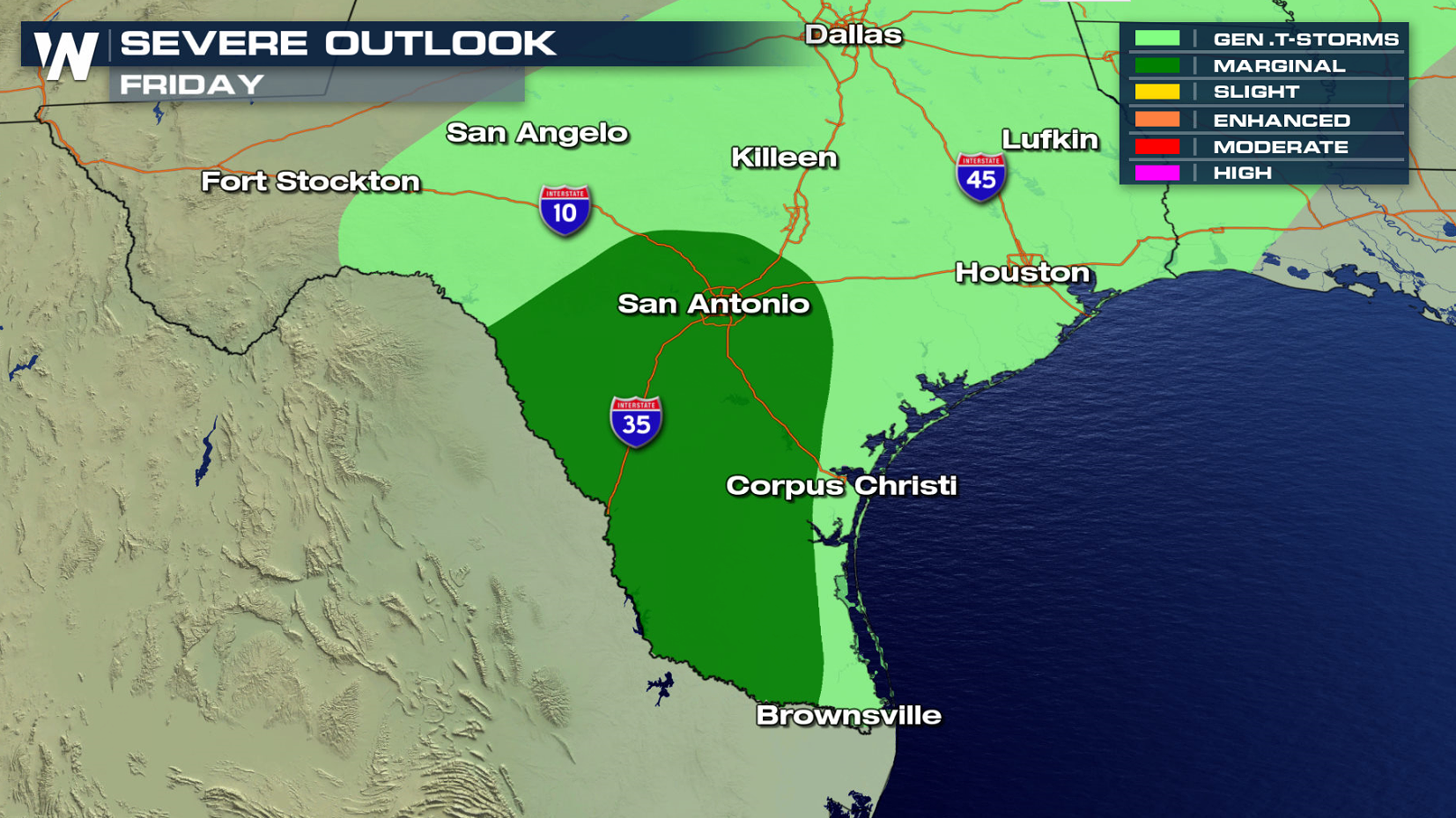
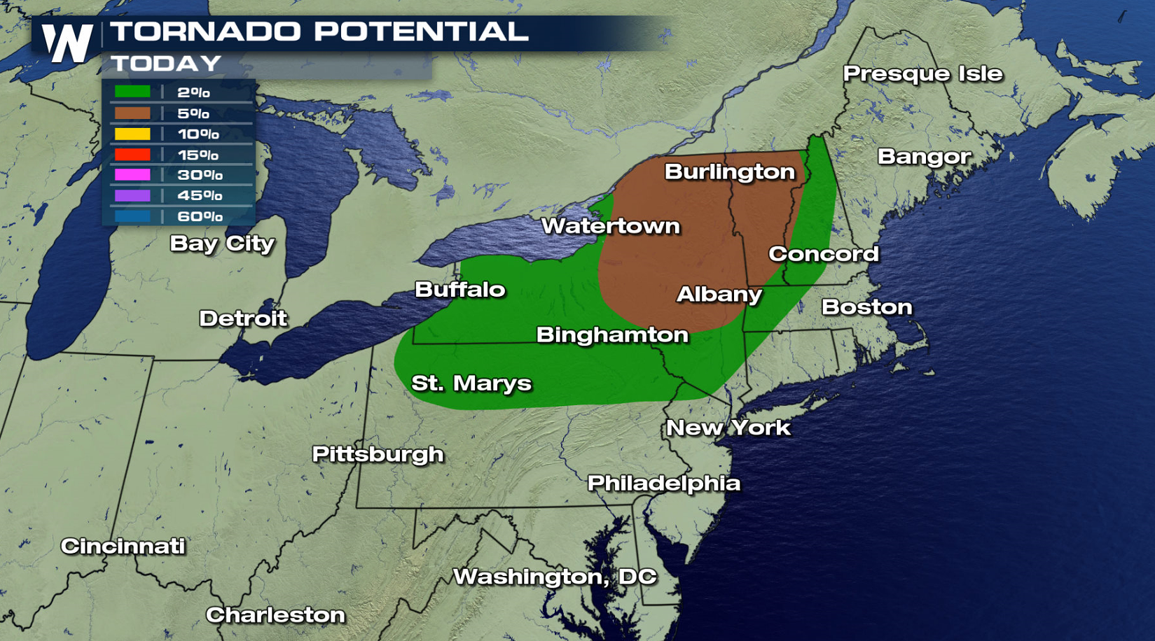
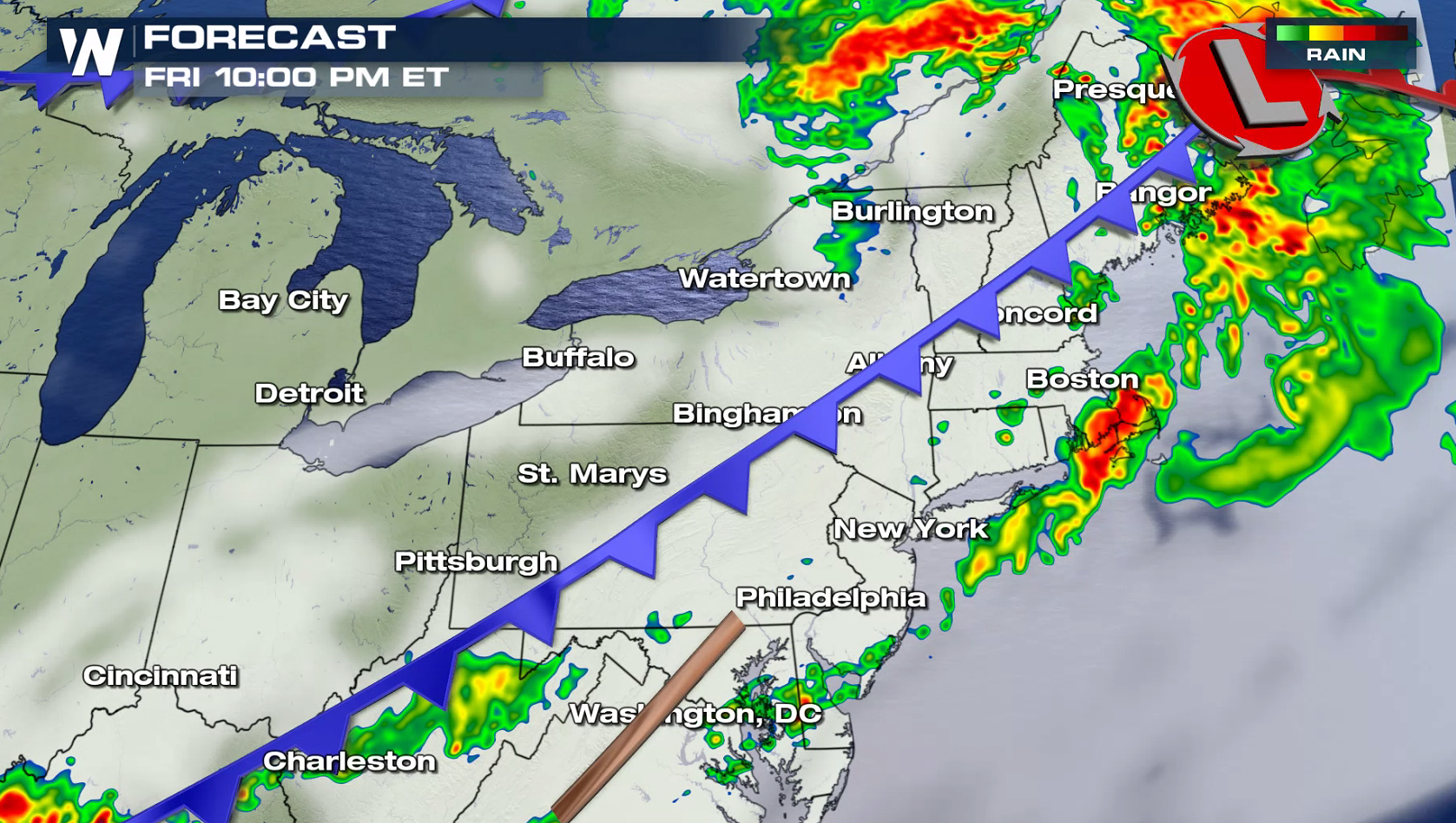
After several days of severe thunderstorms in the Plains, today's threat area shifts into the Northeast. An enhanced risk for severe thunderstorms has been outlined from the Storm Prediction Center over most of Vermont and New York. A marginal risk extends from Maine to Michigan and also in south Texas.
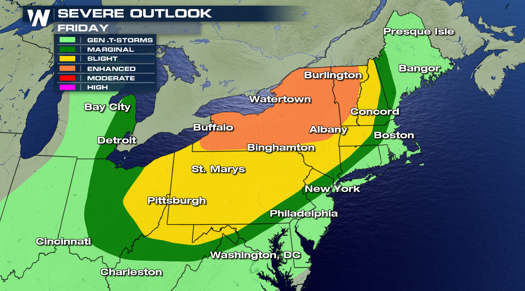
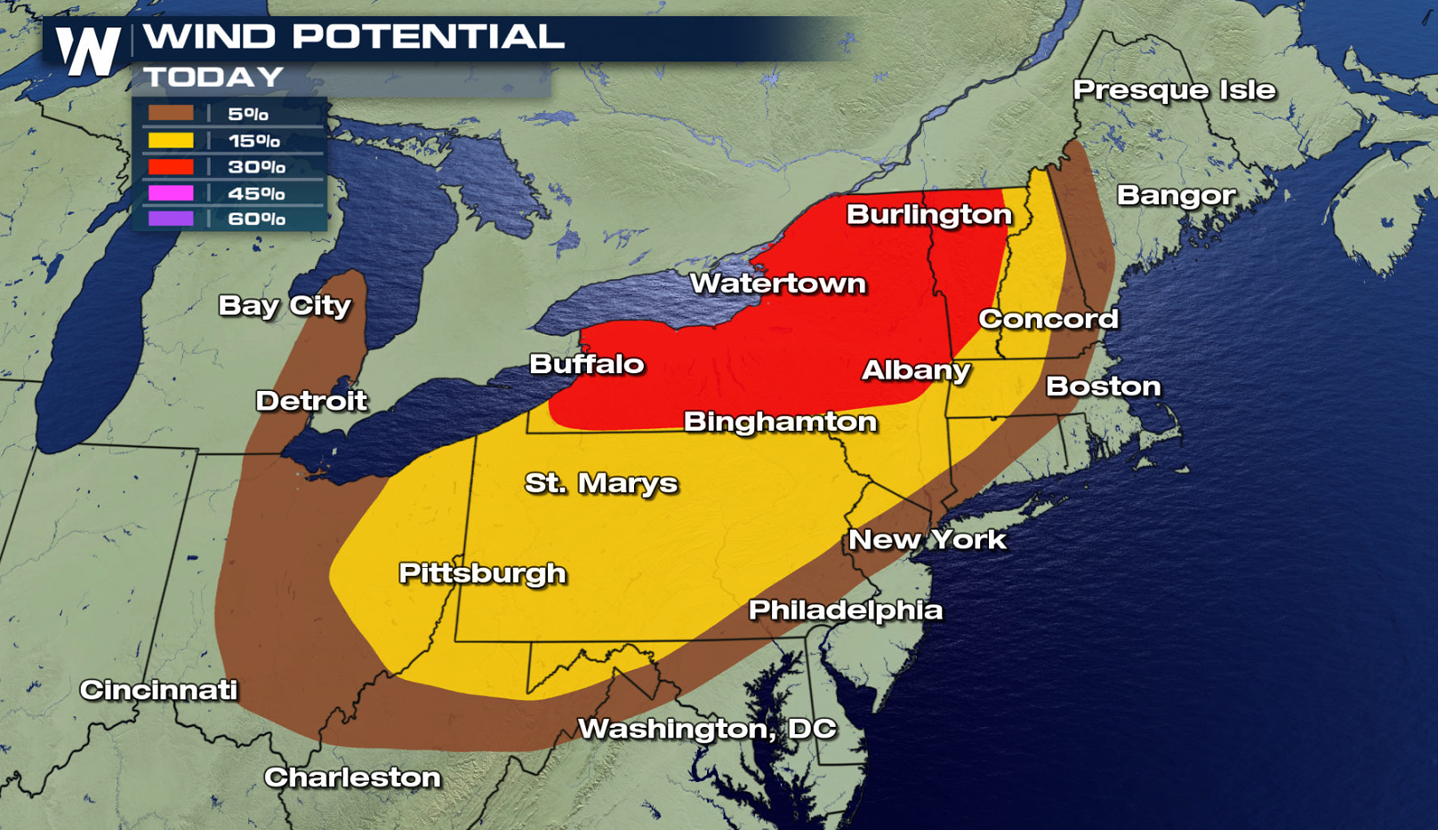
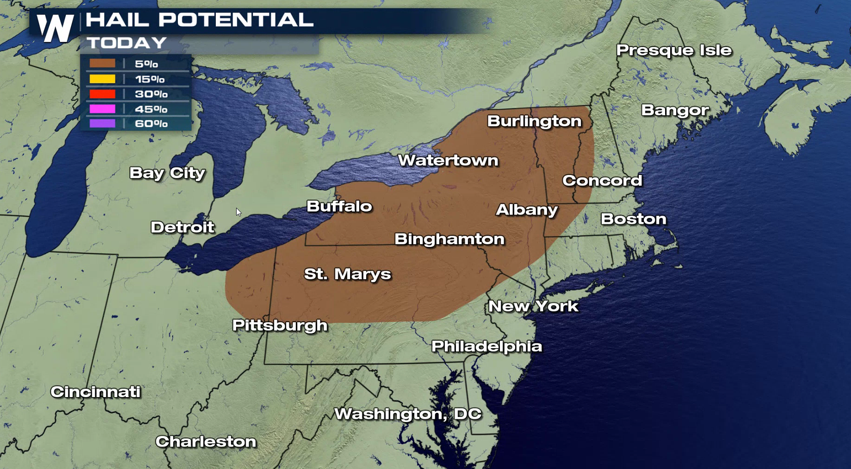
 Strong wind gusts higher than 60 mph are the biggest concern for later this afternoon. There is also a chance for a tornado, with a low threat for large hail.
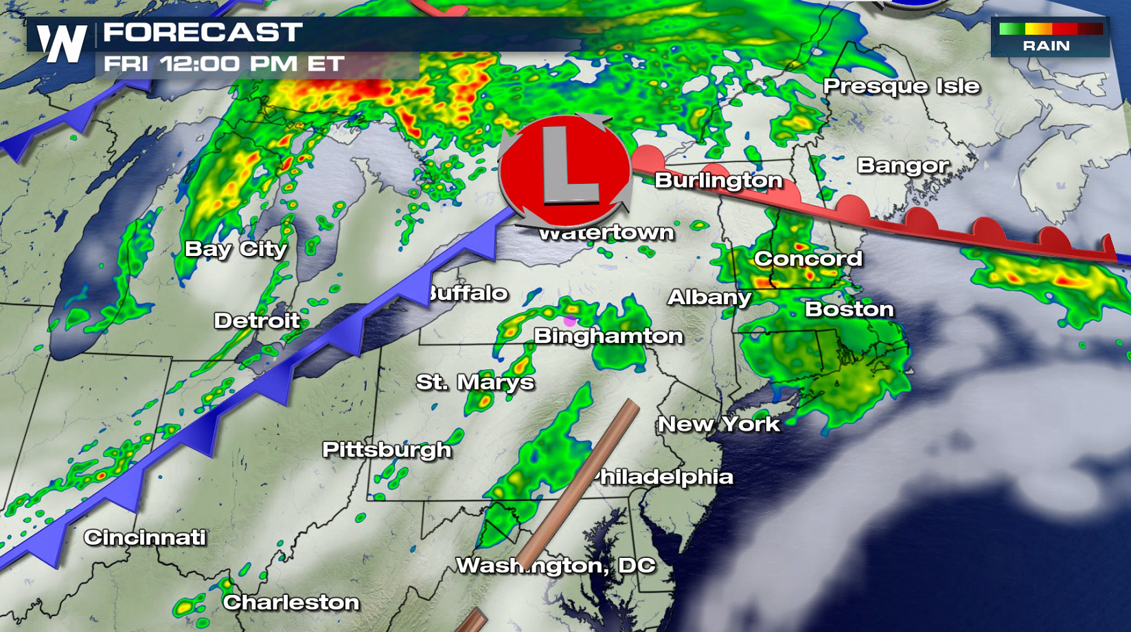
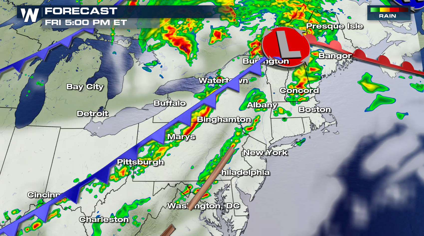
 A warm front is lifting northward through the Northeast, as a low pressure center moves into the region. This will push warmer and more humid air across the area, aiding thunderstorm development. A cold front south of the low will be the focus for severe thunderstorms in the afternoon and evening. As the front moves into the Atlantic Ocean later tonight, the severe weather threat will end.
 For WeatherNation: Meteorologist Mace Michaels
Strong wind gusts higher than 60 mph are the biggest concern for later this afternoon. There is also a chance for a tornado, with a low threat for large hail.
A warm front is lifting northward through the Northeast, as a low pressure center moves into the region. This will push warmer and more humid air across the area, aiding thunderstorm development. A cold front south of the low will be the focus for severe thunderstorms in the afternoon and evening. As the front moves into the Atlantic Ocean later tonight, the severe weather threat will end.
For WeatherNation: Meteorologist Mace MichaelsAll Weather News
More
Wildfire Outbreak in the Pacific Northwest
SPOKANE, WA - On Saturday, August 1st, the Ol
3 Aug 2026 1:55 AM

More Storms for the East Through Monday
A low-pressure system that moved through the
3 Aug 2026 1:50 AM


After Reaching Category 5, Genevieve Weakens in the Pacific
PacificGenevieve formed last Friday south of
3 Aug 2026 12:30 AM

Flooding, Severe Storms Target the Midwest Again
After an active week of storms across the nor
1 Aug 2026 1:40 AM

Flooding Risk Increases as Heavy Rain Targets the Tri-State Area
Tuesday, heavy rainfall moved across the Nort
30 Jul 2026 12:25 AM

Severe Weather: Energy From the Midwest Now in the Southeast
UPPER MIDWEST - Through Monday, dangerous tor
29 Jul 2026 10:30 PM