Small Severe Risk in Southwest Texas Today
Top Stories
21 Oct 2021 4:00 PM
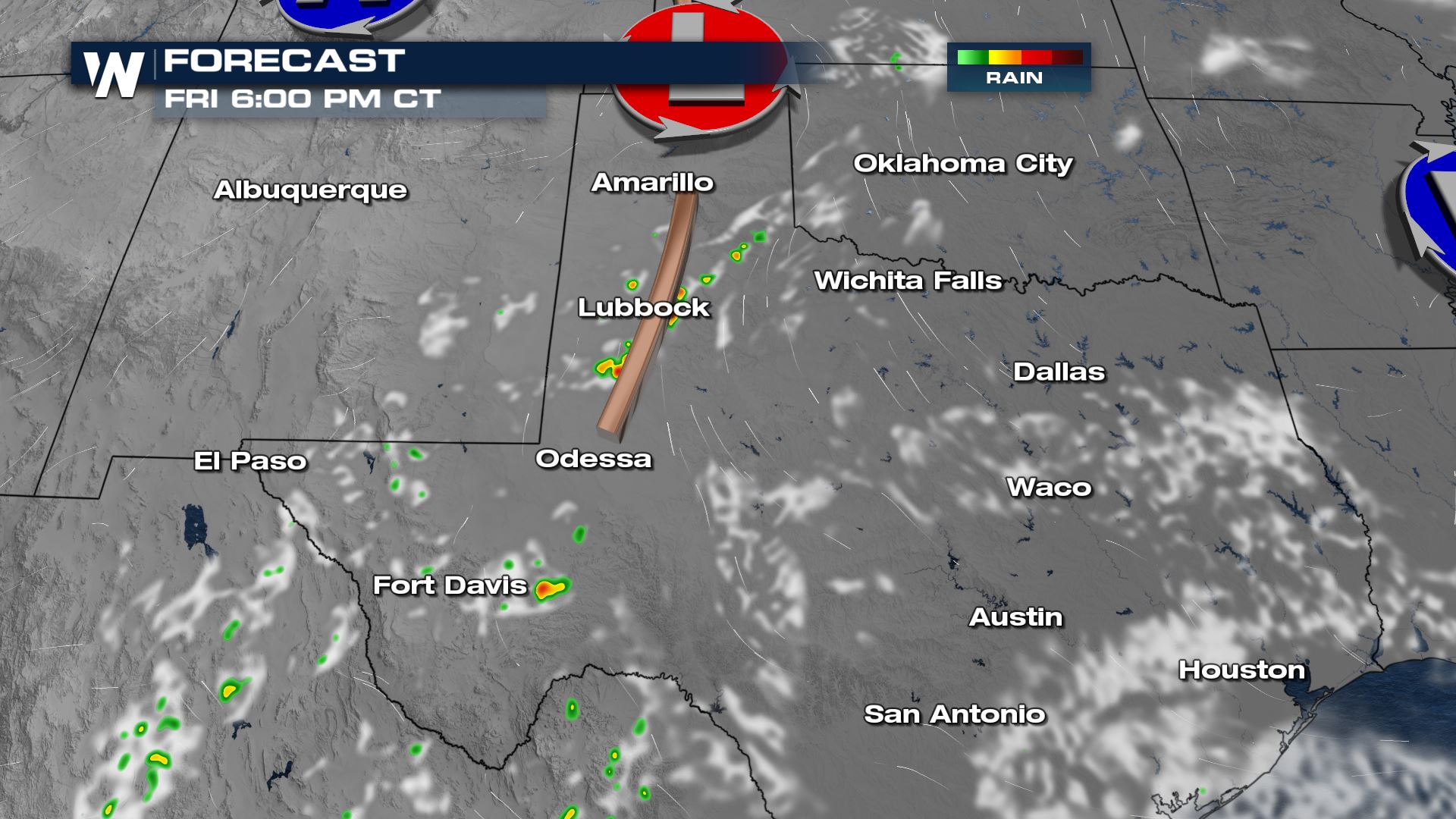
Isolated storms are expected to develop in the Big Bend region of Texas this afternoon. The risk of large hail and gusty winds will be present with any storm that pops up.
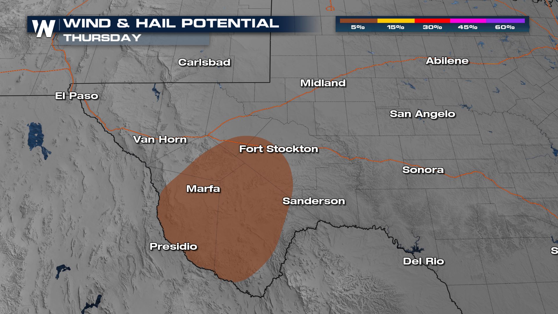
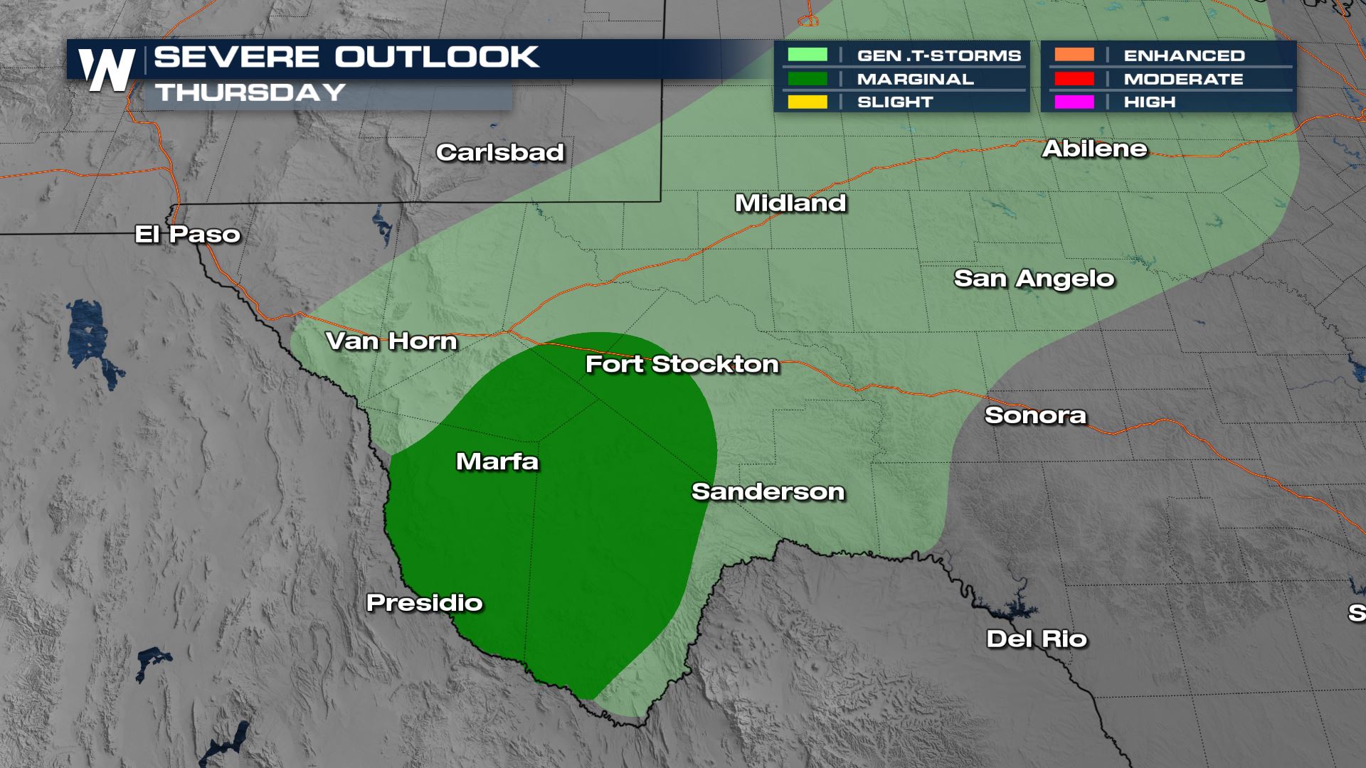 Locations from Fort Stockton to Presidio are under the marginal risk (level 1 out of 5). Any storm will be capable of producing strong winds near 60 mph and large hail during the afternoon and evening.
 Storms will again be possible on Friday in western Oklahoma and the Texas Panhandle, but severe weather is not expected as this point in time. A few thunderstorms could produce small hail and wind gusts of 40-50 mph.
 You can always find more on the severe risk in the South-Central as :30 past the hour on WeatherNation!
Forecast
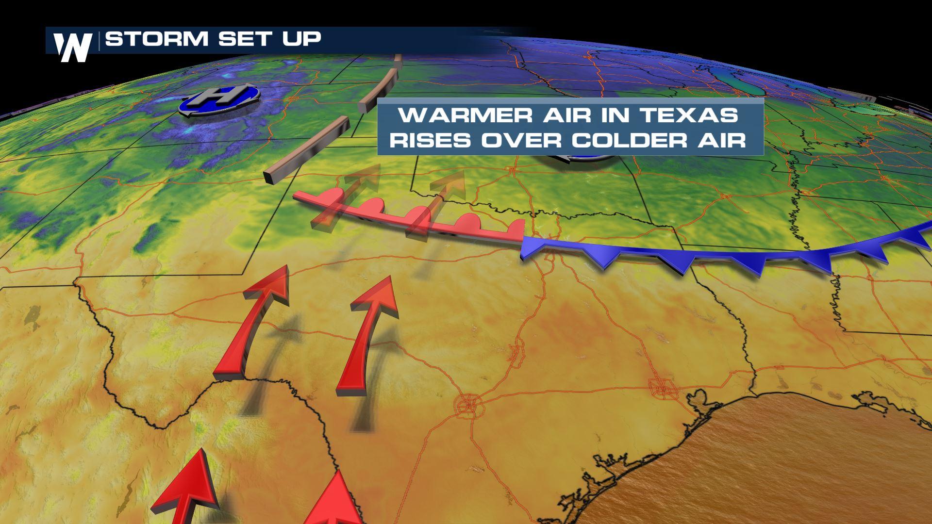
A weak disturbance will slide through the region and meet up with an area of warm, humid air at the surface and modest wind shear in the upper atmosphere. While coverage is expected to remain limited, any storm that is able to develop in an area of weak lift has the potential of becoming strong or severe.
Locations from Fort Stockton to Presidio are under the marginal risk (level 1 out of 5). Any storm will be capable of producing strong winds near 60 mph and large hail during the afternoon and evening.
Timing
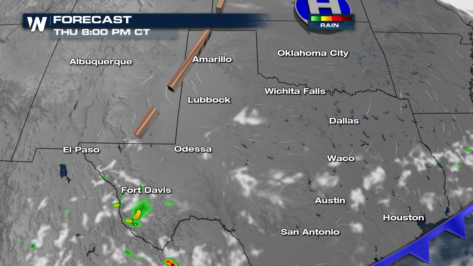
Storms will e few and far between but those that develop do contain the risk of gusty winds and hail along with flash flooding concerns. Activity lessens after sundown.
Storms will again be possible on Friday in western Oklahoma and the Texas Panhandle, but severe weather is not expected as this point in time. A few thunderstorms could produce small hail and wind gusts of 40-50 mph.
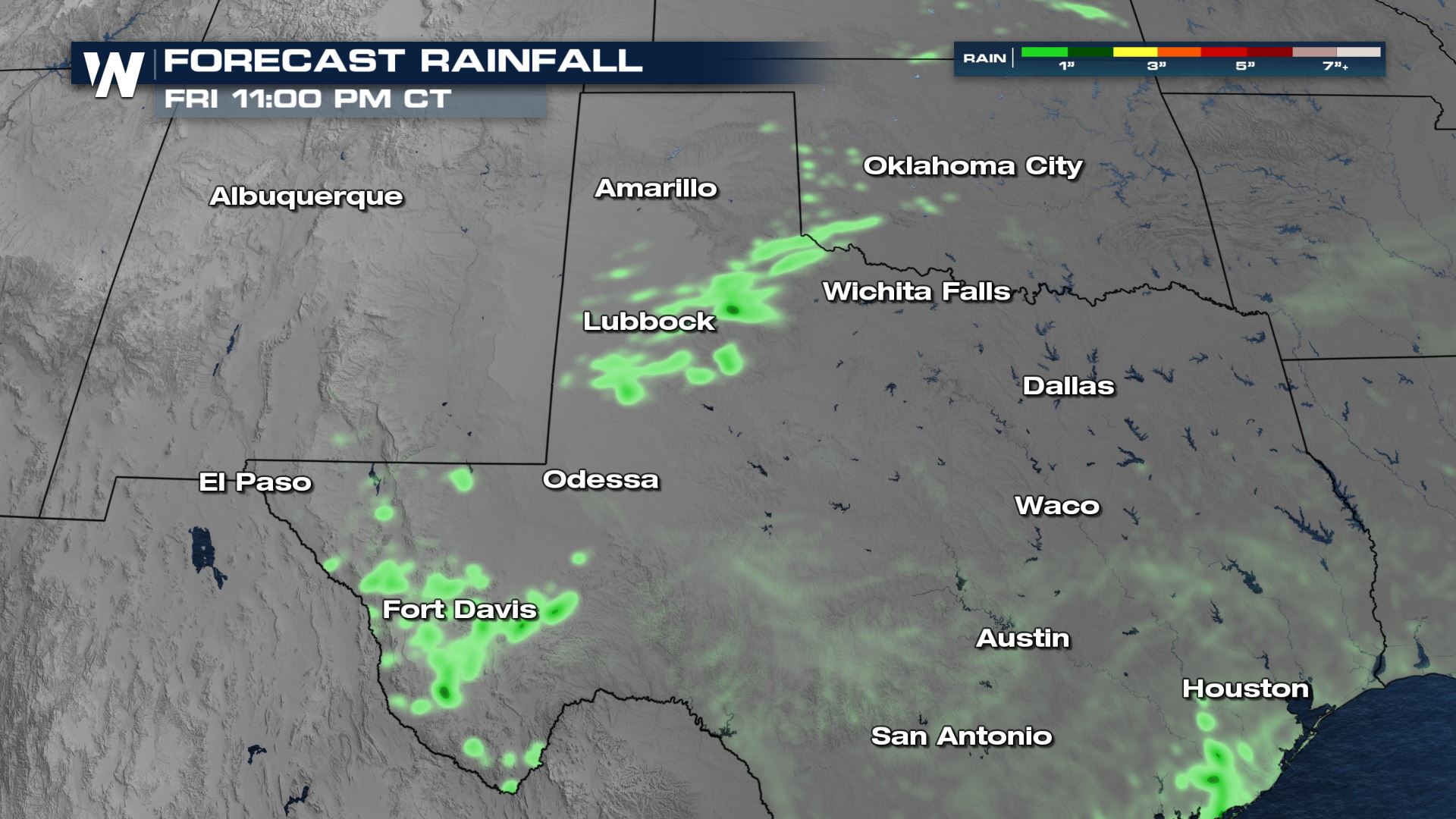
Rainfall
Due to the slow movement of the storms, isolated flash flood is not out of the question. As much as 1” - 3” of rain is possible through Friday evening from southern Oklahoma to southwest Texas.
You can always find more on the severe risk in the South-Central as :30 past the hour on WeatherNation!All Weather News
More
East Gears Up for Stormy, Wet Weekend
A low pressure system crashing through the Mi
1 Aug 2026 9:15 PM


Flooding, Severe Storms Target the Midwest Again
After an active week of storms across the nor
1 Aug 2026 1:40 AM

After Reaching Category 5, Genevieve Weakens in the Pacific
PacificFausto is now a post-tropical cyclone.
31 Jul 2026 1:30 AM

Flooding Risk Increases as Heavy Rain Targets the Tri-State Area
Tuesday, heavy rainfall moved across the Nort
30 Jul 2026 12:25 AM

Severe Weather: Energy From the Midwest Now in the Southeast
UPPER MIDWEST - Through Monday, dangerous tor
29 Jul 2026 10:30 PM