Snow and Ice Persist on Saturday in the Upper-Midwest

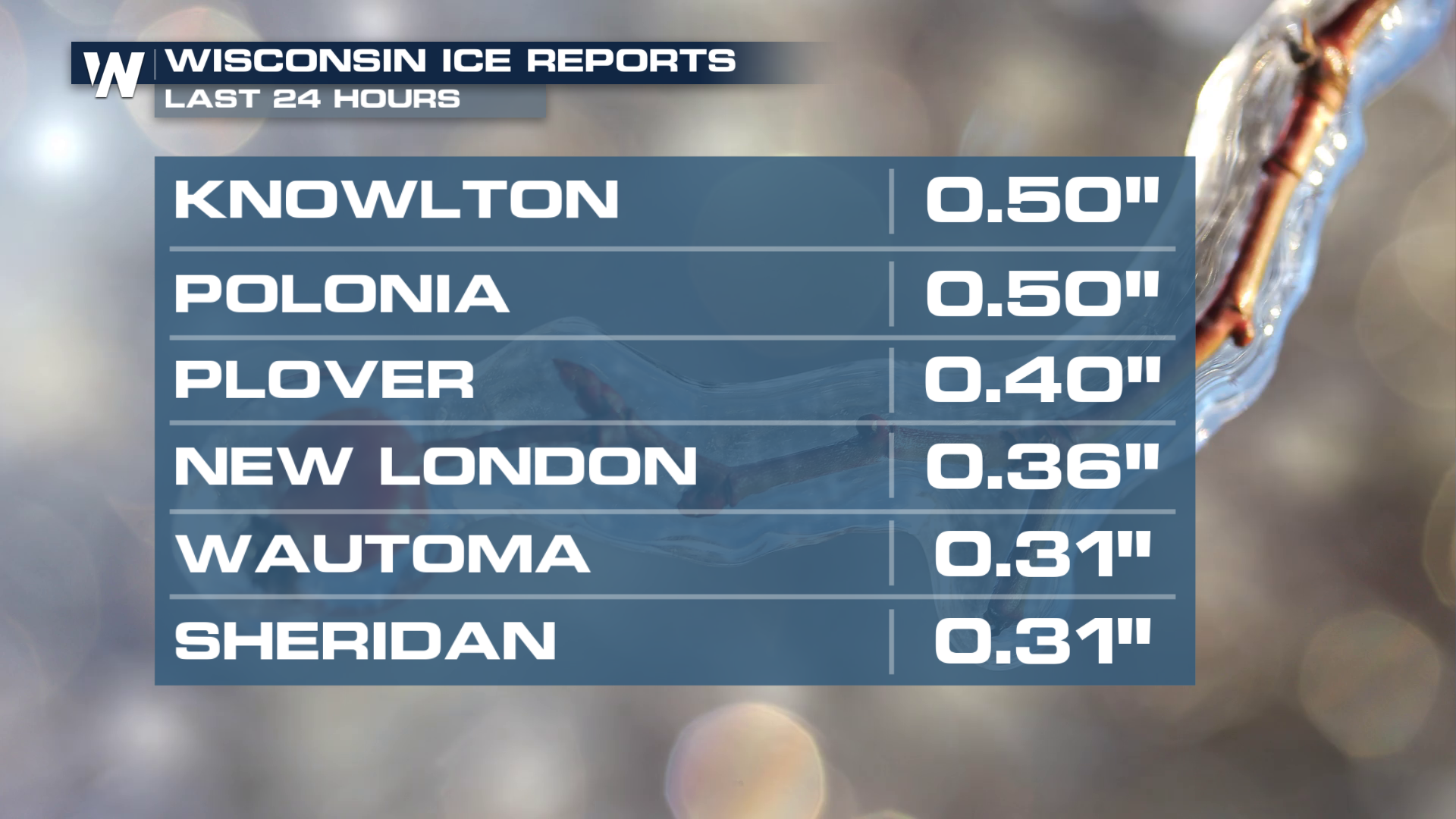
On the northern side of the strong low creating severe weather chances, snow and ice continue across the Upper Midwest and Great Lakes. Since Thursday, ice has accreted up to half an inch thick in parts of Wisconsin.
 Thousands of residents are in the dark because of trees falling on power lines, though those numbers did improve through the day on Friday. Heavy snow began to fall and accumulate quickly on Friday, with totals by Saturday morning already surpassing a foot!
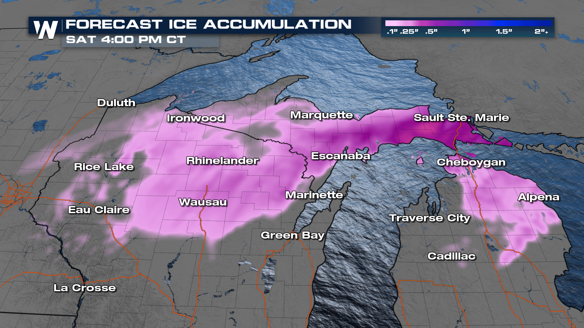
 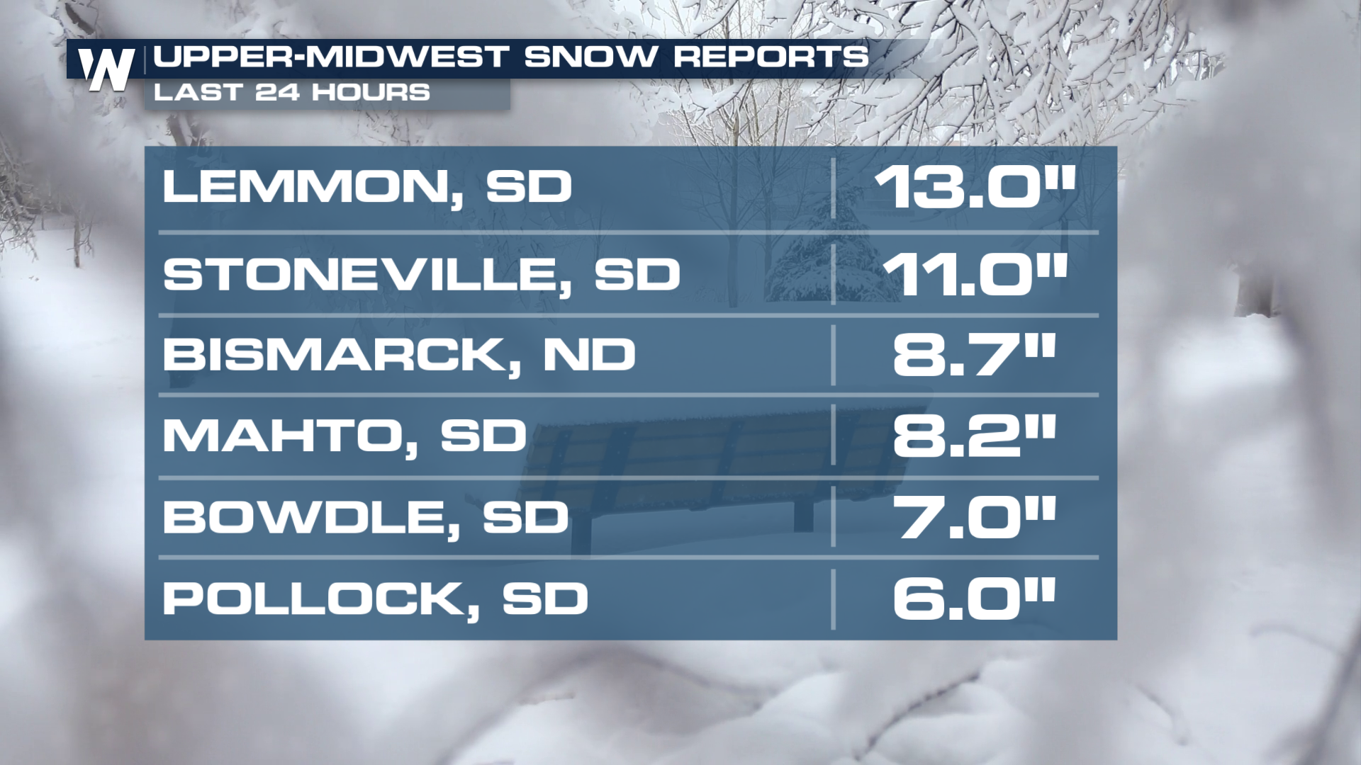 Winter alerts are out including Ice Storm Warnings for Northern Wisconsin and the UP of Michigan. Some areas could see ice totals up to a half inch. The new ice concerns are already over some of the same areas who may still be in the dark from Thursday's event. Heavy snow will continue on the back side for the Dakotas and northern Minnesota where winter storm warnings are in effect.
 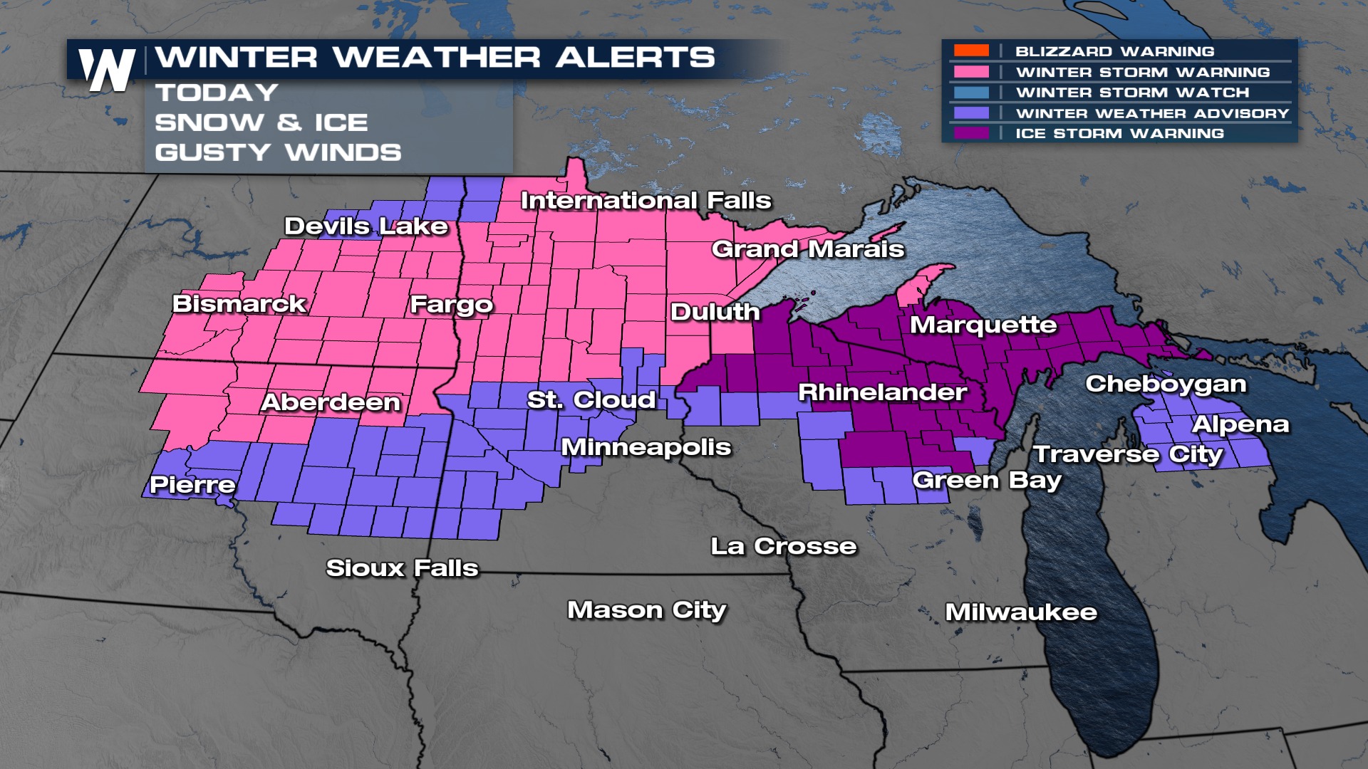 Freezing rain looks to persist in northern Michigan through the mid-to-late morning, possibly into the early afternoon. Heavy snow will gradually shift east behind the low, coming down heavily from the Dakotas through Northern Minnesota.
An additional 4-8 inches of snow (image top of page) will be likely across the Dakotas and Minnesota. In addition, significant icing looks to be possible across Michigan. Travel will be tough this weekend so avoid travel if you can!