Snow in The South: Light Accumulations Sunday Morning

SOUTH - Rounds of cold arctic air have been pushing across the South. As we head into the weekend, another frontal system will draw in just enough cold air and encounter just enough moisture to bring the potential for snow to the South. Totals should be on the lighter side, but some areas could see 1-3" stick.

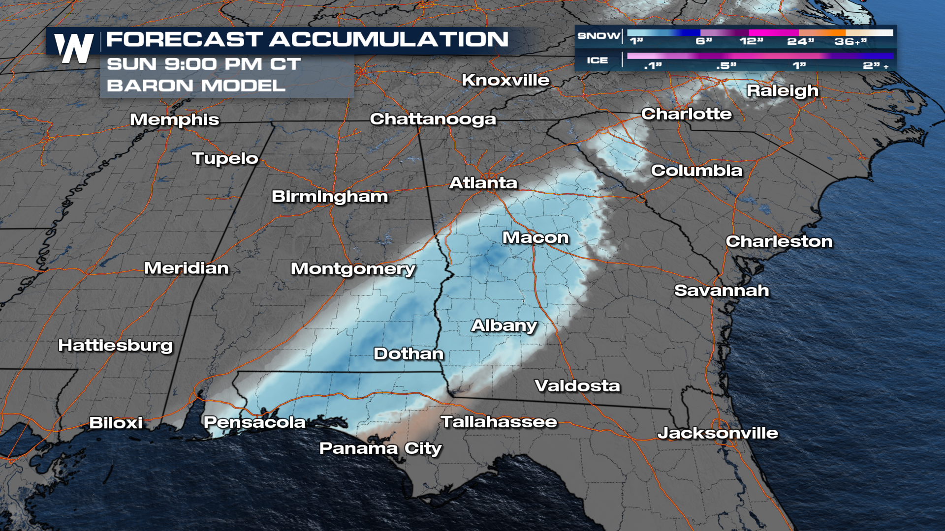
A winter weather advisory has been issued from eastern Alabama into southern Georgia, even a few into the northern Panhandle of Florida! Snow could accumulate in these areas, including interstates like I-75, I-16, and I-20.
Forecast
The NBM (National Blend of Models) shows the probability of snow across the South. Currently, the best chances are from southeastern Alabama up through the Carolinas.
Moisture is likely to begin as rainfall on Saturday before transitioning to snow into late Saturday night, but more likely Sunday morning. Snow could then continue along the frontal boundary into the late morning on Sunday.
Totals
Winter Storm Warnings are up for parts of Central Georgia where as much as three to four inches of snow could fall. However, the snow will not stick around for long as temperatures warm above freezing into the afternoon hours.
Be sure to join us on WeatherNation as we continue to fine-tune this forecast in the coming days.


