More Snow for the Northern Plains
Special Stories
25 Mar 2018 5:08 PM
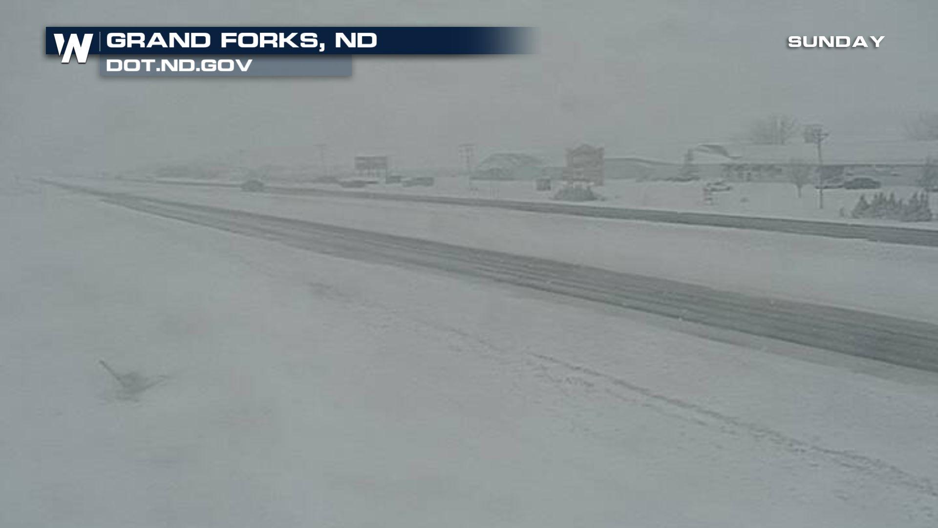
Sunday turned out to be quite snowy across eastern North Dakota. The Grand Forks area picked up over 6 inches by late afternoon. The potential exists for several inches more before the system winds down Monday.
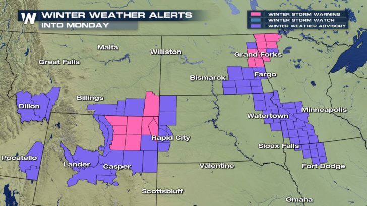 Snow is expected to impact areas from the Northern Rockies into the plains of Wyoming, the Dakotas, and Minnesota now through Monday night.
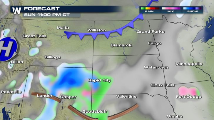
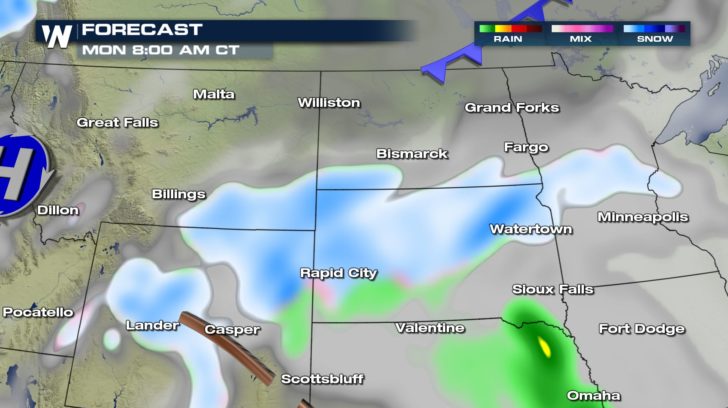
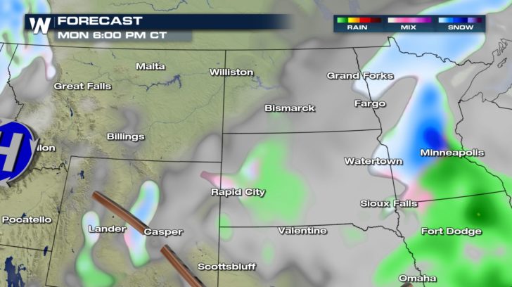 In addition to the Interstate 29 corridor in eastern North Dakota, heavy snow totals of 6 inches or more will be possible in northeast Wyoming and the Black Hills of South Dakota. Winds will be brisk, so blowing and drifting will be a concern in open areas.
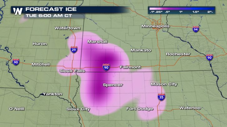
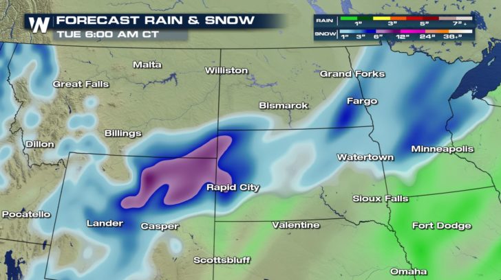 Further east, a wintry mix of snow, rain, and freezing rain will impacts areas of Minnesota, Iowa, and eastern South Dakota. A light glaze of ice is possible Monday.
 Be sure to follow WeatherNation on Twitter and Facebook for details on this top weather story and many more!
-Meteorologist Joe Astolfi
Be sure to follow WeatherNation on Twitter and Facebook for details on this top weather story and many more!
-Meteorologist Joe Astolfi
Snow is expected to impact areas from the Northern Rockies into the plains of Wyoming, the Dakotas, and Minnesota now through Monday night.
In addition to the Interstate 29 corridor in eastern North Dakota, heavy snow totals of 6 inches or more will be possible in northeast Wyoming and the Black Hills of South Dakota. Winds will be brisk, so blowing and drifting will be a concern in open areas.
Further east, a wintry mix of snow, rain, and freezing rain will impacts areas of Minnesota, Iowa, and eastern South Dakota. A light glaze of ice is possible Monday.
Be sure to follow WeatherNation on Twitter and Facebook for details on this top weather story and many more!
-Meteorologist Joe AstolfiAll Weather News
More


More Storms for the East Sunday and Monday
A low-pressure system crashing through the Mi
2 Aug 2026 2:20 AM

After Reaching Category 5, Genevieve Weakens in the Pacific
PacificGenevieve formed on last Friday south
2 Aug 2026 1:30 AM

Flooding, Severe Storms Target the Midwest Again
After an active week of storms across the nor
1 Aug 2026 1:40 AM

Flooding Risk Increases as Heavy Rain Targets the Tri-State Area
Tuesday, heavy rainfall moved across the Nort
30 Jul 2026 12:25 AM

Severe Weather: Energy From the Midwest Now in the Southeast
UPPER MIDWEST - Through Monday, dangerous tor
29 Jul 2026 10:30 PM