Snow Returns to the Northwest Mountains
Special Stories
15 Feb 2020 6:44 PM
WINTER WEATHER ALERTS
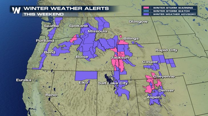 Winter weather alerts extend from the Cascades to the Tetons and south to the Colorado Rockies. More than a foot of snow is likely through the weekend in multiple mountain ranges across the West. We could even see snowfall totals getting close to 2 feet!
ROAD IMPACTS
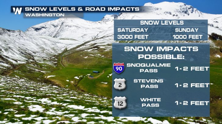 Snow levels are expected to drop to elevations as low as 1000 feet through the mountain passes in Washington by Sunday. Travel through the busier mountain passes is expected to be impacted at times.
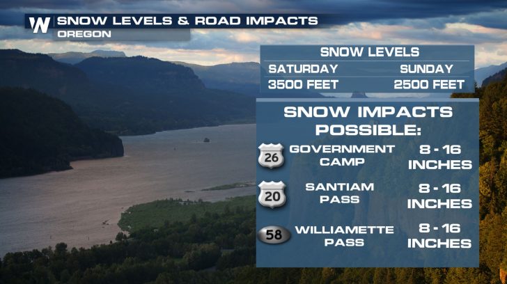 Travel through the mountain passes in Oregon will also be tricky. Snow levels are expected to drop as low as 2500 by Sunday, with 8 to 16 inches of snow possible in some locations.
The Cascades through Oregon will likely see more moisture than the ranges in Washington, with the bulk of the snow falling by Sunday night.
Travel through the mountain passes in Oregon will also be tricky. Snow levels are expected to drop as low as 2500 by Sunday, with 8 to 16 inches of snow possible in some locations.
The Cascades through Oregon will likely see more moisture than the ranges in Washington, with the bulk of the snow falling by Sunday night.
FORECAST SNOWFALL
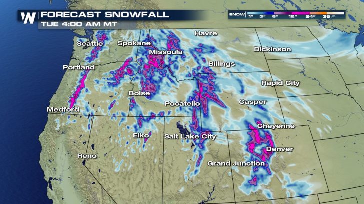 The Rockies through Wyoming and Colorado are expected to receive over a foot of snow on many peaks and ridges, while the Wasatch Range, east of Salt Lake City, is also expecting more than 18 inches on some peaks through Monday morning.
FORECAST
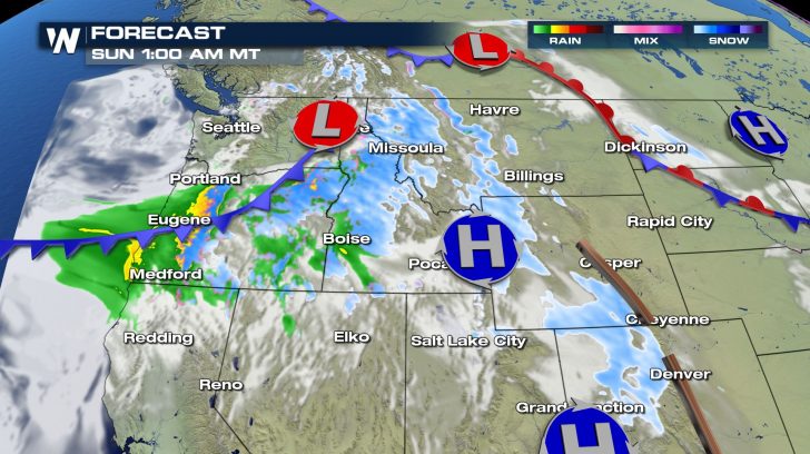
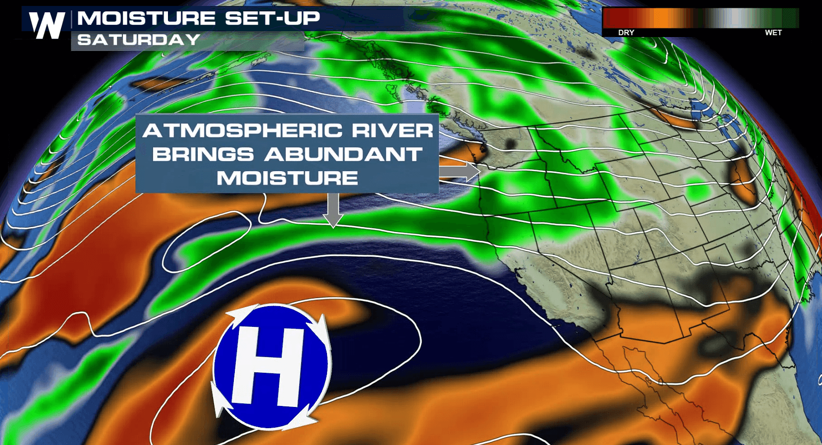
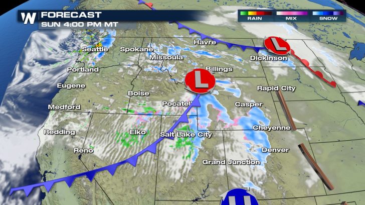 Constant moisture streaming into the northwest will lead to constant snowfall and rainfall for many. Snow will continue throughout the entire day on Sunday and into Monday.
Through Sunday morning, coastal areas in Oregon and northern California will wake up to soggy conditions. Heavy downpours should be expected. Once we make it to the afternoon, much of the rain will have moved out.
If you have travel plans this weekend in the Northwest, check back with WeatherNation for the latest information.
Constant moisture streaming into the northwest will lead to constant snowfall and rainfall for many. Snow will continue throughout the entire day on Sunday and into Monday.
Through Sunday morning, coastal areas in Oregon and northern California will wake up to soggy conditions. Heavy downpours should be expected. Once we make it to the afternoon, much of the rain will have moved out.
If you have travel plans this weekend in the Northwest, check back with WeatherNation for the latest information.All Weather News
More
East Gears Up for Stormy, Wet Weekend
A low pressure system crashing through the Mi
1 Aug 2026 11:35 AM


Flooding, Severe Storms Target the Midwest Again
After an active week of storms across the nor
1 Aug 2026 1:40 AM


After Reaching Category 5, Genevieve Weakens in the Pacific
PacificFausto is now a post-tropical cyclone.
31 Jul 2026 1:30 AM

Flooding Risk Increases as Heavy Rain Targets the Tri-State Area
Tuesday, heavy rainfall moved across the Nort
30 Jul 2026 12:25 AM

Severe Weather: Energy From the Midwest Now in the Southeast
UPPER MIDWEST - Through Monday, dangerous tor
29 Jul 2026 10:30 PM