Snow Wrapping Up in Colorado Overnight
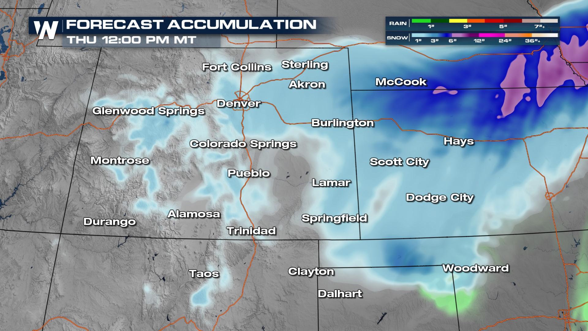
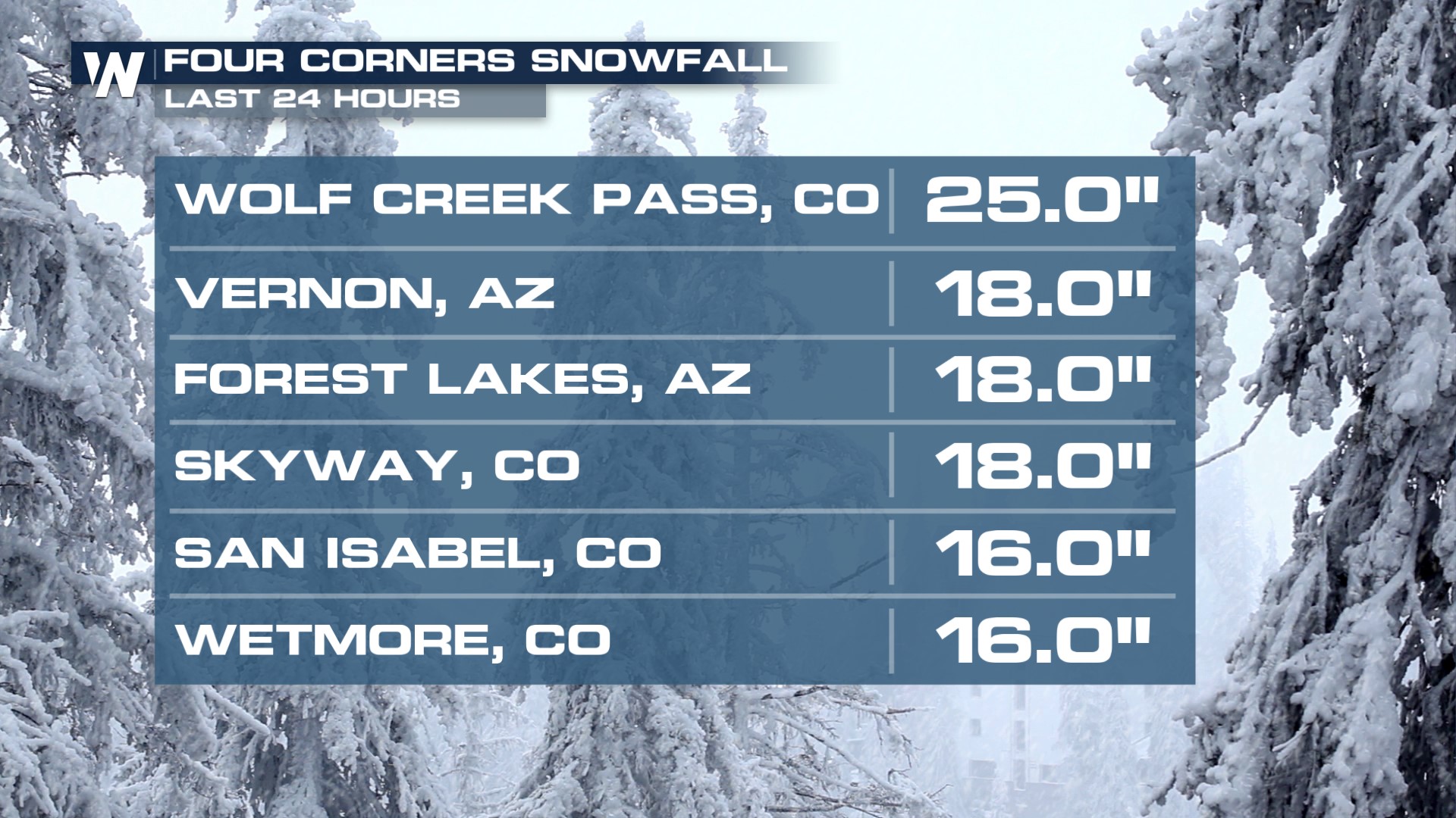
Our Colorado Low will be exiting into the Plains overnight, wrapping up additional snow for the four corners states through the morning hours. Snowfall totals have been impressive in the mountains, check out some of our top reports!
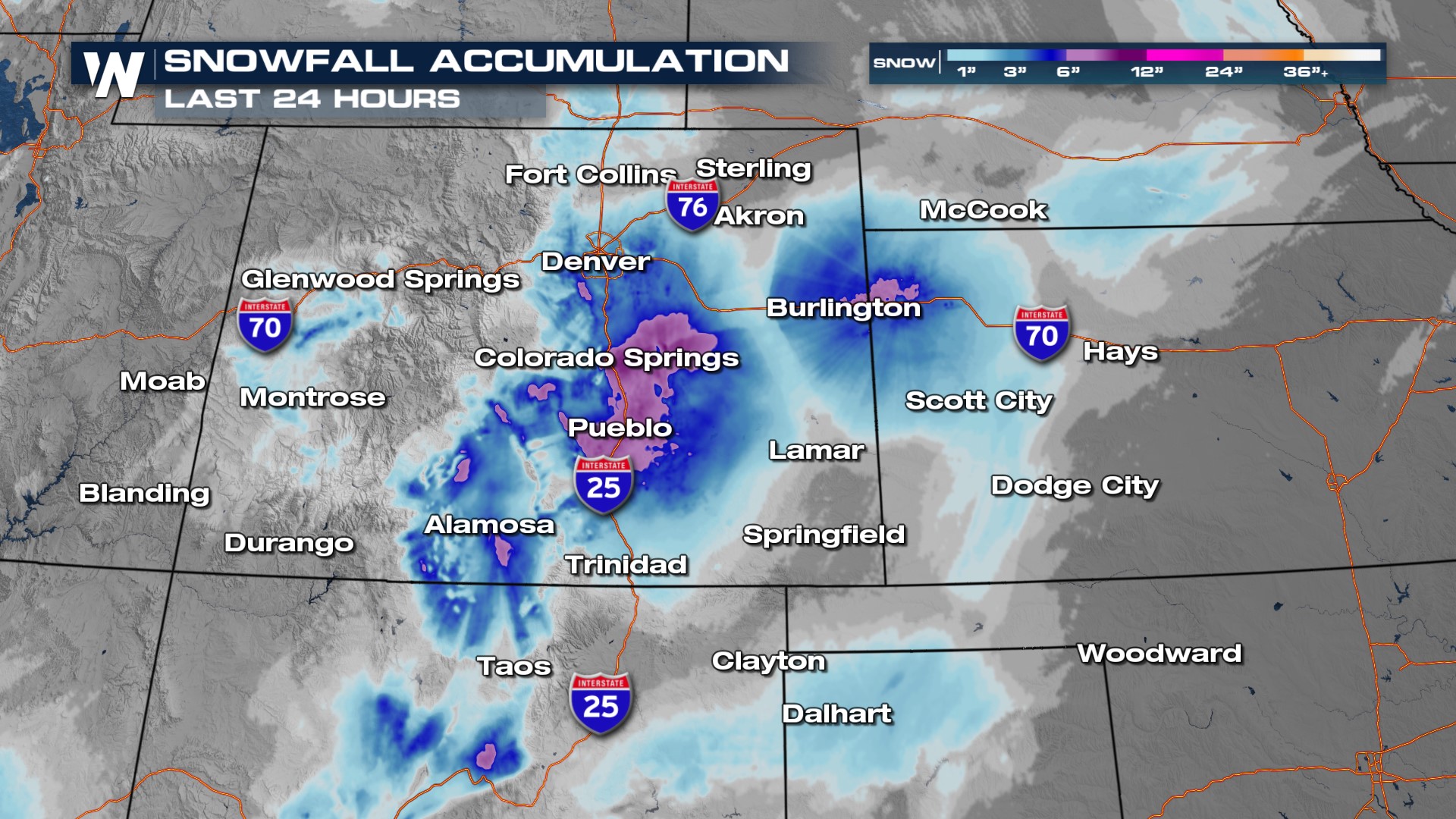
 In fact, some areas along the I-25 corridor broke records! According to the National Weather Service of Pueblo, Colorado Springs, and Pueblo set daily snowfall records.
Alerts
Winter weather alerts end overnight through Thursday morning into the Plains.
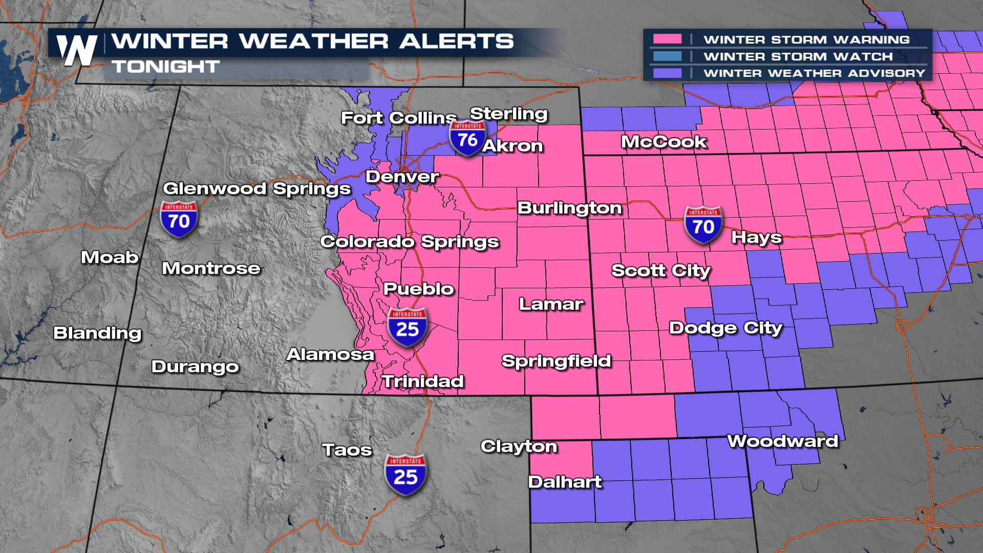
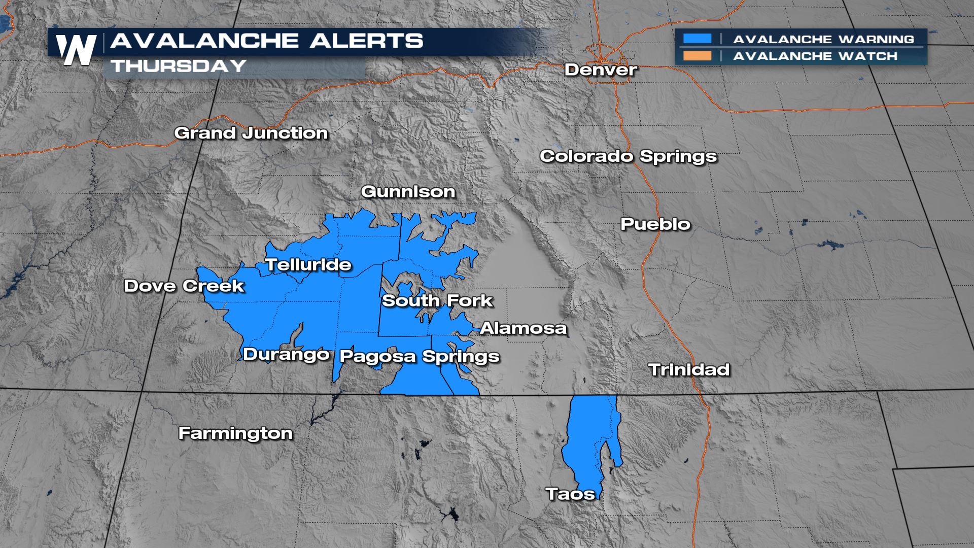
Due to the weight of new snowfall, the avalanche threat is high, especially through the San Juan mountains of SW Colorado and the Sangre de Cristos through southern Colorado and New Mexico. Don't backcountry ski and if you're hitting the slopes in Telluride, Taos, or Wolf Creek, be sure to carry an avalanche beacon.
Snow showers wrap up overnight and head in to the Plains, Upper Midwest and Great Lakes. Be sure to tune in to WeatherNation for the details and timing of the snow in those areas!
For more details on this top weather headline be sure to join us live on WeatherNation.


