Snowfall Along Lake Ontario for Wednesday
Special Stories
2 Dec 2020 4:30 AM
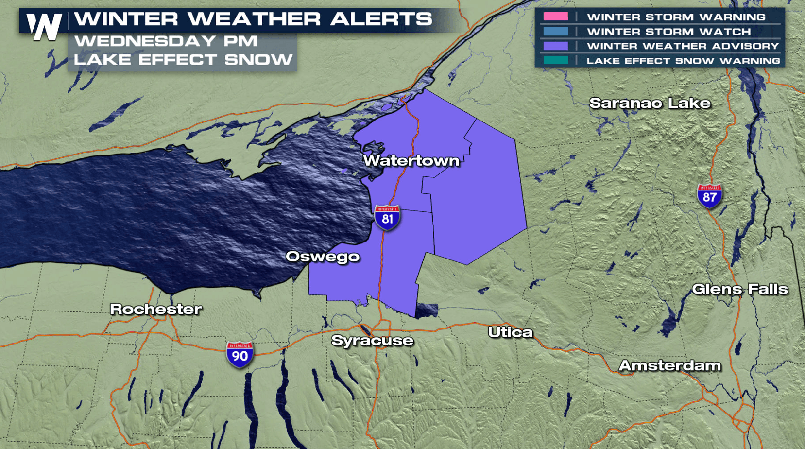
Lake enhanced snow showers will be falling along the eastern shores of Lake Ontario today (Wednesday), bringing several inches of accumulation. Winter weather advisories have been issued for up to 6" of snowfall. Totals will be lower around Lake Erie, with only a couple inches expected near Buffalo and Rochester, NY.
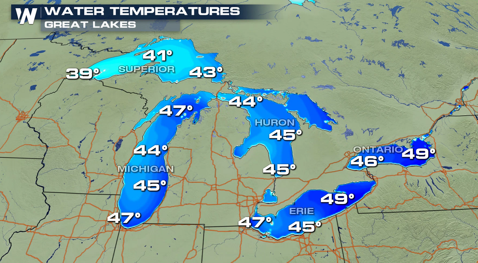
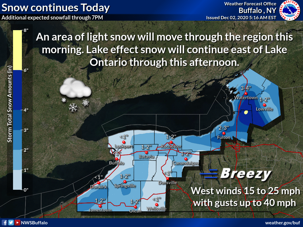 An upper level disturbance and a surface trough will bring moisture and energy for snow showers. The warm lake waters will enhance snowfall. Water temperatures are in the 40s to near 50 degrees, but air temperatures are 20 to 30 degrees colder at cloud level, producing additional clouds and snow. Coupled with an offshore, westerly wind over the lakes, the heaviest snow will fall on the eastern shores of Lake Ontario near Watertown, NY.
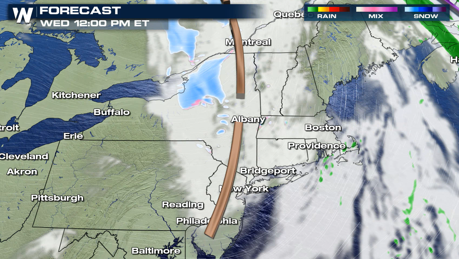
 The trough of low pressure will move across the region through this afternoon (Wednesday), bringing the areas of snow. The system will move east of the Great Lakes tonight and snow showers will come to an end.
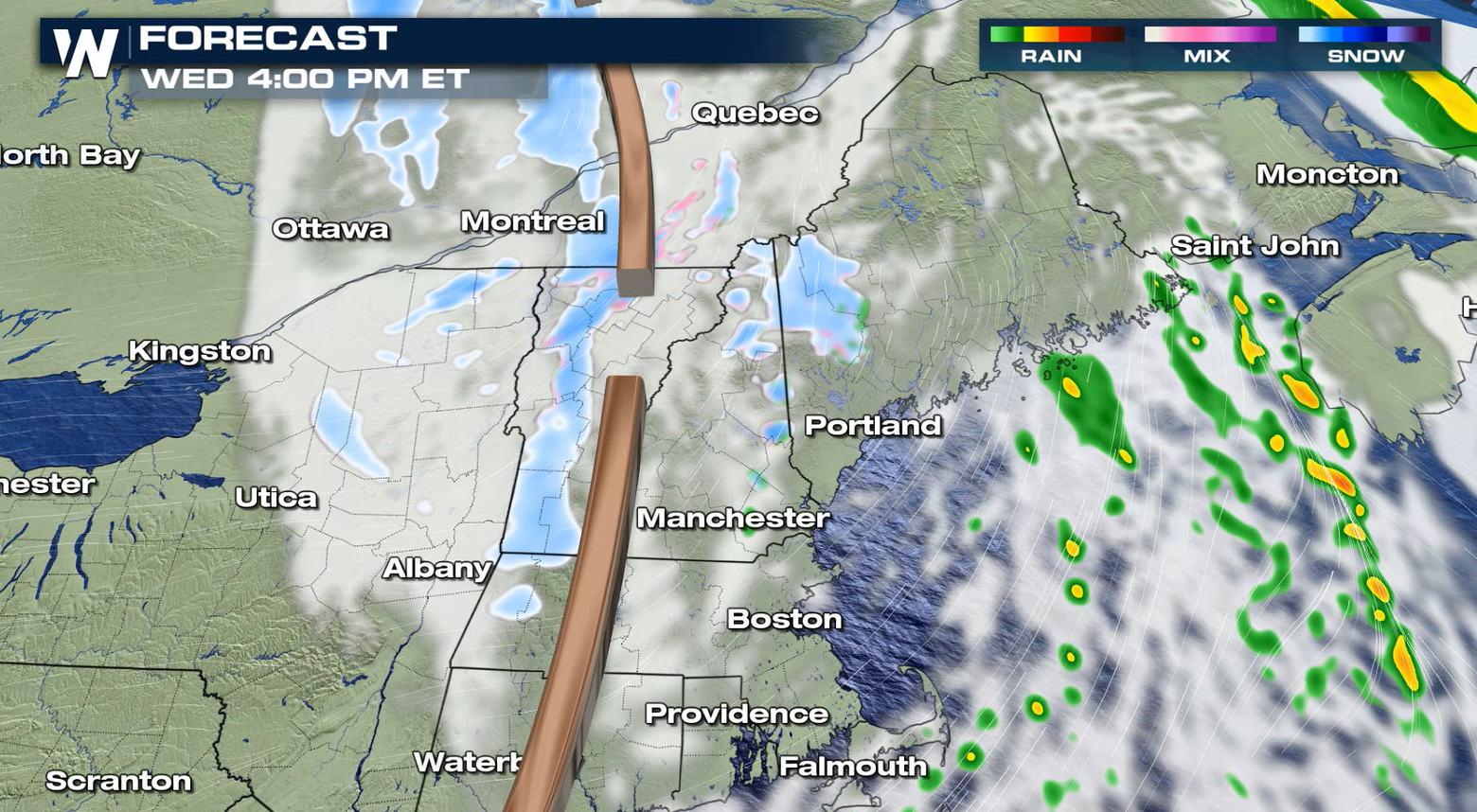
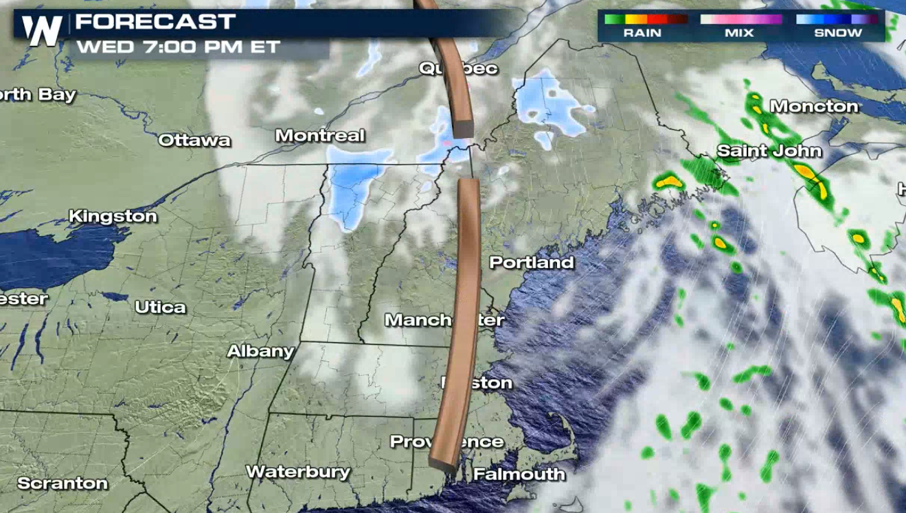 WeatherNation will keep you updated on-air and online with the latest forecasts and accumulations for the Great Lakes.
An upper level disturbance and a surface trough will bring moisture and energy for snow showers. The warm lake waters will enhance snowfall. Water temperatures are in the 40s to near 50 degrees, but air temperatures are 20 to 30 degrees colder at cloud level, producing additional clouds and snow. Coupled with an offshore, westerly wind over the lakes, the heaviest snow will fall on the eastern shores of Lake Ontario near Watertown, NY.
The trough of low pressure will move across the region through this afternoon (Wednesday), bringing the areas of snow. The system will move east of the Great Lakes tonight and snow showers will come to an end.
WeatherNation will keep you updated on-air and online with the latest forecasts and accumulations for the Great Lakes.All Weather News
More
Wildfire Outbreak in the Pacific Northwest
Conditions have been incredibly dry out west.
2 Aug 2026 1:30 PM

After Reaching Category 5, Genevieve Weakens in the Pacific
PacificGenevieve formed on last Friday south
2 Aug 2026 1:25 PM

More Storms for the East Sunday and Monday
A low-pressure system crashing through the Mi
2 Aug 2026 1:25 PM


Flooding, Severe Storms Target the Midwest Again
After an active week of storms across the nor
1 Aug 2026 1:40 AM

Flooding Risk Increases as Heavy Rain Targets the Tri-State Area
Tuesday, heavy rainfall moved across the Nort
30 Jul 2026 12:25 AM

Severe Weather: Energy From the Midwest Now in the Southeast
UPPER MIDWEST - Through Monday, dangerous tor
29 Jul 2026 10:30 PM