Southeast Severe Chances

Special Stories
12 May 2019 11:15 AM
SEVERE OUTLOOK
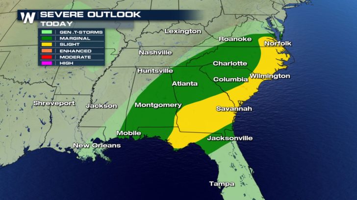
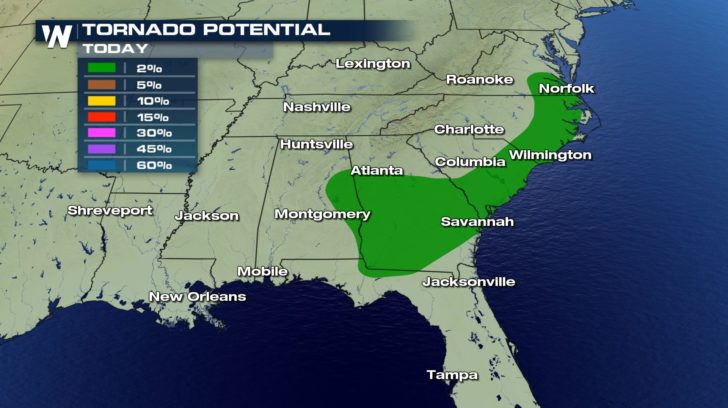 Severe weather continues in the southeast, today. Anything from damaging winds, hail, and tornadoes will all pose a threat.
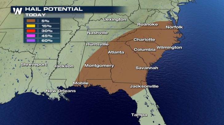
Hail could reach up to an inch in diameter.
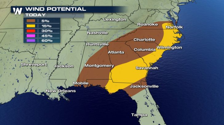
Winds could range anywhere from 58 mph to 70 mph within some of the storms.
FORECAST
Severe weather continues in the southeast, today. Anything from damaging winds, hail, and tornadoes will all pose a threat.
Hail could reach up to an inch in diameter.
Winds could range anywhere from 58 mph to 70 mph within some of the storms.
FORECAST
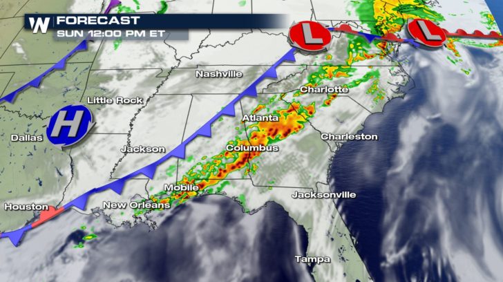
 The forecast shows a line of strong storms forming as we head into the afternoon. This band will hold together until around 5 PM this evening.
After, the cold front will slide off the coast and much of the rain will clear out.
Heavy rain showers will hang around the Florida panhandle throughout the night and into Monday morning.
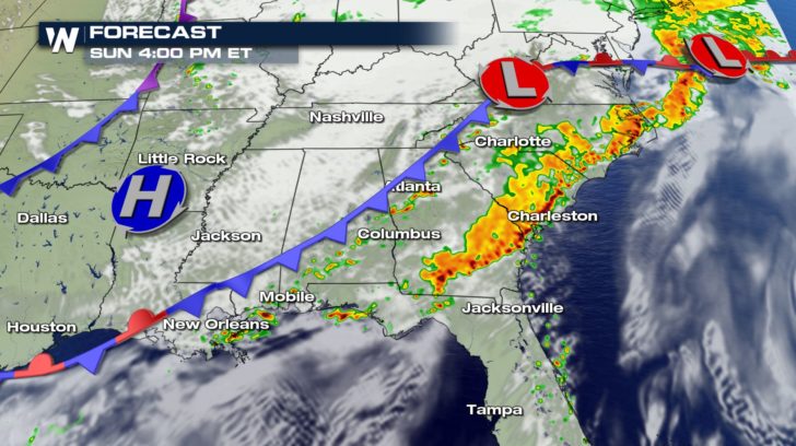
The forecast shows a line of strong storms forming as we head into the afternoon. This band will hold together until around 5 PM this evening.
After, the cold front will slide off the coast and much of the rain will clear out.
Heavy rain showers will hang around the Florida panhandle throughout the night and into Monday morning.
Severe weather continues in the southeast, today. Anything from damaging winds, hail, and tornadoes will all pose a threat.
Hail could reach up to an inch in diameter.
Winds could range anywhere from 58 mph to 70 mph within some of the storms.
FORECAST
The forecast shows a line of strong storms forming as we head into the afternoon. This band will hold together until around 5 PM this evening.
After, the cold front will slide off the coast and much of the rain will clear out.
Heavy rain showers will hang around the Florida panhandle throughout the night and into Monday morning.All Weather News
More
More Storms for the East Through Monday
A low-pressure system that moved through the
2 Aug 2026 10:40 PM

Wildfire Outbreak in the Pacific Northwest
SPOKANE, WA - On Saturday, August 1st, the Ol
2 Aug 2026 10:35 PM


After Reaching Category 5, Genevieve Weakens in the Pacific
PacificGenevieve formed on last Friday south
2 Aug 2026 6:25 PM

Flooding, Severe Storms Target the Midwest Again
After an active week of storms across the nor
1 Aug 2026 1:40 AM

Flooding Risk Increases as Heavy Rain Targets the Tri-State Area
Tuesday, heavy rainfall moved across the Nort
30 Jul 2026 12:25 AM

Severe Weather: Energy From the Midwest Now in the Southeast
UPPER MIDWEST - Through Monday, dangerous tor
29 Jul 2026 10:30 PM