Southeast Severe Chances
Special Stories
7 Jul 2019 11:37 AM
SEVERE OUTLOOK
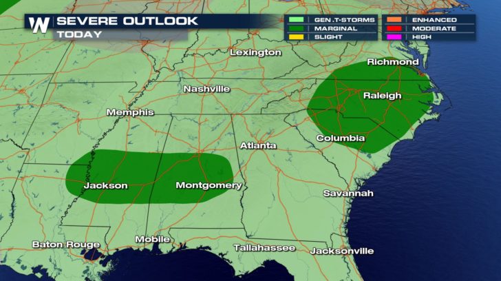
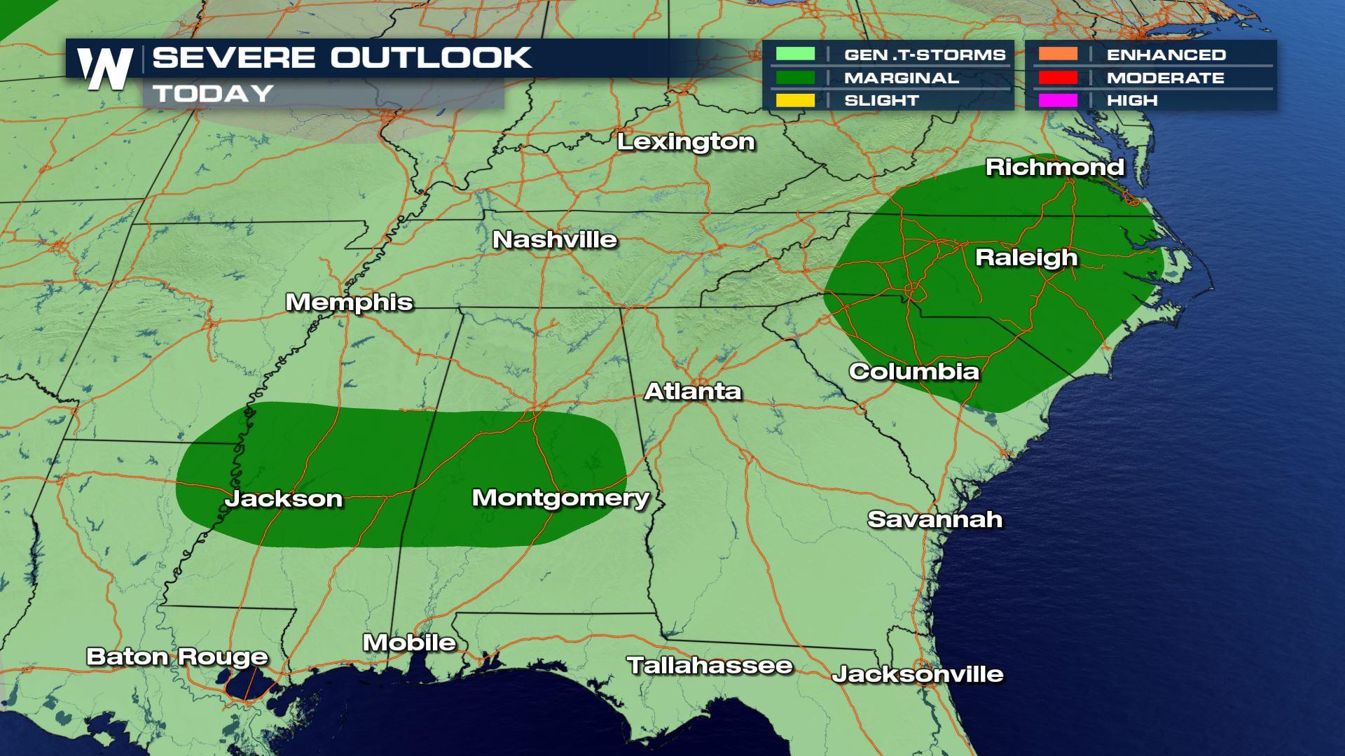
 A marginal threat of severe weather is in place for areas in the southeast. Isolated severe thunderstorms may be possible for the afternoon and evening hours.
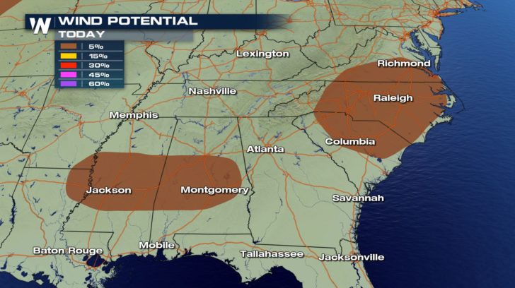
We aren't looking at a tornado or hail threat. The main threat will be damaging winds. Winds could exceed 58 mph within some of these storms.
A marginal threat of severe weather is in place for areas in the southeast. Isolated severe thunderstorms may be possible for the afternoon and evening hours.
We aren't looking at a tornado or hail threat. The main threat will be damaging winds. Winds could exceed 58 mph within some of these storms.
FORECAST
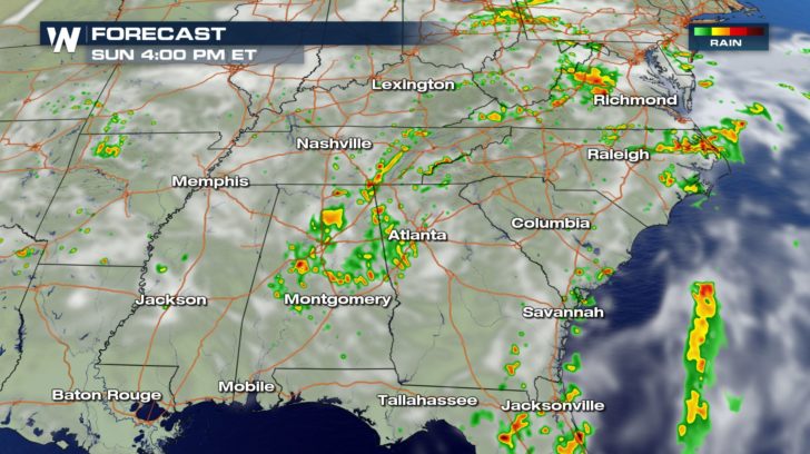
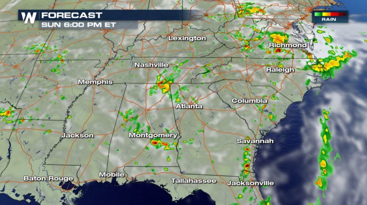
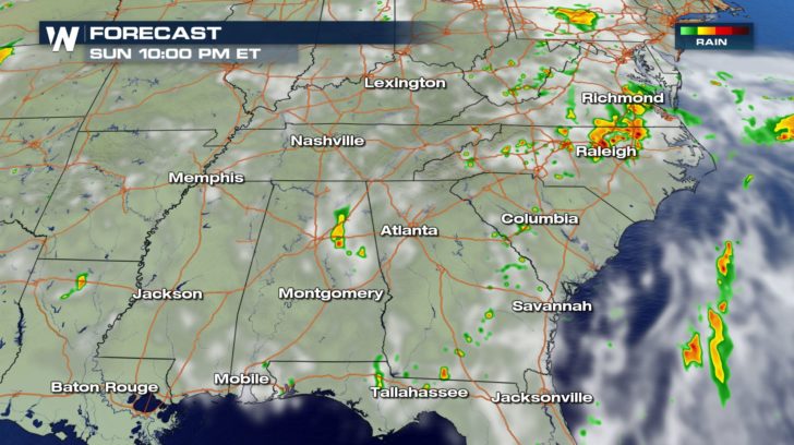 Storms will fire off as we head towards the evening hours and last late into the night. As we head into early Monday morning, many of these storms will quiet down, and we'll be back to quiet conditions for the start to the work week.
All Weather News
More
More Storms for the East Through Monday
A low-pressure system that moved through the
2 Aug 2026 10:40 PM

Wildfire Outbreak in the Pacific Northwest
SPOKANE, WA - On Saturday, August 1st, the Ol
2 Aug 2026 10:35 PM


After Reaching Category 5, Genevieve Weakens in the Pacific
PacificGenevieve formed on last Friday south
2 Aug 2026 6:25 PM

Flooding, Severe Storms Target the Midwest Again
After an active week of storms across the nor
1 Aug 2026 1:40 AM

Flooding Risk Increases as Heavy Rain Targets the Tri-State Area
Tuesday, heavy rainfall moved across the Nort
30 Jul 2026 12:25 AM

Severe Weather: Energy From the Midwest Now in the Southeast
UPPER MIDWEST - Through Monday, dangerous tor
29 Jul 2026 10:30 PM