Plains and Ohio Valley Severe Weather Risk
Special Stories
19 Mar 2020 7:00 AM
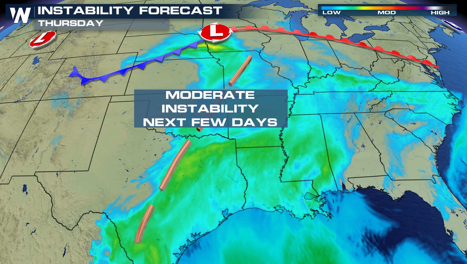
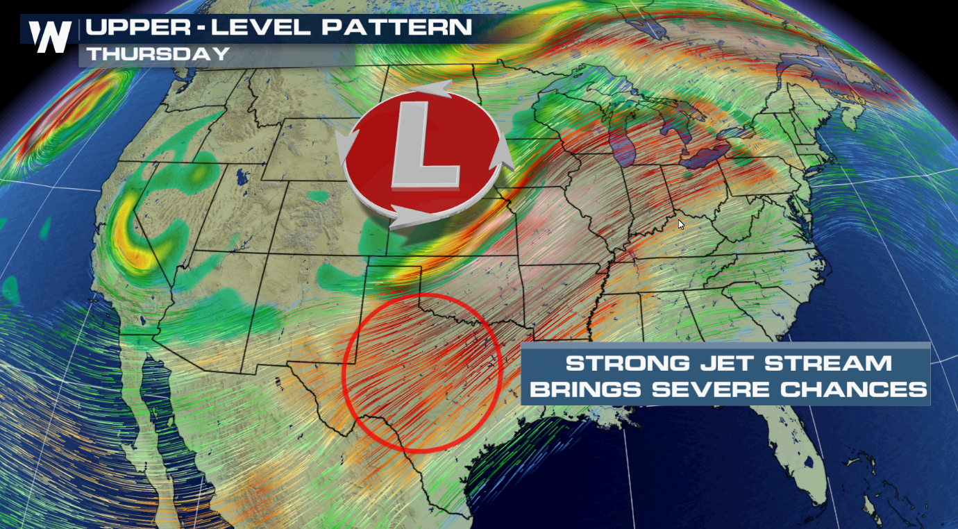
An intensifying Jet Stream, coupled with increasing instability, will aid in the development of severe thunderstorms for the Plains today (Thursday).
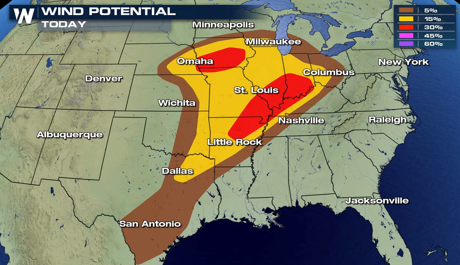
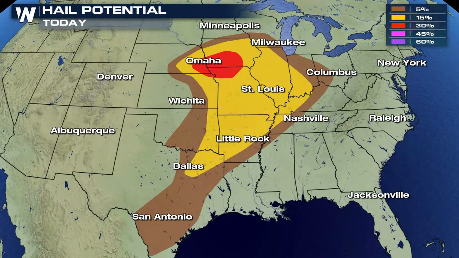
 The threat area from the Storm Prediction Center extends from Lake Michigan to the Rio Grande River in Texas. An enhanced slight risk includes areas from Indianapolis to Paducah and throughout much of Iowa.
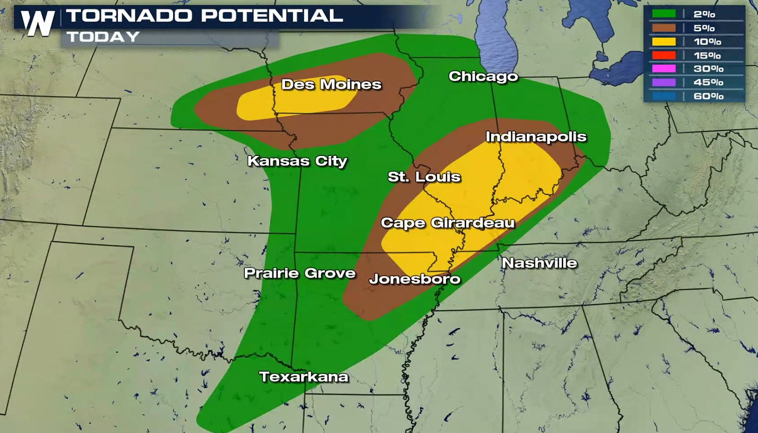
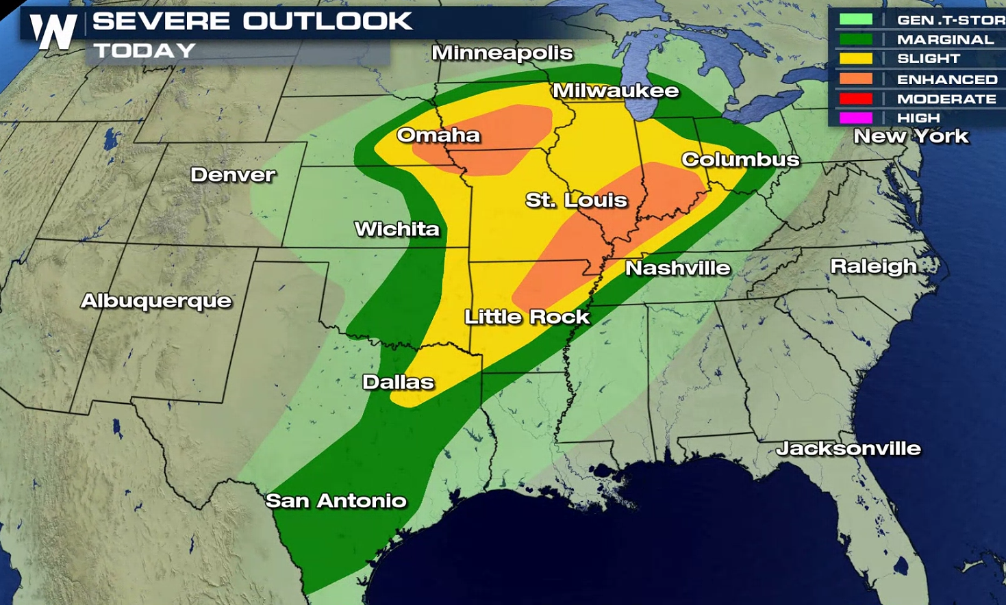 Large hail greater than the size of a quarter and wind gusts higher than 58 mph are the biggest concerns. Isolated tornadoes are also possible.
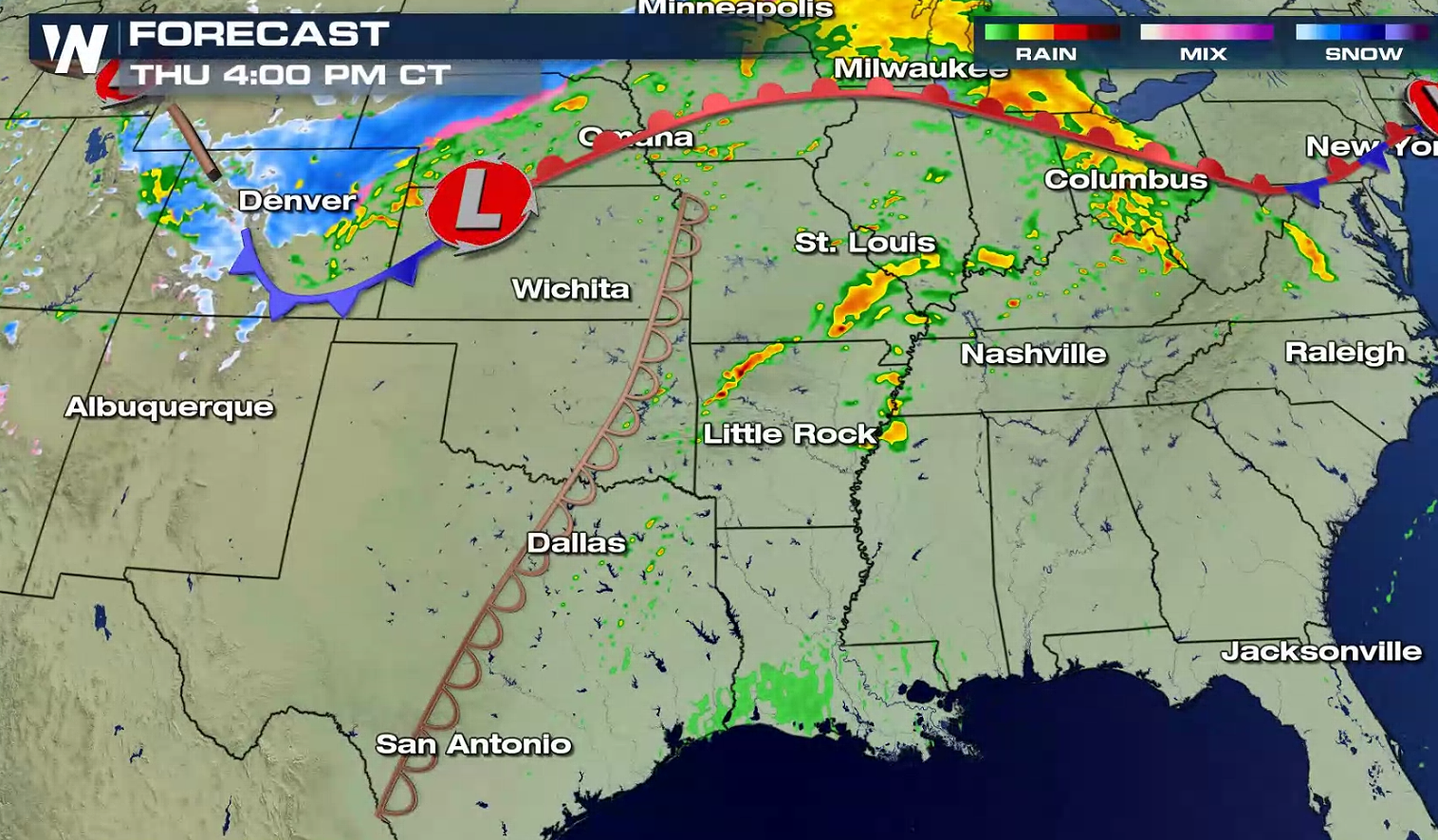
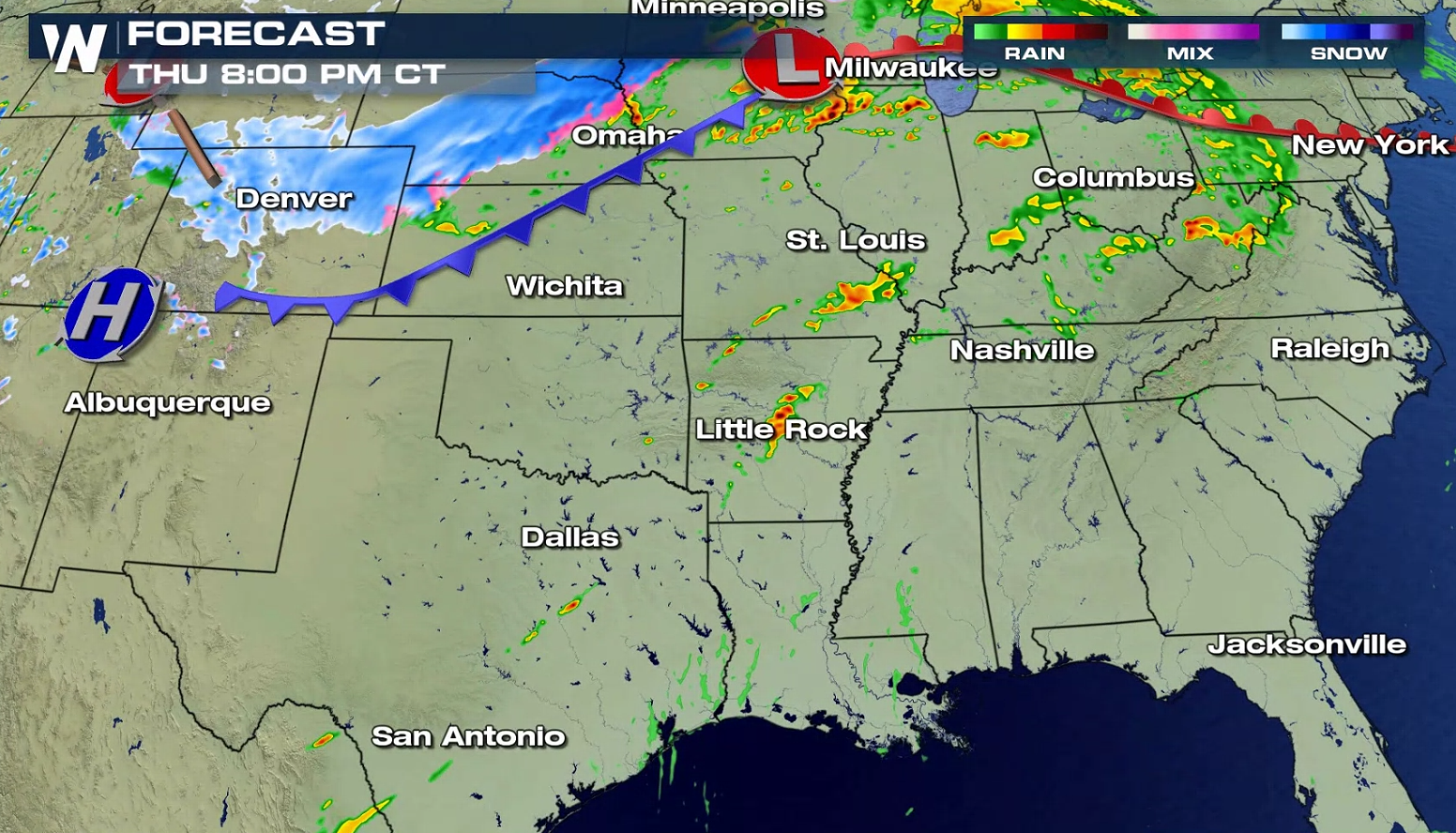
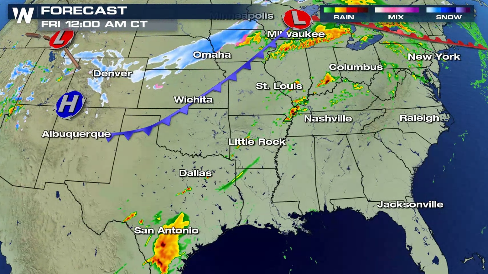
 A series of fronts will be in the region this afternoon and evening (Thursday). It will be the main focus for thunderstorms, along with a low pressure center. A trough / dry line in the Central and Southern Plains will interact with upper level energy in the late afternoon and evening. As Jet Stream energy arrives and instability builds, severe storms will develop.
 WeatherNation will keep you up-to-date on-air and online. If you are in the severe weather risk areas, be sure to check back for the latest watches and warnings.

 The threat area from the Storm Prediction Center extends from Lake Michigan to the Rio Grande River in Texas. An enhanced slight risk includes areas from Indianapolis to Paducah and throughout much of Iowa.
 Large hail greater than the size of a quarter and wind gusts higher than 58 mph are the biggest concerns. Isolated tornadoes are also possible.


 A series of fronts will be in the region this afternoon and evening (Thursday). It will be the main focus for thunderstorms, along with a low pressure center. A trough / dry line in the Central and Southern Plains will interact with upper level energy in the late afternoon and evening. As Jet Stream energy arrives and instability builds, severe storms will develop.


 WeatherNation will keep you up-to-date on-air and online. If you are in the severe weather risk areas, be sure to check back for the latest watches and warnings.
All Weather News
More