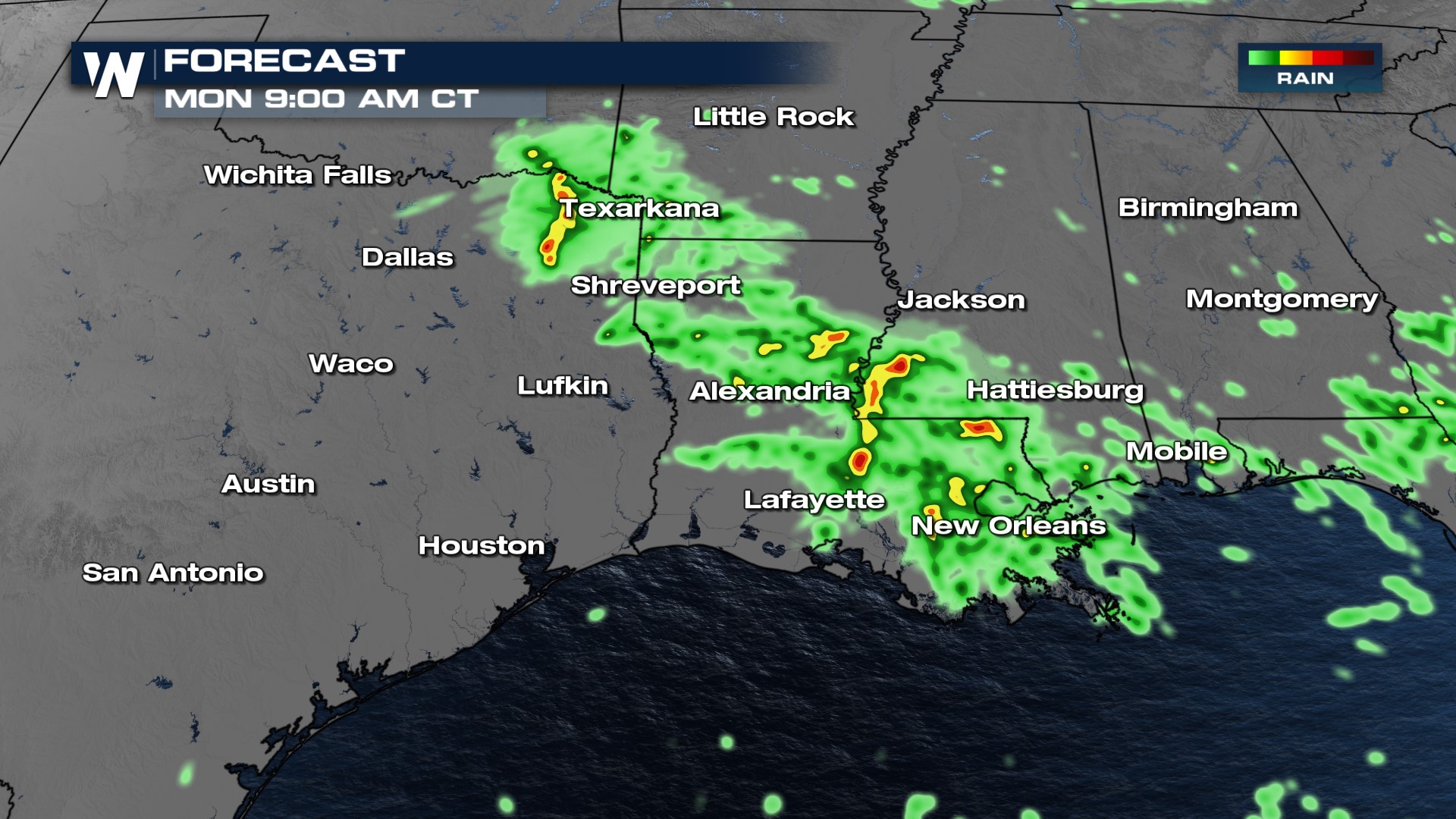
Texarkana to Florida Storms and Heavy Rain

Chances are if you live in the southern Plains this summer, you've heard us use this term: MCS. So what is it? MCS stands for Mesoscale Convective System, also known as a cluster of thunderstorms. The National Weather Service defines it as:
A complex of thunderstorms which becomes organized on a scale larger than individual thunderstorms, and normally persists for several hours or more.
Severe Outlook
The Severe Thunderstorm Watch across the south has been trimmed back as storms continue eastwards. Storm will continue through Louisiana and Mississippi with the chance for 70mph winds.
The Storm Prediction Center has also upgraded the risk for severe weather from marginal to SLIGHT (level 2 out of 5).
 Our main hazards will be the threat of damaging winds in these areas, especially including the Shreveport and I-20 area.

Timing
Storms are already happening in the Texarkana, ArkLaTex area now and will continue to move south and southeast through this evening and tonight. This will bring heavy rain to oversaturated soils. Storms have fired along our stalled out boundary - that's what giving these regions enough lift to spark storms.
Flooding
In addition to the wind threat, be prepared for heavy rainfall and flooding. Intense rainfall rates can lead to flash flooding, especially in low-lying and poor drainage areas so use extra caution if you have to be out on the roads during these storms.

 By Monday, the risk for heavy rainfall shifts to more of Louisiana as well as Florida.
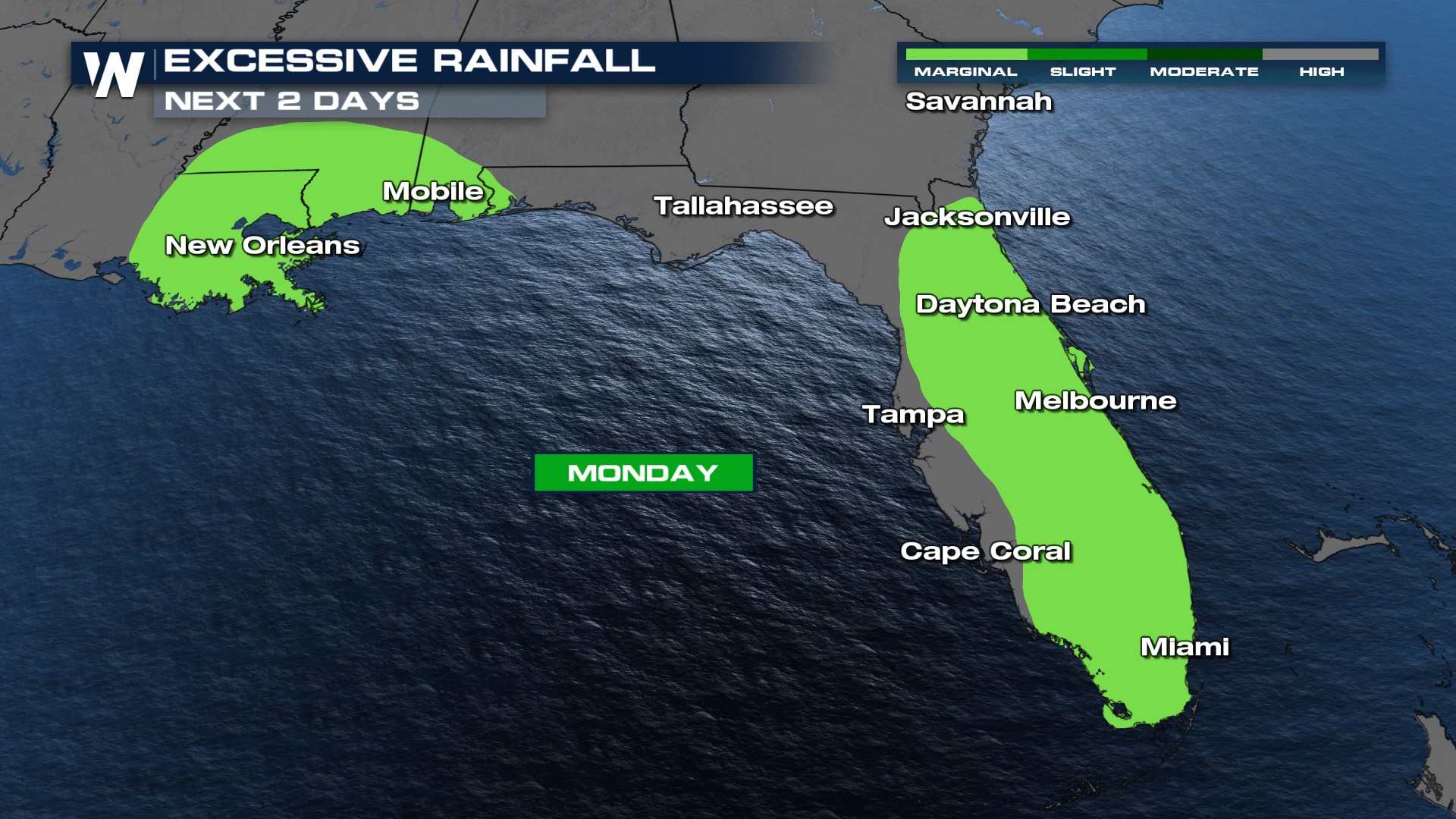 Most of Monday's storms will fire up with daytime heating.
For more on this weather headline be sure to join us on WeatherNation. For more on temperatures and extended forecasts in this area join us for our central regional 30 minutes past the hour.


