Still A Chance Of Severe Storms Into Friday
Special Stories
30 May 2019 3:00 AM
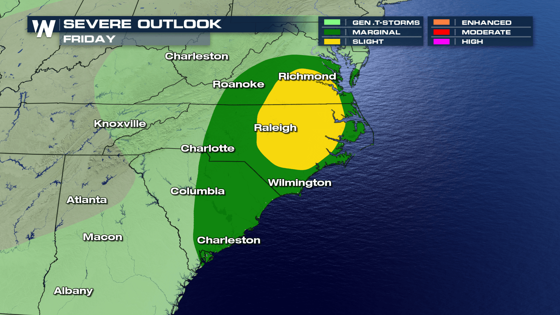
The threat of severe weather continues through the end of the week, as another wave of energy moves into the region. The SPC, or Storm Prediction Center, has issued a Slight risk of severe weather for areas in North Carolina and Virginia. Gusty winds, damaging hail and an isolated tornado will be the largest threats throughout the area.
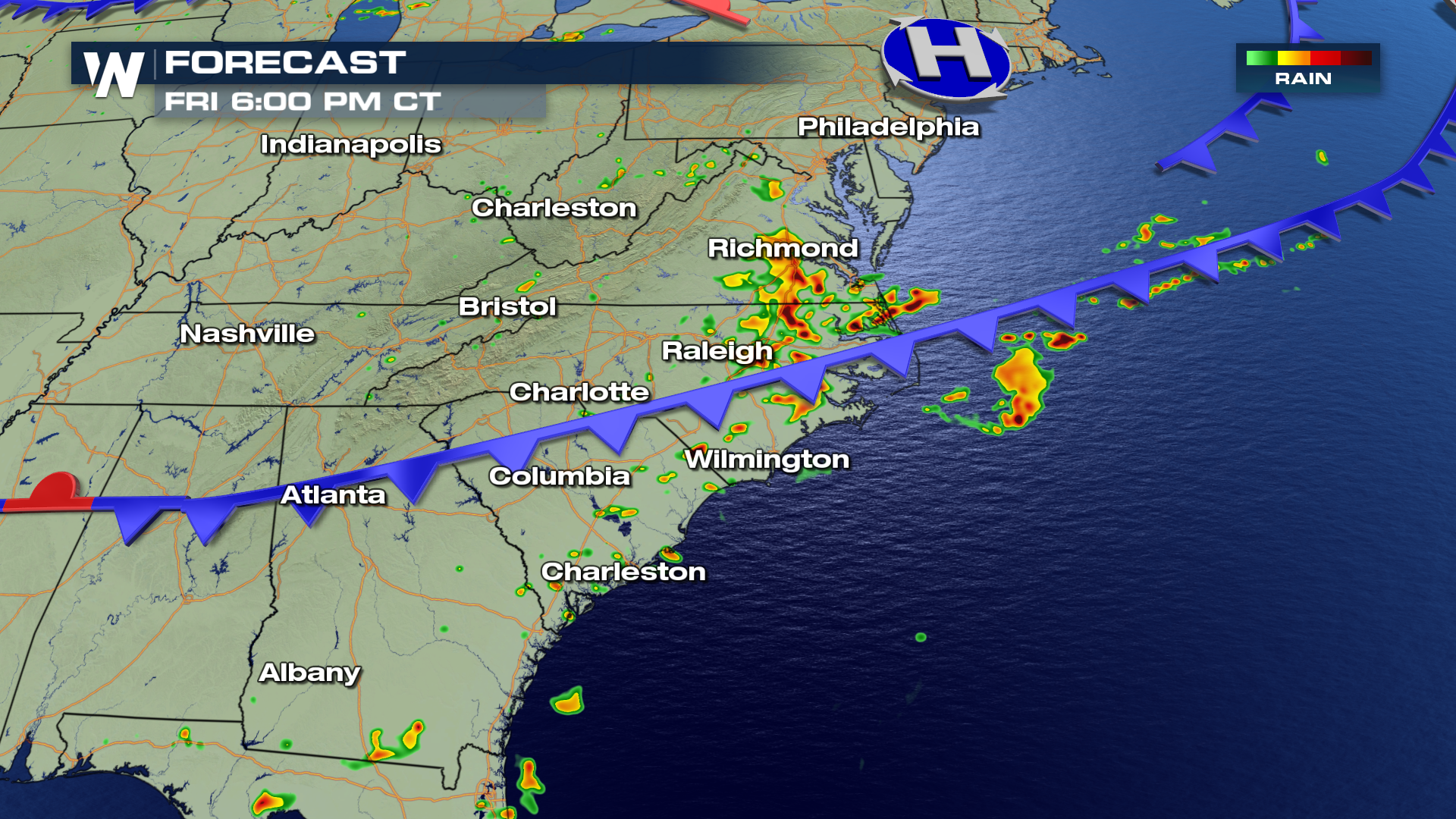
 Here is the expected timing of storms tomorrow afternoon. The best chance of strong to severe storms will likely be during the afternoon and evening hours, as moisture combines with peak daytime heating. The storms will likely be scattered, following a weak cold front moving through the area.
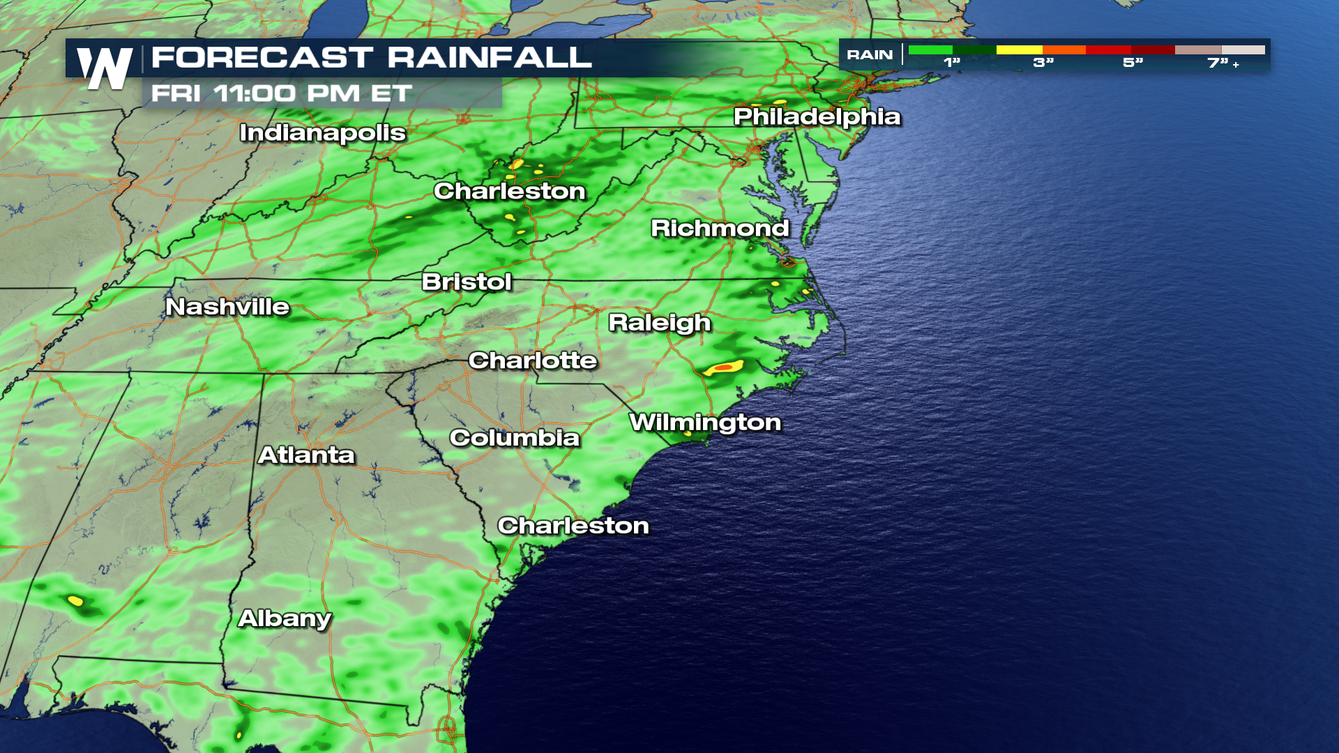
 Additional rainfall totals will range from around an inch to near 3 inches in the heaviest hit areas.
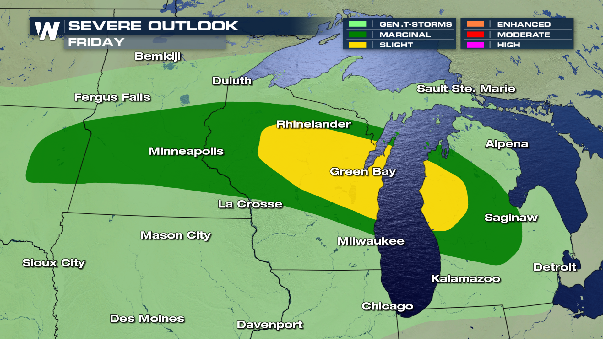
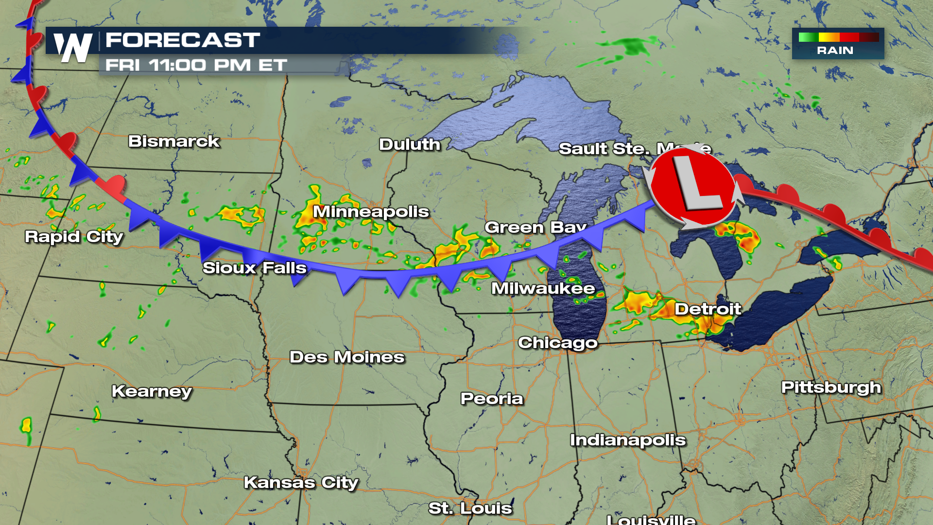
 The SPC has also issued a Slight risk of severe weather for areas in the upper mid-west and the Great Lakes Friday afternoon. Portions of Wisconsin and Michigan will see the highest chance of severe storms. Hail, windy conditions and isolated tornadoes will be the largest threats through the evening.
 Here is the timing for storms through Friday night.
 For WeatherNation, I'm Meteorologist Greg Rule
Here is the expected timing of storms tomorrow afternoon. The best chance of strong to severe storms will likely be during the afternoon and evening hours, as moisture combines with peak daytime heating. The storms will likely be scattered, following a weak cold front moving through the area.
Additional rainfall totals will range from around an inch to near 3 inches in the heaviest hit areas.
The SPC has also issued a Slight risk of severe weather for areas in the upper mid-west and the Great Lakes Friday afternoon. Portions of Wisconsin and Michigan will see the highest chance of severe storms. Hail, windy conditions and isolated tornadoes will be the largest threats through the evening.
Here is the timing for storms through Friday night.
For WeatherNation, I'm Meteorologist Greg RuleAll Weather News
More

Tropics: Fausto Heads towards Hawaii; Genevieve a Major Hurricane
PacificTropical Storm Fausto continues to tra
28 Jul 2026 11:30 PM

Flooding Risk Increases as Heavy Rain Targets the Tri-State Area
TRI-STATE AREA - Along with the threat of sev
28 Jul 2026 11:20 PM


Southeast Flood Risk Lingers Near Stalled Front
A stalled boundary over the Southeast will ke
25 Jul 2026 10:55 AM

Another Round of Storms Targets the Northeast
Tuesday brought severe weather again across p
23 Jul 2026 1:15 AM