Flood Threat Lingers in New England Saturday

Top Stories
10 May 2025 7:25 PM
A break in storms for the Northeast is on the way this Sunday, but first, another round of heavy showers is expected. This follows heavy rain earlier in the week, leaving soils saturated and primed for additional flooding.
 A few showers linger in Maine, and everything clears out as the low moves east. Drier conditions tonight and on Sunday.
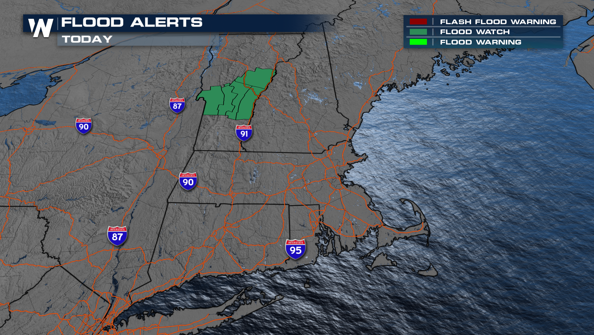
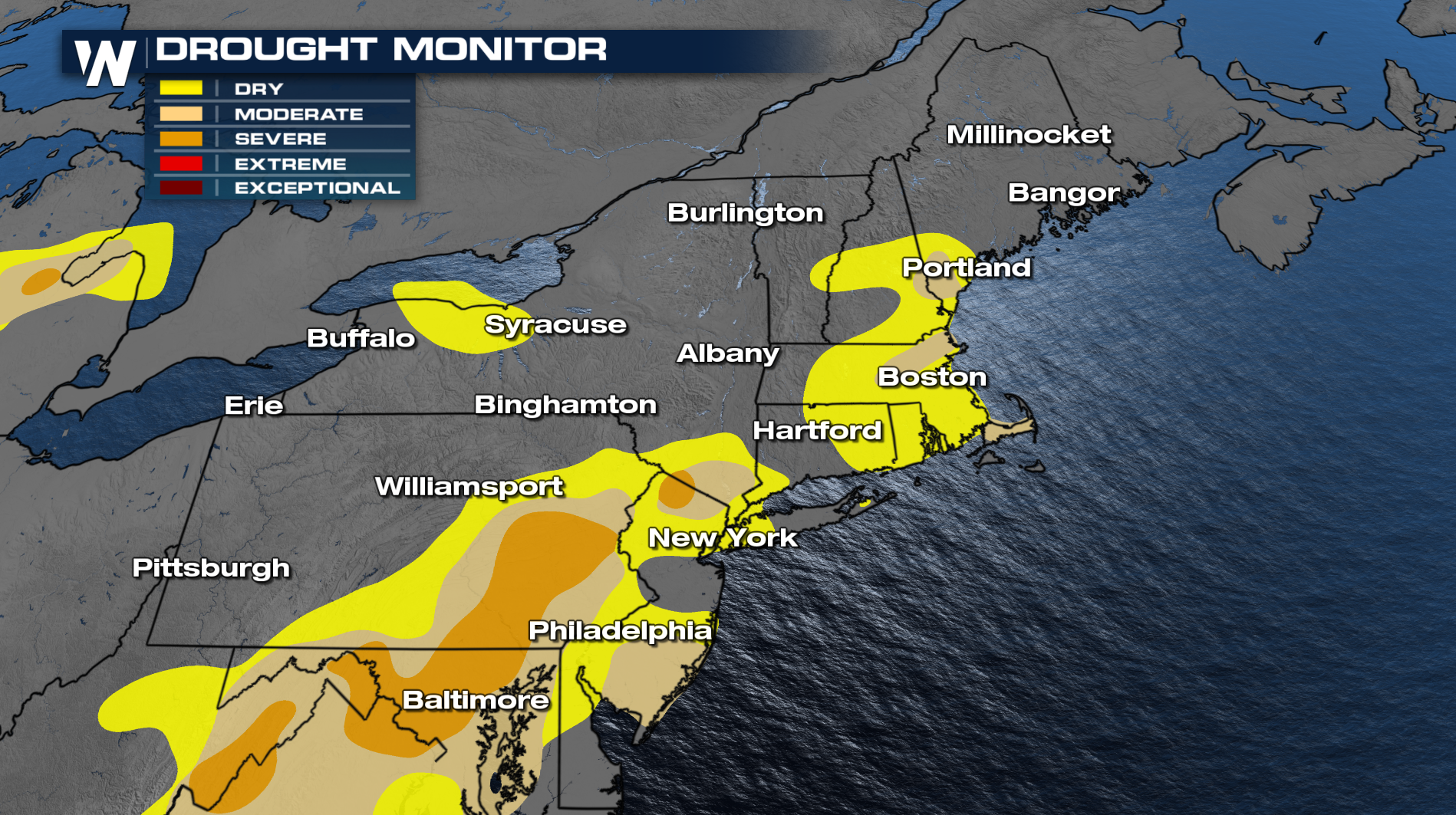
With last week's cutoff low in the Northeast, the grounds are saturated, and more isolated flooding is possible. On the other hand, the rain has been beneficial in helping with the ongoing drought.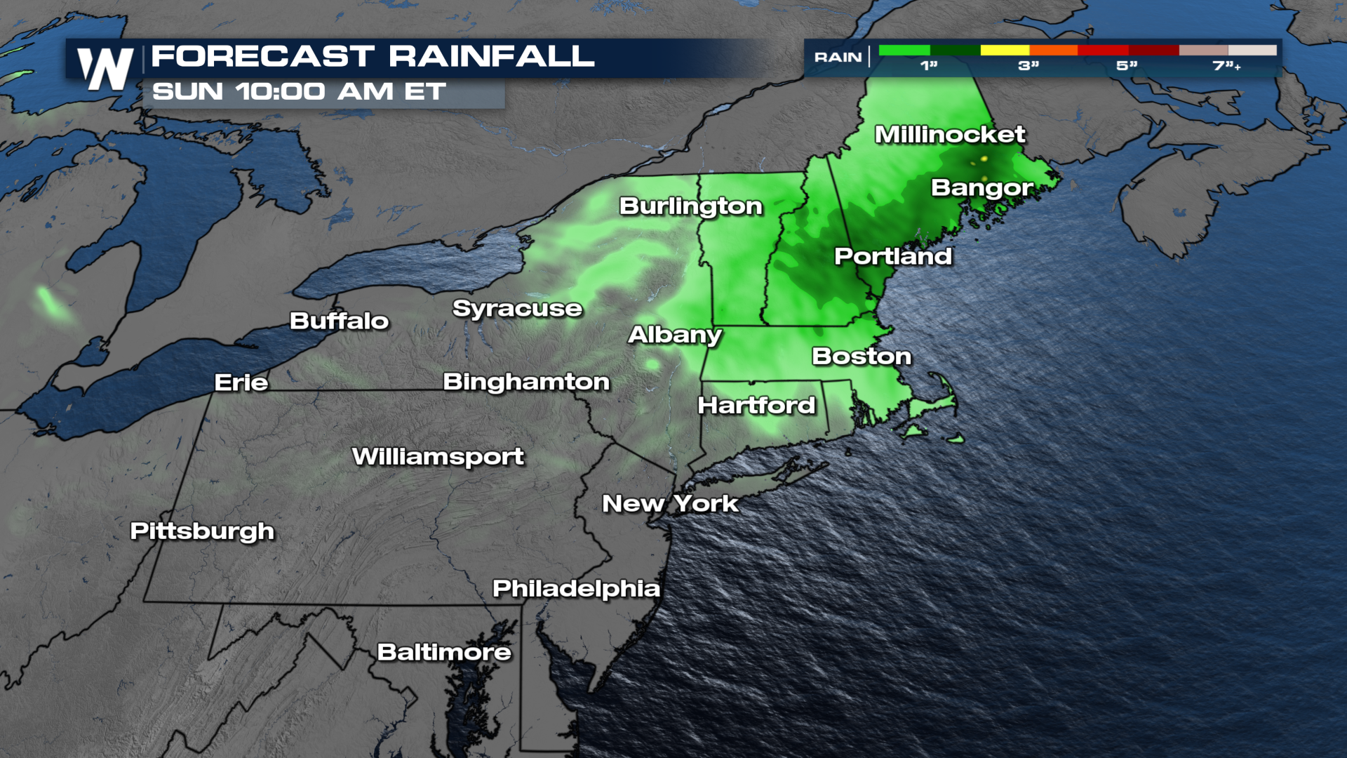
 Tune into WeatherNation:10 past the hour for the eastern regional forecast for more details.
All Weather News
More

Flooding Risk Increases as Heavy Rain Targets the Tri-State Area
TRI-STATE AREA - Along with the threat of sev
29 Jul 2026 2:00 AM

Tropics: Fausto Heads towards Hawaii; Genevieve a Major Hurricane
PacificTropical Storm Fausto continues to tra
29 Jul 2026 1:35 AM


Southeast Flood Risk Lingers Near Stalled Front
A stalled boundary over the Southeast will ke
25 Jul 2026 10:55 AM

Another Round of Storms Targets the Northeast
Tuesday brought severe weather again across p
23 Jul 2026 1:15 AM