Stormy Skies Return to the Northeast Tuesday
Special Stories
9 Jul 2018 4:15 PM
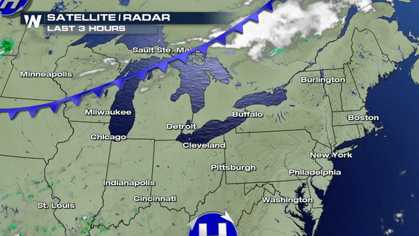
Another front will be moving across the Great Lakes overnight and continue pushing east through the day on Tuesday.
 Temperatures ahead of the front will be noticeably warmer and most of the day will stay dry for parts of the coastal areas.
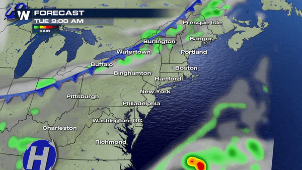
 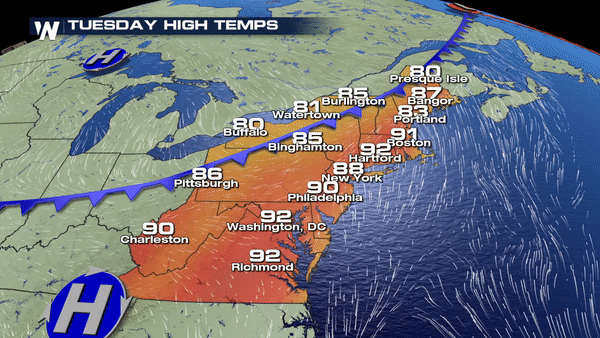 Storms will begin to fire up through the heat of the day and become more widespread by the late afternoon and early evening hours.
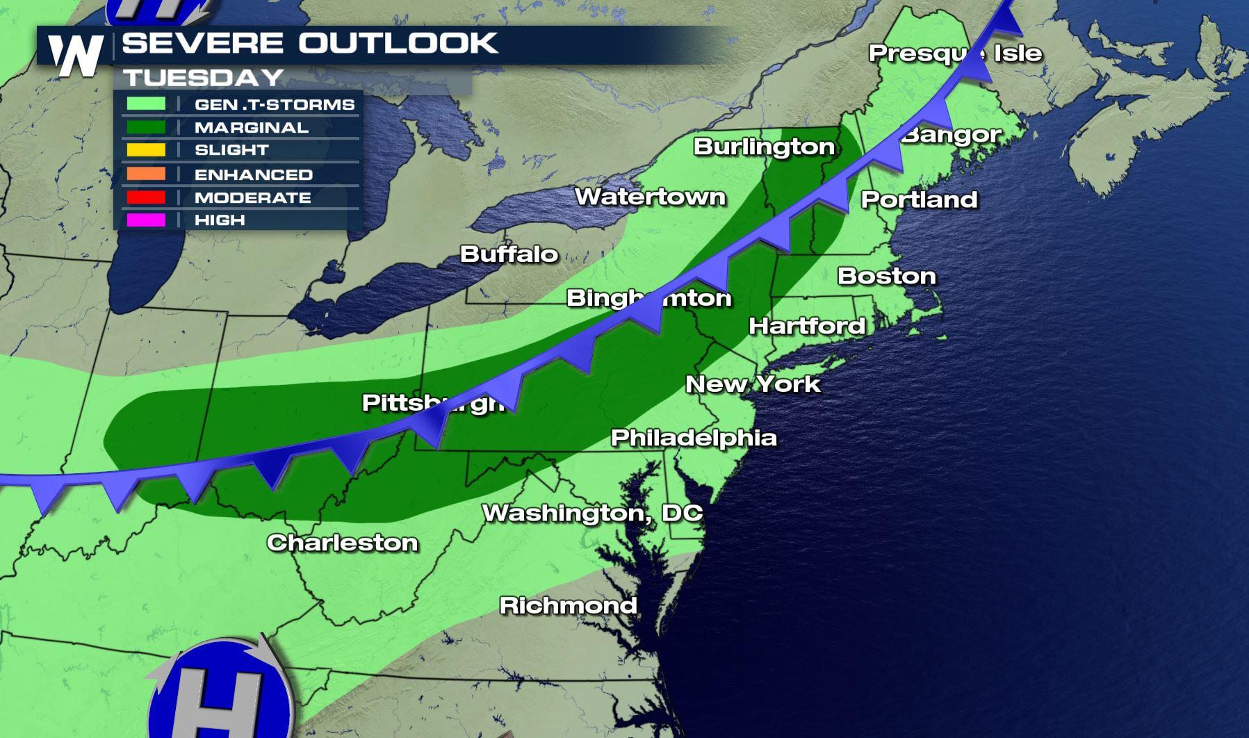
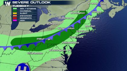
 There is a marginal risk in place across the northeast as some storms could become strong to severe. The main concern will be the potential for damaging winds. The timing for severe storms will primarily come into the afternoon hours and possibly lingering into the evening.
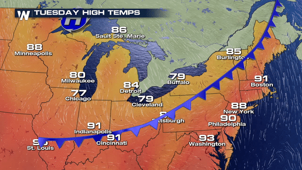
 This front will keep temperatures in check by reinforcing wind out of the northwest knocking afternoon highs back into the 70's and 80's on Tuesday. In other words, keeping conditions very nice and comfortable.
 This sure beats the oppressive heat and humidity we saw last week right? We think so.
Enjoy!
Meteorologist Merry Matthews
This sure beats the oppressive heat and humidity we saw last week right? We think so.
Enjoy!
Meteorologist Merry Matthews
Temperatures ahead of the front will be noticeably warmer and most of the day will stay dry for parts of the coastal areas.
Storms will begin to fire up through the heat of the day and become more widespread by the late afternoon and early evening hours.
There is a marginal risk in place across the northeast as some storms could become strong to severe. The main concern will be the potential for damaging winds. The timing for severe storms will primarily come into the afternoon hours and possibly lingering into the evening.
This front will keep temperatures in check by reinforcing wind out of the northwest knocking afternoon highs back into the 70's and 80's on Tuesday. In other words, keeping conditions very nice and comfortable.
This sure beats the oppressive heat and humidity we saw last week right? We think so.
Enjoy!
Meteorologist Merry MatthewsAll Weather News
More
More Storms for the East Through Monday
A low-pressure system that moved through the
2 Aug 2026 10:40 PM

Wildfire Outbreak in the Pacific Northwest
SPOKANE, WA - On Saturday, August 1st, the Ol
2 Aug 2026 10:35 PM


After Reaching Category 5, Genevieve Weakens in the Pacific
PacificGenevieve formed on last Friday south
2 Aug 2026 6:25 PM

Flooding, Severe Storms Target the Midwest Again
After an active week of storms across the nor
1 Aug 2026 1:40 AM

Flooding Risk Increases as Heavy Rain Targets the Tri-State Area
Tuesday, heavy rainfall moved across the Nort
30 Jul 2026 12:25 AM

Severe Weather: Energy From the Midwest Now in the Southeast
UPPER MIDWEST - Through Monday, dangerous tor
29 Jul 2026 10:30 PM