Stormy Weather for the Mississippi Valley and Southeast This Week
Special Stories
18 Feb 2019 3:06 AM
A low pressure system out of the Gulf of Mexico will provide some stormy conditions the next few days across the South and Southeast. Tuesday and Wednesday could even have some severe weather chances. Here is the very latest.
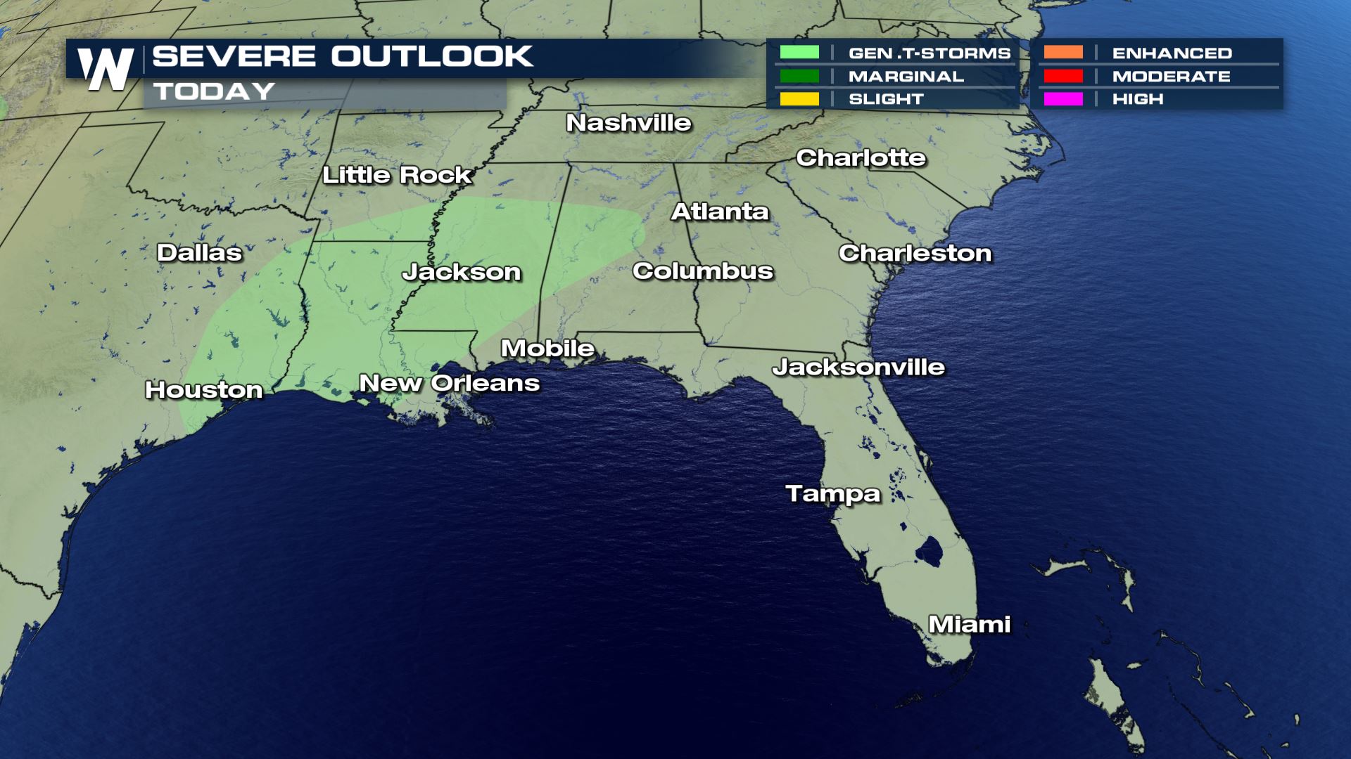
 Only general storms in the forecast Monday, but Tuesday the severe weather risk begins to increase. Large hail and damaging winds will be possible.
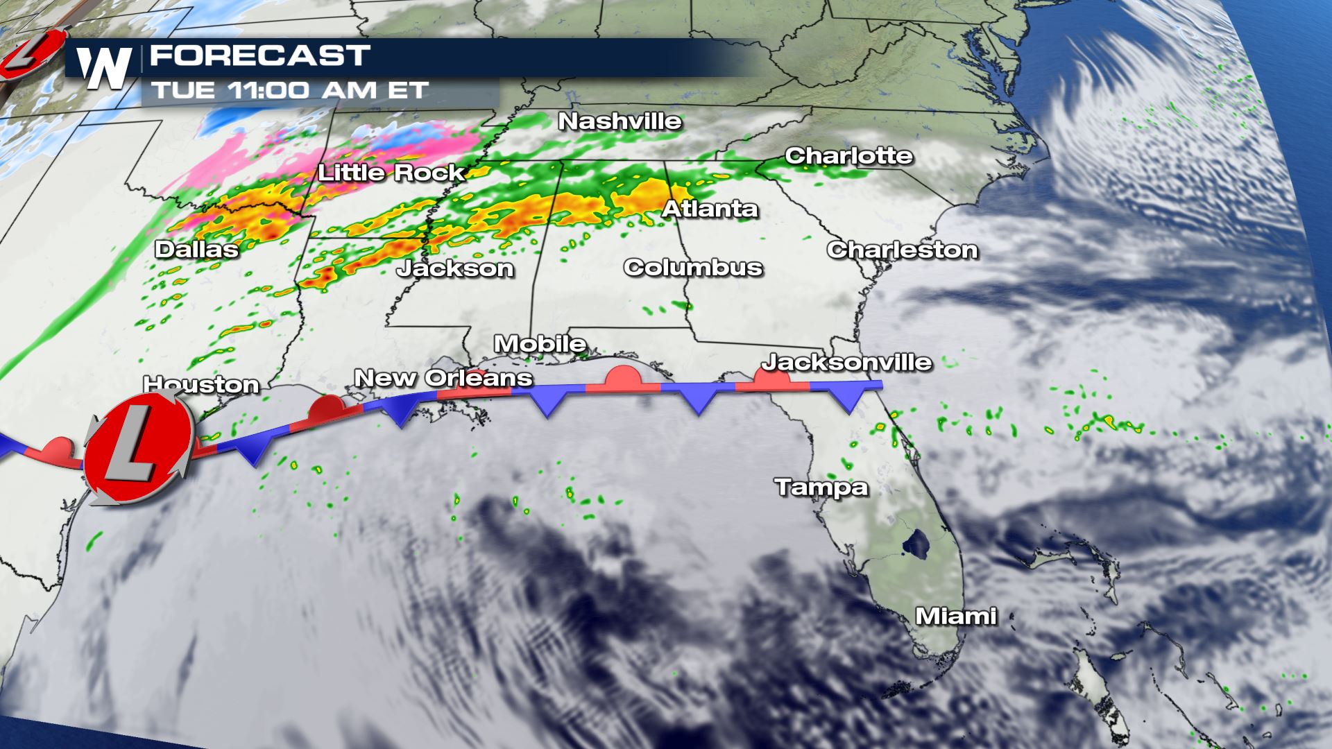

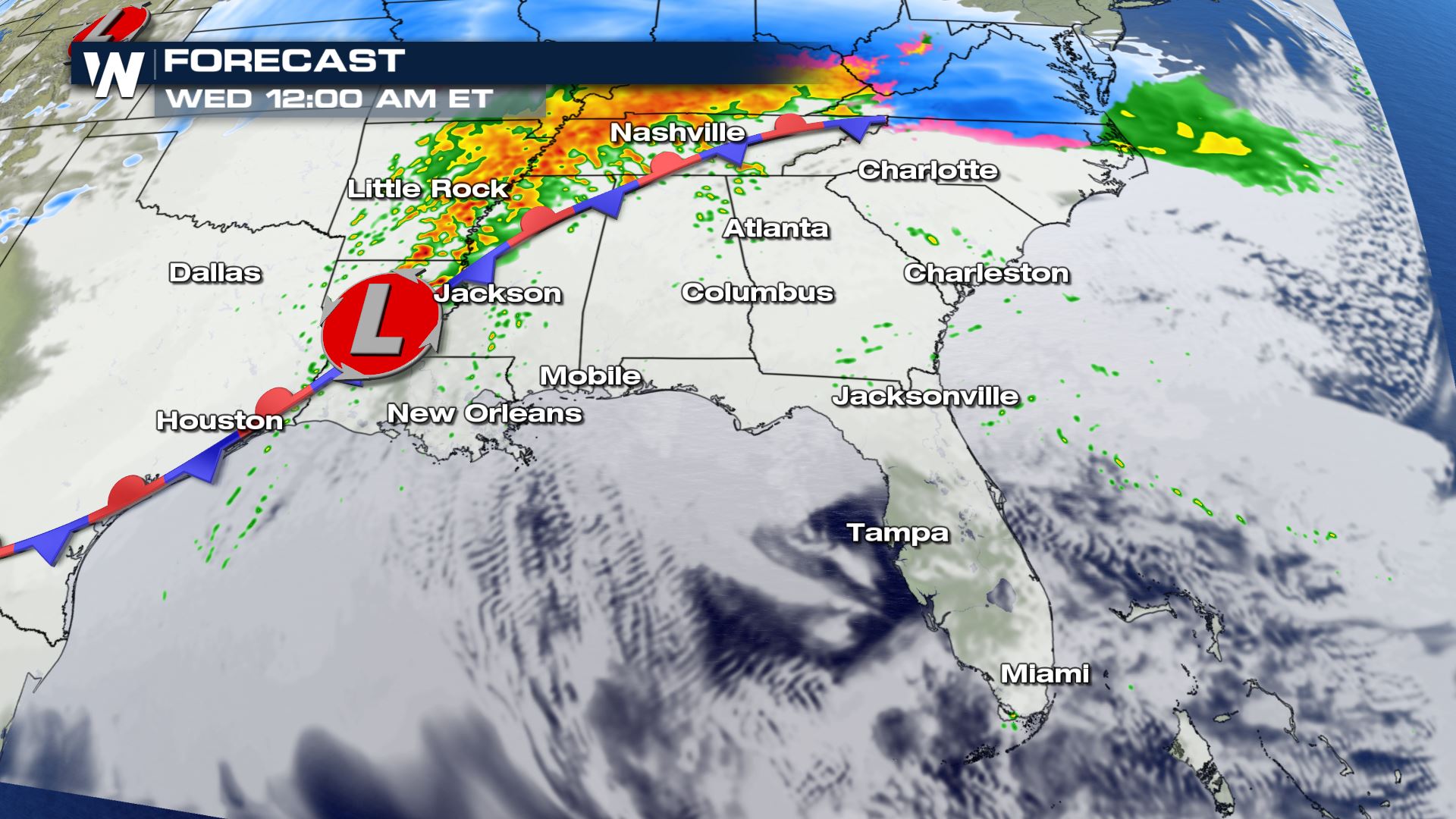
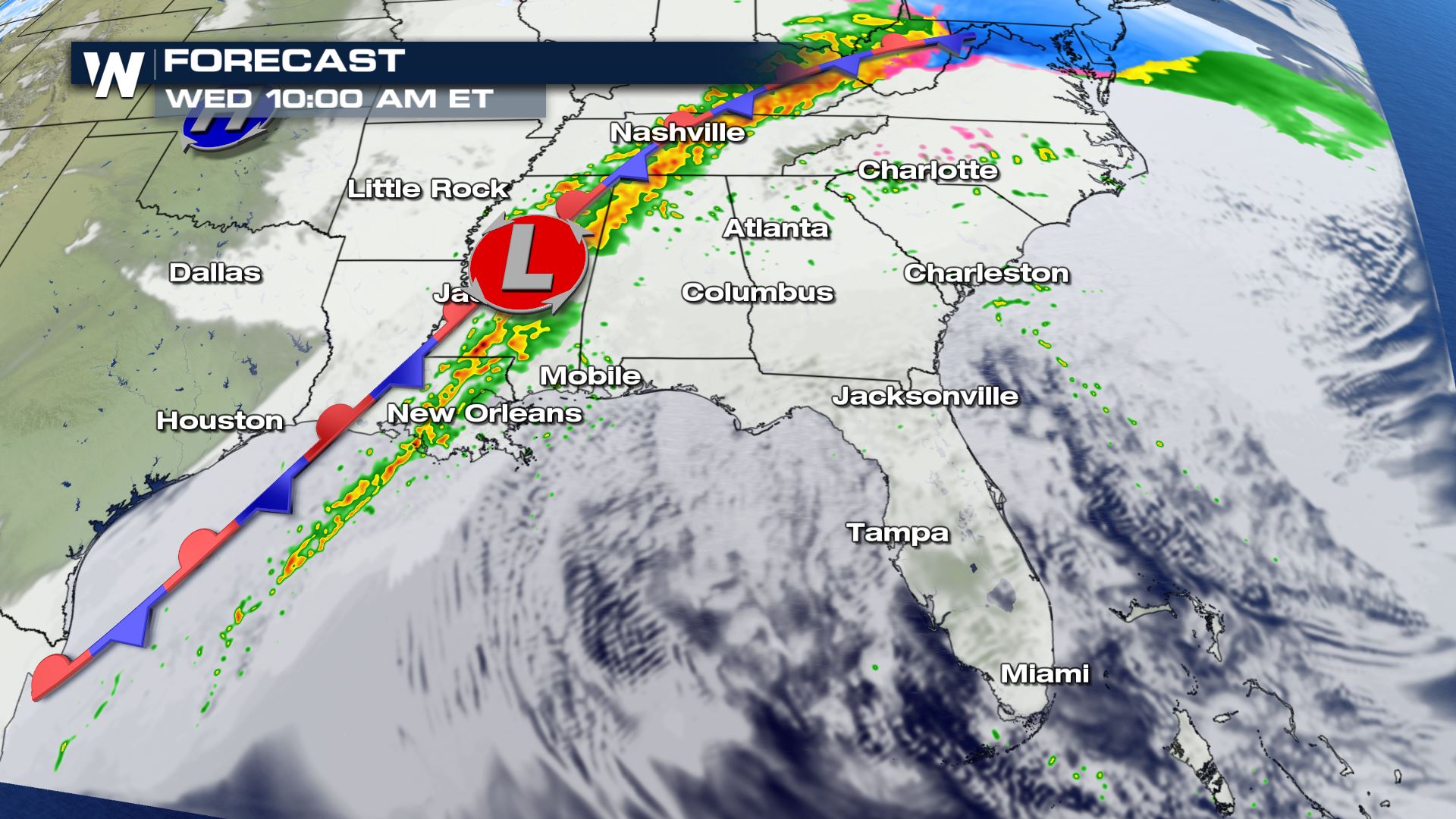
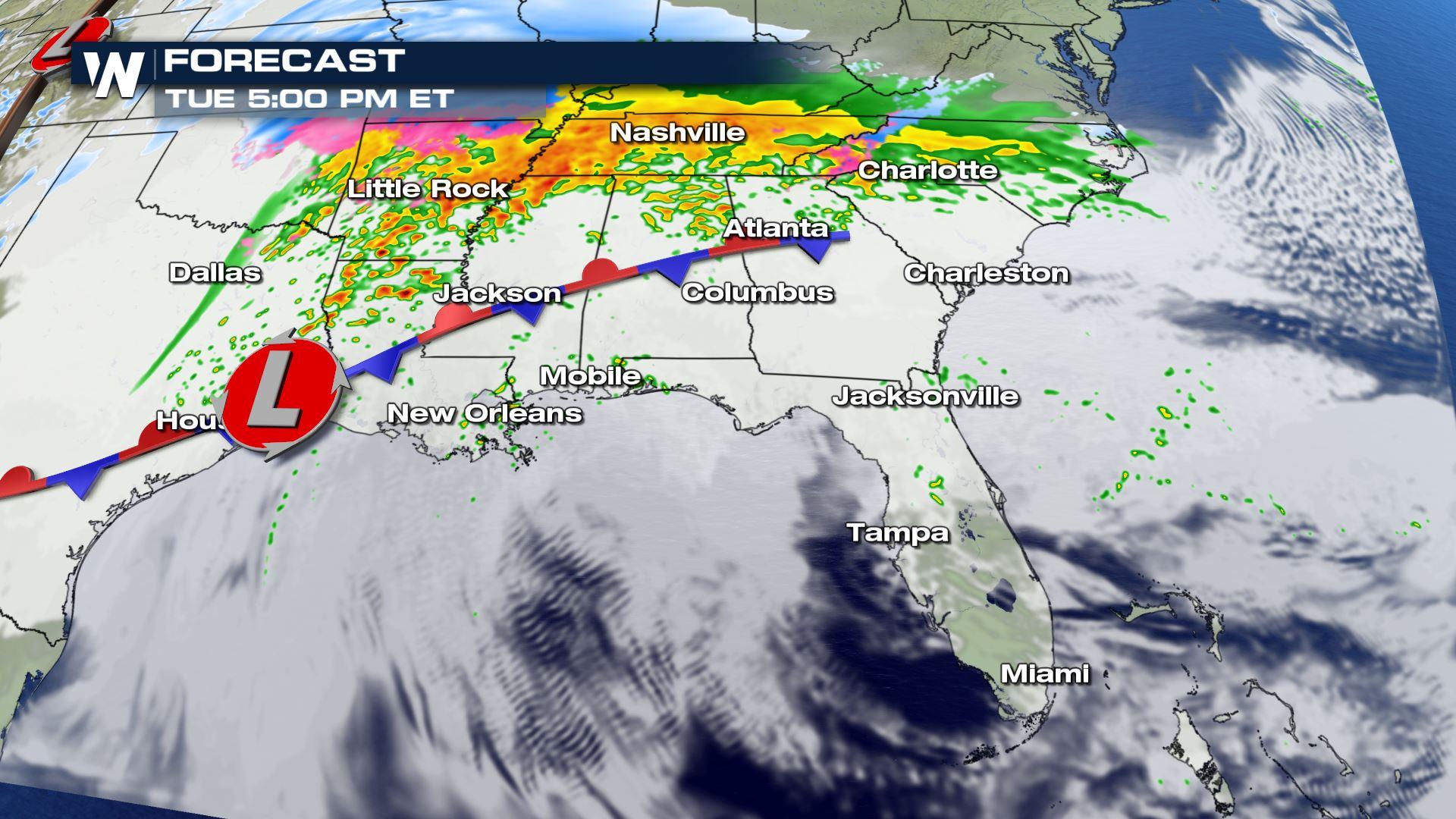
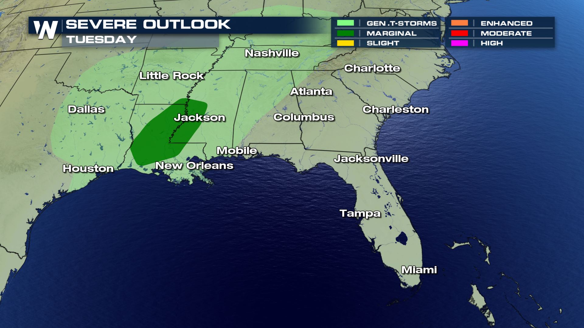
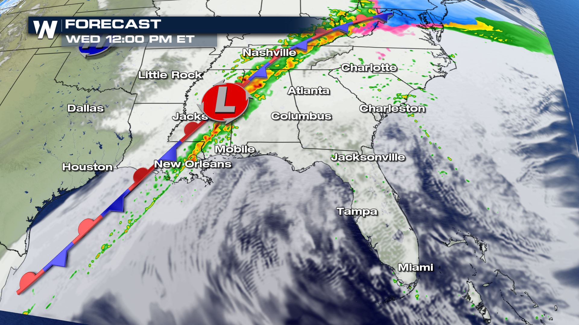 The strongest storms should be building over the Lower Mississippi Valley by Tuesday morning. These storms could contain large hail and damaging winds. The isolated severe threat will last into Wednesday as well.
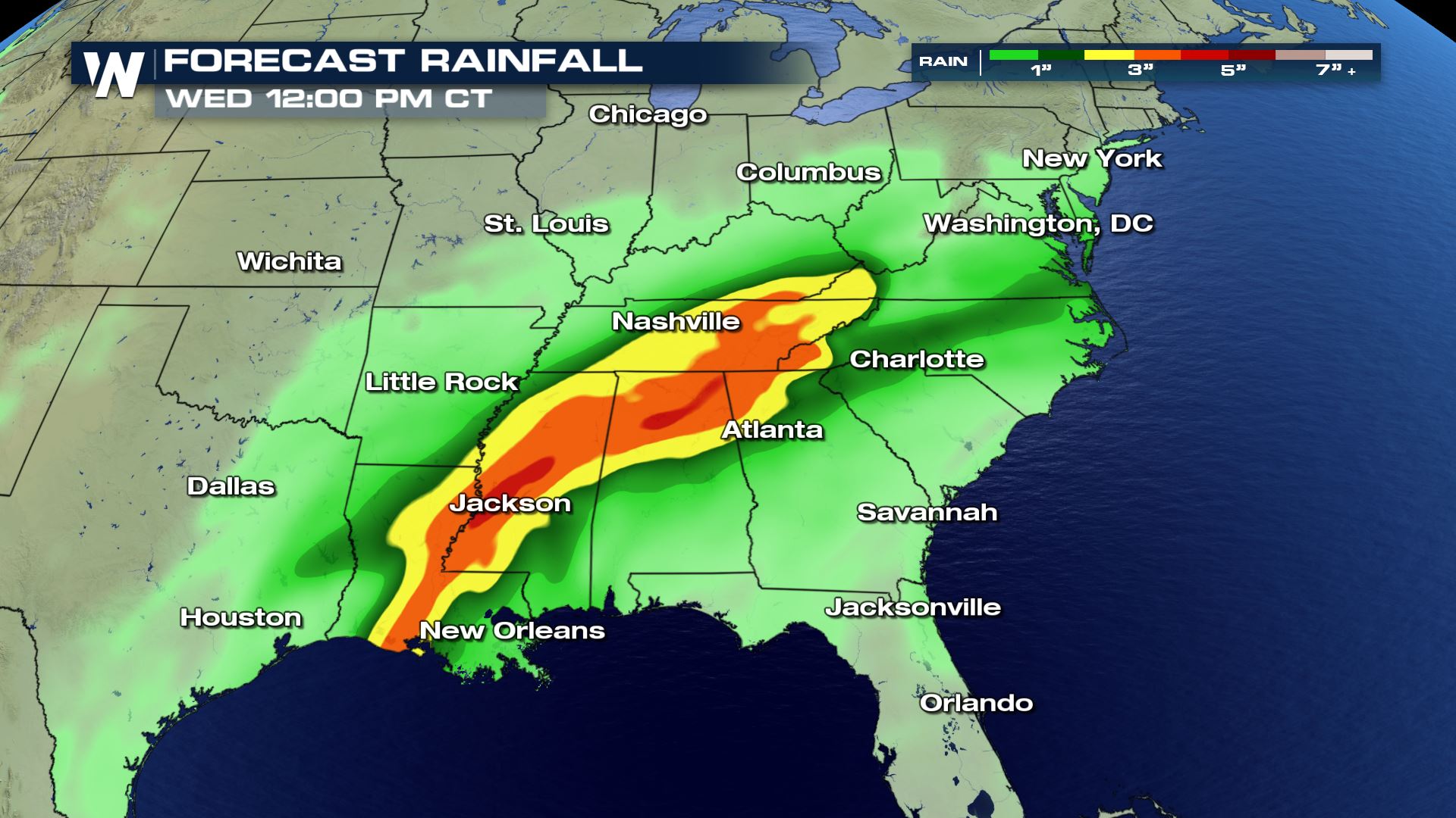 Heavy rain will lead to widespread flash flooding from the Gulf COast to the Tennessee Valley. Rivers will likely be rising too. Definitely be prepared for dangerous flooding conditions in these areas the next few days.
Severe Outlook
Only general storms in the forecast Monday, but Tuesday the severe weather risk begins to increase. Large hail and damaging winds will be possible.
Forecast
The strongest storms should be building over the Lower Mississippi Valley by Tuesday morning. These storms could contain large hail and damaging winds. The isolated severe threat will last into Wednesday as well.
Rainfall Potential
Heavy rain will lead to widespread flash flooding from the Gulf COast to the Tennessee Valley. Rivers will likely be rising too. Definitely be prepared for dangerous flooding conditions in these areas the next few days.All Weather News
More

Flooding, Severe Storms Target the Midwest Again
After an active week of storms across the nor
1 Aug 2026 1:40 AM


After Reaching Category 5, Genevieve Weakens in the Pacific
PacificFausto is now a post-tropical cyclone.
31 Jul 2026 1:30 AM

Flooding Risk Increases as Heavy Rain Targets the Tri-State Area
Tuesday, heavy rainfall moved across the Nort
30 Jul 2026 12:25 AM

Severe Weather: Energy From the Midwest Now in the Southeast
UPPER MIDWEST - Through Monday, dangerous tor
29 Jul 2026 10:30 PM