Rotating Supercells Detected in Hawaii This Morning

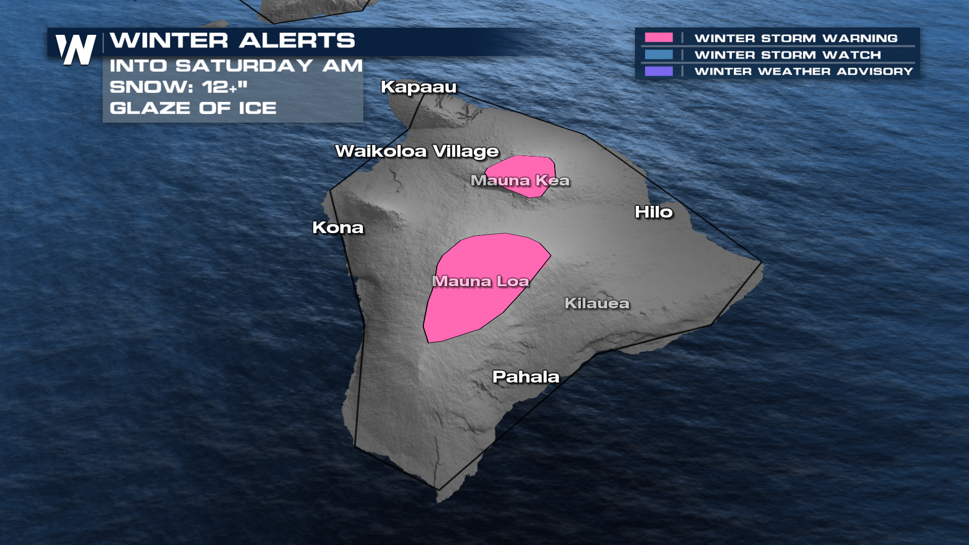
This might not be the best time to visit Hawaii! A large dip in the jet stream is delivering a powerful storm system loaded with heavy rain, thunderstorms, gusty wind (30-60mph), and even snow accumulation on Mauna Kea (above 13,000ft). Impacts will continue into Saturday morning.
On Thursday morning, local radar out of Kauai was showing rotating supercells. The radar presentation looked more like a tornado outbreak on the Plains!
The forecast will remain very active across the entire chain of islands through at least Saturday morning.
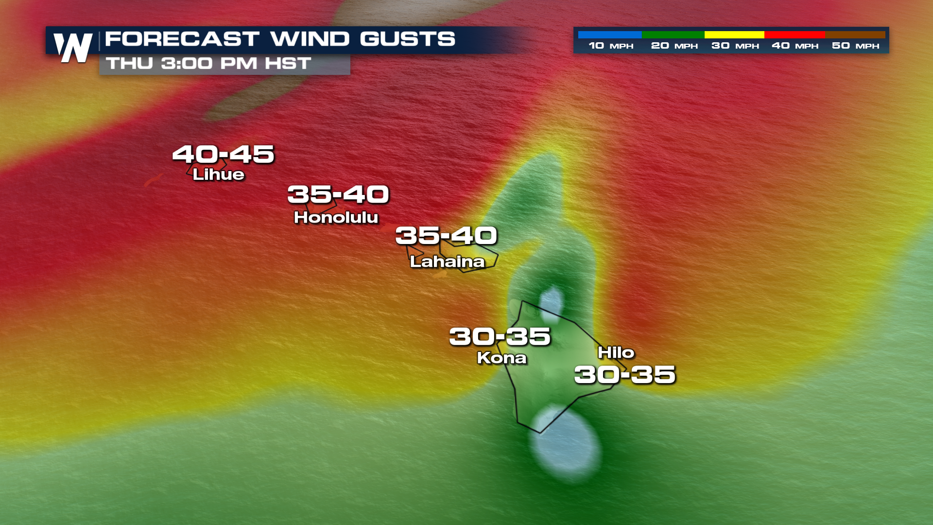
Even outside of the thunderstorms, ambient winds look to be very strong through this evening. High Wind Warnings across the entire state continue into Friday morning.
It may seem counter-intuitive, but there are even Winter Storm Warnings on the Big Island! At the peaks of Mauna Loa and Mauna Kea, blizzard conditions could be realized at times, with heavy snow and wind gusts up to 85mph!