Strong Winds Fueling Fires Over the Plains and Southwest
Special Stories
31 Mar 2021 6:00 AM
After intense winds brought extreme fire conditions to the Great Plains on Monday, dry and gusty conditions are expected to continue at times through Thursday. Offshore winds will increase the fire danger in the Southwest while also creating the potential for record breaking temperatures. Ongoing wildfires in the Plains may be difficult to contain.
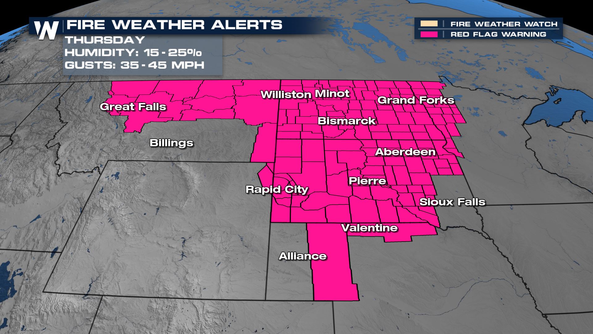
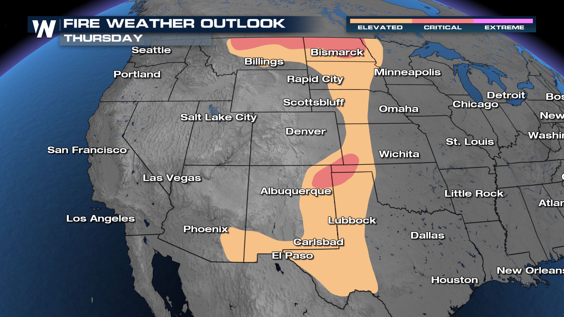
A trough moving through the Central and Eastern United States will spur gusty conditions across the Plain and Midwest on Wednesday. Low relatively humidity will accompany these gusts with abundant dry fuels, like dead grass. On Thursday (image below) a new trough moving through the Rockies will help to continue gusty conditions near the border with Canada. At the same time, surface high pressure building in the Mississippi Valley will create a pressure gradient over the Southern Plains to create gusty conditions by the afternoon.
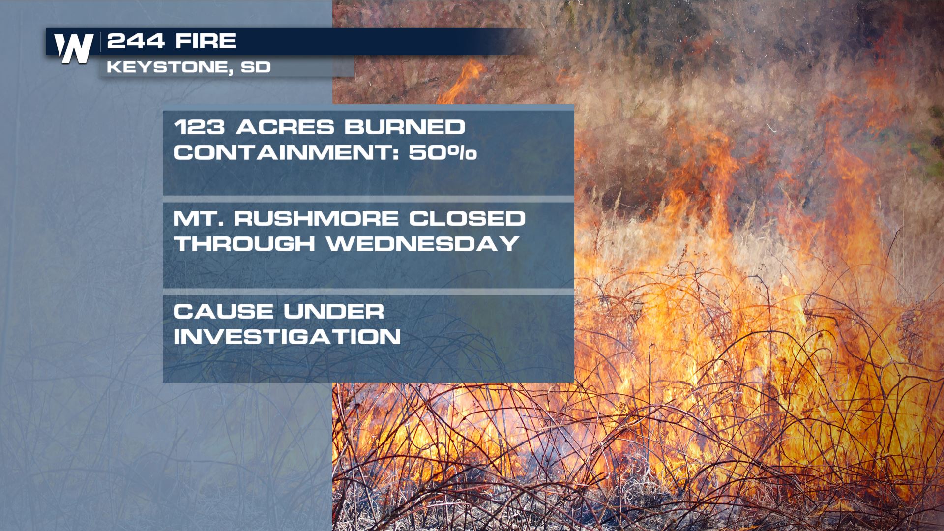
 In Keystone, SD another fire sparked which has prompted evacuations and closures around Mount Rushmore. Firefighters say good progress has been made to contain the blaze which has been determined to be human caused, though the exact cause is still under investigation.
 [embed]https://twitter.com/PennCoSheriff/status/1376637181297618948[/embed]
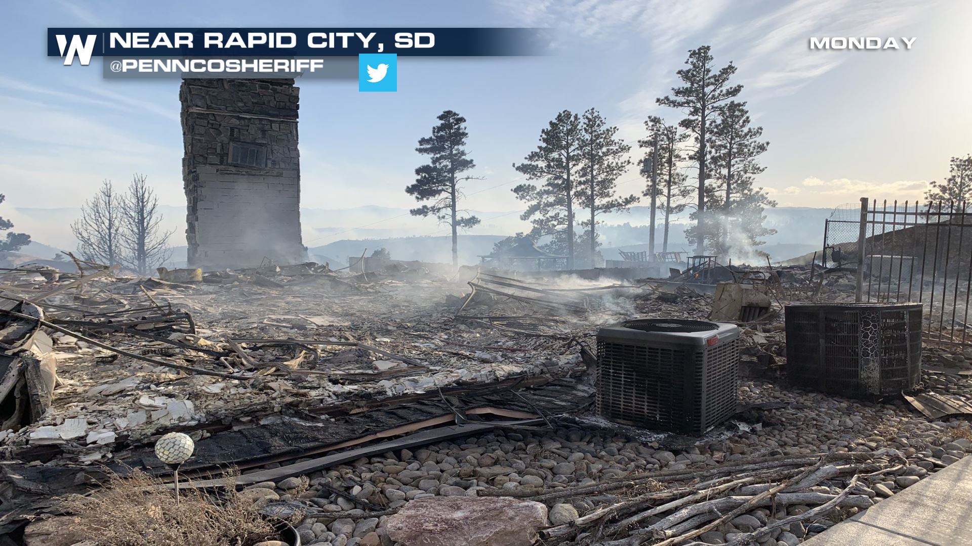
This home below was destroyed by the fire. Only the chimney remains.
 Always check with local officials before doing any outdoor burning if you're in a fire prone location. Stay with WeatherNation on air and online for updates.
CURRENT FIRES
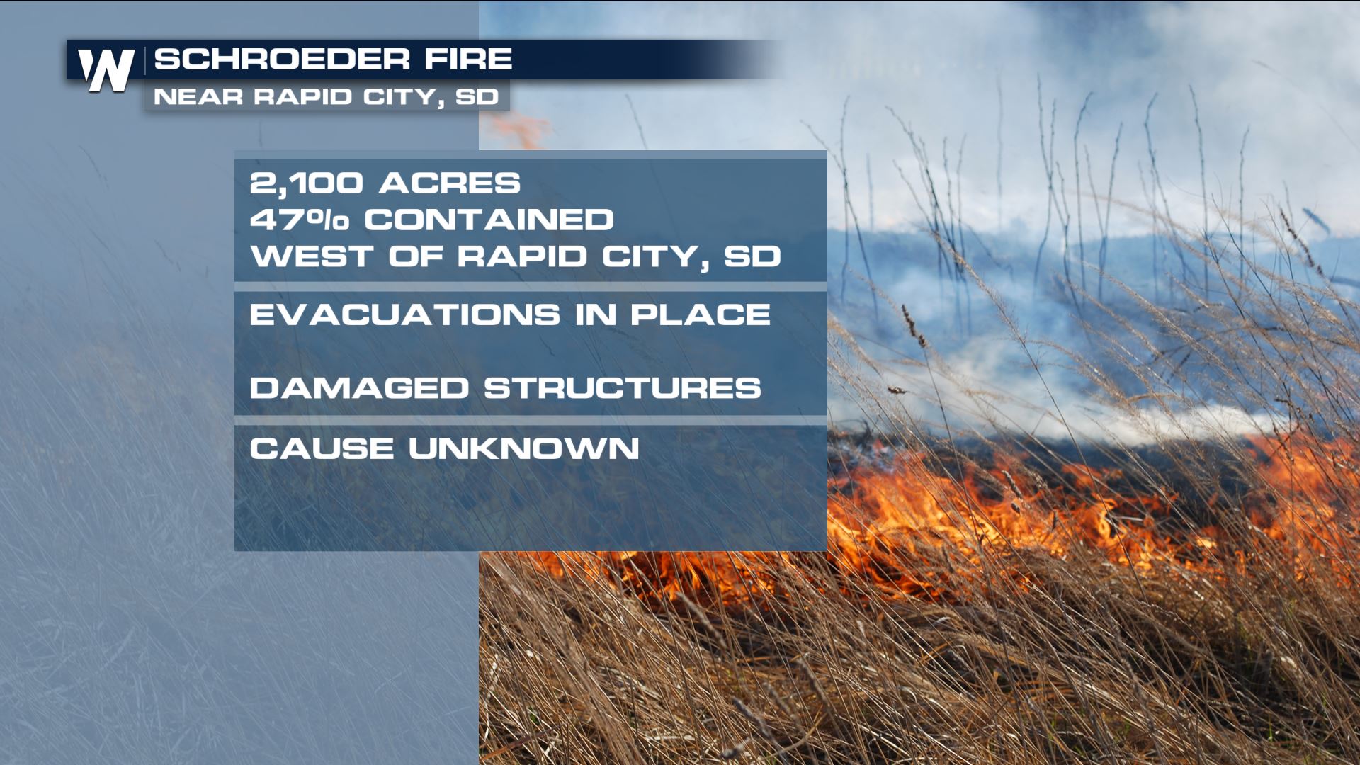
On Monday, a fire erupted just west of Rapid City that continues to threaten the city. Evacuations remain in place for certain neighborhoods. In Keystone, SD another fire sparked which has prompted evacuations and closures around Mount Rushmore. Firefighters say good progress has been made to contain the blaze which has been determined to be human caused, though the exact cause is still under investigation.
 [embed]https://twitter.com/PennCoSheriff/status/1376637181297618948[/embed]
This home below was destroyed by the fire. Only the chimney remains.

Thursday Fire Danger
Red flag warnings are in effect for the afternoon hours on Thursday. Red flag warnings are issued when several hours of high fire danger are expected, which usually occurs during the warmest and driest period of the day through the afternoon hours.
 Always check with local officials before doing any outdoor burning if you're in a fire prone location. Stay with WeatherNation on air and online for updates.
All Weather News
More