Lake Effect Precipitation - Some See First Snow!

SARANAC LAKE, NY - The Adirondacks have seen their first snowfall of the season on Monday! Most of these flurries melted upon contact, but, according to the National Weather Service in Burlington, VT, snow levels for the Adirondacks have come down to about 1800 feet with a few reports of 1-2" over elevated and grassy surfaces.
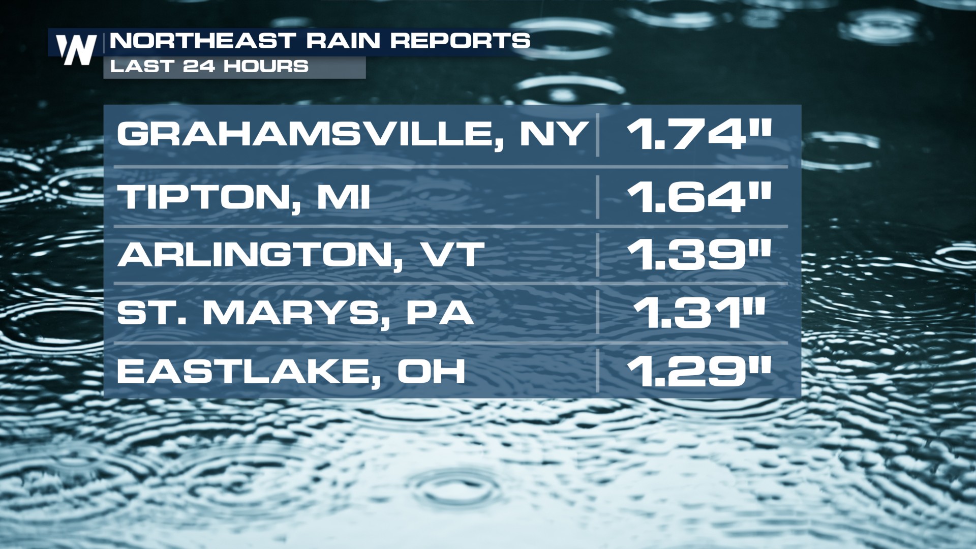
Monday's gloomy skies and intermittent rain will be tough to shake, along with the cooler weather behind. Rainfall totals have climbed up to nearly 2" in upstate New York.
 The Storm Prediction Center has issued "general" thunderstorm outlooks for the Great Lakes and Ohio Valley through tonight with some of the remnants of this system pushing through.
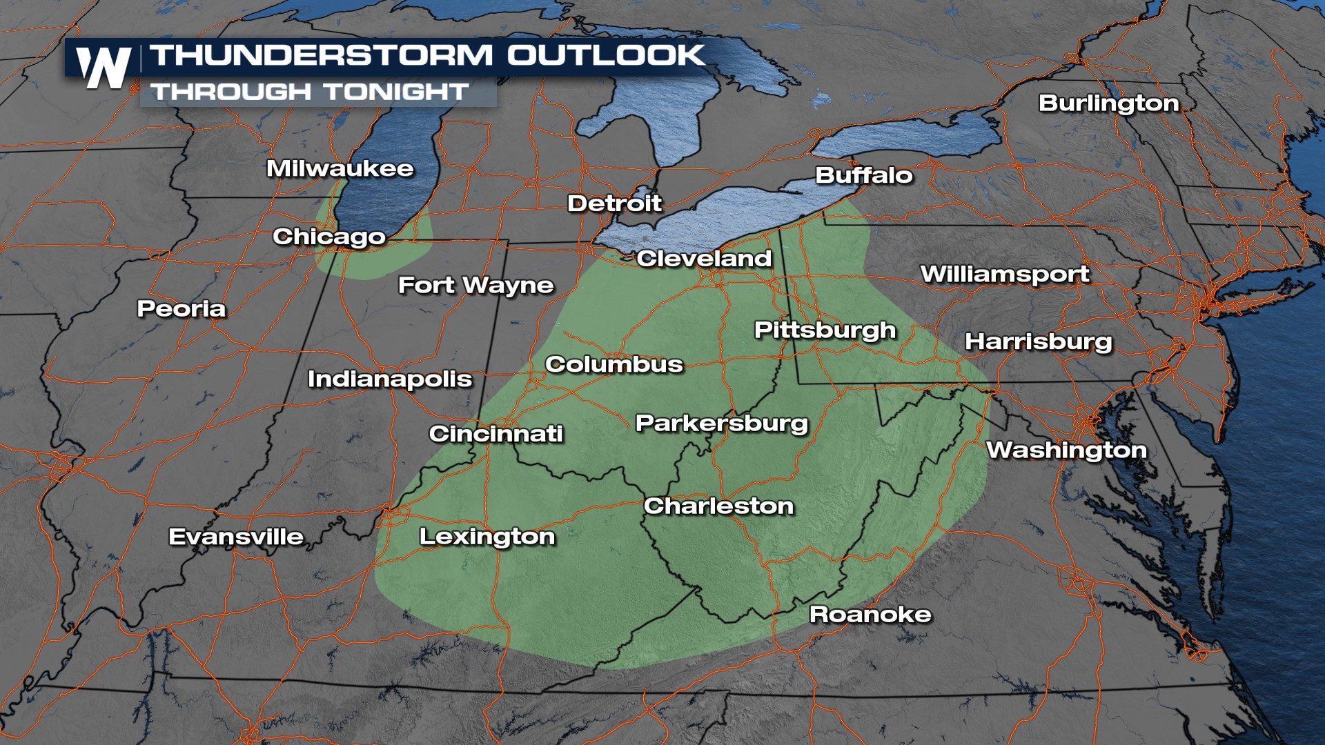
We expect scattered showers and storms to continue. The warm temperatures of the Great Lakes and cold air aloft will be responsible for some lightning strikes with lake-effect showers.
With cold enough air over land, higher elevations have already seen a few snow flurries due to lake effect precipitation and another inch or two is still possible. 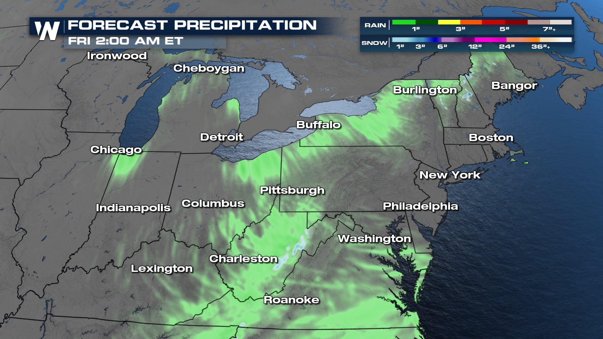 For more details on the ongoing heatwave, catch your East Regional Forecast at :10 past every hour.


