The Arctic – Remote, but not Isolated
Special Stories
11 Mar 2019 3:30 AM
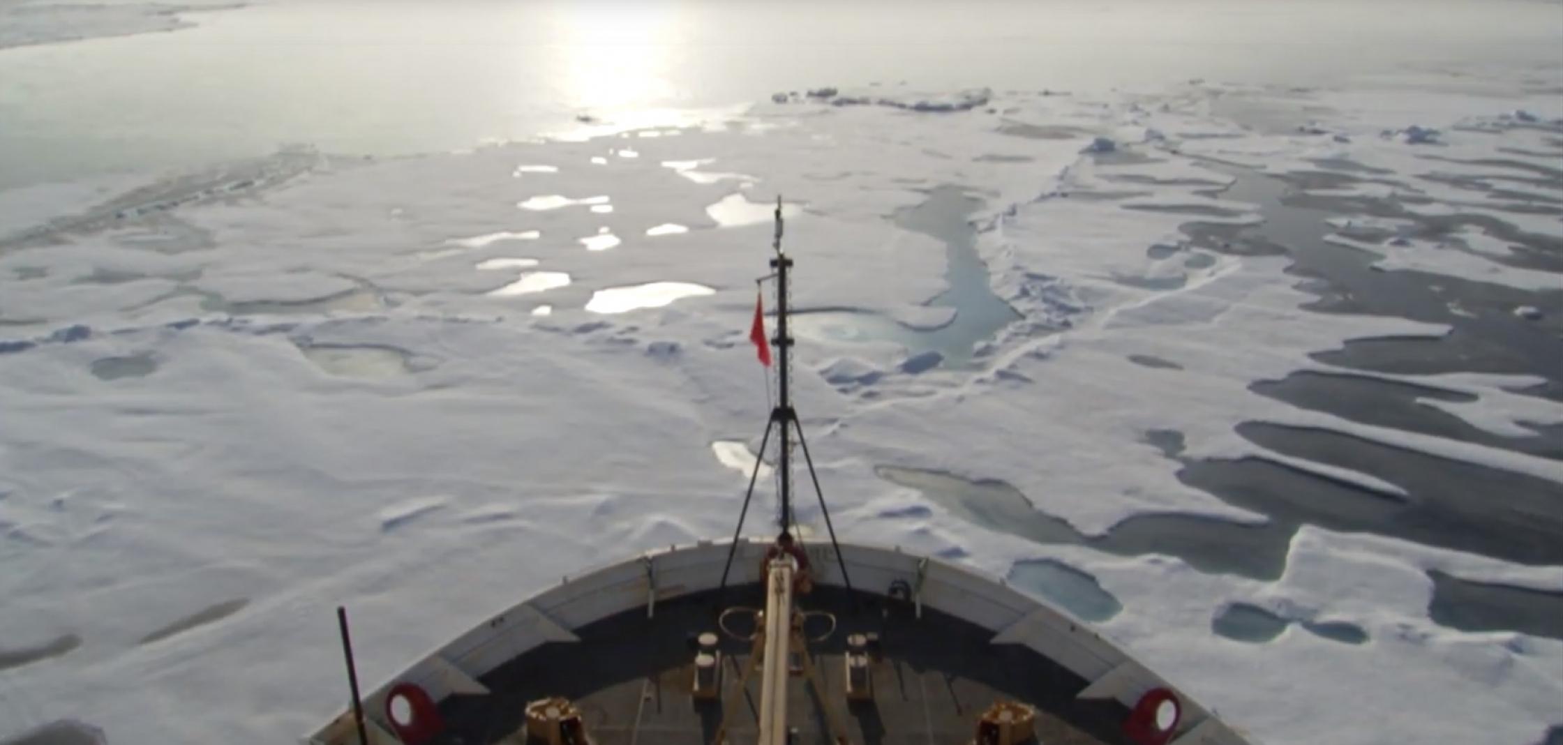
[An icebreaker traveling through icy Arctic waters. From NOAA]
[NOAA] Meteorology work in the Arctic is far-reaching and includes: ice and snow forecasts, satellites observations, new data gathering technologies, nautical charting, response and restoration, biological surveys and international collaboration.
https://www.youtube.com/watch?v=6e7EJeZJSKY
[Like a thermostat for our planet, the Arctic helps to stabilize global climate and regulate temperatures worldwide. Video from NOAA]
Earth's thermostat
Like a thermostat for our planet, the Arctic helps to stabilize global climate and regulate temperatures worldwide. What happens in the Arctic doesn't stay in the Arctic, and changes in the Arctic's seemingly harsh, but inherently fragile environment have a profound global reach.
Changes can destabilize the world's weather patterns and ocean circulation, affecting everything from food security and human, fish and wildlife health, to safe navigation, local to global economies, and national security.
https://www.youtube.com/watch?v=pR8DSwNJWm0
Typically, Arctic ice that lasts at least one summer is thicker and more likely to survive future summers. But as this animation shows, ice that is nine years or older is melting fast. Older ice is shown in white. Seasonal ice is the darkest blue.
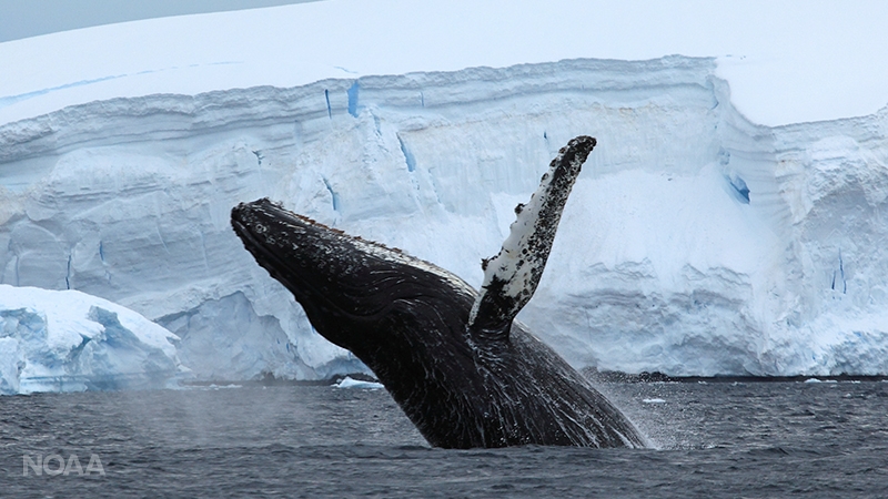 [Humpback whale breaching in the Arctic. (iStock)]
On the cutting-edge
With many partners, NOAA is on the cutting-edge of monitoring Arctic conditions, pioneering innovative technologies, and creatively collecting data and other scientific information vital to shaping sound Arctic policy and stewardship.
https://www.youtube.com/watch?v=7JIwOB5jB60
A Coupled Arctic Forecast System (CAFS) is being evaluated to improve ice and snow forecasts, which are critical to coastal communities and safe navigation. Below are seven-day forecasts for the Arctic Ocean north of Alaska to the North Pole. Arrows show the direction of surface winds. The longer the arrow, the stronger the winds. The winds can move ice, creating areas where it's pulled apart or compressed.
https://www.youtube.com/watch?v=plT25Y6oOaU
[Seven-day forecasts for the Arctic Ocean north of Alaska to the North Pole. Percentage of sea ice coverage on the left and depth of snow on ice on the right. Arrows show the direction and strength of surface winds. From NOAA]
New Arctic testbed
NOAA capabilities in Alaska continue to evolve. Three 24/7 Weather Forecast Offices and 11 additional offices provide weather services. There are hydrologic forecasts and sea ice analyses and forecasts. Support for weather aviation includes volcanic ash advisories. Just north of Anchorage is the National Tsunami Warning Center.
To meet emerging needs, an NOAA Arctic Test Bed has been designed as a nexus for improving NOAA's responsiveness to changing science and service priorities. The Test Bed will pilot and operationalize products and services critical to Alaska's residents, infrastructure and environment, and advance NOAA's goal of building a Weather-Ready Nation.
https://www.youtube.com/watch?v=jTDxUZyUhz4
[Humpback whale breaching in the Arctic. (iStock)]
On the cutting-edge
With many partners, NOAA is on the cutting-edge of monitoring Arctic conditions, pioneering innovative technologies, and creatively collecting data and other scientific information vital to shaping sound Arctic policy and stewardship.
https://www.youtube.com/watch?v=7JIwOB5jB60
A Coupled Arctic Forecast System (CAFS) is being evaluated to improve ice and snow forecasts, which are critical to coastal communities and safe navigation. Below are seven-day forecasts for the Arctic Ocean north of Alaska to the North Pole. Arrows show the direction of surface winds. The longer the arrow, the stronger the winds. The winds can move ice, creating areas where it's pulled apart or compressed.
https://www.youtube.com/watch?v=plT25Y6oOaU
[Seven-day forecasts for the Arctic Ocean north of Alaska to the North Pole. Percentage of sea ice coverage on the left and depth of snow on ice on the right. Arrows show the direction and strength of surface winds. From NOAA]
New Arctic testbed
NOAA capabilities in Alaska continue to evolve. Three 24/7 Weather Forecast Offices and 11 additional offices provide weather services. There are hydrologic forecasts and sea ice analyses and forecasts. Support for weather aviation includes volcanic ash advisories. Just north of Anchorage is the National Tsunami Warning Center.
To meet emerging needs, an NOAA Arctic Test Bed has been designed as a nexus for improving NOAA's responsiveness to changing science and service priorities. The Test Bed will pilot and operationalize products and services critical to Alaska's residents, infrastructure and environment, and advance NOAA's goal of building a Weather-Ready Nation.
https://www.youtube.com/watch?v=jTDxUZyUhz4
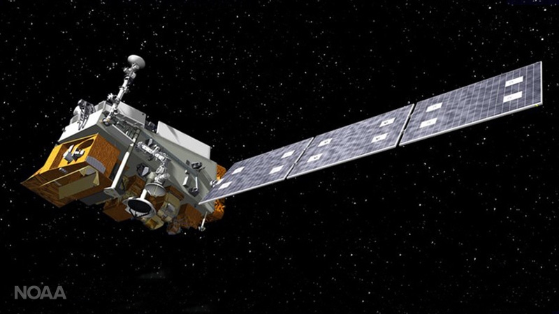 Polar-orbiting satellites such as NOAA-20 and Suomi NPP fly over the Arctic 28 times daily, collecting valuable data from the atmosphere and sea ice to improve weather forecasts and climate information. Working together, the two systems provide high-resolution data and imagery to improve sea ice and snow cover monitoring and the tracking of wildfire smoke and volcanic ash.
In ice-choked waters, satellite observations contribute to safe aviation and navigation, informing the decisions of emergency managers, fishing communities, and the tourism and energy industries, among others.
Polar-orbiting satellites such as NOAA-20 and Suomi NPP fly over the Arctic 28 times daily, collecting valuable data from the atmosphere and sea ice to improve weather forecasts and climate information. Working together, the two systems provide high-resolution data and imagery to improve sea ice and snow cover monitoring and the tracking of wildfire smoke and volcanic ash.
In ice-choked waters, satellite observations contribute to safe aviation and navigation, informing the decisions of emergency managers, fishing communities, and the tourism and energy industries, among others.
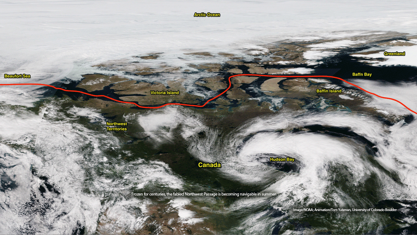 [Frozen for centuries, the fabled Northwest Passage is becoming navigable in summer. Image/NOAA; Animation/Tom Yulsman, University of Colorado Boulder.]
Fast-rising vessel traffic also raises the risk of polluting pristine waters. What happens, for example, if an oil spill freezes and ice covers it? Because the ice is moving, the oil is, too. Knowing where it’s headed is critical to know what will happen once the oil thaws.
[Frozen for centuries, the fabled Northwest Passage is becoming navigable in summer. Image/NOAA; Animation/Tom Yulsman, University of Colorado Boulder.]
Fast-rising vessel traffic also raises the risk of polluting pristine waters. What happens, for example, if an oil spill freezes and ice covers it? Because the ice is moving, the oil is, too. Knowing where it’s headed is critical to know what will happen once the oil thaws.
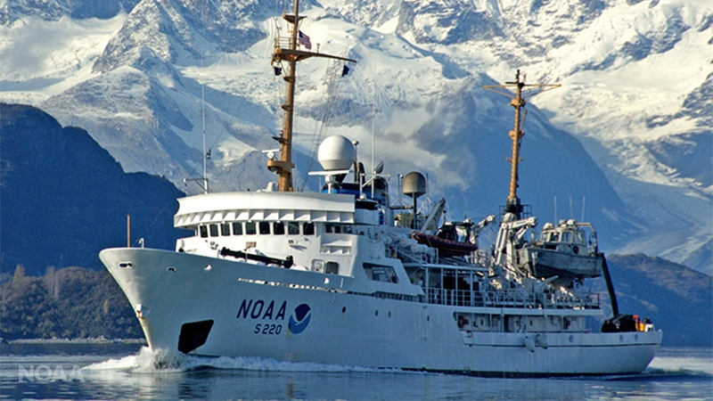 [NOAA Ship Fairweather underway in Alaska. From NOAA]
Arctic ERMA is a huge asset in a region where emergency response is particularly challenging. In a single interactive map, ERMA provides fast visualization of on-the-ground conditions, supporting rapid response to environmental hazards and other incidents.
[NOAA Ship Fairweather underway in Alaska. From NOAA]
Arctic ERMA is a huge asset in a region where emergency response is particularly challenging. In a single interactive map, ERMA provides fast visualization of on-the-ground conditions, supporting rapid response to environmental hazards and other incidents.
 [Projected area of Anchorage earthquake, Nov. 30, 2018 From NOAA]
ERMA integrates static and real-time data. Local stakeholders and regional responders have identified data needs in over 500 areas, including weather, sea ice and vessel zones.
Polar projections are a recent addition, providing more accurate detail than a flat-map perspective. They are key to estimating how far an oil spill is from land and to improve the ability of all Arctic nations to see the same details at the same time.
[Projected area of Anchorage earthquake, Nov. 30, 2018 From NOAA]
ERMA integrates static and real-time data. Local stakeholders and regional responders have identified data needs in over 500 areas, including weather, sea ice and vessel zones.
Polar projections are a recent addition, providing more accurate detail than a flat-map perspective. They are key to estimating how far an oil spill is from land and to improve the ability of all Arctic nations to see the same details at the same time.
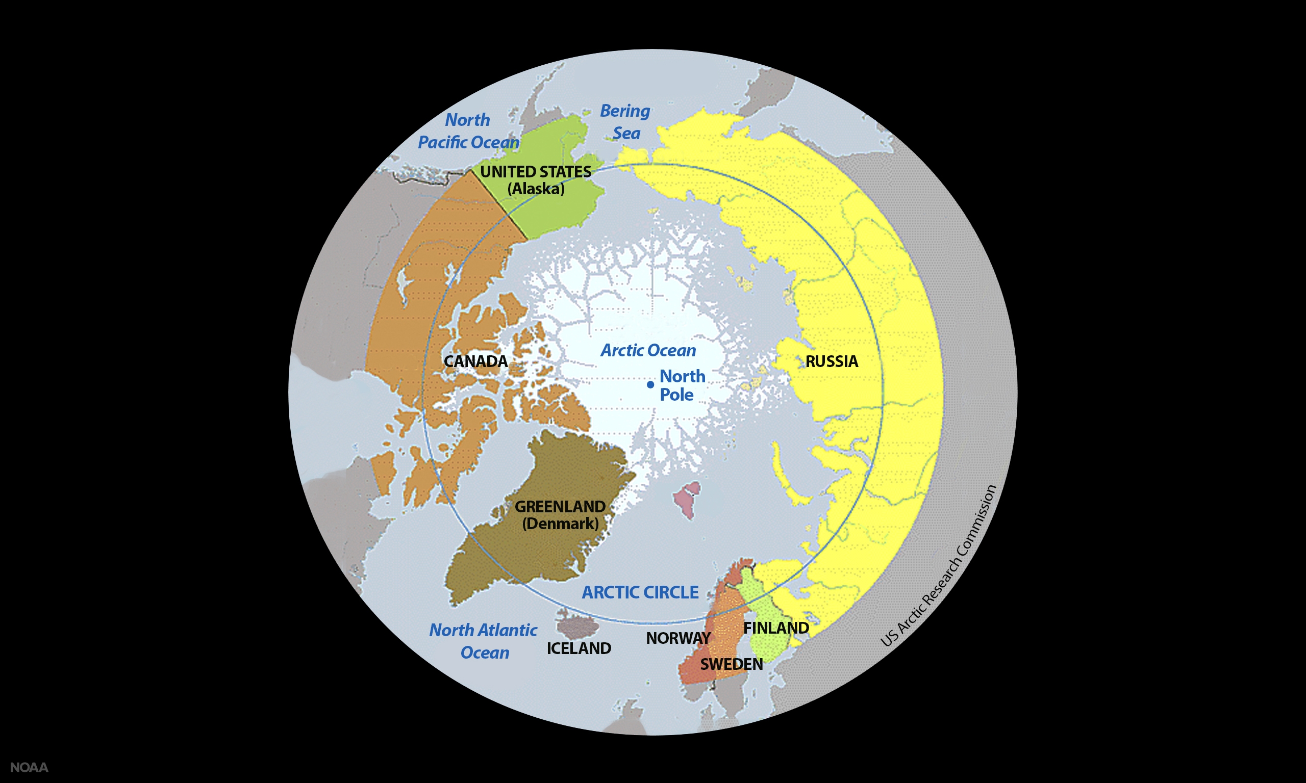 [Eight countries in the Arctic Circle. From US Arctic Research Commission]
Sharing Arctic observations will improve hurricane, drought, severe weather and other forecasts worldwide. The prospect of viable fishing in the Arctic led to a new agreement, including a research and monitoring component, which is aimed at supporting sustainability for U.S. fishing communities.
NOAA has contributed information about microplastics and other marine litter. Pending approval at an upcoming Arctic Council Ministerial, the information can bolster action about growing litter concerns in the Arctic.
[Eight countries in the Arctic Circle. From US Arctic Research Commission]
Sharing Arctic observations will improve hurricane, drought, severe weather and other forecasts worldwide. The prospect of viable fishing in the Arctic led to a new agreement, including a research and monitoring component, which is aimed at supporting sustainability for U.S. fishing communities.
NOAA has contributed information about microplastics and other marine litter. Pending approval at an upcoming Arctic Council Ministerial, the information can bolster action about growing litter concerns in the Arctic.
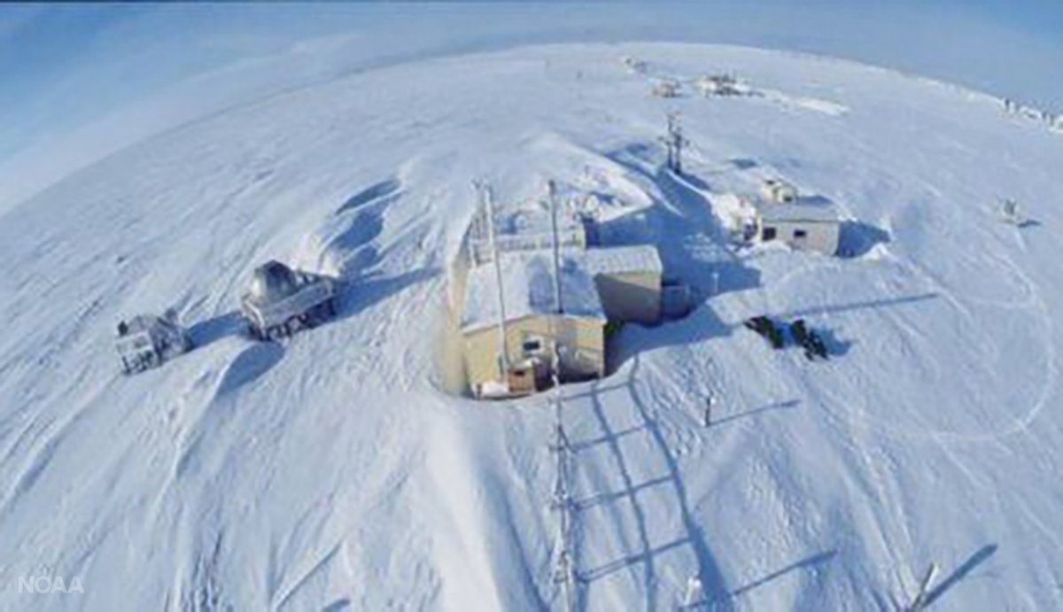 [Barrow Atmospheric Baseline Observatory. From NOAA]
NOAA is also actively engaged in developing assessments such as this year’s update on ocean acidification that will serve as the basis of policy recommendations at the Ministerial.
Edited for WeatherNation by Meteorologist Mace Michaels
[Barrow Atmospheric Baseline Observatory. From NOAA]
NOAA is also actively engaged in developing assessments such as this year’s update on ocean acidification that will serve as the basis of policy recommendations at the Ministerial.
Edited for WeatherNation by Meteorologist Mace Michaels
[Humpback whale breaching in the Arctic. (iStock)]
On the cutting-edge
With many partners, NOAA is on the cutting-edge of monitoring Arctic conditions, pioneering innovative technologies, and creatively collecting data and other scientific information vital to shaping sound Arctic policy and stewardship.
https://www.youtube.com/watch?v=7JIwOB5jB60
A Coupled Arctic Forecast System (CAFS) is being evaluated to improve ice and snow forecasts, which are critical to coastal communities and safe navigation. Below are seven-day forecasts for the Arctic Ocean north of Alaska to the North Pole. Arrows show the direction of surface winds. The longer the arrow, the stronger the winds. The winds can move ice, creating areas where it's pulled apart or compressed.
https://www.youtube.com/watch?v=plT25Y6oOaU
[Seven-day forecasts for the Arctic Ocean north of Alaska to the North Pole. Percentage of sea ice coverage on the left and depth of snow on ice on the right. Arrows show the direction and strength of surface winds. From NOAA]
New Arctic testbed
NOAA capabilities in Alaska continue to evolve. Three 24/7 Weather Forecast Offices and 11 additional offices provide weather services. There are hydrologic forecasts and sea ice analyses and forecasts. Support for weather aviation includes volcanic ash advisories. Just north of Anchorage is the National Tsunami Warning Center.
To meet emerging needs, an NOAA Arctic Test Bed has been designed as a nexus for improving NOAA's responsiveness to changing science and service priorities. The Test Bed will pilot and operationalize products and services critical to Alaska's residents, infrastructure and environment, and advance NOAA's goal of building a Weather-Ready Nation.
https://www.youtube.com/watch?v=jTDxUZyUhz4
Collecting vital data
NOAA satellites keep an eye on many areas where ground observations are scarce. The new GOES-17 geostationary satellite has begun watching parts of Alaska and the neighboring Canadian Arctic from more than 22,000 miles above Earth.
Polar-orbiting satellites such as NOAA-20 and Suomi NPP fly over the Arctic 28 times daily, collecting valuable data from the atmosphere and sea ice to improve weather forecasts and climate information. Working together, the two systems provide high-resolution data and imagery to improve sea ice and snow cover monitoring and the tracking of wildfire smoke and volcanic ash.
In ice-choked waters, satellite observations contribute to safe aviation and navigation, informing the decisions of emergency managers, fishing communities, and the tourism and energy industries, among others.
Filling observation gaps
Riveting new technology is revolutionizing understanding of the still largely unknown Arctic environment, filling significant gaps in ocean and atmospheric observations. https://www.youtube.com/watch?v=IXdYZ-MM-Cc [Technologies NOAA uses to study the Arctic include the following: prawler mooring system, saildrones, oculus coastal gliders and ALAMO floats. From NOAA] Partnering with industry, academia and other federal partners, NOAA is on the leading edge of pioneering these technologies. The unmanned, fast and cost-effective tools are sturdy enough to withstand icy temperatures and collect quality data for long periods. The data have a broad reach. Scientists, for example, need reliable data about the rate of melting Arctic ice to accurately predict extreme weather in the rest of the world. Charting the future Once impenetrable to all but the hardiest, Arctic waters are now budding hubs of activity. All of this new traffic needs to run safely. NOAA is updating nautical charts and increasing tide and current monitoring. Shoreline and other geodetic surveys are underway along with preparations for potential oil spills and other hazards that can now stretch to the North Pole.
[Frozen for centuries, the fabled Northwest Passage is becoming navigable in summer. Image/NOAA; Animation/Tom Yulsman, University of Colorado Boulder.]
Fast-rising vessel traffic also raises the risk of polluting pristine waters. What happens, for example, if an oil spill freezes and ice covers it? Because the ice is moving, the oil is, too. Knowing where it’s headed is critical to know what will happen once the oil thaws.
[NOAA Ship Fairweather underway in Alaska. From NOAA]
Arctic ERMA is a huge asset in a region where emergency response is particularly challenging. In a single interactive map, ERMA provides fast visualization of on-the-ground conditions, supporting rapid response to environmental hazards and other incidents.
[Projected area of Anchorage earthquake, Nov. 30, 2018 From NOAA]
ERMA integrates static and real-time data. Local stakeholders and regional responders have identified data needs in over 500 areas, including weather, sea ice and vessel zones.
Polar projections are a recent addition, providing more accurate detail than a flat-map perspective. They are key to estimating how far an oil spill is from land and to improve the ability of all Arctic nations to see the same details at the same time.
Tracking seal populations
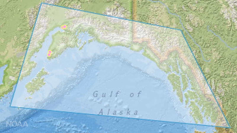
How Arctic change is affecting northern Bering Sea ecosystems is of particular interest to NOAA scientists. Seals are key predators in the marine food chain and an important food source for Alaska's Native communities. Changes in populations or behavior could impact marine ecosystems and the people that rely on them. https://www.youtube.com/watch?v=vHVcENFWNf8 Searching the Bering Sea for ribbon, spotted, bearded and ringed seals, fisheries scientists are collecting biological information and attaching satellite tracking devices to develop population estimates and study the seals’ movements, habitat and feeding behavior. For last year's survey, NOAA researchers traveled more than 235 miles farther north than for previous studies. Research showed declining fat in spotted seal pups over the past four years, suggesting their mothers were eating less and providing less food. International collaboration As a leading voice on the Arctic Council, NOAA works closely with other Arctic nations and Native communities. NOAA activities benefit from these and other efforts.
[Eight countries in the Arctic Circle. From US Arctic Research Commission]
Sharing Arctic observations will improve hurricane, drought, severe weather and other forecasts worldwide. The prospect of viable fishing in the Arctic led to a new agreement, including a research and monitoring component, which is aimed at supporting sustainability for U.S. fishing communities.
NOAA has contributed information about microplastics and other marine litter. Pending approval at an upcoming Arctic Council Ministerial, the information can bolster action about growing litter concerns in the Arctic.
[Barrow Atmospheric Baseline Observatory. From NOAA]
NOAA is also actively engaged in developing assessments such as this year’s update on ocean acidification that will serve as the basis of policy recommendations at the Ministerial.
Edited for WeatherNation by Meteorologist Mace MichaelsAll Weather News
More
Tropical Storm Chantal Forms This Morning
Tropical Storm Chantal has formed, with winds
5 Jul 2025 4:35 PM

Catastrophic Flooding in the Texas Hill Country
Multiple Flash Flood Emergencies were issued
5 Jul 2025 4:35 PM


Severe Storms in the Midwest Continue To Spoil the Holiday Weekend
NORTHERN PLAINS - A frontal system continues
5 Jul 2025 8:30 AM

Near Seasonal Temperatures for Many Come July 4th!
AAA is expecting over 70 million travelers to
4 Jul 2025 10:15 AM


Northwest Heat Met With Thunderstorm Risk
NORTHWEST - Today, portions of Montana are un
3 Jul 2025 12:00 AM