Tornado Watch Issued for the Midwest. Are You Ready?
Special Stories
3 Oct 2018 4:01 PM
The time to be weather aware and weather ready is *now* as a tornado watch has been issued for parts of the Upper Midwest.
https://www.facebook.com/WeatherNation/posts/10156862129939874
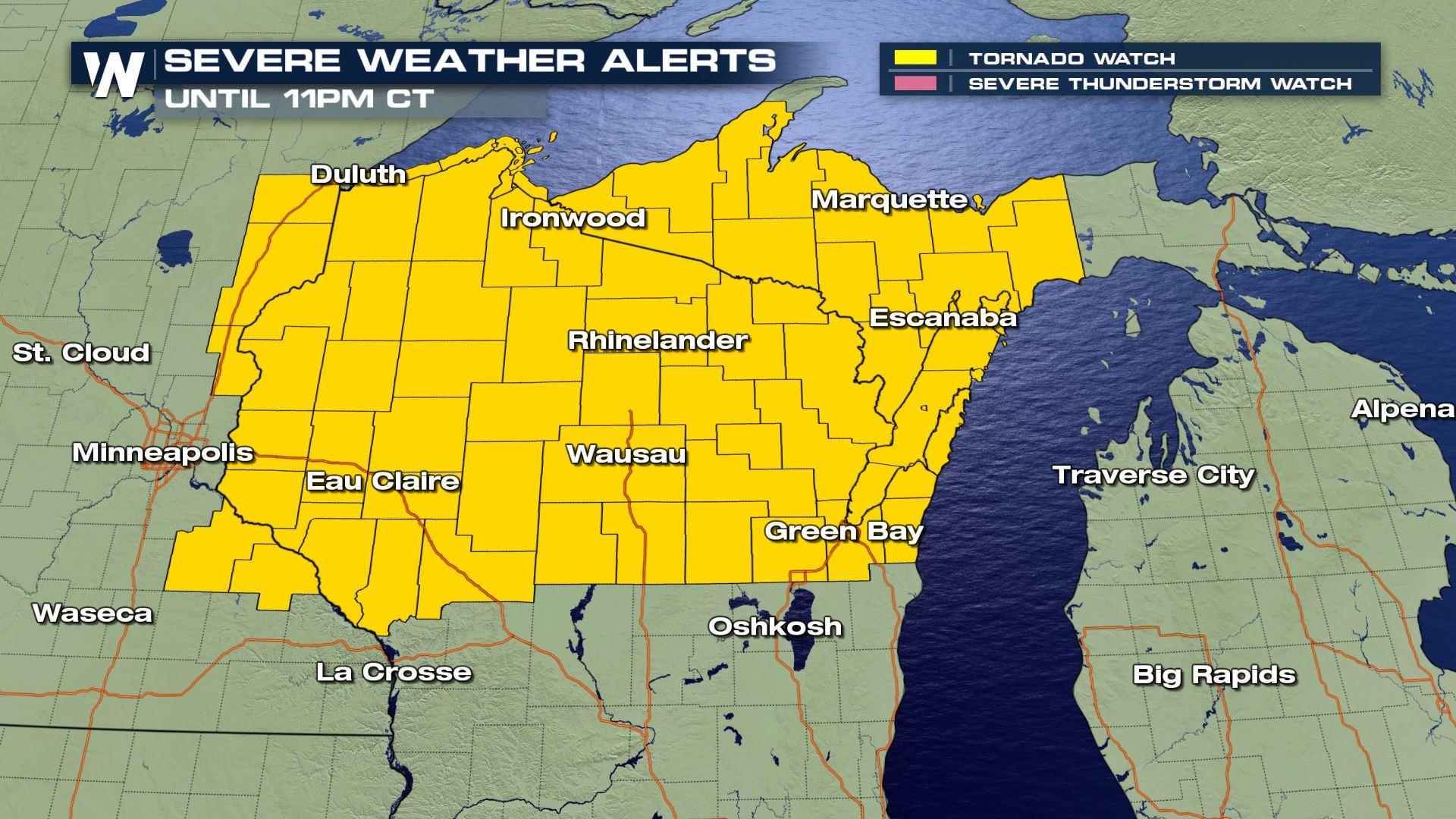
The tornado watch is in effect for areas colored in yellow along the Minnesota and Wisconsin border until 11 p.m. local time Wednesday, October 3rd. The tornado watch is also in effect for the northern half of Wisconsin and parts of the Upper Peninsula of Michigan.
Related Story: Severe Storms Likely Across The Upper Midwest Wednesday
Question is, are you weather ready and/or weather aware?
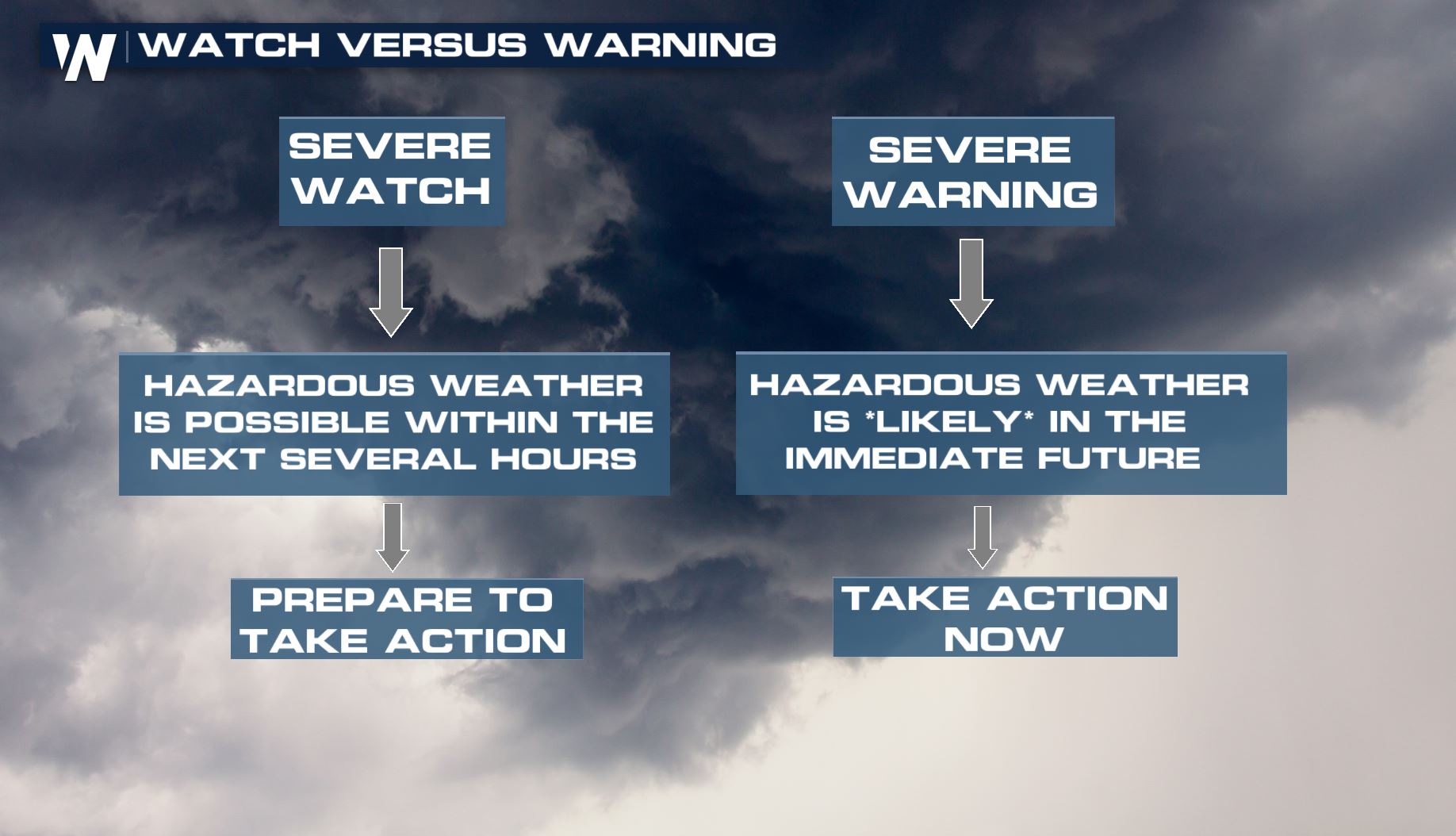 First things first, we'll discuss terminology. The difference between a severe (or tornado) watch versus warning is listed above. This applies for all kinds of weather alerts, from tornadoes to floods. The key message is for you to listen/watch out for the warnings!
New Weather Model May Increase Tornado Warning Lead Times
Now, let's talk estimated timing so that you're even more ready.
First things first, we'll discuss terminology. The difference between a severe (or tornado) watch versus warning is listed above. This applies for all kinds of weather alerts, from tornadoes to floods. The key message is for you to listen/watch out for the warnings!
New Weather Model May Increase Tornado Warning Lead Times
Now, let's talk estimated timing so that you're even more ready.
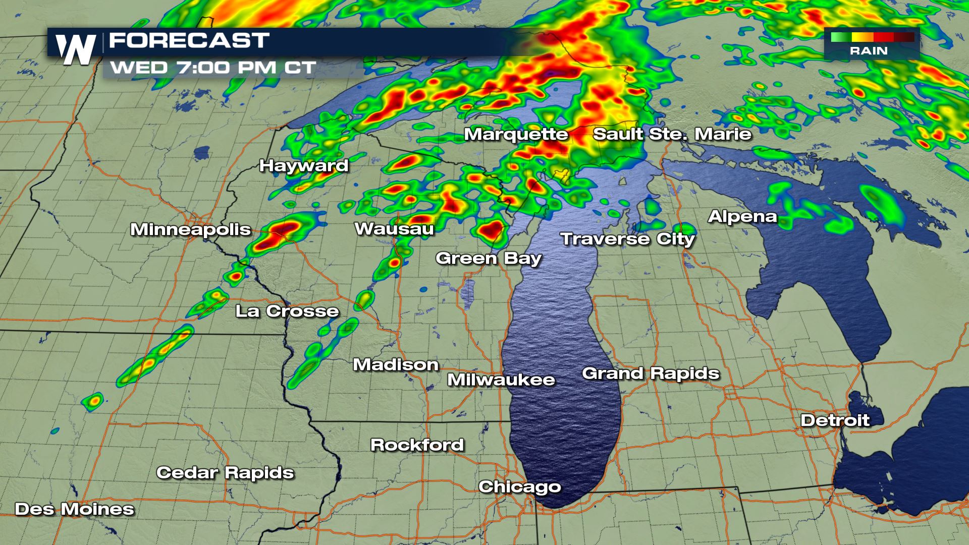 The simulated radar at 7 p.m. Central Wednesday, October 3 where reds show where anticipated thunderstorms are expected.
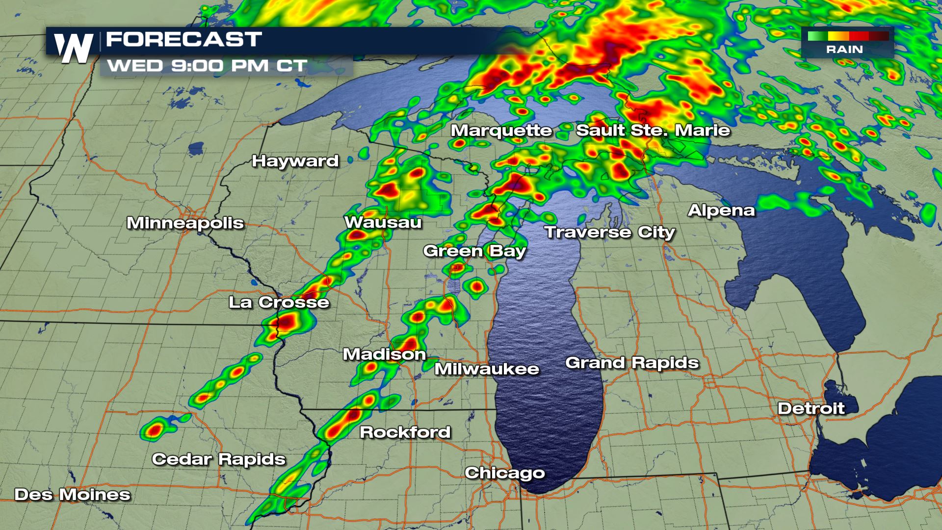 The simulated radar at 9 p.m. Central Wednesday, October 3 where reds show where anticipated thunderstorms are expected.
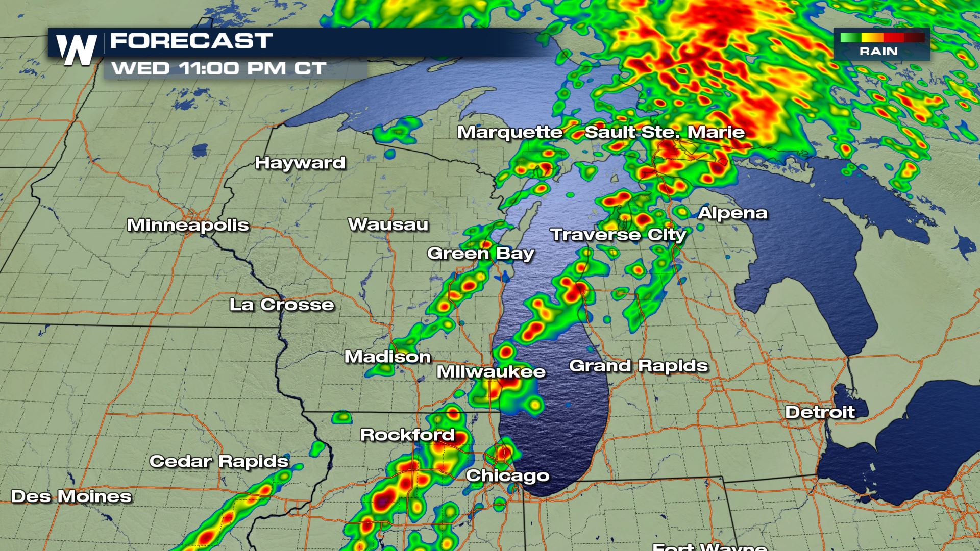 The simulated radar at 11 p.m. Central Wednesday, October 3 where reds show where anticipated thunderstorms are expected.
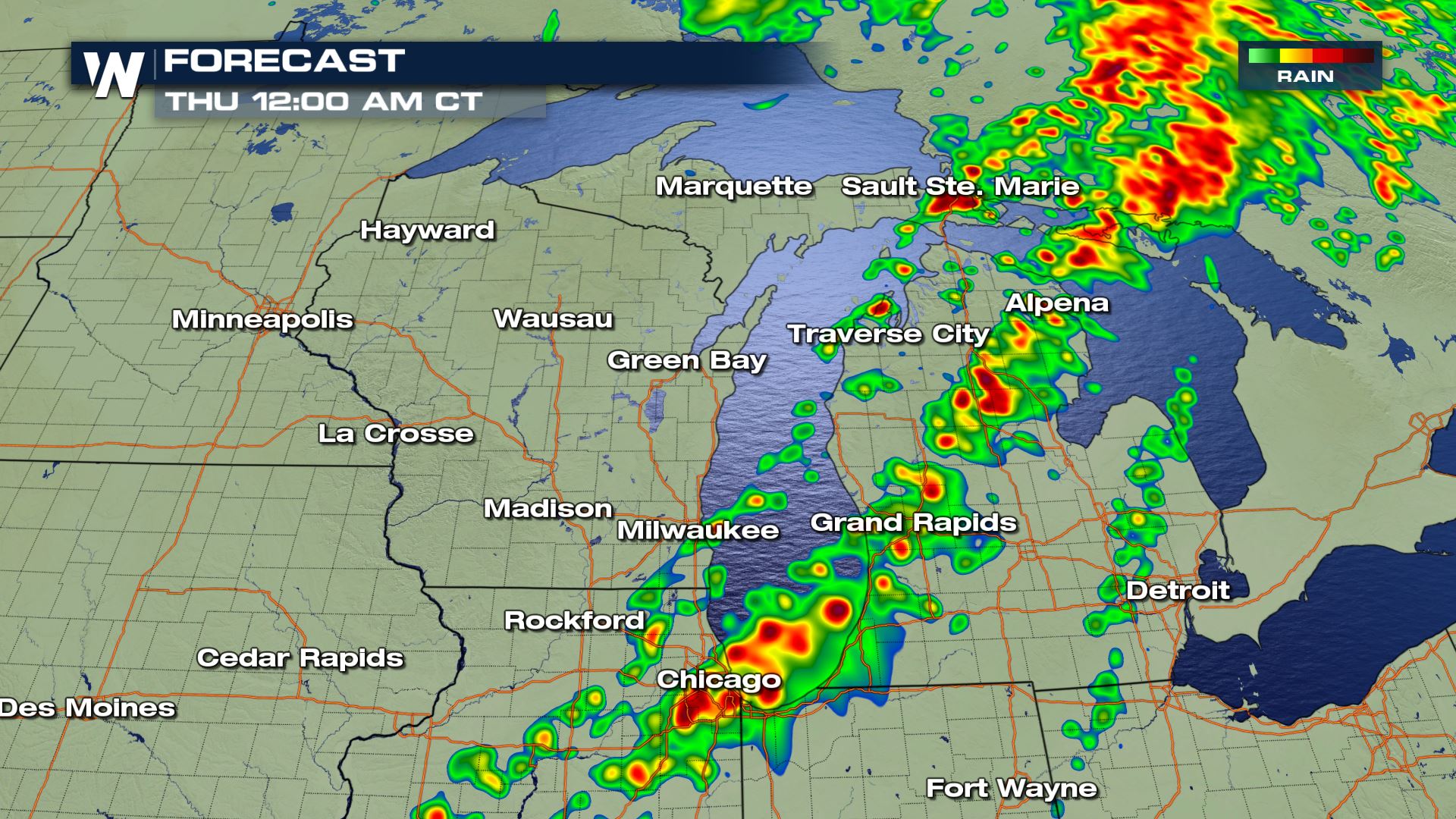 The simulated radar at 12 a.m. Central Thursday, October 4 where reds show where anticipated thunderstorms are expected.
It's just the start. Related Story: The Plains and Midwest in Store for a Soggy Week
Finally, what do we do if a tornado warning is issued for our location?
Well, you'll probably first hear the sound that you did earlier today on your cell phone. Which one was that? It was the nationally-dispersed Emergency Alert System notification that went out to all of the public earlier today, as a test. It was loud, but it's the same noise that sounds when a tornado warning is issued for your location...unless you purposely turn that alert off in your device.
[Mock Scenario] Now we know a warning has been issued for our location. Next, we need go into the lowest, most-interior room of a securely-built structure and wait for the storm to pass. We've labeled these spots in red below:
The simulated radar at 12 a.m. Central Thursday, October 4 where reds show where anticipated thunderstorms are expected.
It's just the start. Related Story: The Plains and Midwest in Store for a Soggy Week
Finally, what do we do if a tornado warning is issued for our location?
Well, you'll probably first hear the sound that you did earlier today on your cell phone. Which one was that? It was the nationally-dispersed Emergency Alert System notification that went out to all of the public earlier today, as a test. It was loud, but it's the same noise that sounds when a tornado warning is issued for your location...unless you purposely turn that alert off in your device.
[Mock Scenario] Now we know a warning has been issued for our location. Next, we need go into the lowest, most-interior room of a securely-built structure and wait for the storm to pass. We've labeled these spots in red below:
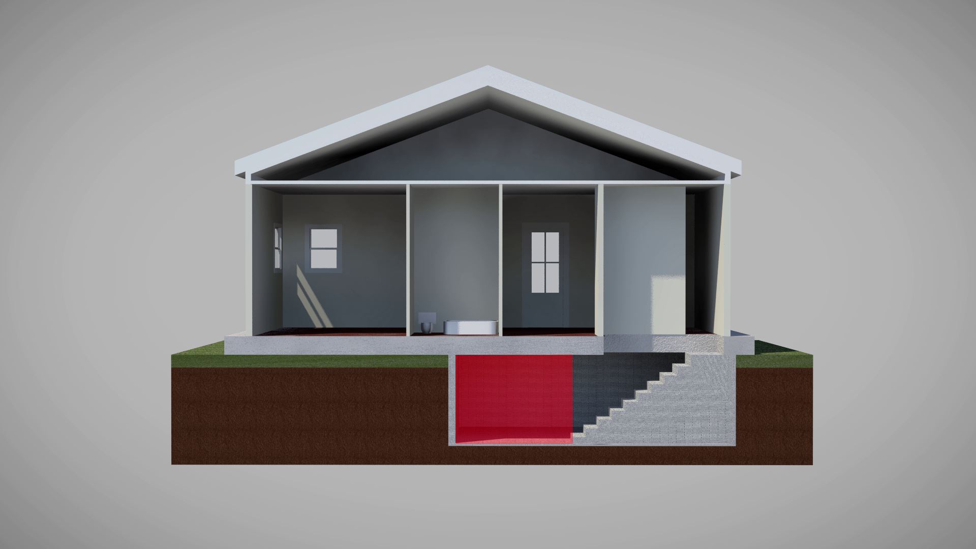 Red marks the spot of where you want to be (for safety) during a tornado warning.
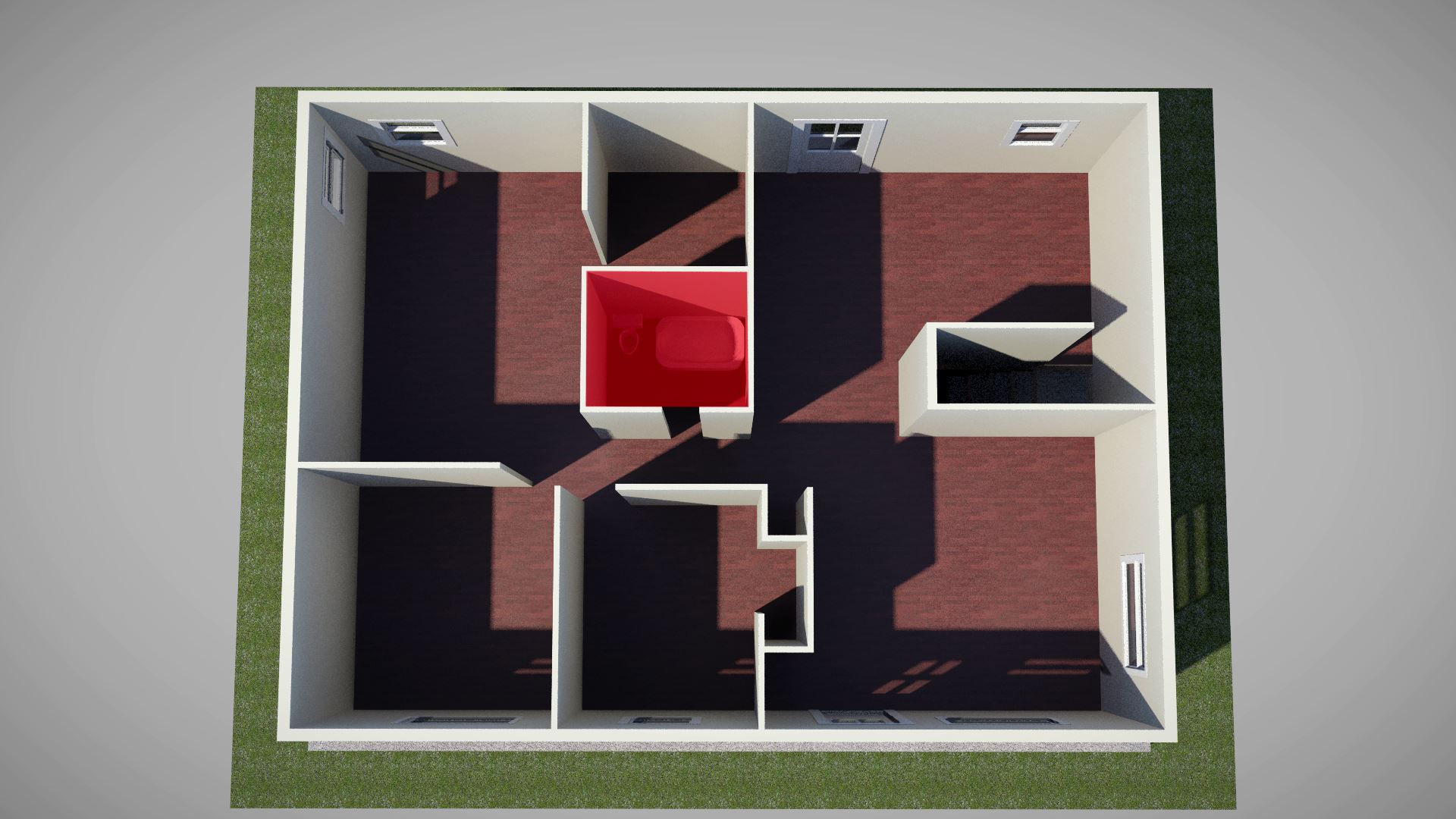 Red marks the spot of where you want to be (for safety) during a tornado warning.
Continue to stay with WeatherNation for additional updates regarding this ongoing weather story.
For WeatherNation, Meteorologist Steve Glazier
Red marks the spot of where you want to be (for safety) during a tornado warning.
Continue to stay with WeatherNation for additional updates regarding this ongoing weather story.
For WeatherNation, Meteorologist Steve Glazier
First things first, we'll discuss terminology. The difference between a severe (or tornado) watch versus warning is listed above. This applies for all kinds of weather alerts, from tornadoes to floods. The key message is for you to listen/watch out for the warnings!
New Weather Model May Increase Tornado Warning Lead Times
Now, let's talk estimated timing so that you're even more ready.
The simulated radar at 7 p.m. Central Wednesday, October 3 where reds show where anticipated thunderstorms are expected.
The simulated radar at 9 p.m. Central Wednesday, October 3 where reds show where anticipated thunderstorms are expected.
The simulated radar at 11 p.m. Central Wednesday, October 3 where reds show where anticipated thunderstorms are expected.
The simulated radar at 12 a.m. Central Thursday, October 4 where reds show where anticipated thunderstorms are expected.
It's just the start. Related Story: The Plains and Midwest in Store for a Soggy Week
Finally, what do we do if a tornado warning is issued for our location?
Well, you'll probably first hear the sound that you did earlier today on your cell phone. Which one was that? It was the nationally-dispersed Emergency Alert System notification that went out to all of the public earlier today, as a test. It was loud, but it's the same noise that sounds when a tornado warning is issued for your location...unless you purposely turn that alert off in your device.
[Mock Scenario] Now we know a warning has been issued for our location. Next, we need go into the lowest, most-interior room of a securely-built structure and wait for the storm to pass. We've labeled these spots in red below:
Red marks the spot of where you want to be (for safety) during a tornado warning.
Red marks the spot of where you want to be (for safety) during a tornado warning.
Continue to stay with WeatherNation for additional updates regarding this ongoing weather story.
For WeatherNation, Meteorologist Steve GlazierAll Weather News
More
East Gears Up for Stormy, Wet Weekend
A low pressure system crashing through the Mi
1 Aug 2026 6:15 PM


Flooding, Severe Storms Target the Midwest Again
After an active week of storms across the nor
1 Aug 2026 1:40 AM

After Reaching Category 5, Genevieve Weakens in the Pacific
PacificFausto is now a post-tropical cyclone.
31 Jul 2026 1:30 AM

Flooding Risk Increases as Heavy Rain Targets the Tri-State Area
Tuesday, heavy rainfall moved across the Nort
30 Jul 2026 12:25 AM

Severe Weather: Energy From the Midwest Now in the Southeast
UPPER MIDWEST - Through Monday, dangerous tor
29 Jul 2026 10:30 PM