Alberto Dissipates in Mexico Thursday Afternoon
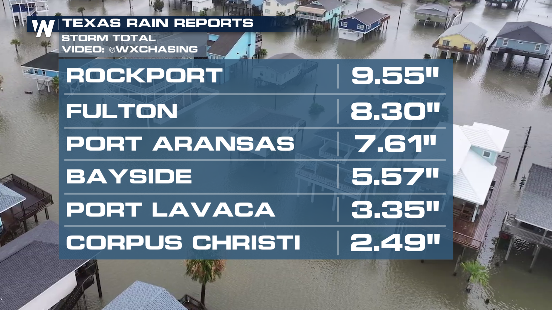
As of 4 PM CDT, the National Hurricane Center has issued its last advisory on Alberto, now dissipating into remnants. Alberto made landfall in Mexico early Thursday morning, near the town of Tampico, as a tropical storm. This system impacted south Texas with heavy rainfall and strong winds over the past few days, but the biggest impacts were coastal flooding and storm surges. Storm surge was measured at 2-4' along the Texas coastline as onshore flow pushes water into communities.
Still, a few isolated storms are possible however new rain totals will be less than 1" but given how saturated the ground is, additional rain could lead to rapid onset flooding. Travel may remain challenging so please heed any flash flood warnings that are issued and if you can avoid traveling on the roads today, do so.
 The National Hurricane Center has highlighted another potential low-pressure system in the western Gulf for this weekend. As a reminder, 2024 is expected to be above average for tropical activity due to a La Nina forming during the peak of hurricane season in September. Tropical activity can and does occur in early June. It only takes one storm to impact you and the time to prepare is before the storm hits!