Upper Midwest Forecast Update - Heavy Snow and Some Ice Ahead
Special Stories
17 Apr 2018 4:13 PM
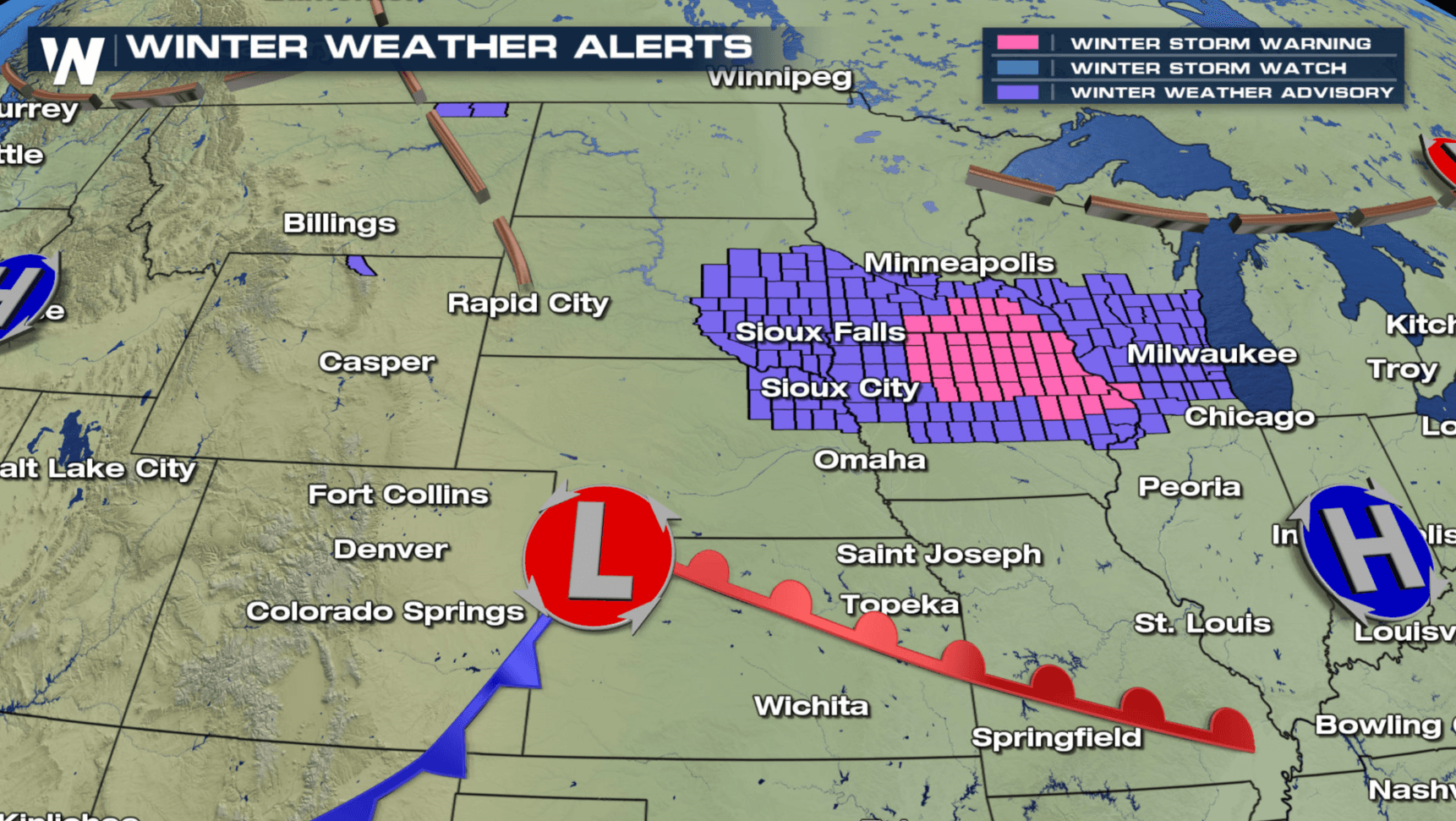
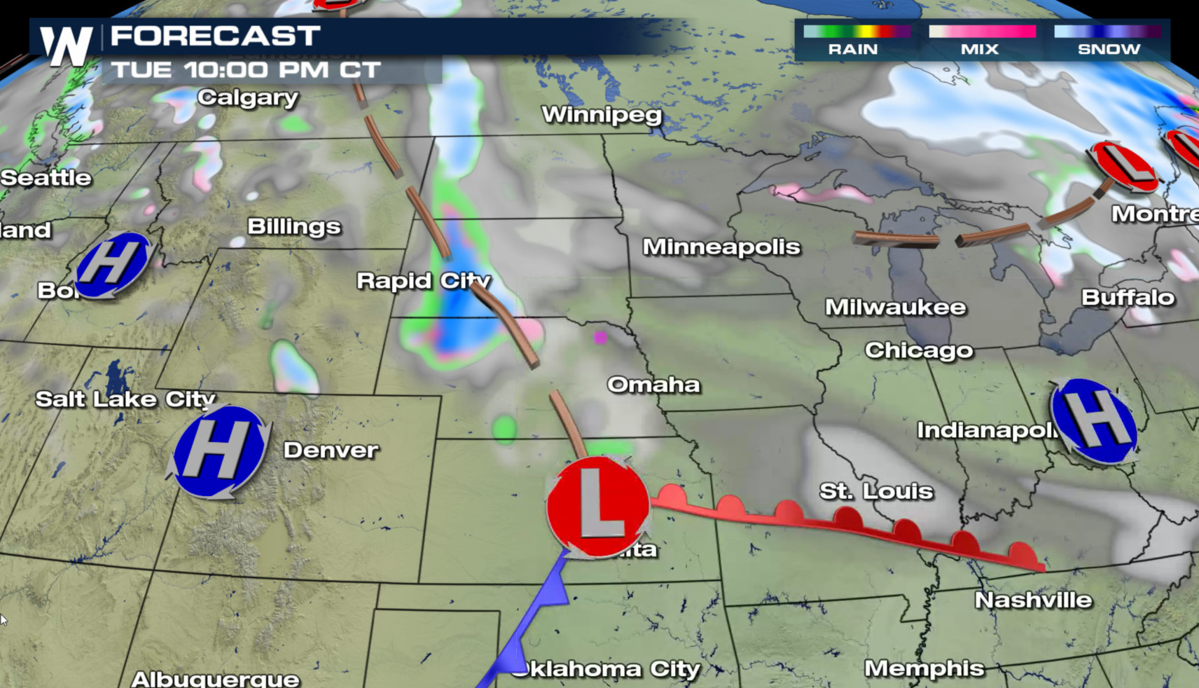
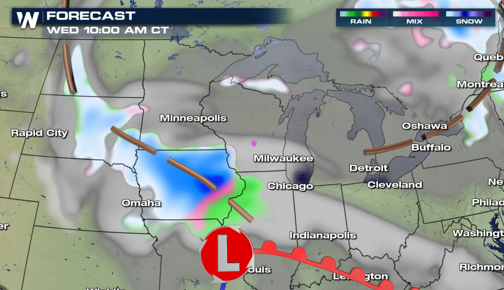
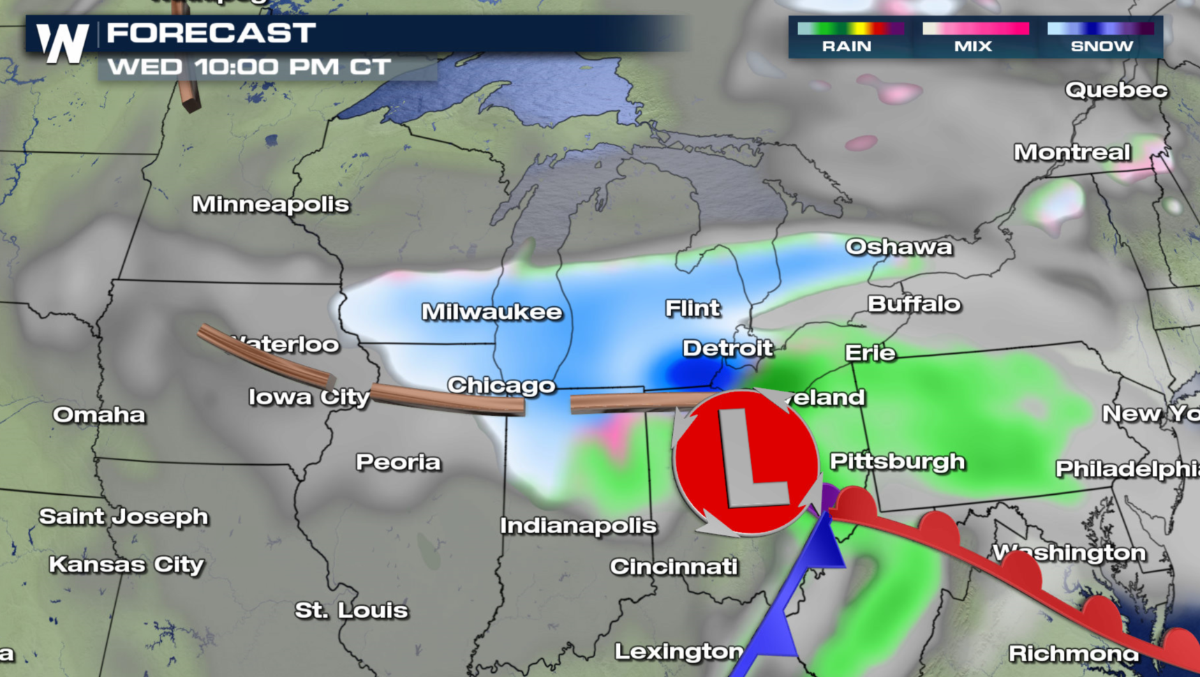
What seems to be a never ending parade of winter storms in the northern tier of the nation this month continues. Another storm system will affect the Upper Midwest later tonight into Wednesday. Winter Storm Warnings have been issued in parts of Minnesota, Iowa, and Illinois. Snowfall accumulations may climb to near a foot from near Des Moines to Madison. A mix of sleet and freezing rain is possible along I-80.
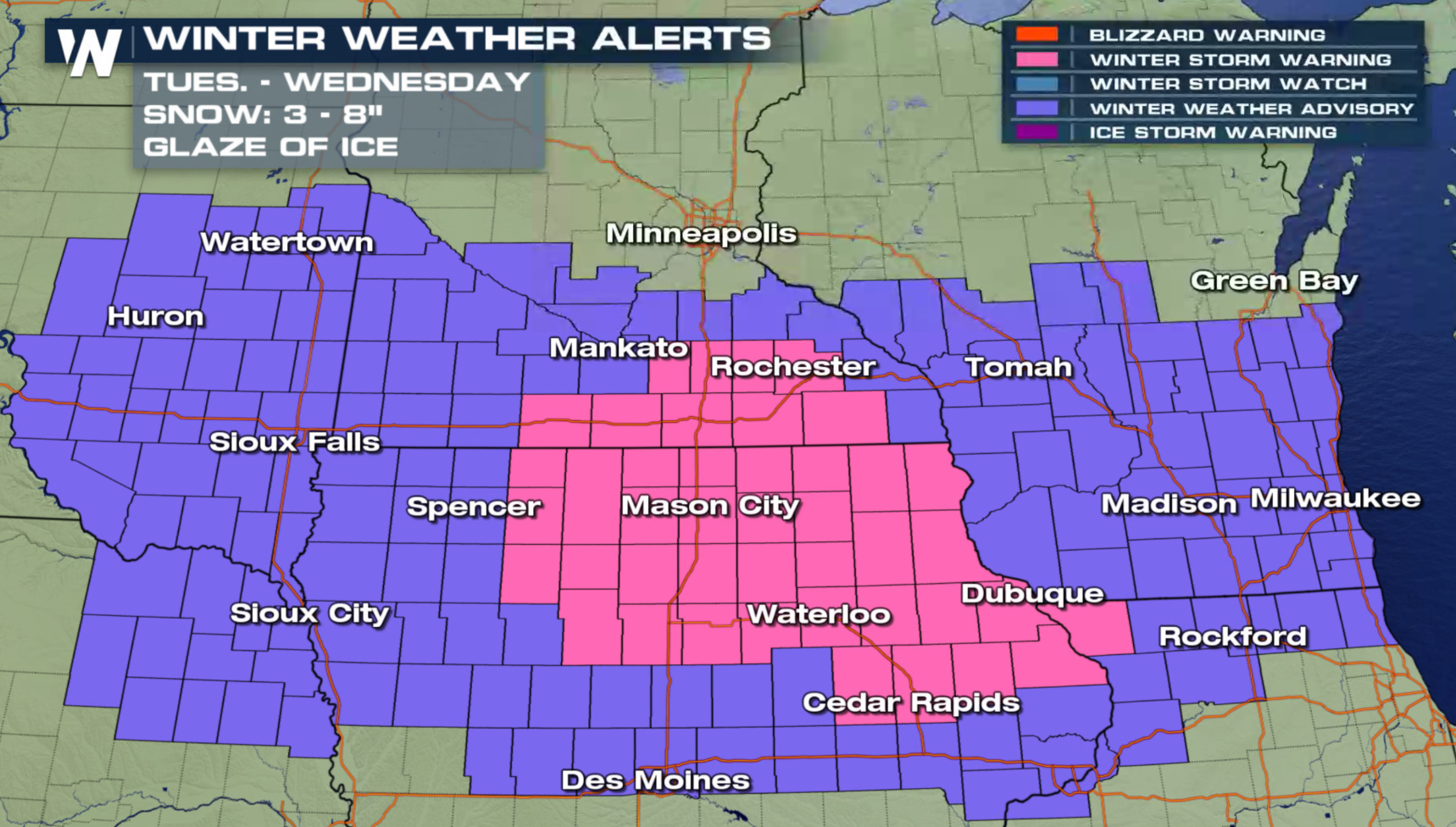
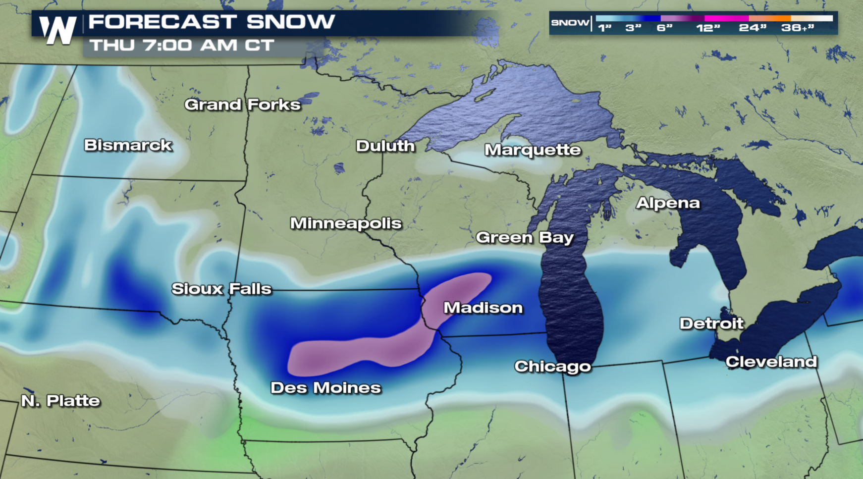
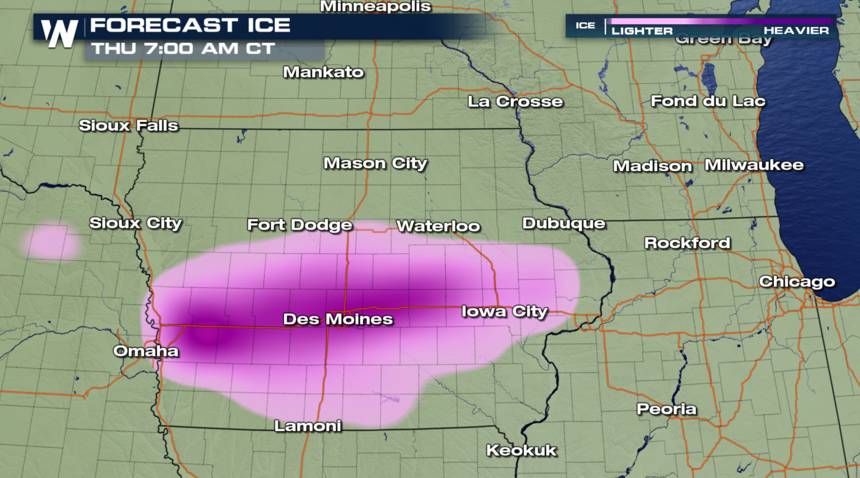 A compact, but intense low pressure center will move into the central Plains tonight and push through the Ohio Valley Wednesday. Heavy snow will track quickly from the High Plains to the Great Lakes. Some icy mixed precipitation is likely.
 For WeatherNation: Meteorologist Mace Michaels
A compact, but intense low pressure center will move into the central Plains tonight and push through the Ohio Valley Wednesday. Heavy snow will track quickly from the High Plains to the Great Lakes. Some icy mixed precipitation is likely.
For WeatherNation: Meteorologist Mace MichaelsAll Weather News
More
Wildfire Outbreak in the Pacific Northwest
SPOKANE, WA - On Saturday, August 1st, the Ol
3 Aug 2026 1:55 AM

More Storms for the East Through Monday
A low-pressure system that moved through the
3 Aug 2026 1:50 AM


After Reaching Category 5, Genevieve Weakens in the Pacific
PacificGenevieve formed last Friday south of
3 Aug 2026 12:30 AM

Flooding, Severe Storms Target the Midwest Again
After an active week of storms across the nor
1 Aug 2026 1:40 AM

Flooding Risk Increases as Heavy Rain Targets the Tri-State Area
Tuesday, heavy rainfall moved across the Nort
30 Jul 2026 12:25 AM

Severe Weather: Energy From the Midwest Now in the Southeast
UPPER MIDWEST - Through Monday, dangerous tor
29 Jul 2026 10:30 PM