Wednesday Severe Weather Update
Special Stories
29 Aug 2018 4:30 AM
Isolated severe storms are in the forecast today from the Lower Mississippi Valley up to the Northeast. The highest risk for severe weather will be mainly over northern New York, Vermont, New Hampshire and Maine, but the chance for a severe storms will be possible anywhere from the Red River to the Ohio Valley.
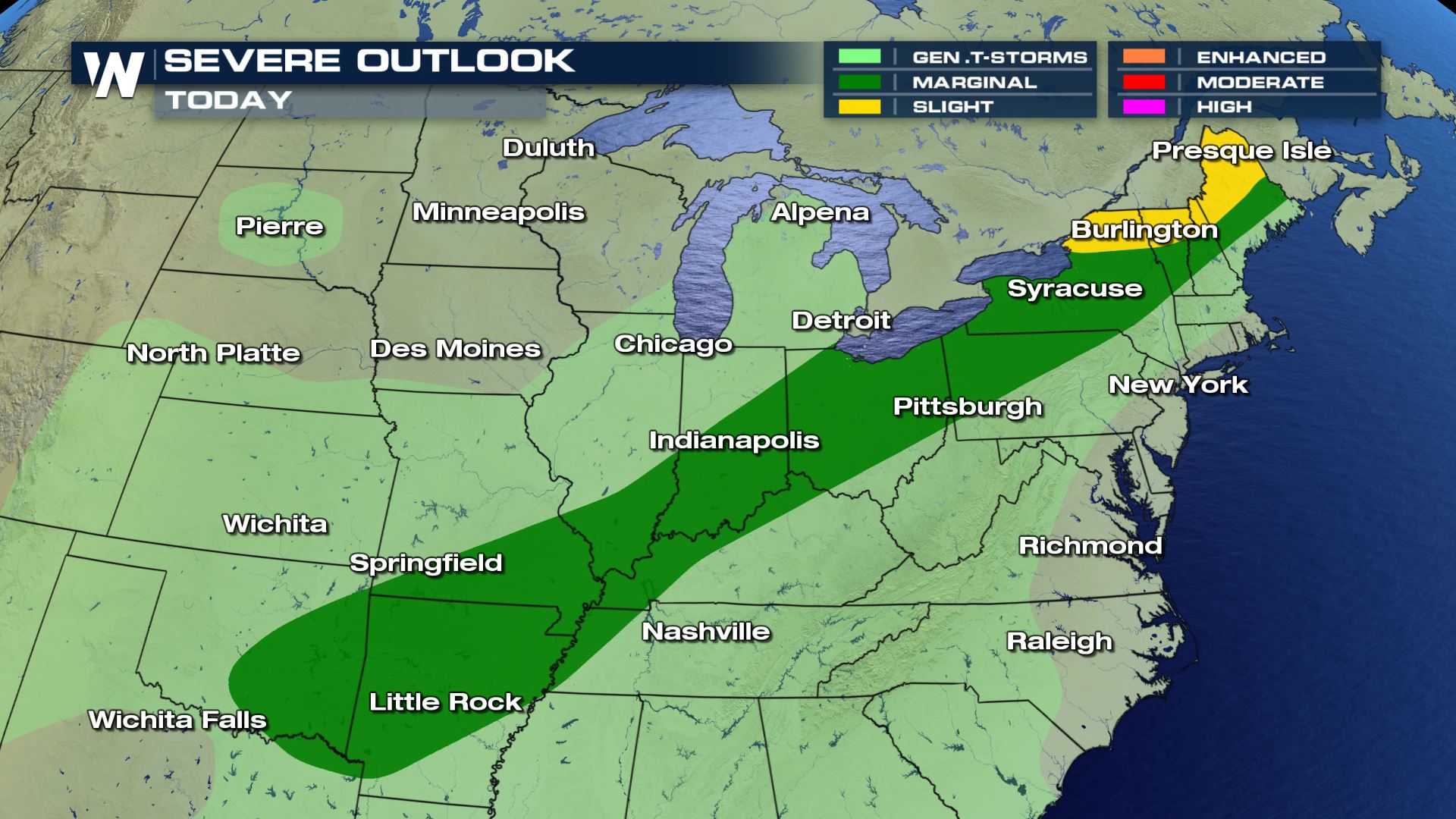
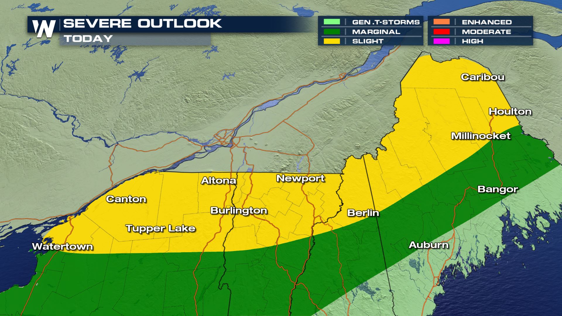 There is a slight risk of severe weather today from New York to Maine. A cold front moving out of the Great Lakes will be the focus for showers and storms today. All the heat and humidity out ahead of the cold front will help increase the instability for severe storm chances this afternoon. Not all modes of severe weather will be in play today, but damaging winds and tornadoes will be possible.
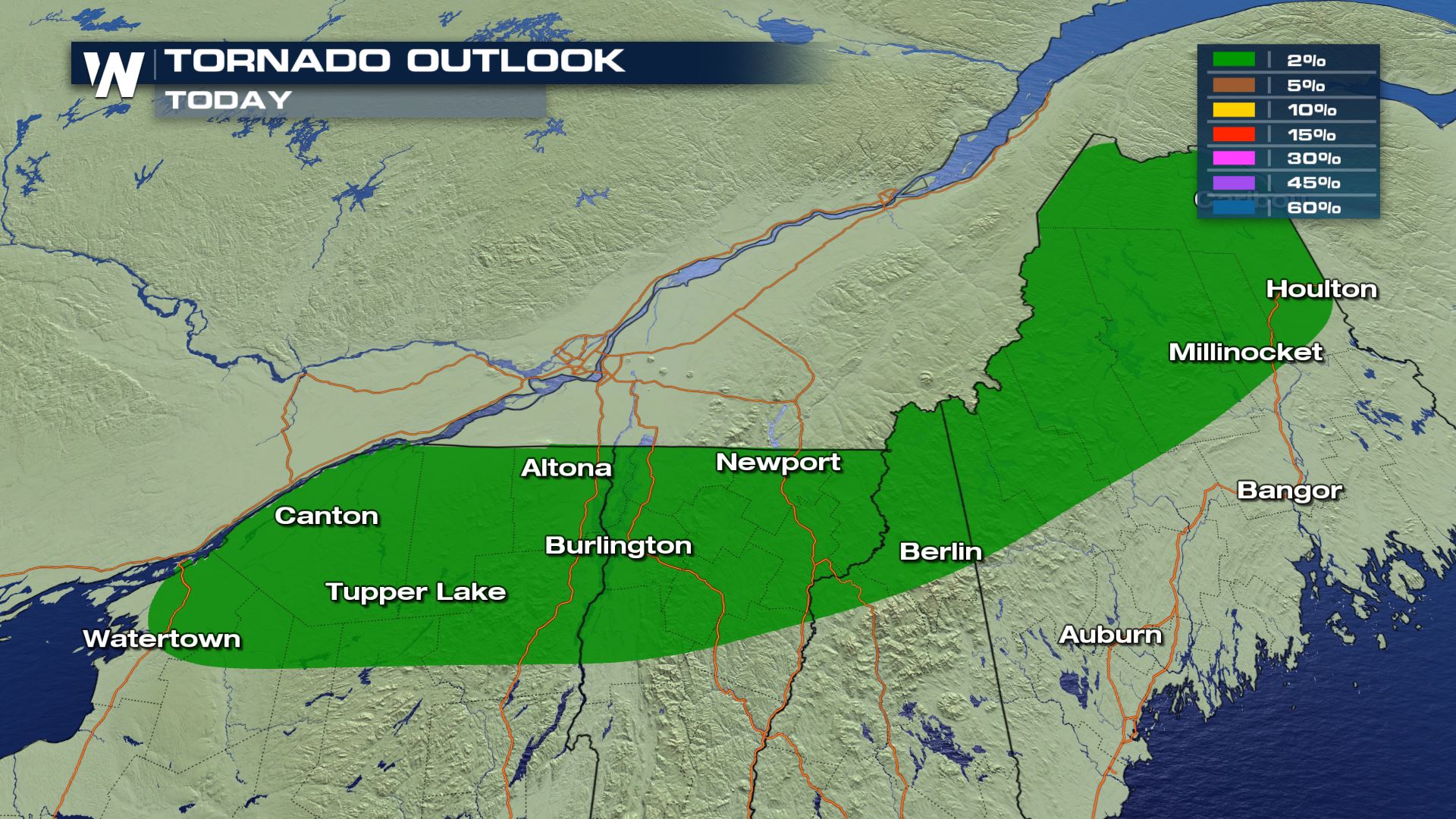
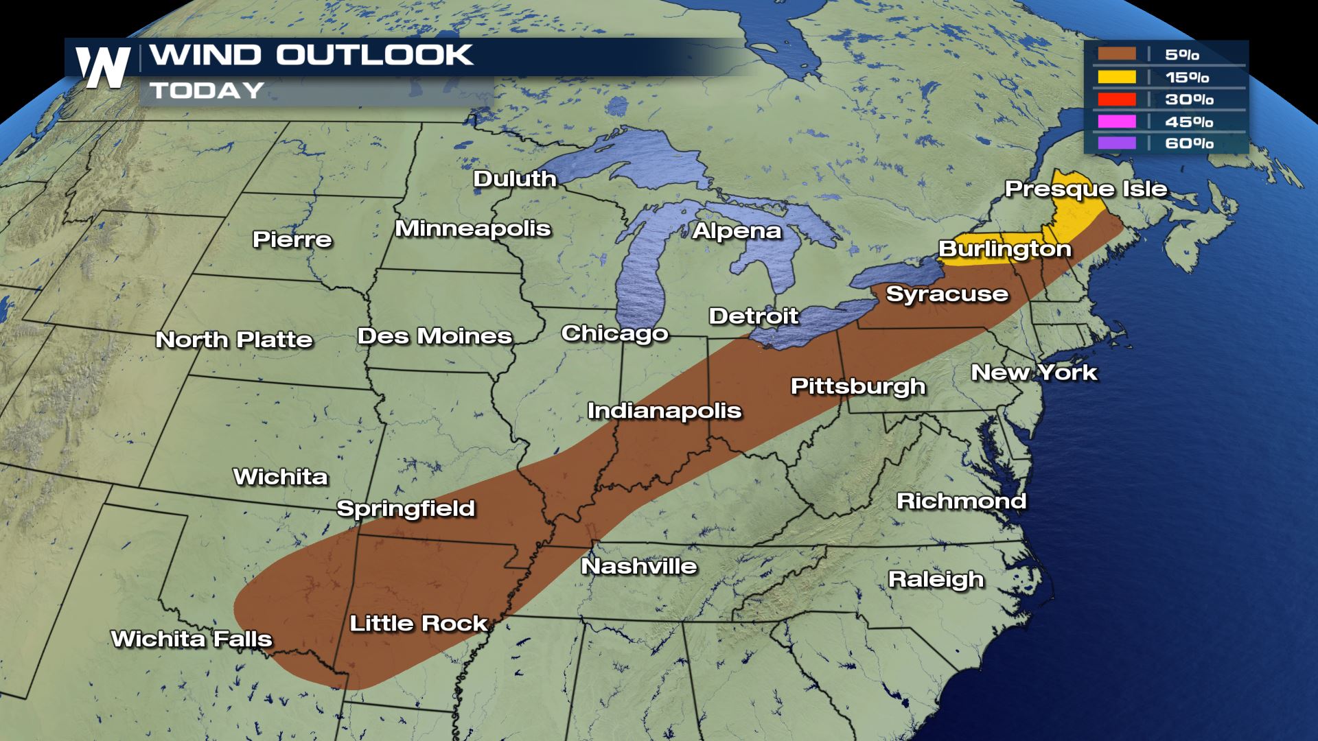 The tornado risk will be confined to Upstate New York, but the risk for damaging winds will cover a much wider area. Take a look at how widespread the risk for damaging winds over 58 mph is for today...it extends from the Red River to Northern Maine.
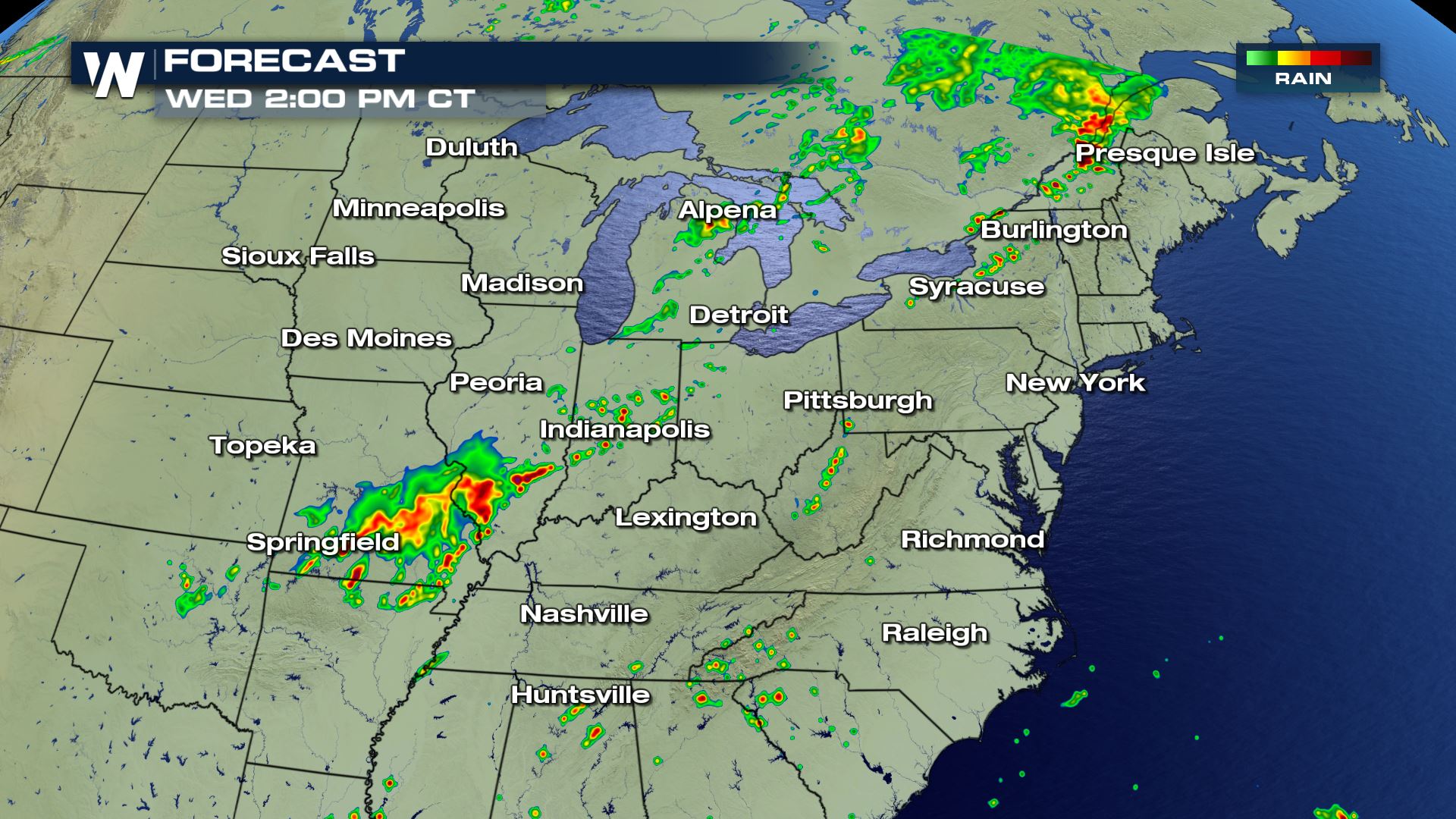
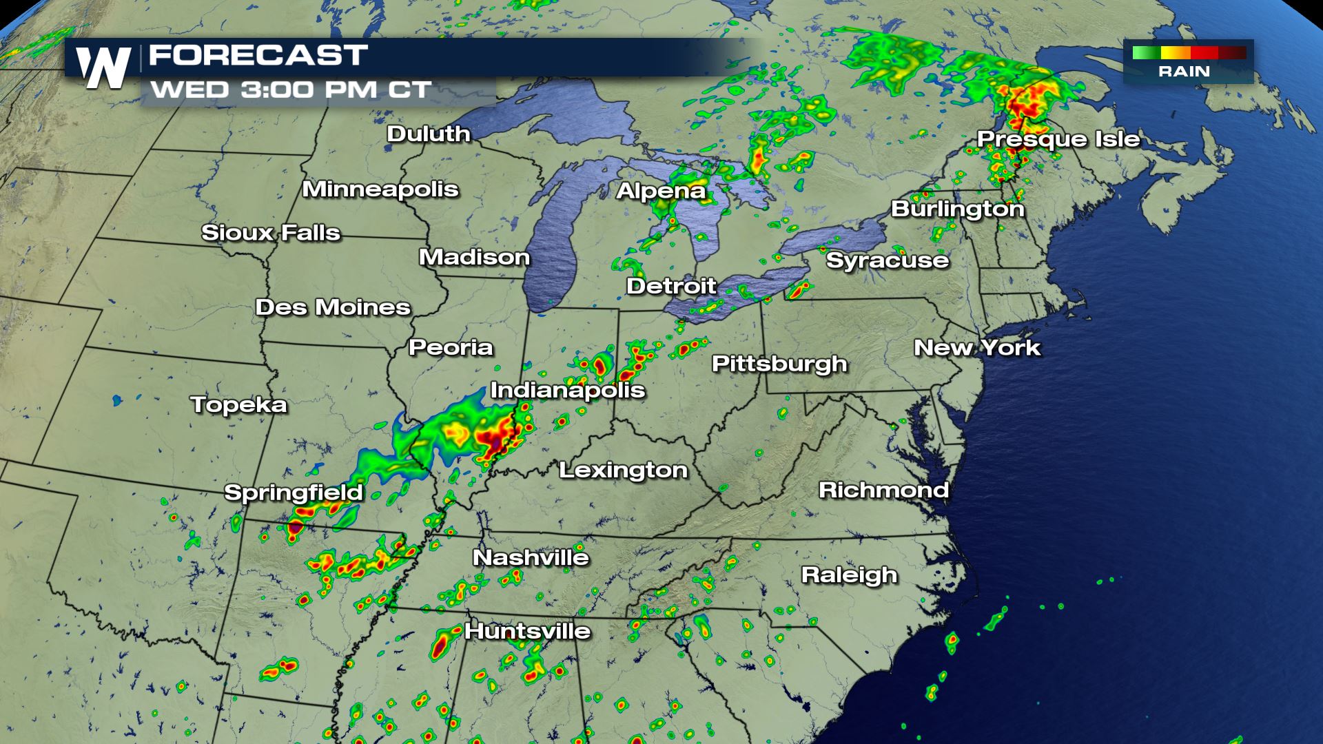
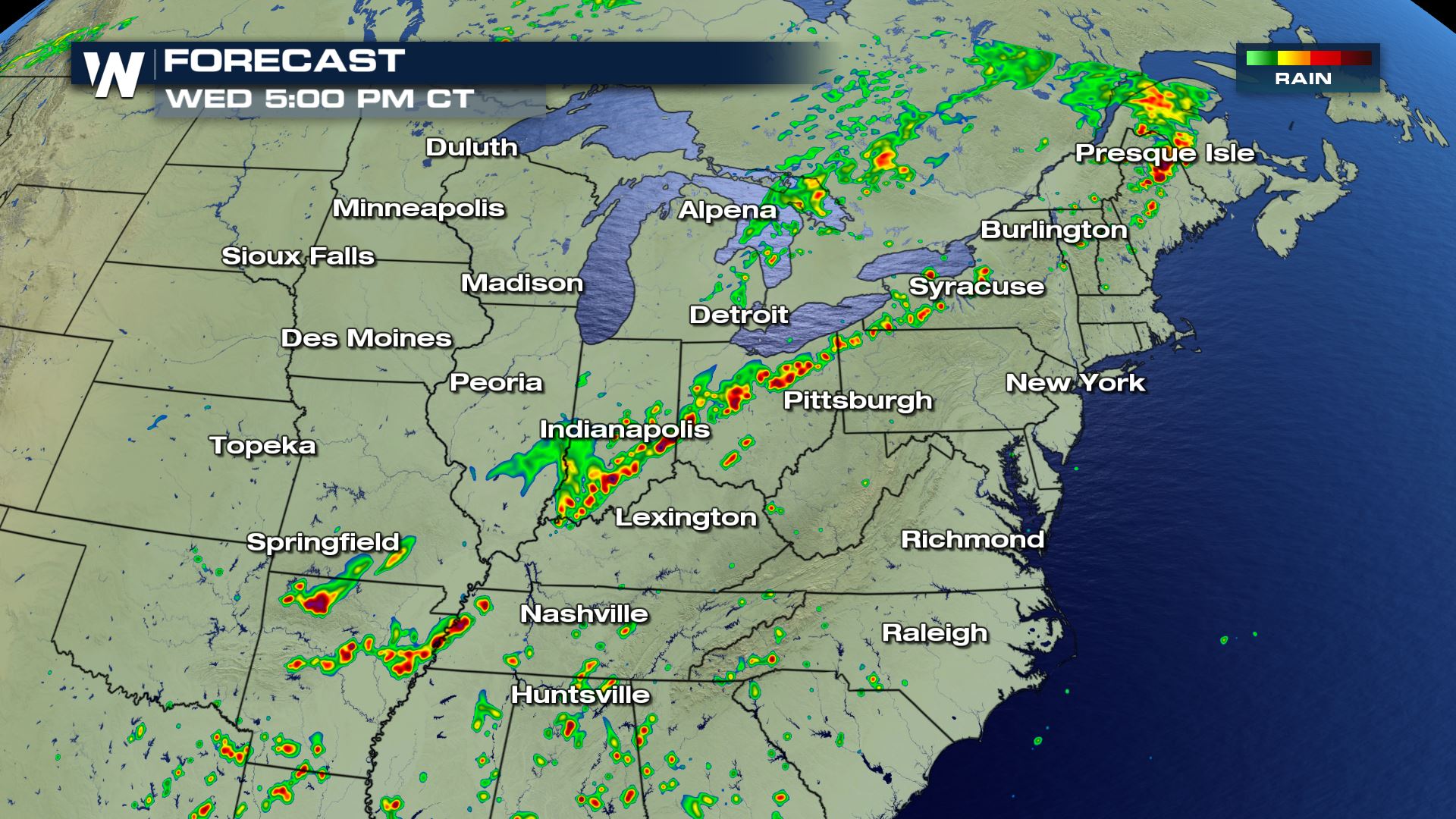
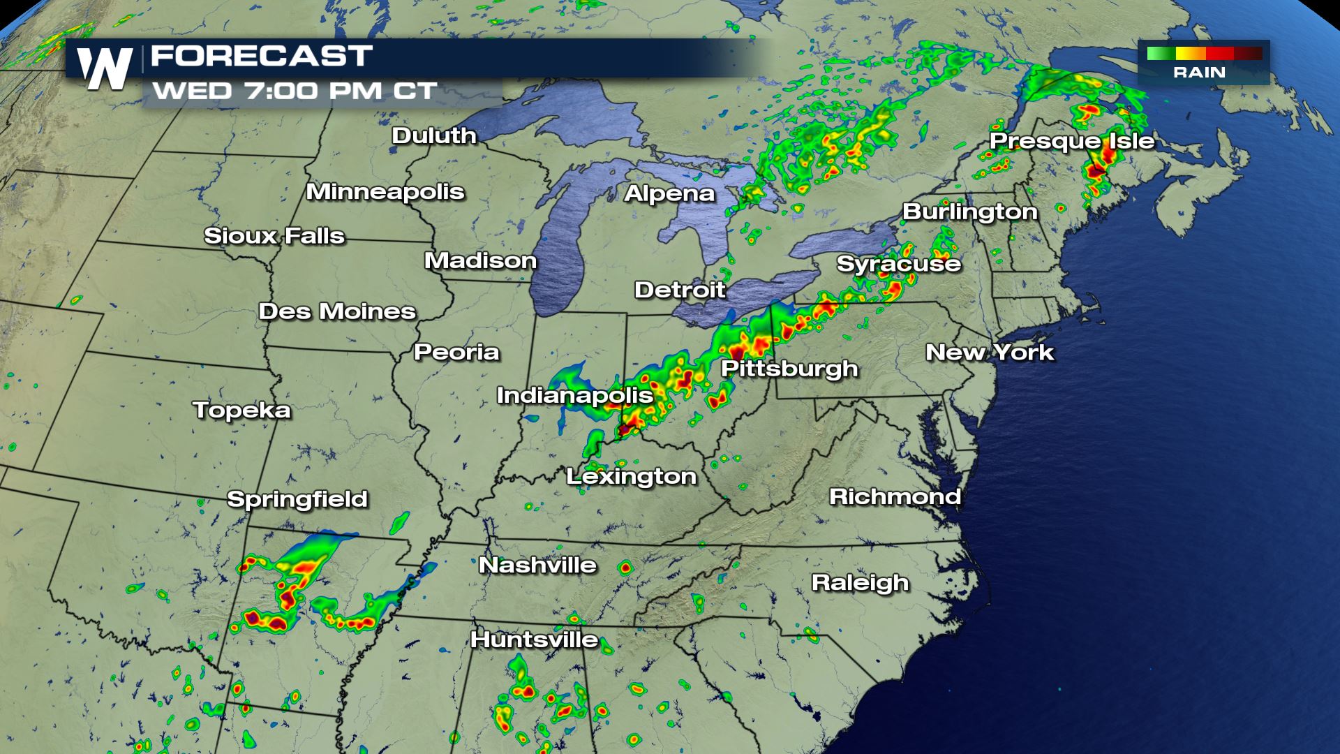 Storm chances will be possible all morning, but the more intense and possibly severe storms will be for the afternoon and evening. Keep checking back with WeatherNation for more updates on today's severe weather chances.
Severe Outlook

 There is a slight risk of severe weather today from New York to Maine. A cold front moving out of the Great Lakes will be the focus for showers and storms today. All the heat and humidity out ahead of the cold front will help increase the instability for severe storm chances this afternoon. Not all modes of severe weather will be in play today, but damaging winds and tornadoes will be possible.
Severe Risks

 The tornado risk will be confined to Upstate New York, but the risk for damaging winds will cover a much wider area. Take a look at how widespread the risk for damaging winds over 58 mph is for today...it extends from the Red River to Northern Maine.
Forecast


 Storm chances will be possible all morning, but the more intense and possibly severe storms will be for the afternoon and evening. Keep checking back with WeatherNation for more updates on today's severe weather chances.
All Weather News
More