Baseball Size Hail Possible in Texas Tonight

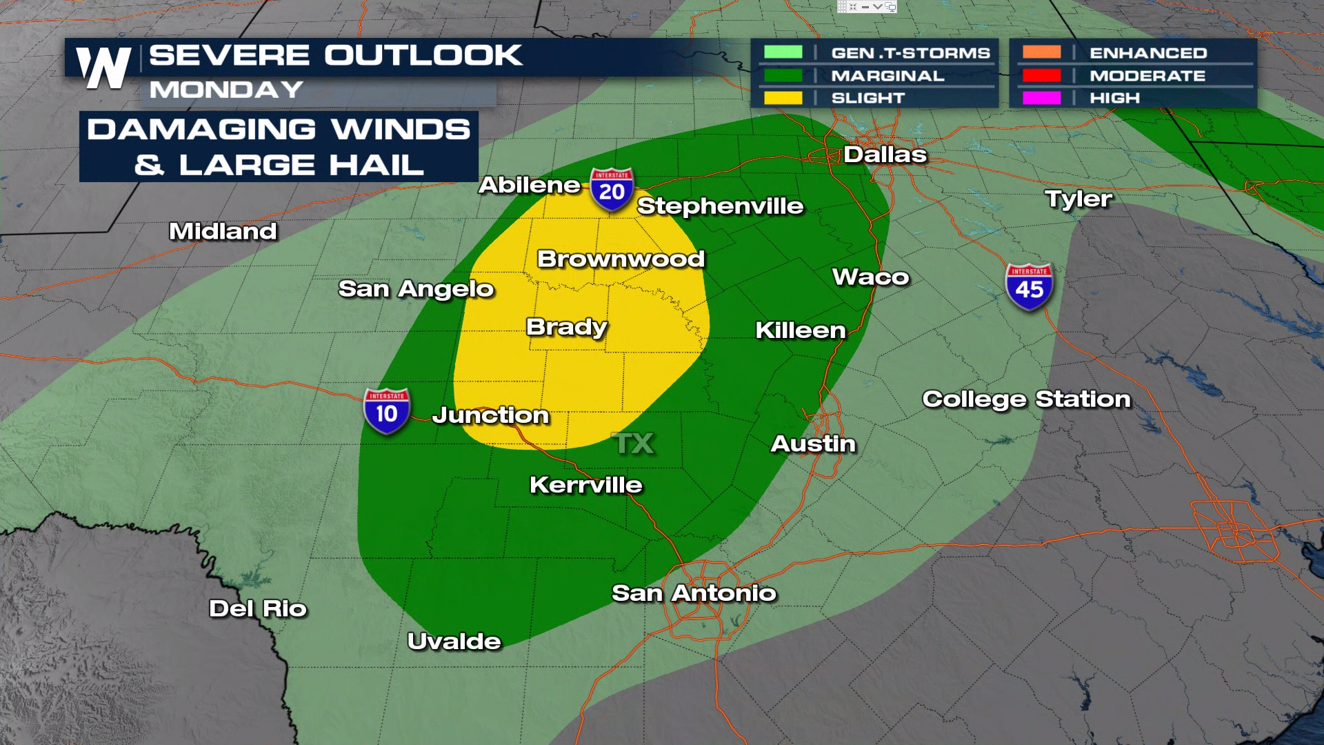
With all of this hot weather and high humidity in the forecast, some areas can expect storms in the Lone Star State the next few days. Today, storms are possible to turn severe through central and west Texas. ABOVE: a severe thunderstorm watch has been issued for portions of Texas for the potential of large hail up to apple in size (3"), damaging winds (75 mph), and frequent lightning possible.
The Storm Prediction Center currently has increased today's risk from marginal to SLIGHT (level 2 out of 5) risk for severe weather west and along the I-35 corridor including the cities of Waco and Austin. The reason for the increase is that temperatures have risen to the triple digits and dewpoints to the 70s east of the dryline.
 Showers and storms continue in central Texas through the evening. Be prepared for gusty winds and locally heavy rain along I-35 through midnight
For more on the storm activity, join WeatherNation streaming 24/7.


