Weekend Snowstorm Targets the Northeast
Special Stories
17 Feb 2018 11:45 AM
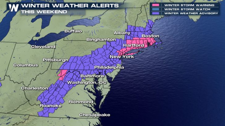
The northeast is bracing for the next round of winter weather. Many areas will see enough snow to cause travel and other impacts, particularly up and down the I-95 corridor this weekend.
https://youtu.be/zJ0baQfILkc
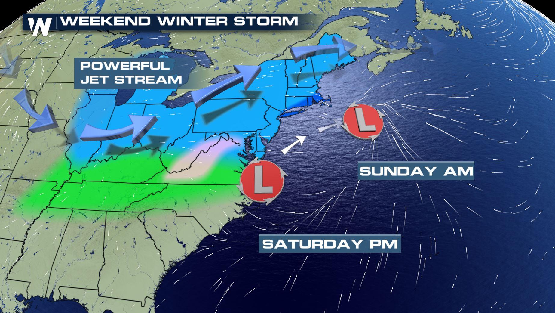
An area of low pressure will push off the mid-Atlantic coastline Saturday, moving to the east-northeast. The low will pass just south of the southern New England coast, but close enough for accumulating snow for many areas from Washington DC to Boston.
 While not a blockbuster of a storm, here's what the northeast can expect.
Timing: Most of the snow will fall from late Saturday through early Sunday for the northeast.
Impacts: Travel may become difficult and potentially dangerous as snow falls through Saturday and Sunday. Visibility may be temporarily reduced in bands of heavier snowfall.
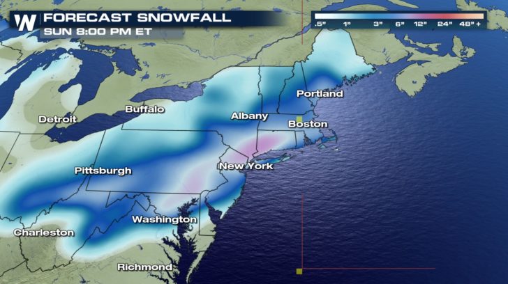
Snow totals: Totals will be heaviest along from northern New Jersey, through Long Island & the greater New York City area, through southern New England to near Boston where 6-10" of snow will accumulate. Lighter totals less than 3-6" will fall through most of the interior northeast from West Virginia to Maine.
While not a blockbuster of a storm, here's what the northeast can expect.
Timing: Most of the snow will fall from late Saturday through early Sunday for the northeast.
Impacts: Travel may become difficult and potentially dangerous as snow falls through Saturday and Sunday. Visibility may be temporarily reduced in bands of heavier snowfall.
Snow totals: Totals will be heaviest along from northern New Jersey, through Long Island & the greater New York City area, through southern New England to near Boston where 6-10" of snow will accumulate. Lighter totals less than 3-6" will fall through most of the interior northeast from West Virginia to Maine.
 Stay with WeatherNation on air and online for continue updates with this most recent round of winter weather.
While not a blockbuster of a storm, here's what the northeast can expect.
Timing: Most of the snow will fall from late Saturday through early Sunday for the northeast.
Impacts: Travel may become difficult and potentially dangerous as snow falls through Saturday and Sunday. Visibility may be temporarily reduced in bands of heavier snowfall.
Snow totals: Totals will be heaviest along from northern New Jersey, through Long Island & the greater New York City area, through southern New England to near Boston where 6-10" of snow will accumulate. Lighter totals less than 3-6" will fall through most of the interior northeast from West Virginia to Maine.
Stay with WeatherNation on air and online for continue updates with this most recent round of winter weather.All Weather News
More
Wildfire Outbreak in the Pacific Northwest
SPOKANE, WA - On Saturday, August 1st, the Ol
3 Aug 2026 1:55 AM

More Storms for the East Through Monday
A low-pressure system that moved through the
3 Aug 2026 1:50 AM


After Reaching Category 5, Genevieve Weakens in the Pacific
PacificGenevieve formed last Friday south of
3 Aug 2026 12:30 AM

Flooding, Severe Storms Target the Midwest Again
After an active week of storms across the nor
1 Aug 2026 1:40 AM

Flooding Risk Increases as Heavy Rain Targets the Tri-State Area
Tuesday, heavy rainfall moved across the Nort
30 Jul 2026 12:25 AM

Severe Weather: Energy From the Midwest Now in the Southeast
UPPER MIDWEST - Through Monday, dangerous tor
29 Jul 2026 10:30 PM