Weekend Storms Target the Great Lakes & Ohio Valley

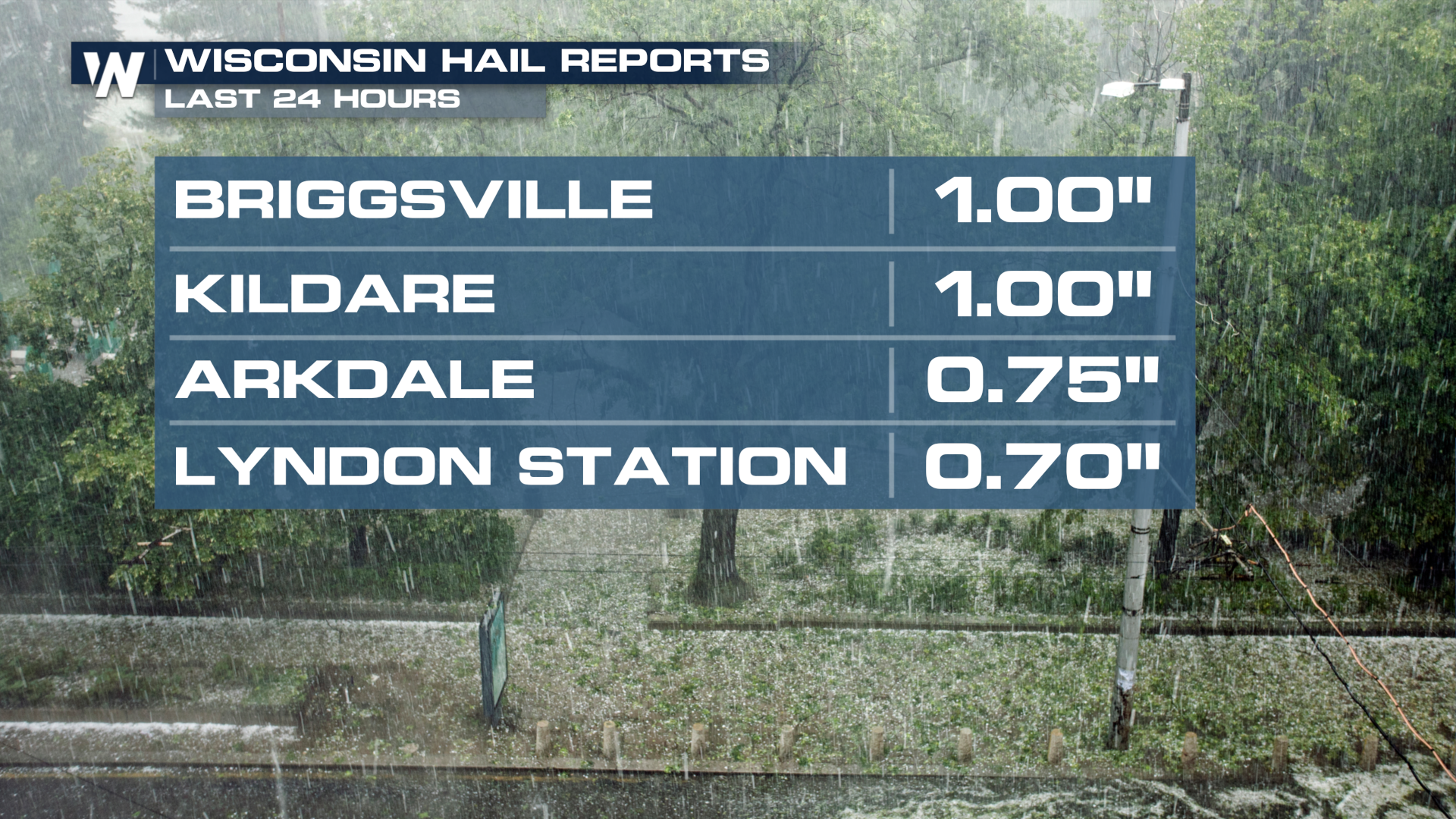
Heavy showers and storms are slowly shifting east through the Midwest with a trough of low pressure that brought heavy showers and storms to the Plains States for much of this week. Hail up to the size of quarters fell in Wisconsin on Friday, with additional severe storms possible today and Sunday. The SPC does not currently have an outlook for Saturday, but one has been issued on Sunday from Michigan to Kentucky (top of page).
As the trough moves east, unstable air is expected to linger ahead of the surface low. With moderate wind shear aloft, storms should be able to organize for at least isolated severe threats of wind and hail.
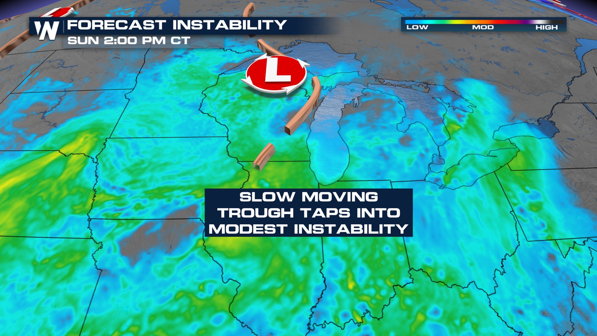
The afternoons look stormiest for both Saturday and Sunday, with the the western side of Lake Michigan clearing more into Sunday as the trough axis swings in that direction.
With multiple rounds of rain and heavy downpours, rainfall totals could top 3-4 inches in some areas by Monday morning.
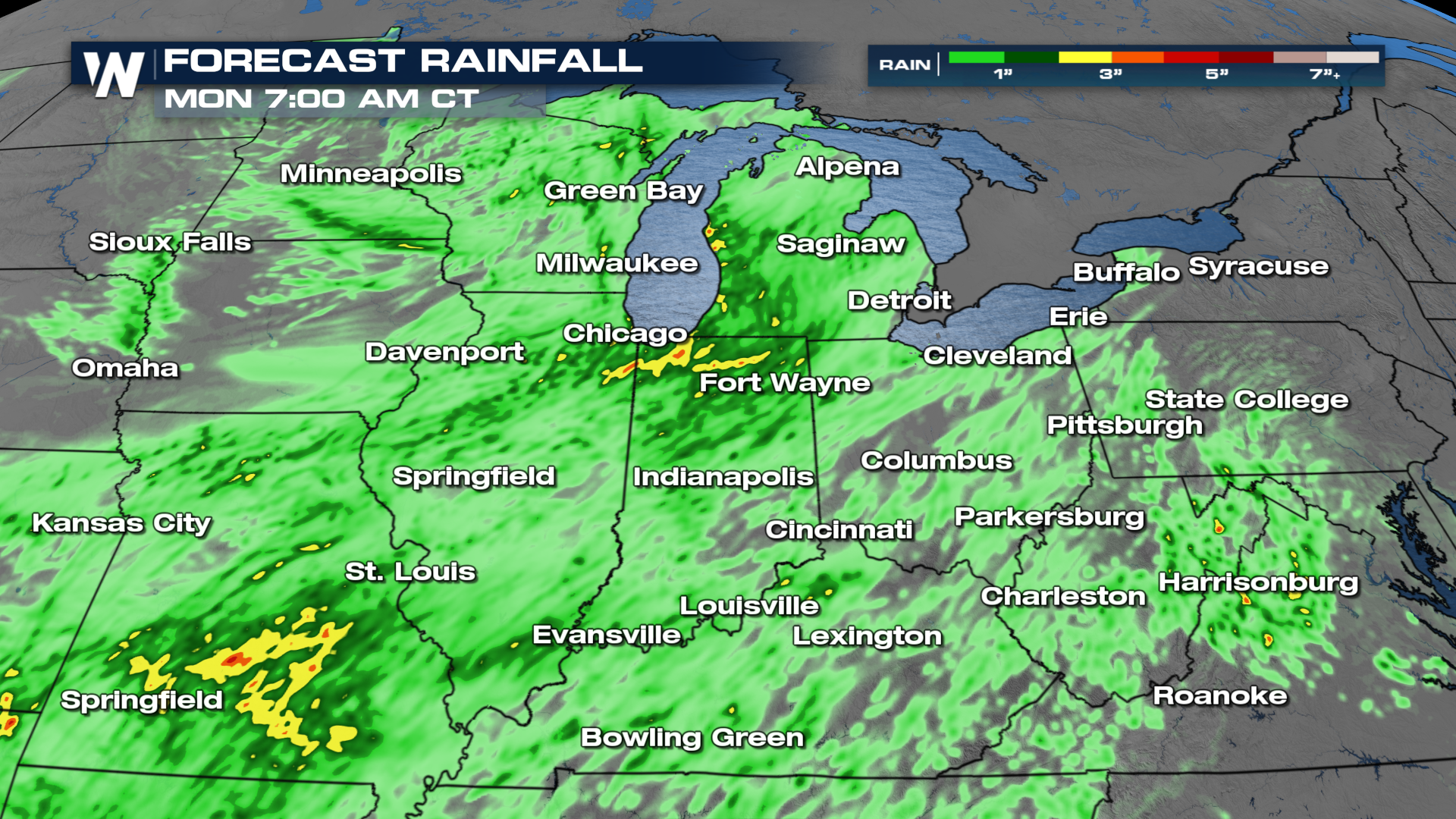
Isolated flash flooding will be possible through at least Monday. The Weather Prediction Center (WPC) is highlighting this threat with excessive rainfall outlooks (below).


