Winter Hangs On - Light Snow in the Northeast

The Northeast has been generally dry and warm this winter and now that we are entering Spring we will see a few weaker systems slide through producing rain and light snow (above) into the start of the work week. A weak clipper system arrives Saturday into Sunday and will also be a light rain/snow maker. The pattern stays active until the start of the work week with another weak system through Monday.
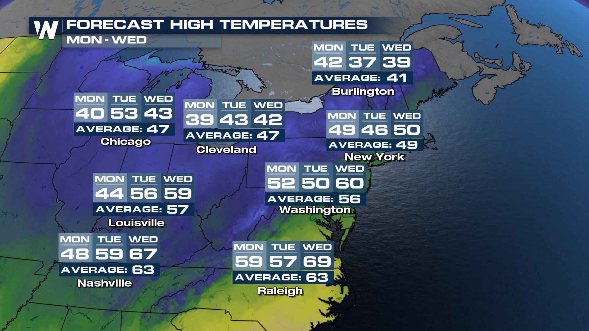
Perhaps more impactful than any rain or snow chance will be the colder air that funnels in behind the front. Temperatures drop Saturday into Sunday, into the 30s and 20s for overnight lows. This will feel chilly, but for many it's still several degrees above normal for mid-March!
High temperatures will fall to about five degrees below average on Monday, Tuesday, and/or Wednesday (depending on what city) and while this won't be record-setting cold, it will feel chilly compared to our warm winter.
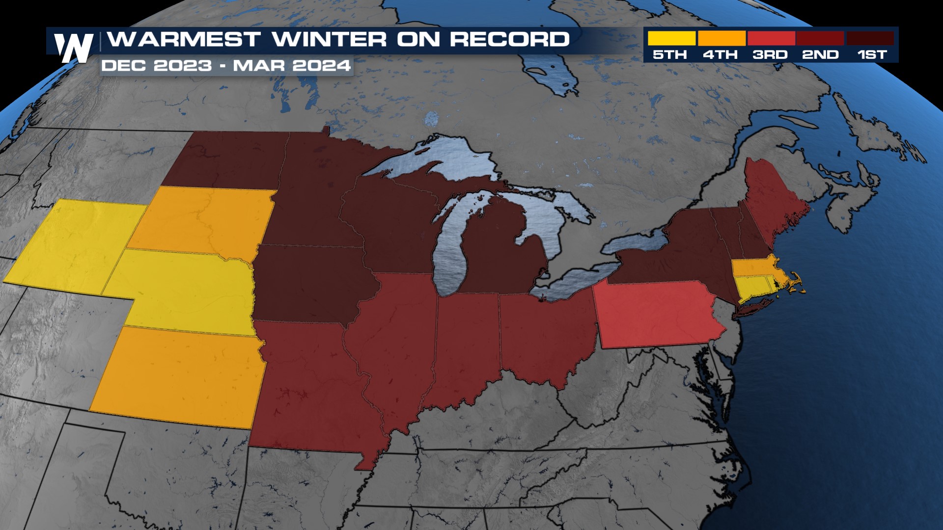
 So many states across the country's northern tier have seen their warmest meteorological winters (December - February) on record, including New York, Vermont, New Hampshire, Michigan, and much of the High Plains.