Wet Weather of 2019 Sets Records in Missouri River Basin
Record-Breaking Events
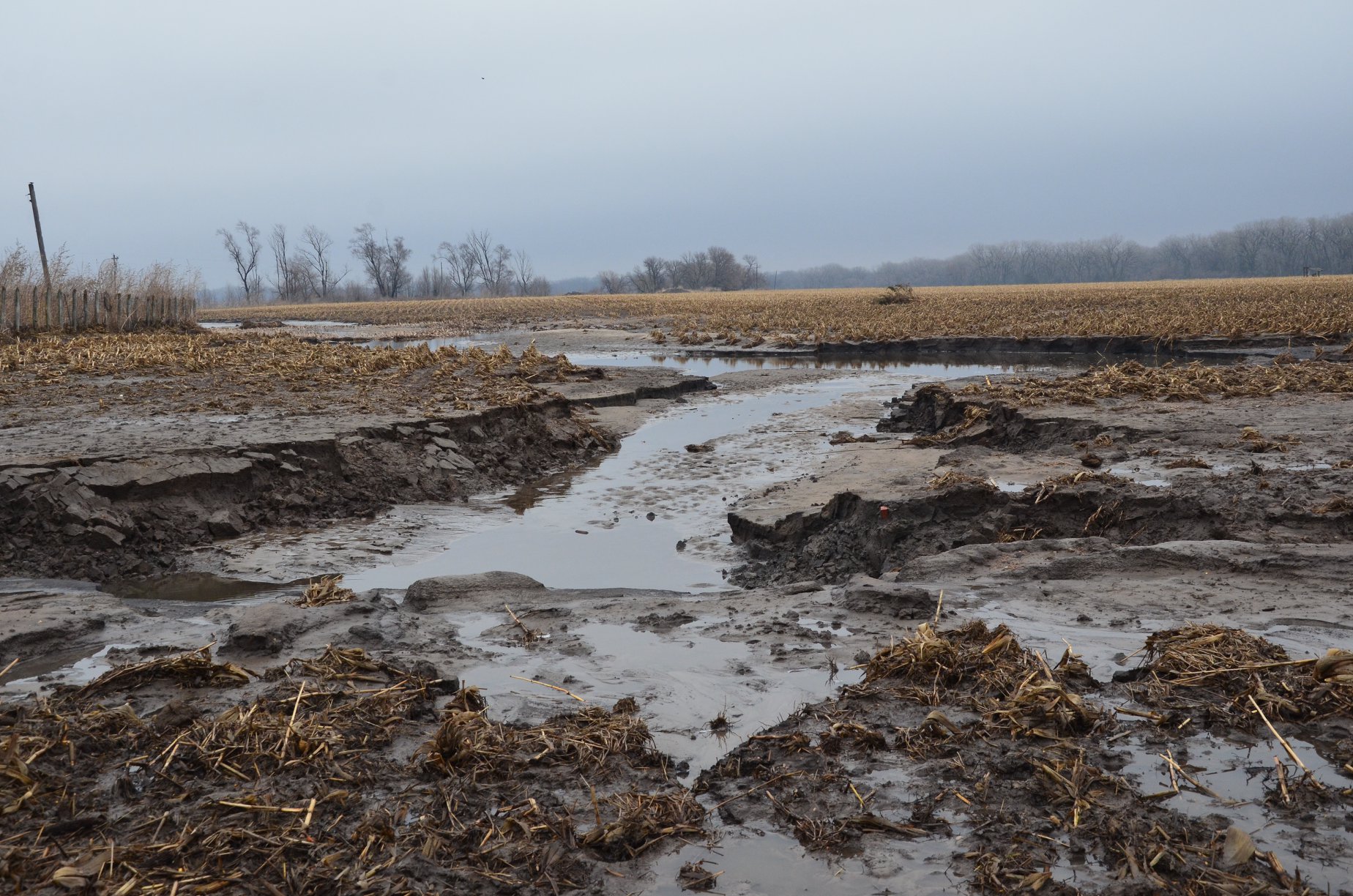
Heavy precipitation and flooding were widespread in 2019. Communities were evacuated. Farmland was inundated. Critical infrastructures, such as roads, bridges, and levees, were damaged or destroyed. Ultimately, 16 major disasters were declared across the region due to weather and climate events in 2019 alone. Although the calculation of losses is not yet finalized, the total will certainly reach into the billions of dollars.
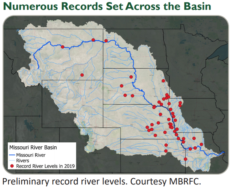
The Missouri River Basin rises in the Rocky Mountains of western Montana and flows east and south before entering the Mississippi River north of St. Louis, Missouri. Though the entire basin saw impacts from extreme precipitation and flooding, Iowa, Nebraska, Missouri, and South Dakota in particular hit record levels.
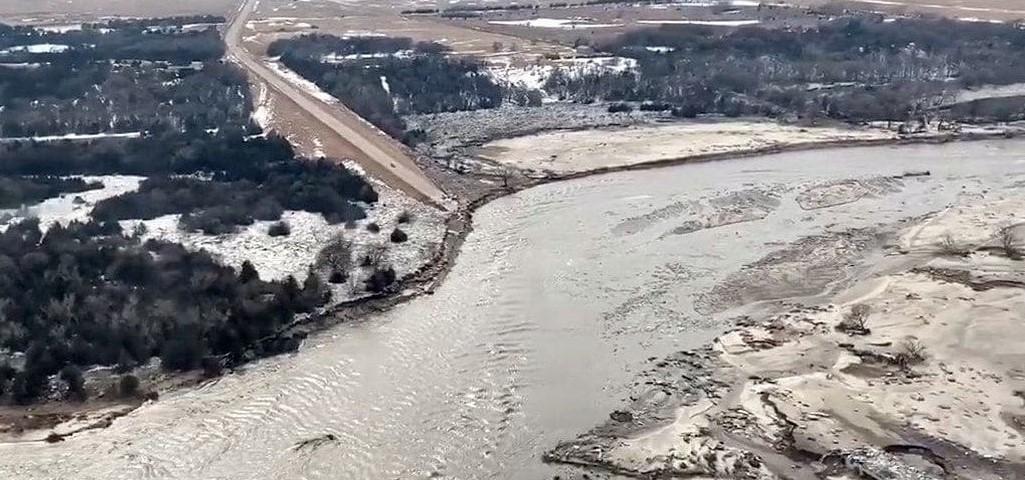
[Fifty record river level events impacted the Missouri River Basin in 2019. From Nebraska, courtesy of Jim Hoppe via NOAA]
Cause and Effect
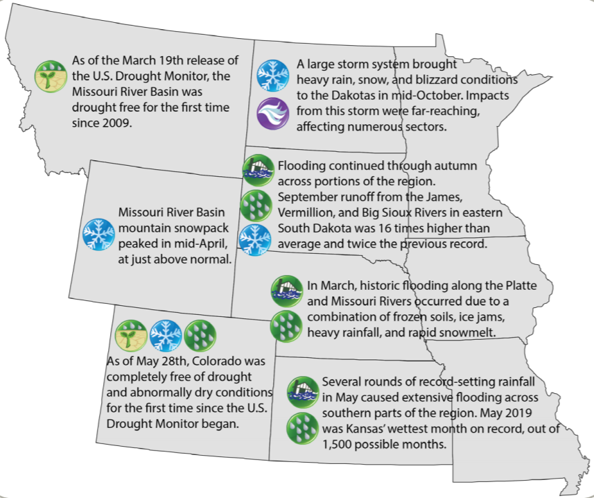
A number of events led to the severe flooding and record rainfall. Conditions the fall prior to 2019 set the stage for impacts. In 125 years of data, the October to December 2018 time period was the 12th wettest on record. Precipitation during this timeframe increased soil moisture, which became locked in frozen soils. A bitterly cold air mass struck in January 2019, causing deeply frozen ground and thick river ice in many areas. Numerous storm systems repeatedly brought mostly frozen precipitation to the region. And, 2018–2019 was also the second wettest on record.
All these conditions built up to the initial record flooding that was triggered by the March 2019 “bomb cyclone” event, which dropped several inches of rain and melted much of the existing plains snowpack virtually overnight. Heavy precipitation in the late spring, summer, and early autumn caused flooding to continue throughout the year.
Untold Impacts
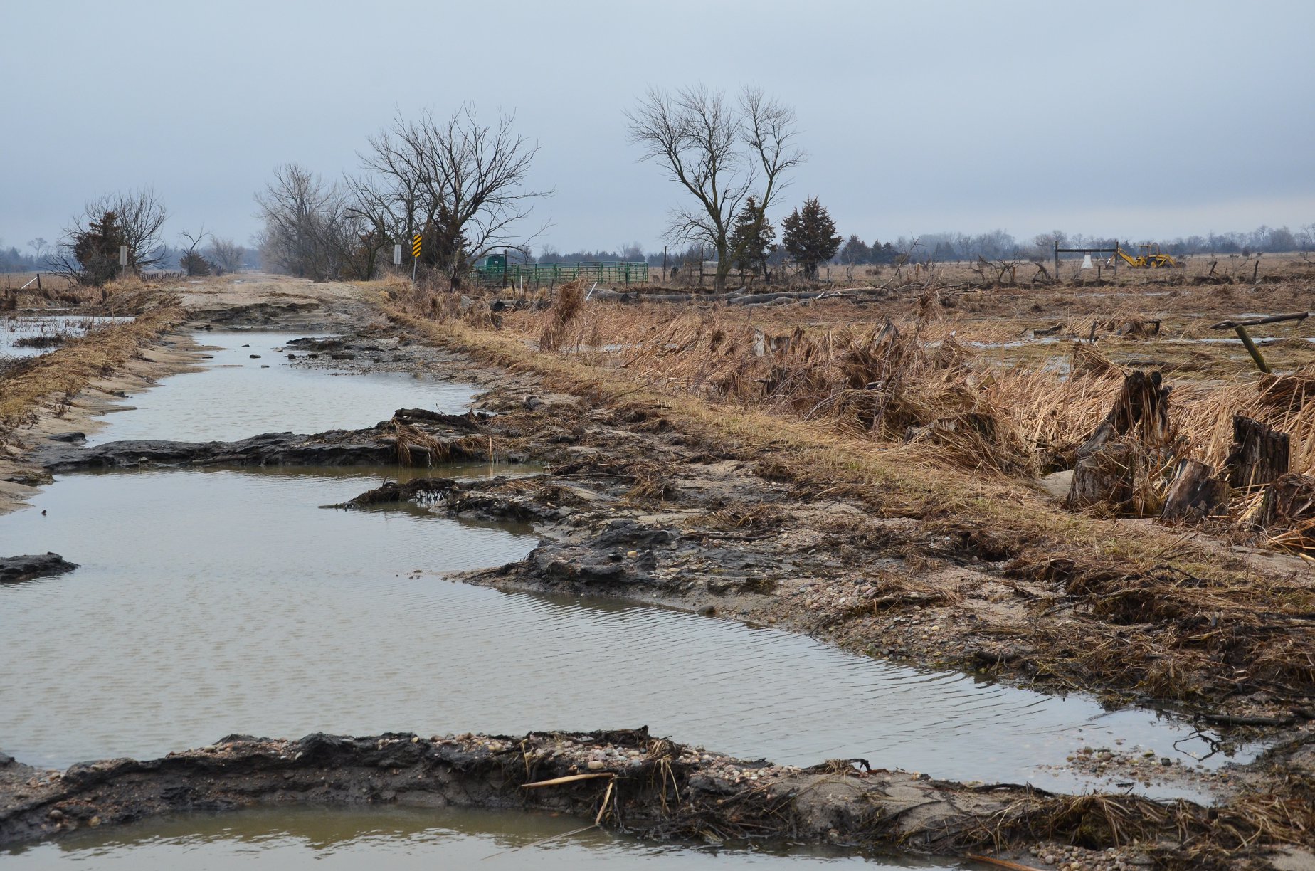
These extreme events impacted many sectors, including agriculture, infrastructure, and ecosystems. The 2019 growing season was particularly impacted. Spring planting was greatly delayed. Nearly 20 million acres went unplanted, with the largest areas occurring in Illinois, Minnesota, North Dakota, Ohio, and South Dakota.
The delay significantly shortened the growing season, and below-normal maximum temperatures in the summer hindered crop development. Despite the slow development, most crops reached maturity, or were close to it, prior to the fall freeze. Crops that were still somewhat immature required additional drying time and management.
However, early season snowstorms in parts of the Dakotas also complicated matters by damaging crops and slowing harvest even further. As of January 1, 2020, over 50% of corn was still unharvested in North Dakota.
[The agricultural sector was impacted particularly hard by the record wetness and flooding. From Nebraska courtesy of Jim Hoppe via NOAA.]
Studying the Past
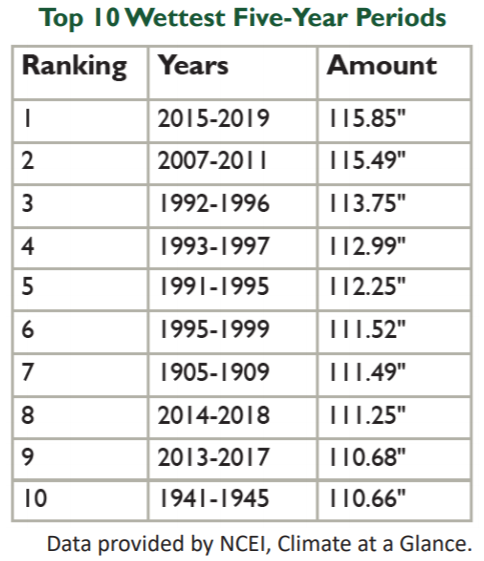
Over the past 125 years, there have been both wet and dry periods in the Missouri River Basin, with a number of extremes in recent years. In just the past ten years, the basin experienced its third driest year (2012) and its third wettest year (2019).
Trends indicate that basin-wide precipitation has increased by about 8% since 1895. This is driven primarily by increases in the spring (14%) and autumn (14%). Precipitation changes are not uniform across the basin, however, as eastern areas have experienced the greatest increases.
According to the Fourth National Climate Assessment, precipitation is projected to continue to increase, particularly in the winter and spring.


