Intense Severe Thunderstorms Possible Overnight Across Kansas and Oklahoma

SOUTHERN PLAINS - After destructive storms earlier this month left thousands without power in Tulsa and Shreveport, we want to be prepared for the potential of this happening again, especially since we have finally seen power restored! An upper-level ridge will continue to steer storms overnight across the southern Plains.
A Severe Thunderstorm Watch is in place overnight for the initial storms developing in the High Plains around the Panhandles and SW Kansas.
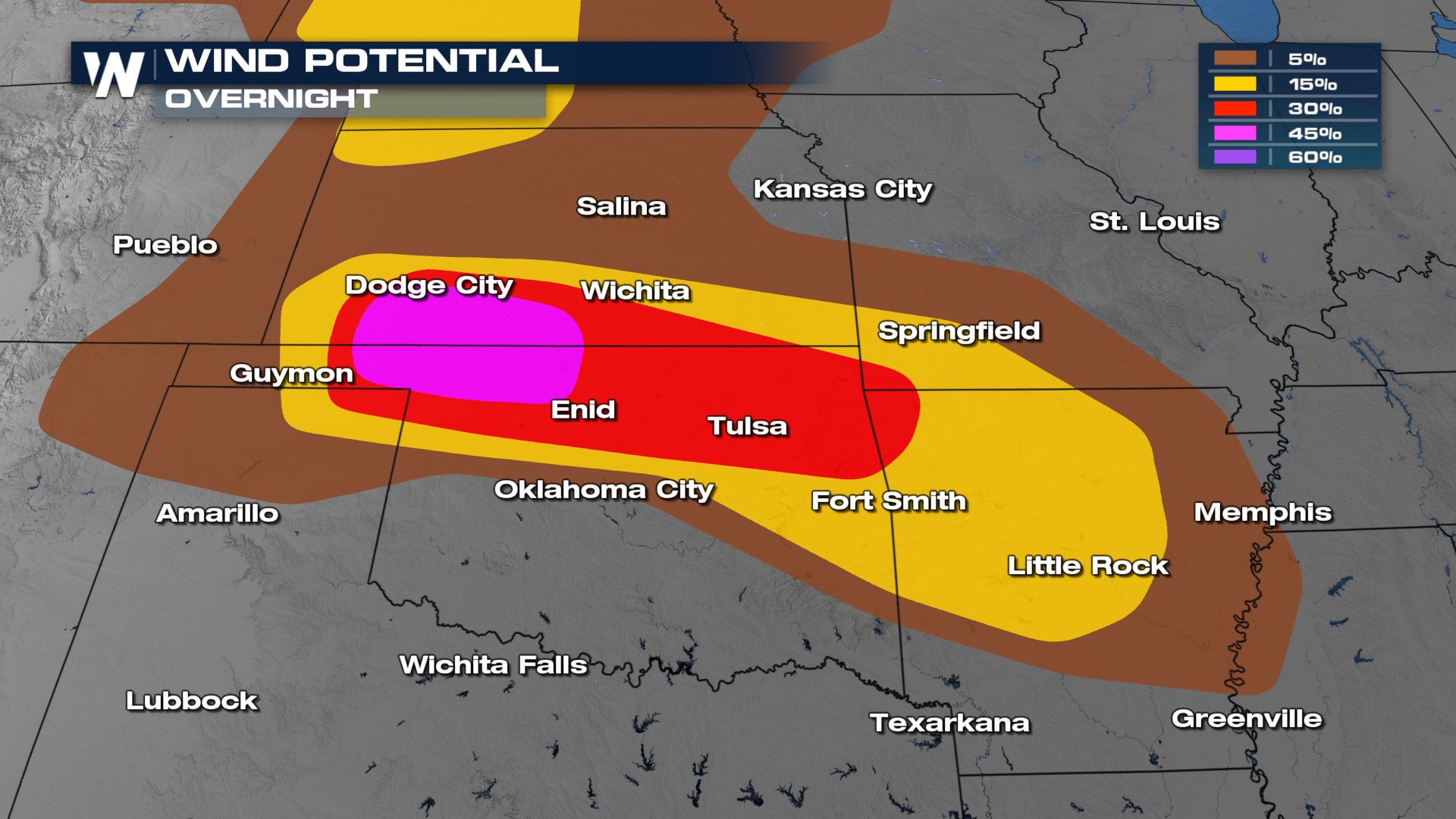
 The threats with these storms are primarily extreme winds up to 100mph and hail up to 3" in diameter. There is a low-end tornado threat as well, but these will be quick spin-ups that won't travel very far. Still, treat every warning with respect and take action when they are issued.
Overnight
The Storm Prediction Center maintains a MODERATE (level 4 out of 5) risk for severe thunderstorms overnight. We are expecting the potential for a "long swath of wind damage potential" according to the SPC's outlook. The reason: steep lapse rates. The upper-level ridge and the extreme surface heating will create an environment where we could see damaging winds and wind-driven hail.
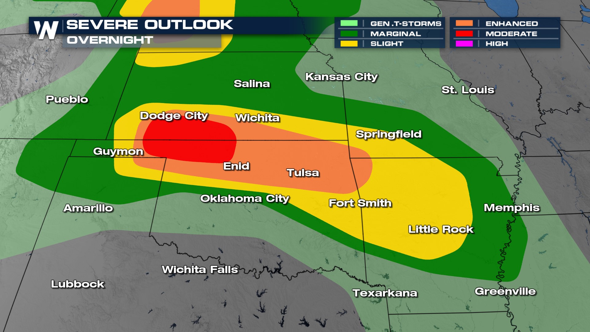 This has led to two significant threats on Tuesday across northern Oklahoma and southern Kansas. Damaging winds greater than 75 mph and damaging hail greater than 2". Our primary threat is damaging winds along the Kansas & Oklahoma border.
 We are expecting MCS (mesoscale convective systems) thunderstorms to move through the southern Plains and dive south into the mid-south and lower Mississippi valley later into the overnight, around the eastern periphery of the heat dome.
Wednesday
On Wednesday we will see storm activity through Mississippi and eastern Arkansas as a few storms survive overnight and create a wind threat during the day. We will see mostly morning storm activity with a few showers remaining through the afternoon and evening hours. In addition, further development will be possible across western Kansas. Data suggest that these storms could move into the upper Midwest by early Thursday morning.

Stay with WeatherNation for the latest in the severe weather and flood threat this week in the South.


