Windy and Cold for the Northeast
Special Stories
5 Mar 2021 8:00 AM
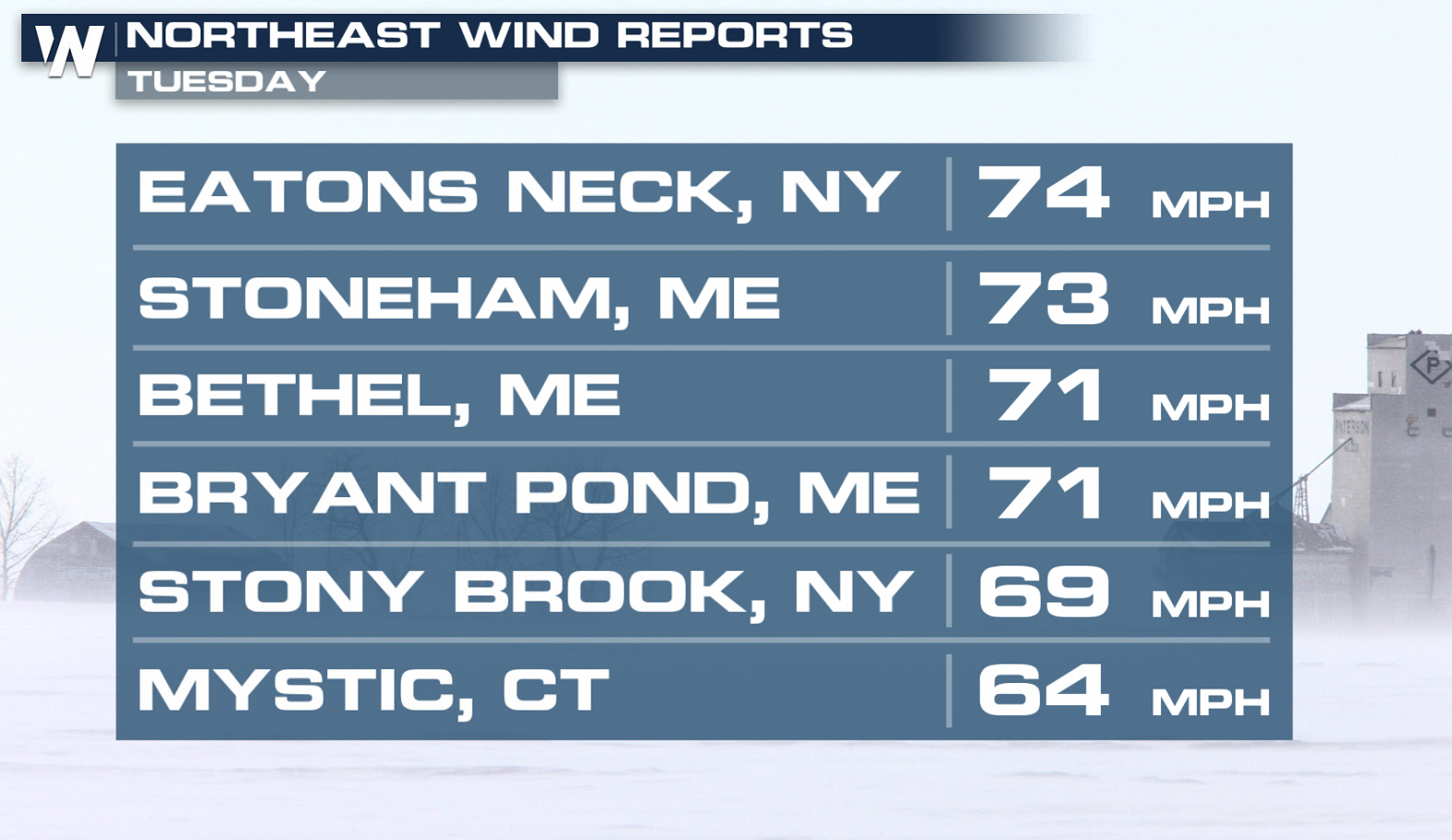
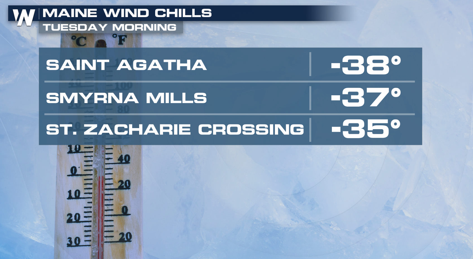
Strong winds and below average temperatures hit the Northeast to start this week. Gusts over 70 mph and wind chills down to 3o to 60 below were reported over the region as the cold temperatures arrived earlier this week.
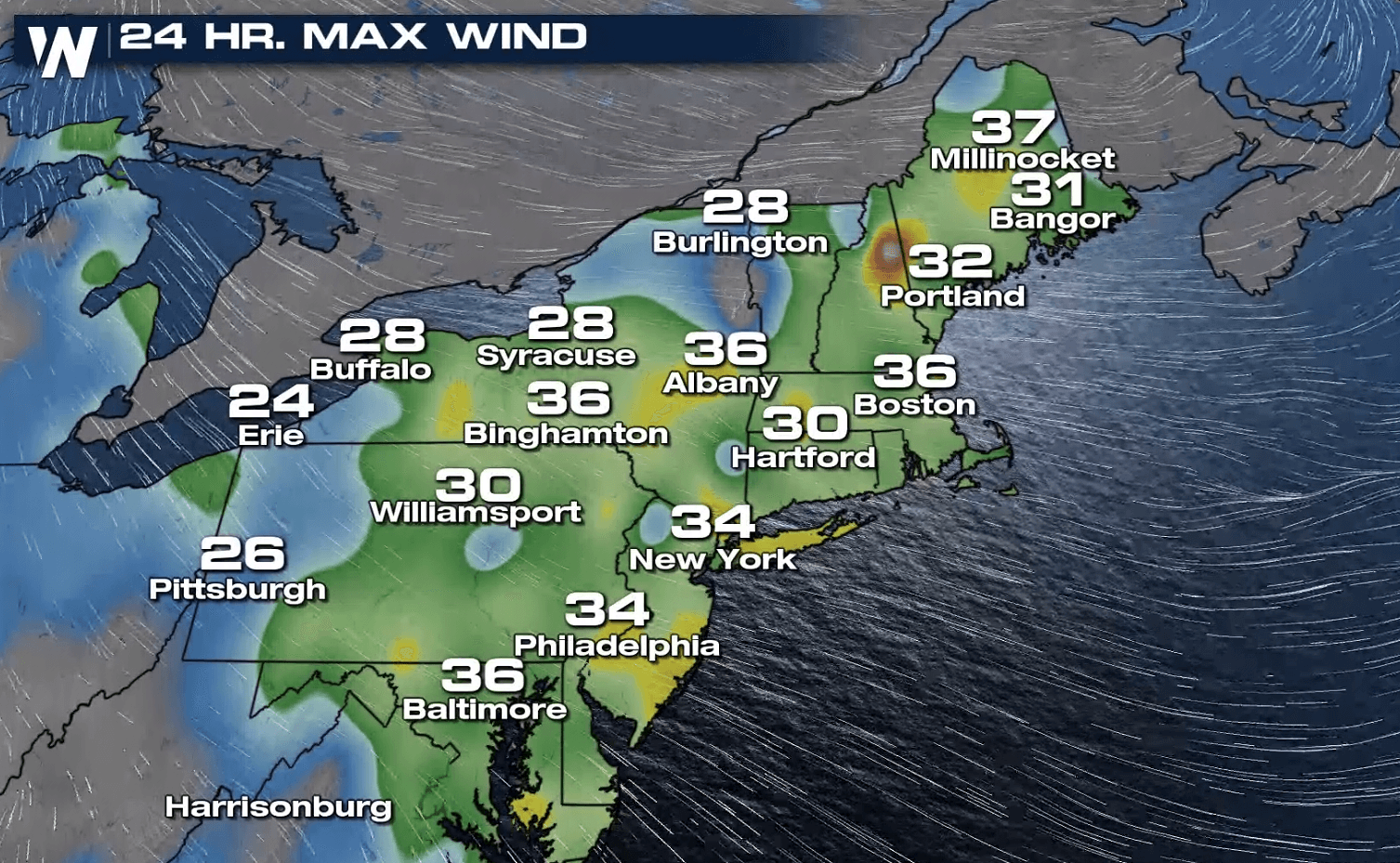
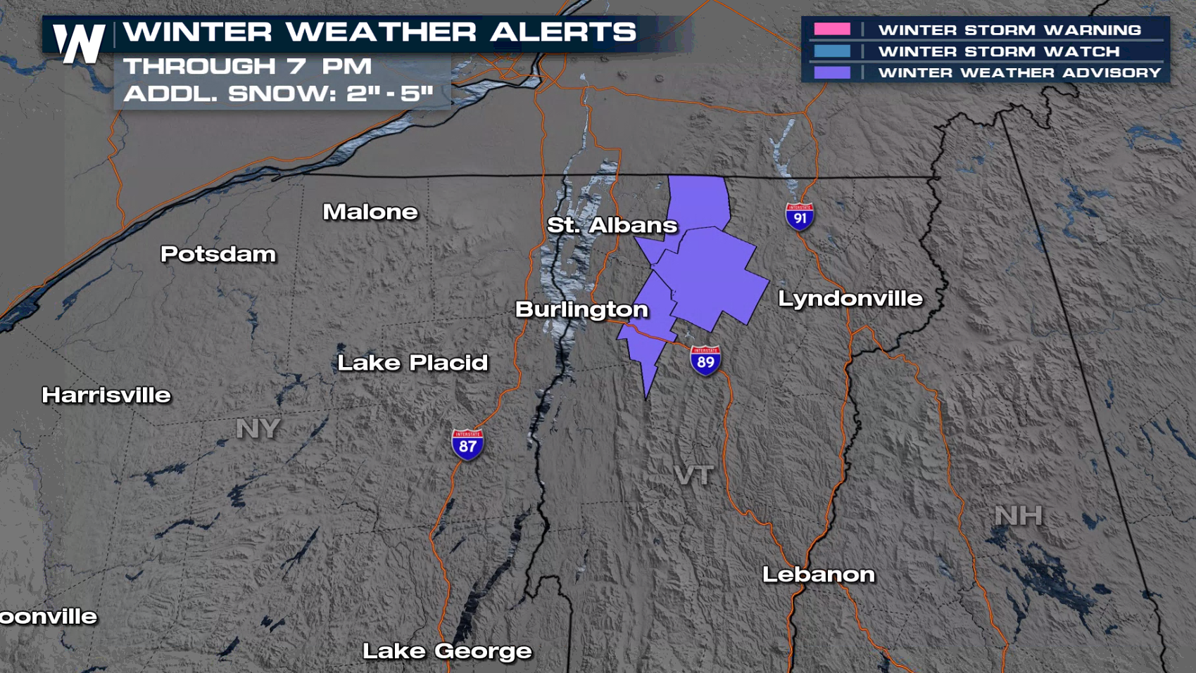
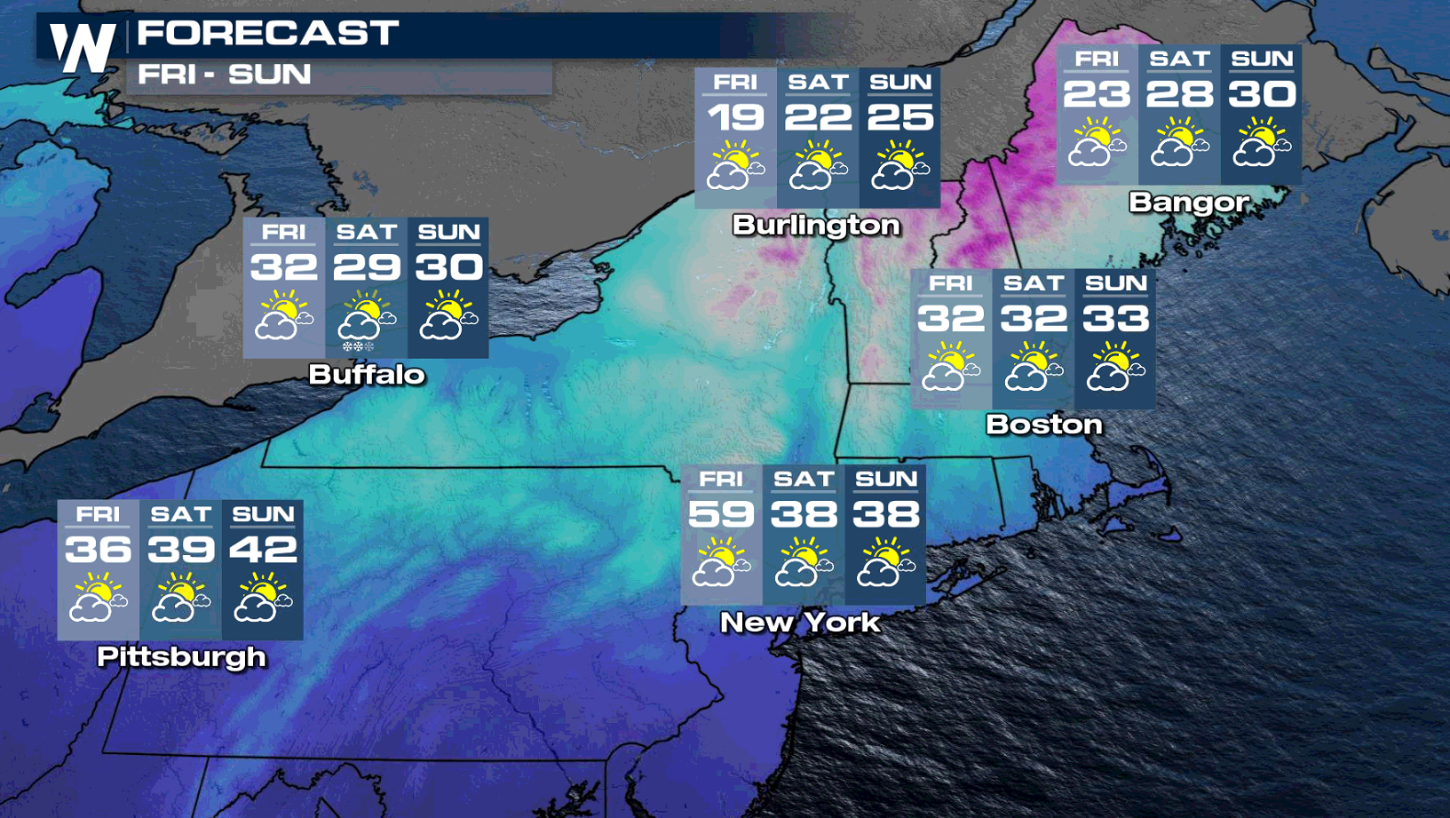
 It won't be as cold or windy today (Friday) compared to earlier in the week, but some lake effect snow is possible in Upstate New York and Northern Vermont. Winter weather advisories have been issued for up to 8" of lake effect snow.
 https://twitter.com/NWSBurlington/status/1367574577690402818
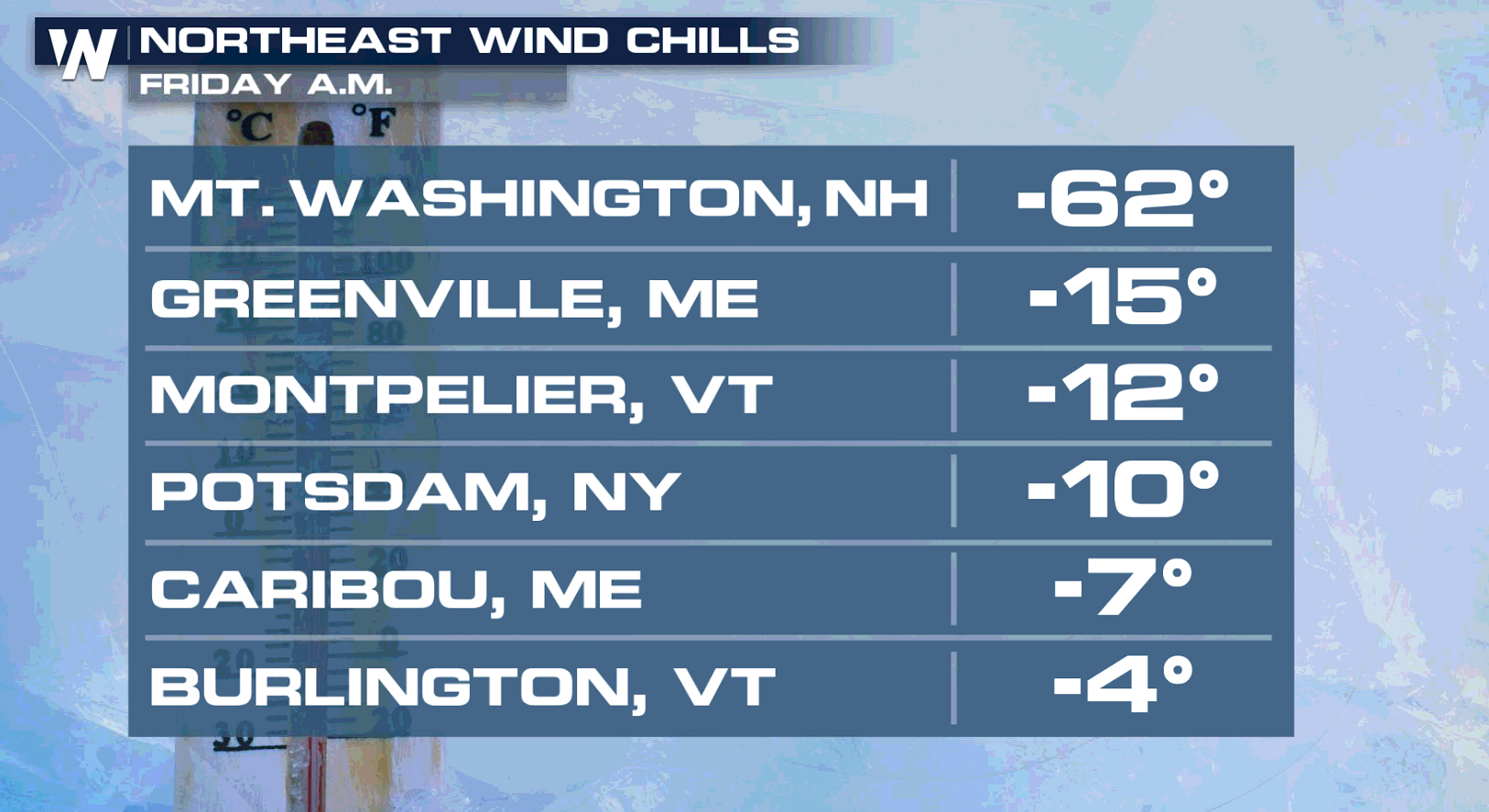
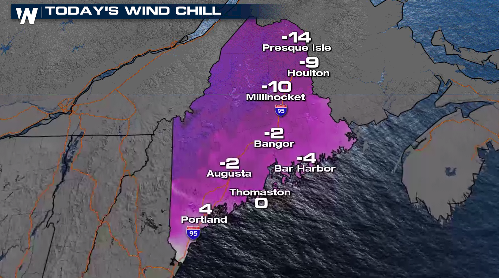
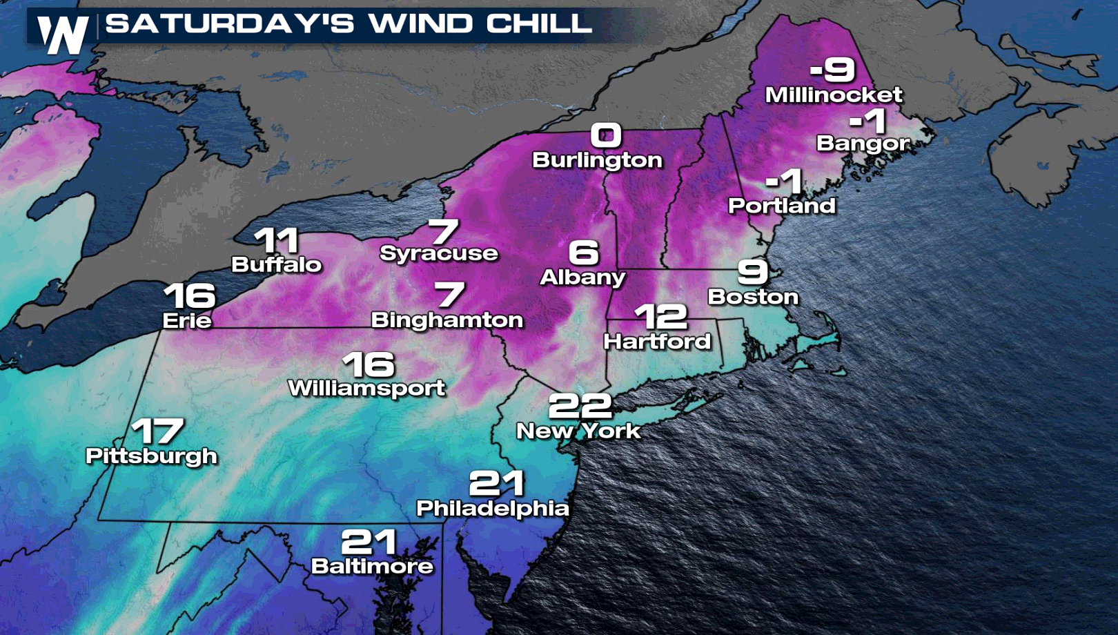
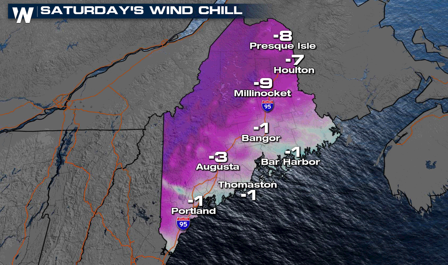
The strong winds coupled with cold temperatures will bring bitter wind chills across Maine and New England. The coldest wind chills will be below zero and in the single digits for many areas.
https://twitter.com/NWSBurlington/status/1367574577690402818
The strong winds coupled with cold temperatures will bring bitter wind chills across Maine and New England. The coldest wind chills will be below zero and in the single digits for many areas.
 The week started with readings dropping 20 to 30 degrees on Monday when compared to this past weekend. Other than a brief warm-up Wednesday, temperatures will stay cold through this weekend.
 WeatherNation will keep you updated on the forecast in the Northeast. Check with us on-air and online for the latest information.
It won't be as cold or windy today (Friday) compared to earlier in the week, but some lake effect snow is possible in Upstate New York and Northern Vermont. Winter weather advisories have been issued for up to 8" of lake effect snow.
https://twitter.com/NWSBurlington/status/1367574577690402818
The strong winds coupled with cold temperatures will bring bitter wind chills across Maine and New England. The coldest wind chills will be below zero and in the single digits for many areas.
The week started with readings dropping 20 to 30 degrees on Monday when compared to this past weekend. Other than a brief warm-up Wednesday, temperatures will stay cold through this weekend.
WeatherNation will keep you updated on the forecast in the Northeast. Check with us on-air and online for the latest information.All Weather News
More
Tropical Storm Chantal Forms This Morning
Tropical Storm Chantal has formed, with winds
5 Jul 2025 4:35 PM

Catastrophic Flooding in the Texas Hill Country
Multiple Flash Flood Emergencies were issued
5 Jul 2025 4:35 PM


Severe Storms in the Midwest Continue To Spoil the Holiday Weekend
NORTHERN PLAINS - A frontal system continues
5 Jul 2025 8:30 AM

Near Seasonal Temperatures for Many Come July 4th!
AAA is expecting over 70 million travelers to
4 Jul 2025 10:15 AM


Northwest Heat Met With Thunderstorm Risk
NORTHWEST - Today, portions of Montana are un
3 Jul 2025 12:00 AM