Over 4 Feet of Snow in Colorado, More Ahead

DENVER, CO - The biggest winter storm in several years has come to an end leaving impressive snow totals in the foothills outside of Denver and Colorado Springs. Small differences in elevation (less than 1,000') greatly impacted the amount of snowfall. For example, Aspen Springs received more than five feet, but less than 40 miles away at the Denver Airport, only 5". The weight of the snow was most impactful, bringing down large tree limbs and powerlines and even after the snow stopped.
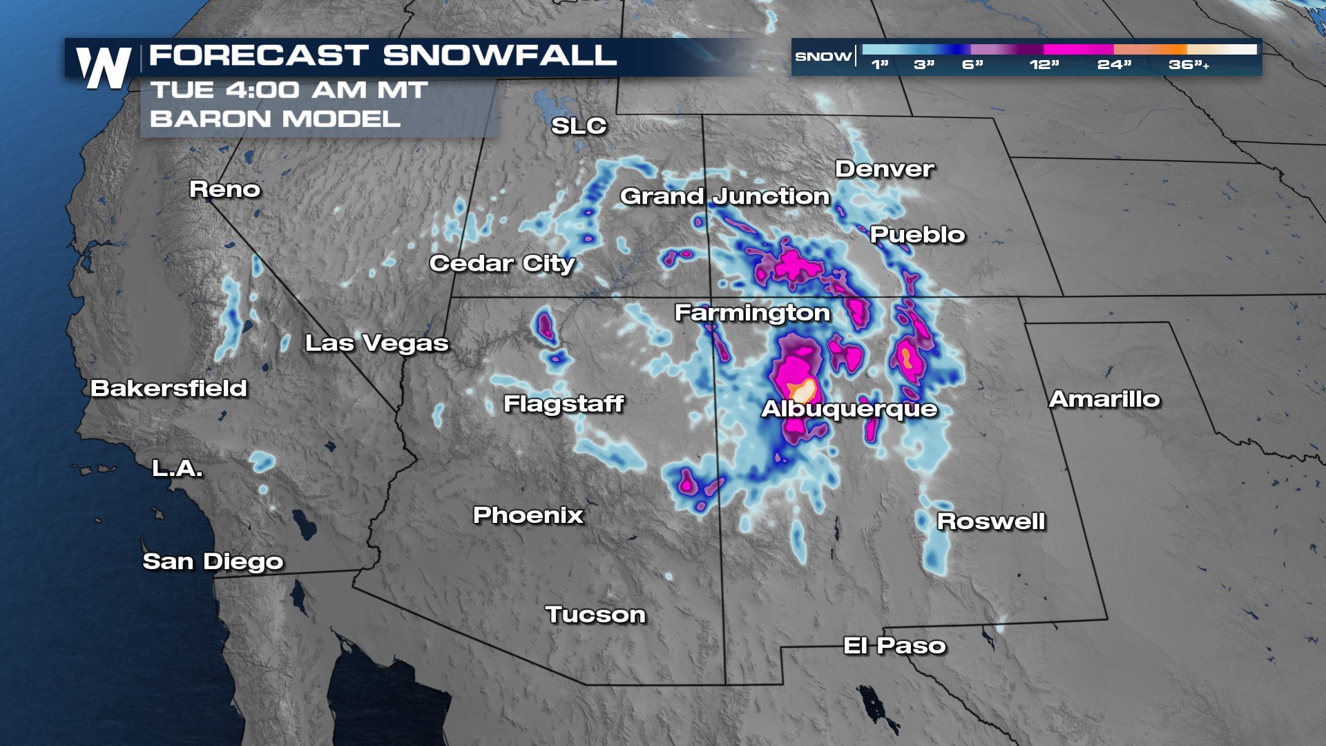
The storm system responsible for the snowfall in Colorado is sitting and spinning across Arizona, keeping the Southwest snowy and breezy through the weekend. Most of Colorado will dry out, with exception of far southern parts of the state.
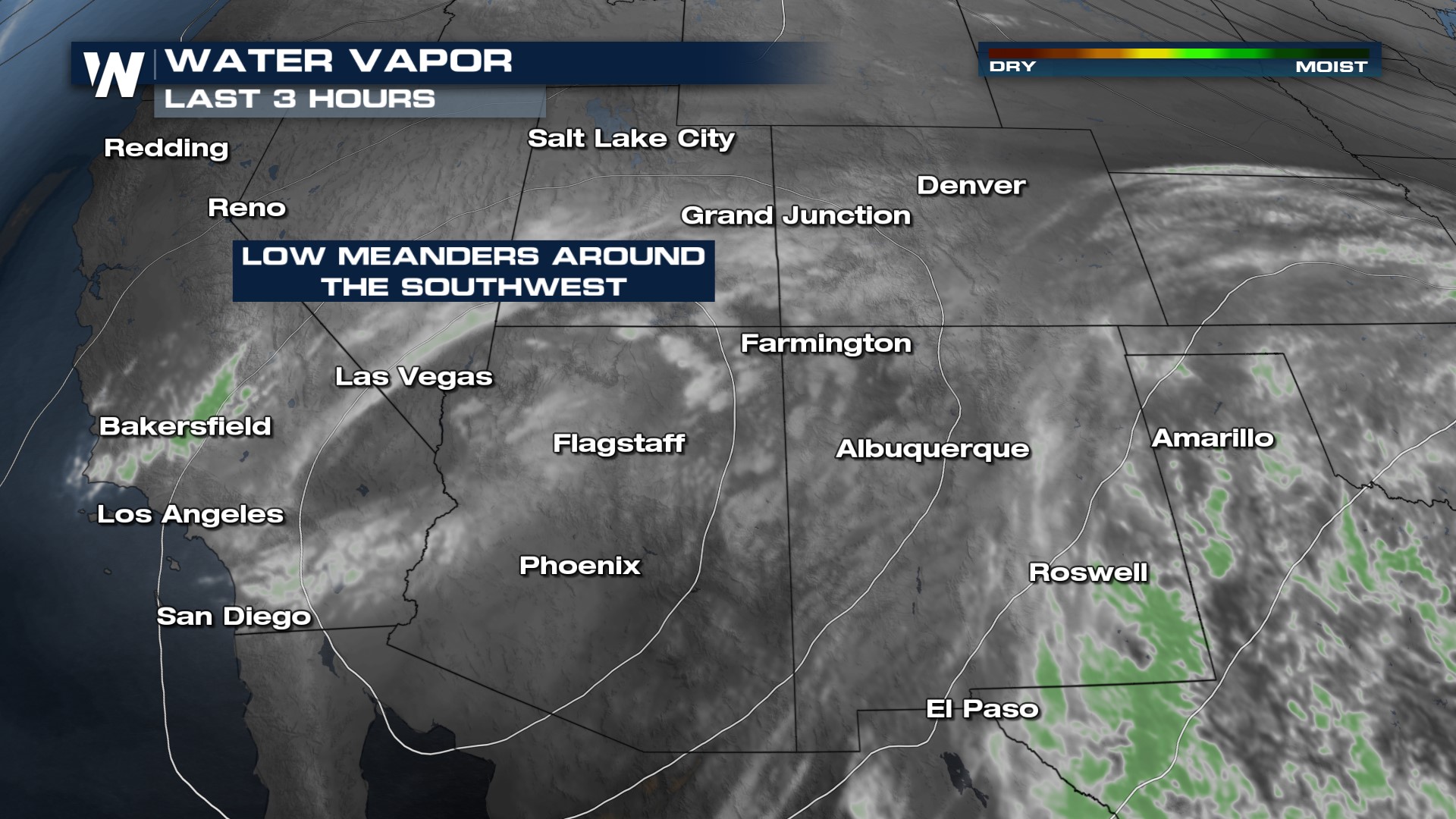 The general pattern will be unsettled with snow confined to the highest elevations of Arizona and Utah throughout Saturday night. By Sunday, moisture will move back into New Mexico and Colorado.
The highest additional snowfall will likely occur in the southwestern mountains of Colorado and the peaks outside of Gallup and Albuquerque, New Mexico. Here, an additional 6-12" of snow will be likely with isolated higher amounts. Elsewhere across the Four Corners, a light 2-4" additional snowfall is forecast.