Heavy rain and snow for the Northeast Christmas Day
Special Stories
25 Dec 2020 8:00 AM
Eastern Winter Alerts
Heavy snow and gusty winds moved in across the Northeast and even Southeast Christmas Eve Thursday into Christmas morning. Over one foot of snow has been reported in Northern Ohio along with over 9 inches in Kentucky and up to 6 inches in Tennessee. The snow wrapping around the low will gradually move east, away from the Ohio River Valley, on Friday as lake effect snow continues, potentially into Sunday for some areas.
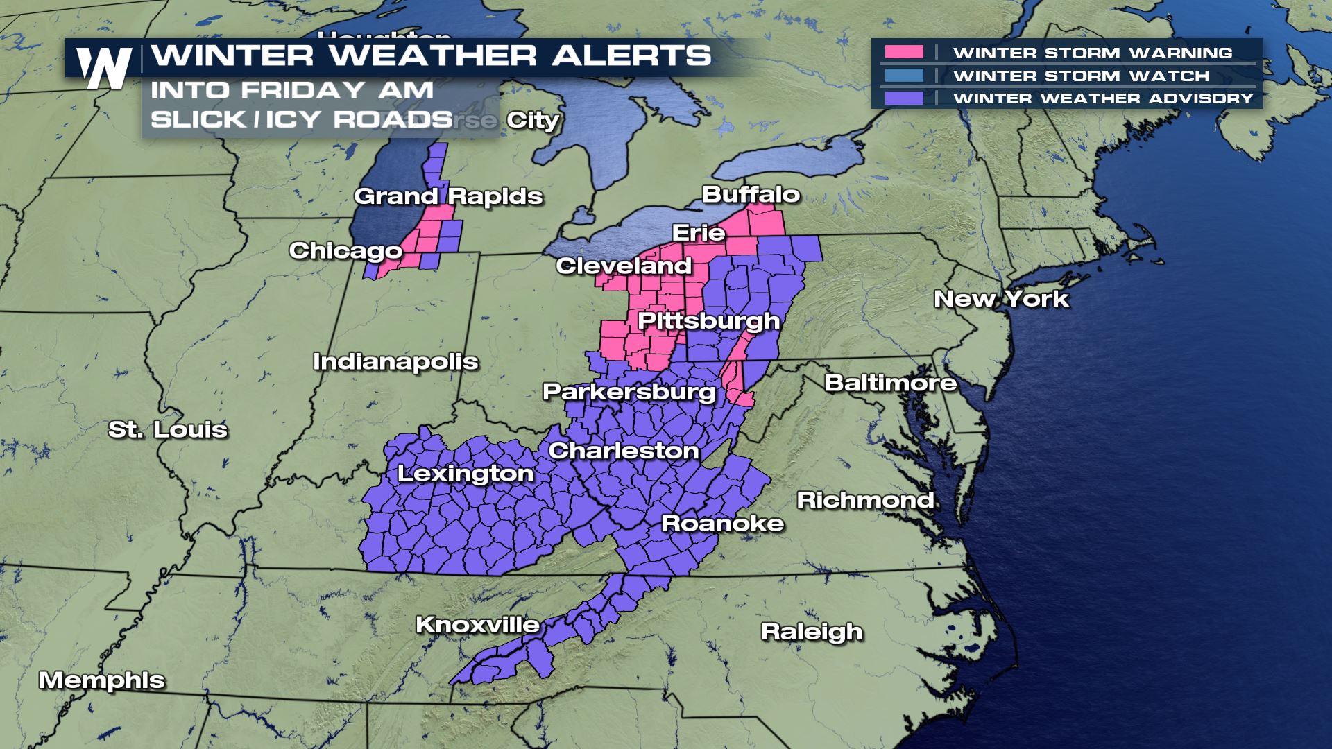
Winter storm warnings remain in effect around Lake Erie to the south for heavy snow into Friday afternoon. Alerts around Lake Michigan and around the shores of Lakes Erie and Ontario will remain in effect for the lake effect snow potential into Saturday or Sunday.
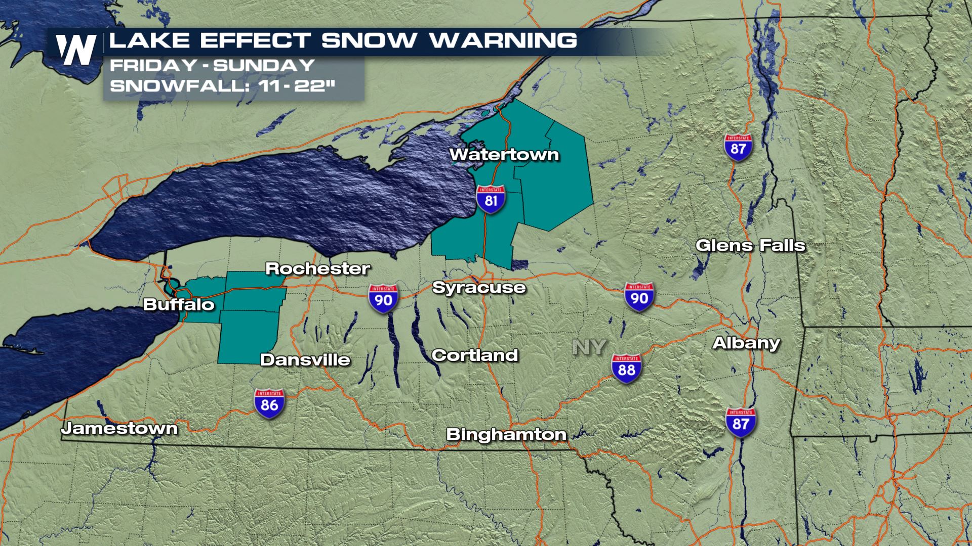
 The Lake Effect snow is expected to be heavy across Western New York. Over 20 inches could accumulate in areas like Watertown and Buffalo through Sunday, prompting the National Weather Service to issue Lake Effect Snow Warnings for those locations.
 Forecast
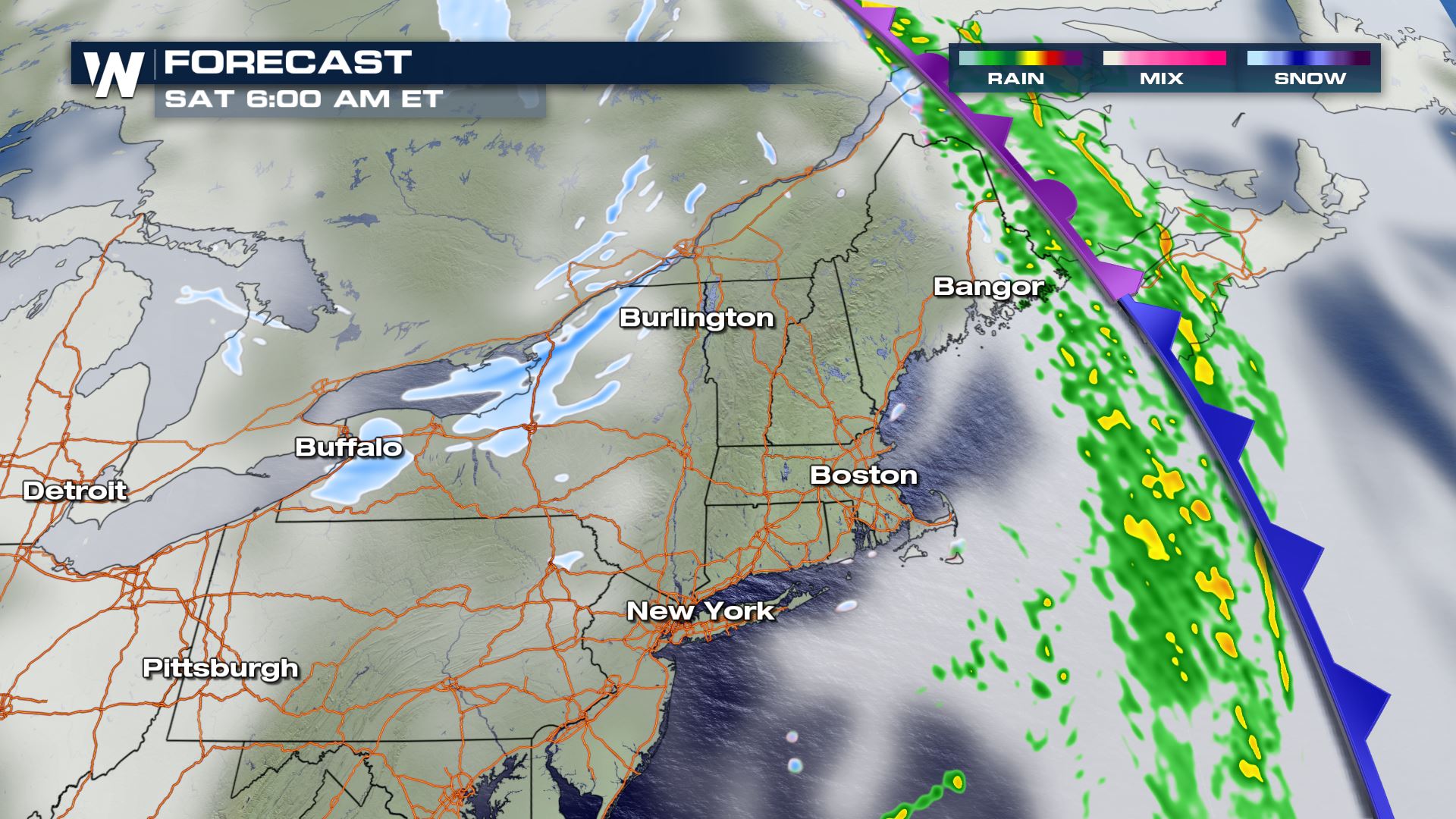
Heavy rain will be ongoing Friday across New England. The cold air doesn't catch up with the moisture and cold front until late Friday. This will allow for the strong wind to bring in a hefty amount of rainfall to New England on Christmas Day. Speaking of, some of the wind will be very strong with power outages and gusts to 65 miles per hour!
Due to warm temperatures in the 50s across much of the Northeast Friday, anywhere heavy rain falls will create the potential for flooding. Not only will heavy rain be falling ahead of the front but massive snowmelt will be ongoing with snow leftover from last week's historic Nor'easter. Flash flood warnings were issued Thursday afternoon around Southern New York and Northern Pennsylvania, including the Binghamton area which saw record rainfall combine with melting snowpack.
Forecast
Heavy rain will be ongoing Friday across New England. The cold air doesn't catch up with the moisture and cold front until late Friday. This will allow for the strong wind to bring in a hefty amount of rainfall to New England on Christmas Day. Speaking of, some of the wind will be very strong with power outages and gusts to 65 miles per hour!
Due to warm temperatures in the 50s across much of the Northeast Friday, anywhere heavy rain falls will create the potential for flooding. Not only will heavy rain be falling ahead of the front but massive snowmelt will be ongoing with snow leftover from last week's historic Nor'easter. Flash flood warnings were issued Thursday afternoon around Southern New York and Northern Pennsylvania, including the Binghamton area which saw record rainfall combine with melting snowpack.
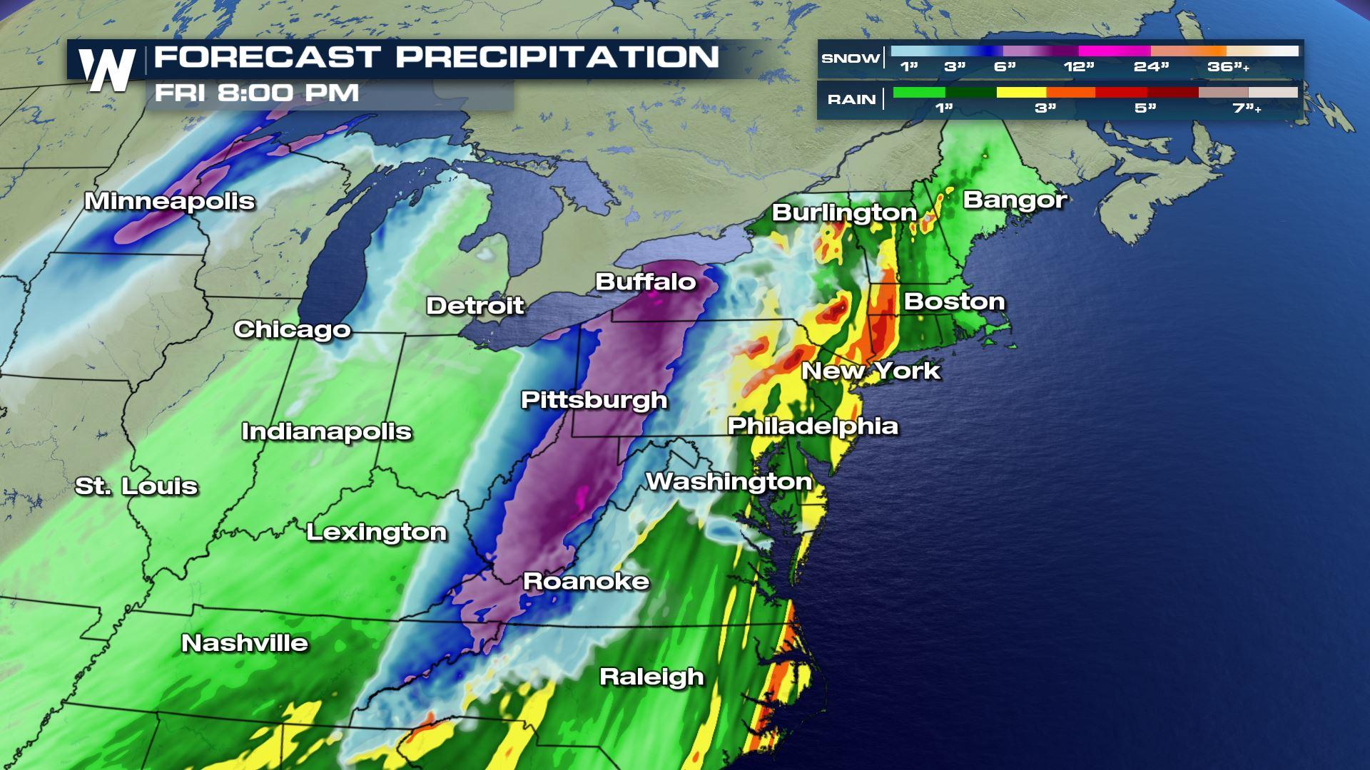
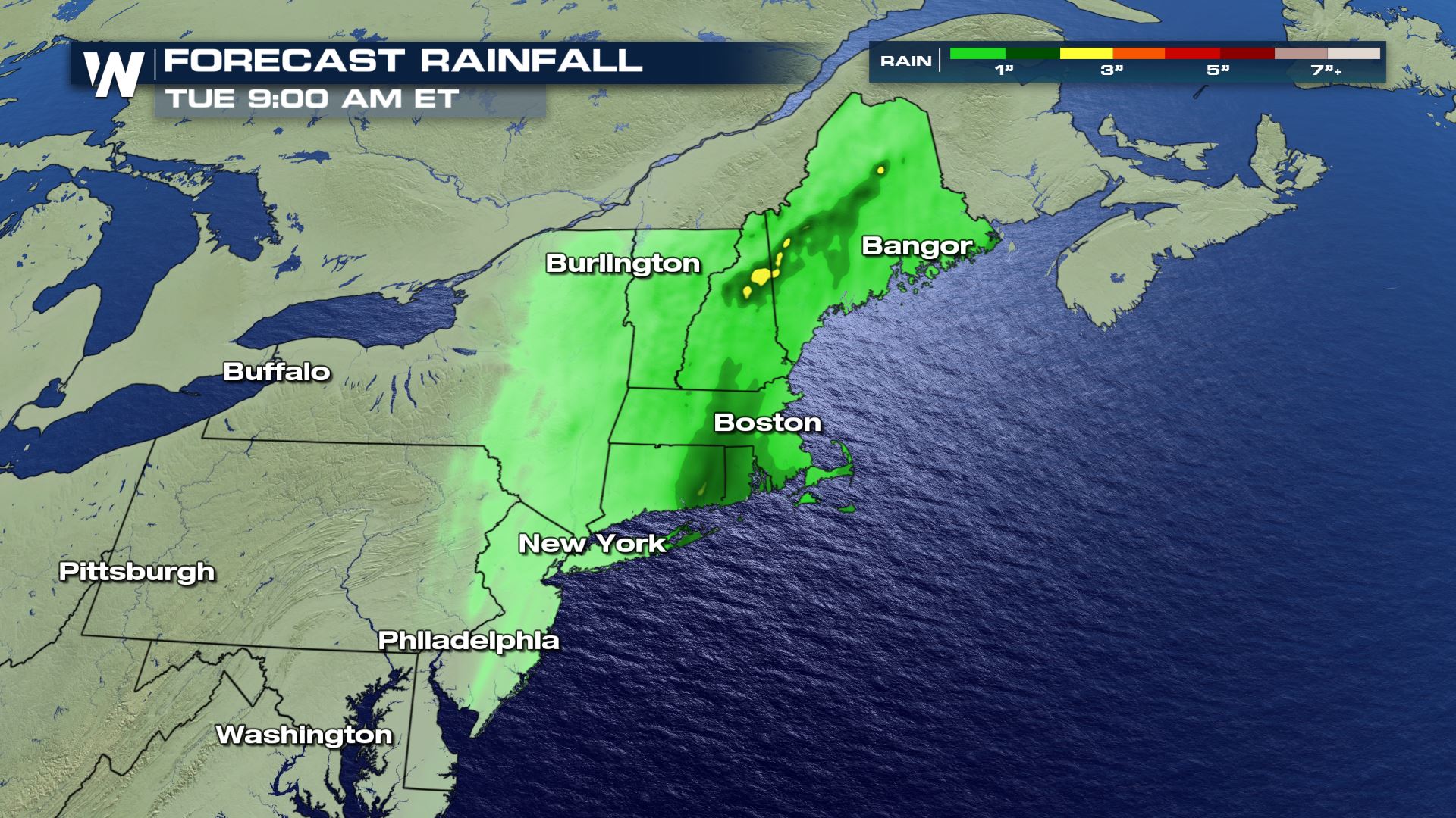
 The map below shows forecast accumulations from Friday morning through the end of the weekend. The heaviest rain on Christmas Day into Saturday is likely across New England from Long Island through Northern Maine.
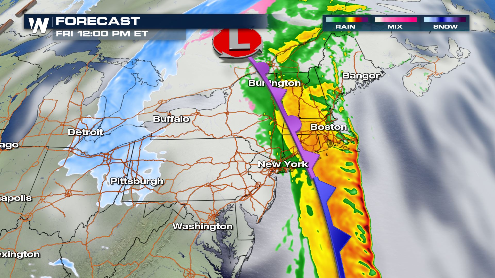
 The low keeps tracking to the northeast while the moisture gets pushed along the cold front. The low pressure is slow to move out which means rain will be ongoing ahead of the front for parts of New England and snow on the back side of the low will be slow to move out as well.
 The wrap around, strong northwesterly wind across the Great Lakes also starts to pick up on the tail end of the winter storm event. Lake enhanced snow for Michigan, western New York and northeast Ohio is likely.
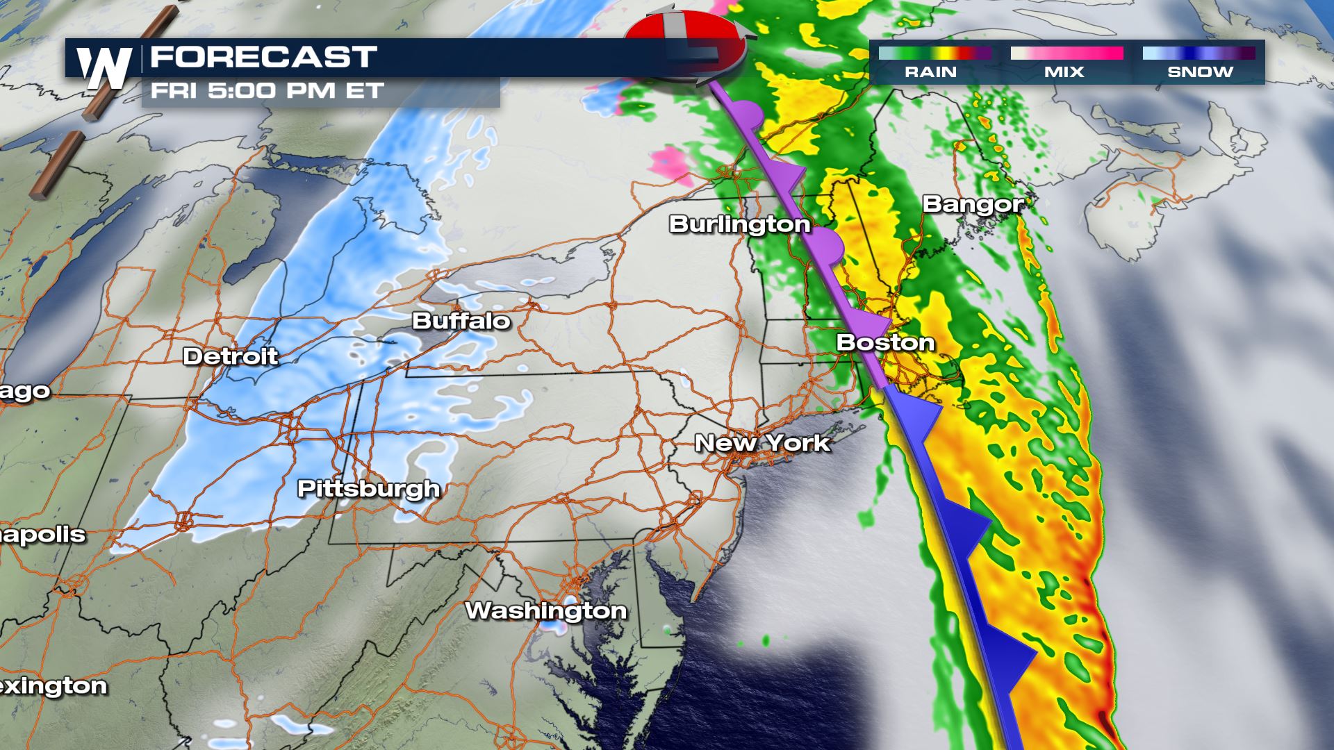
 Additional snow accumulations (in addition to what fell Thursday night into Friday) could top more than 6 inches still, mainly in the higher elevations and on the eastern shores of Lakes Erie and Ontario.
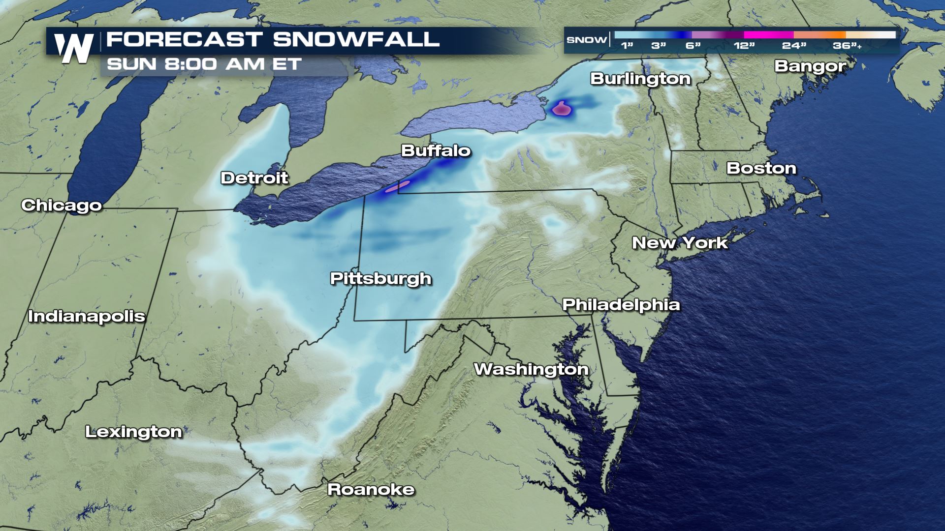 Great Lakes Winter Alerts
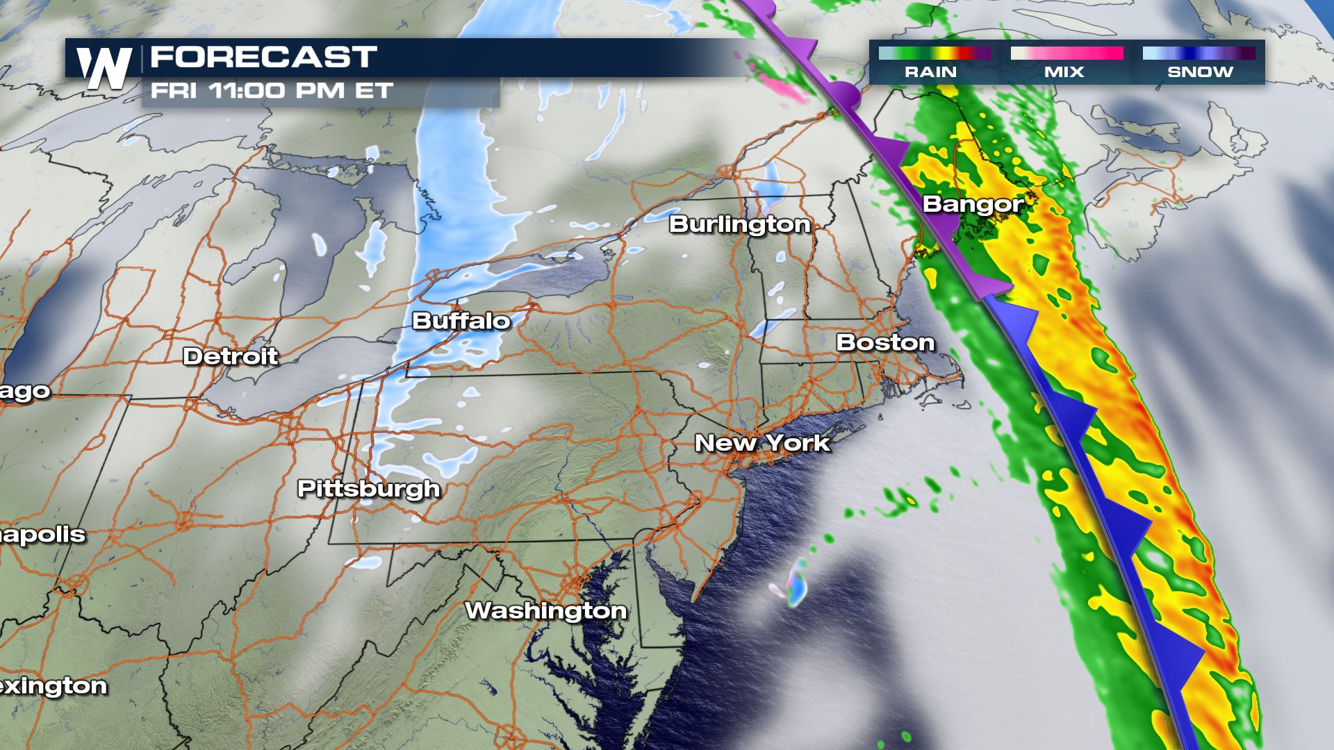
Lake-effect snow will be possible into New York from through Saturday. Accumulation totals could exceed several inches in some areas.
Great Lakes Winter Alerts
Lake-effect snow will be possible into New York from through Saturday. Accumulation totals could exceed several inches in some areas.
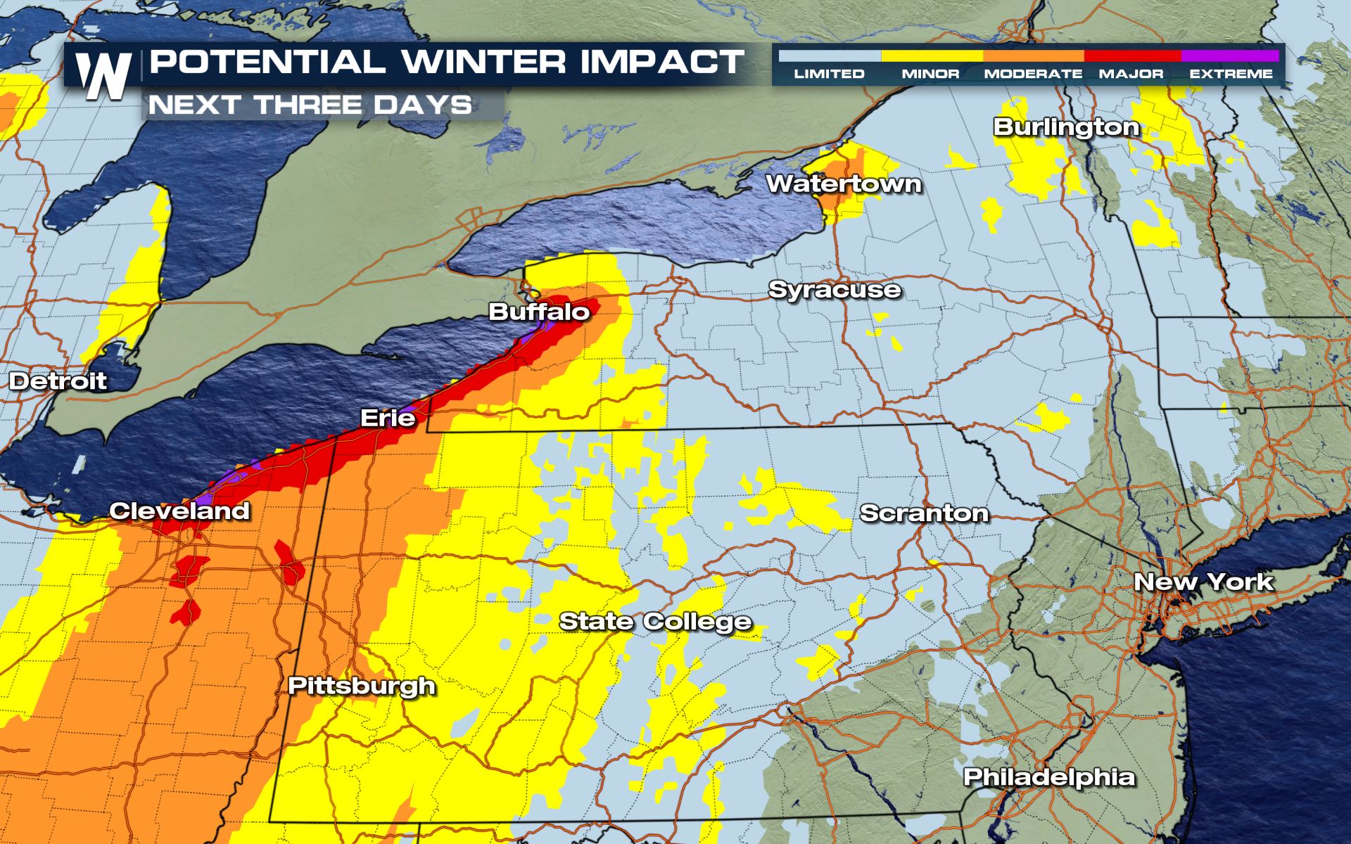 Lake effect snow chances are expected to continue into the day Saturday. This means the lake fronts and snowbelts could see additional snow well after the winter storm moves away.
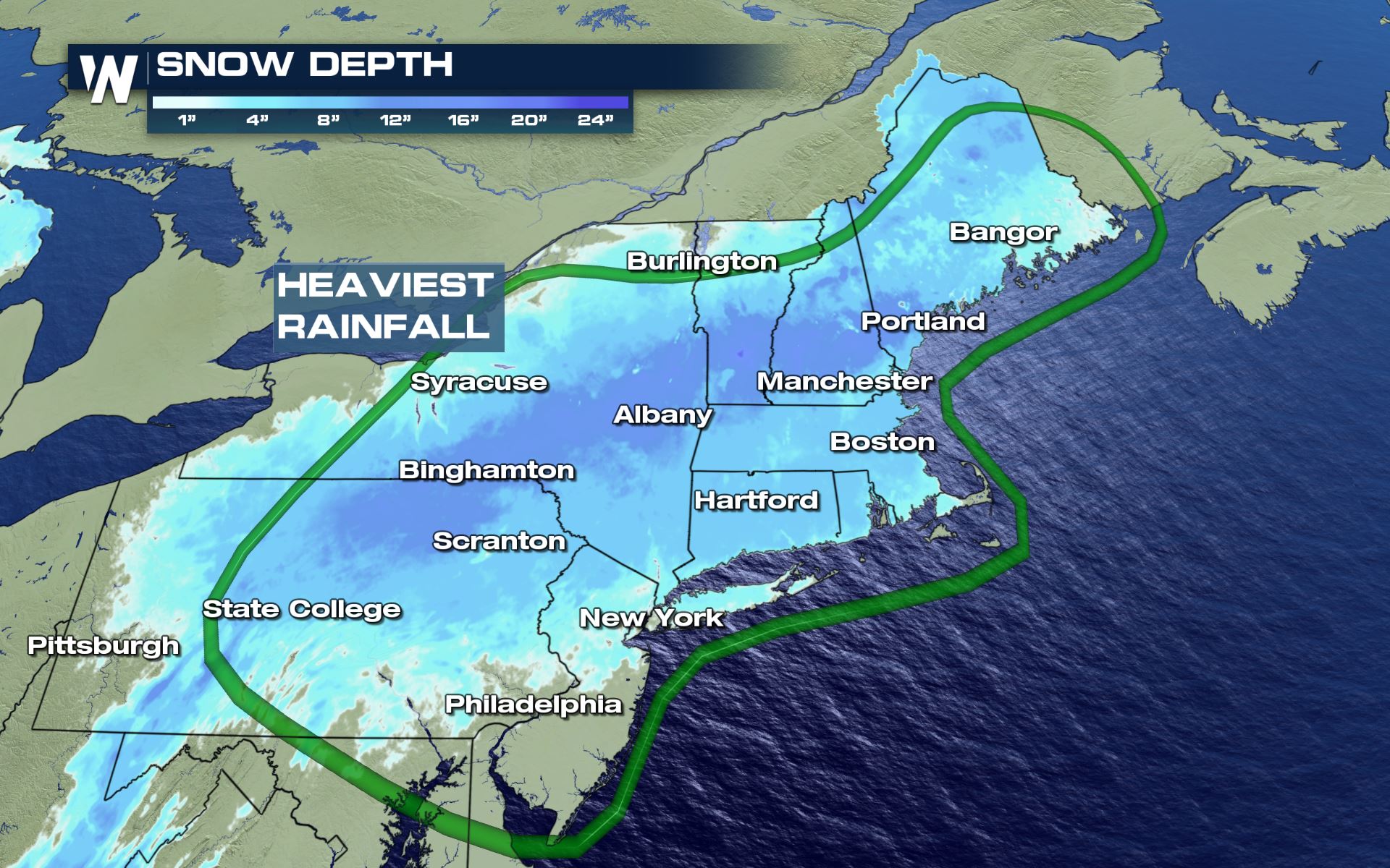
 This accumulation map shows the total forecast rain and snow for the entire event. Stay with us for additional updates!
The Lake Effect snow is expected to be heavy across Western New York. Over 20 inches could accumulate in areas like Watertown and Buffalo through Sunday, prompting the National Weather Service to issue Lake Effect Snow Warnings for those locations.
Forecast
Heavy rain will be ongoing Friday across New England. The cold air doesn't catch up with the moisture and cold front until late Friday. This will allow for the strong wind to bring in a hefty amount of rainfall to New England on Christmas Day. Speaking of, some of the wind will be very strong with power outages and gusts to 65 miles per hour!
Due to warm temperatures in the 50s across much of the Northeast Friday, anywhere heavy rain falls will create the potential for flooding. Not only will heavy rain be falling ahead of the front but massive snowmelt will be ongoing with snow leftover from last week's historic Nor'easter. Flash flood warnings were issued Thursday afternoon around Southern New York and Northern Pennsylvania, including the Binghamton area which saw record rainfall combine with melting snowpack.
The map below shows forecast accumulations from Friday morning through the end of the weekend. The heaviest rain on Christmas Day into Saturday is likely across New England from Long Island through Northern Maine.
The low keeps tracking to the northeast while the moisture gets pushed along the cold front. The low pressure is slow to move out which means rain will be ongoing ahead of the front for parts of New England and snow on the back side of the low will be slow to move out as well.
The wrap around, strong northwesterly wind across the Great Lakes also starts to pick up on the tail end of the winter storm event. Lake enhanced snow for Michigan, western New York and northeast Ohio is likely.
Additional snow accumulations (in addition to what fell Thursday night into Friday) could top more than 6 inches still, mainly in the higher elevations and on the eastern shores of Lakes Erie and Ontario.
Great Lakes Winter Alerts
Lake-effect snow will be possible into New York from through Saturday. Accumulation totals could exceed several inches in some areas.
Lake effect snow chances are expected to continue into the day Saturday. This means the lake fronts and snowbelts could see additional snow well after the winter storm moves away.
This accumulation map shows the total forecast rain and snow for the entire event. Stay with us for additional updates!All Weather News
More
Flooding Risk Increases as Heavy Rain Targets the Tri-State Area
Tuesday, heavy rainfall moved across the nort
29 Jul 2026 6:00 PM


Severe Weather: Energy From the Midwest Now in the Southeast
UPPER MIDWEST - Through Monday, dangerous tor
29 Jul 2026 5:30 PM

Tropics: Fausto Heads towards Hawaii; Genevieve a Major Hurricane
PacificTropical Depression Fausto continues t
29 Jul 2026 10:15 AM


Southeast Flood Risk Lingers Near Stalled Front
A stalled boundary over the Southeast will ke
25 Jul 2026 10:55 AM

Another Round of Storms Targets the Northeast
Tuesday brought severe weather again across p
23 Jul 2026 1:15 AM