Wintry Precipitation Chances Return to the Northern States Sunday

Top Stories
13 Apr 2025 9:45 AM
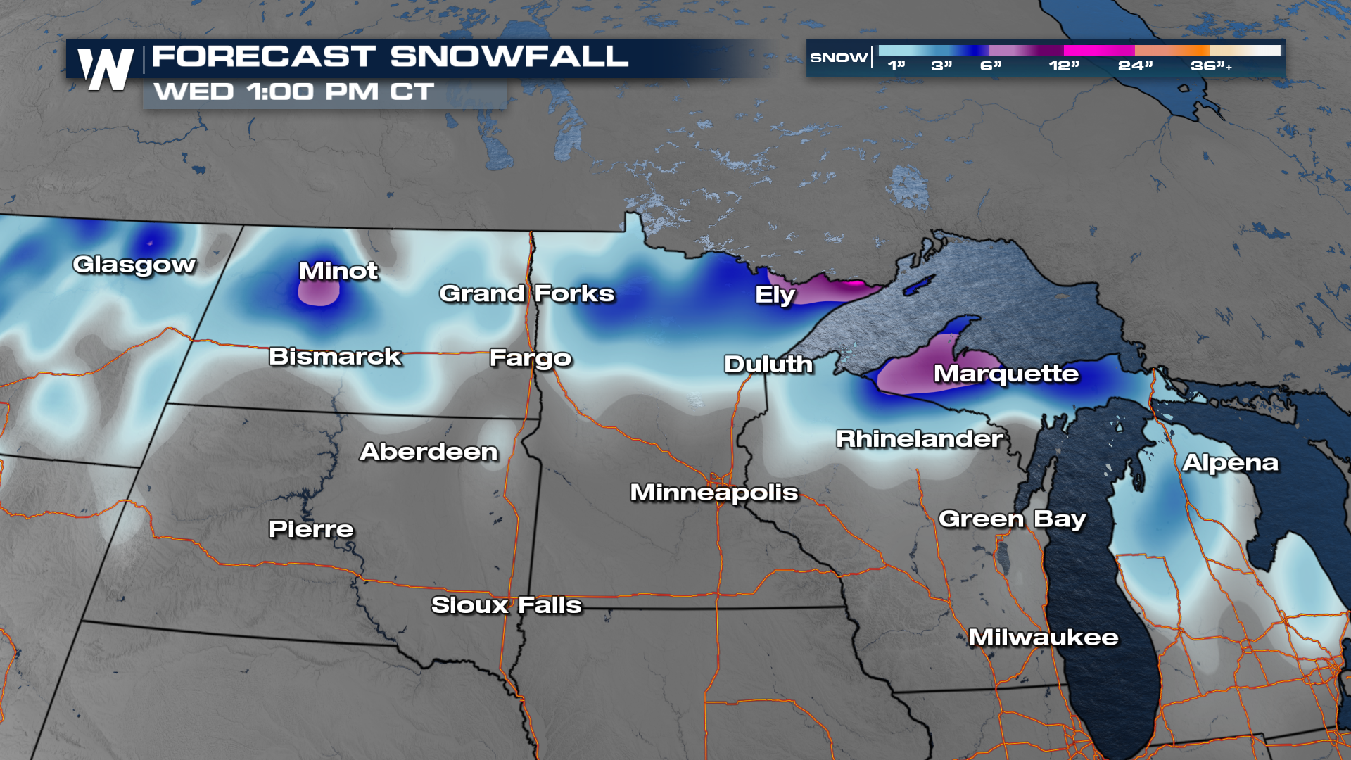
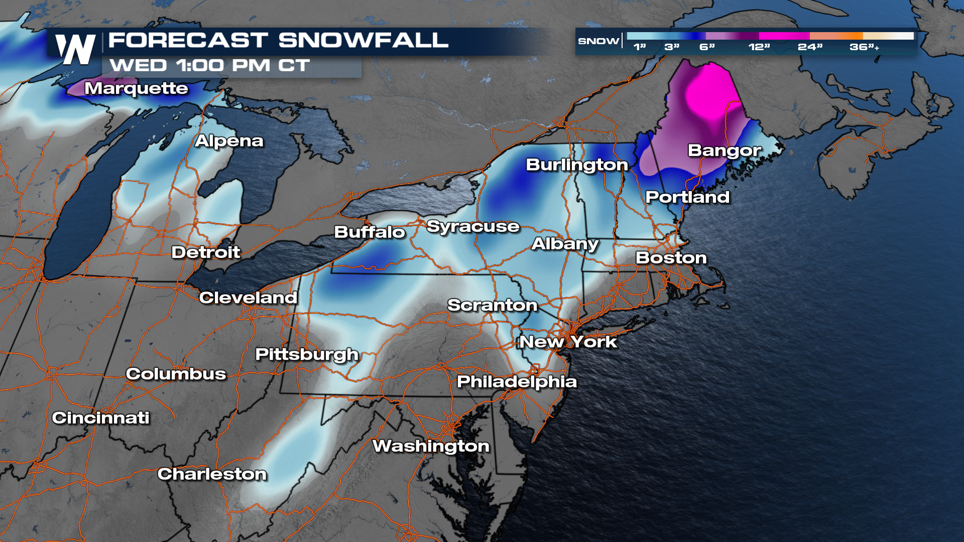
A strengthening storm system from the Northwest will move across the Northern Plains, Great Lakes, and Northeast over the next few days. Although it will be a mix of rain and snow for many, impactful accumulations of snow will be possible. Read more on the warmer side of this system and details about the Severe Threat Monday
According to our latest data, areas favored for significant snow include the Arrowhead of Minnesota, the UP of Michigan, and northern New England. Totals over 6" will be possible in these locations through Wednesday morning.
Overnight temperatures will remain seasonably cold, with the coldest morning ahead being Wednesday for many.
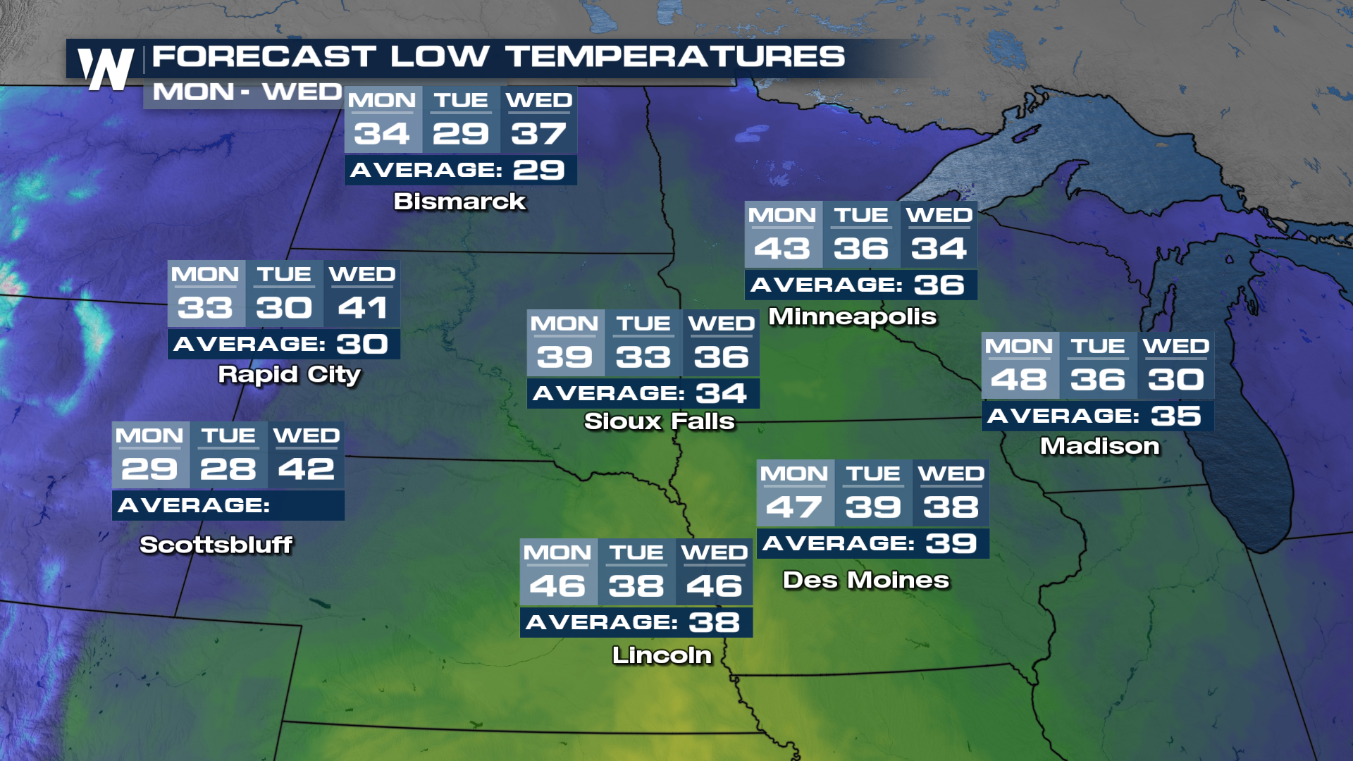
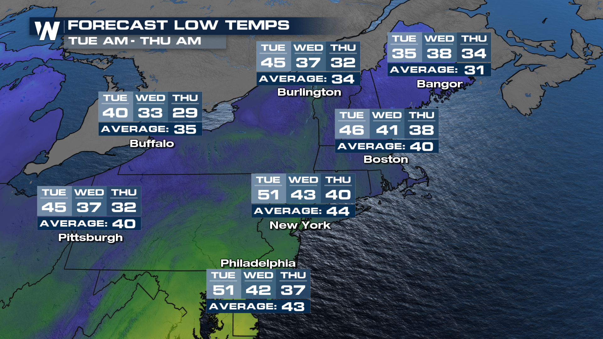
Stay with WeatherNation with winter hanging on as we head into the middle of April!
All Weather News
More

Flooding Risk Increases as Heavy Rain Targets the Tri-State Area
TRI-STATE AREA - Along with the threat of sev
29 Jul 2026 2:00 AM

Tropics: Fausto Heads towards Hawaii; Genevieve a Major Hurricane
PacificTropical Storm Fausto continues to tra
29 Jul 2026 1:35 AM


Southeast Flood Risk Lingers Near Stalled Front
A stalled boundary over the Southeast will ke
25 Jul 2026 10:55 AM

Another Round of Storms Targets the Northeast
Tuesday brought severe weather again across p
23 Jul 2026 1:15 AM