Wintry Weather to Start the Week in the Northeast
Special Stories
23 Mar 2020 7:00 AM
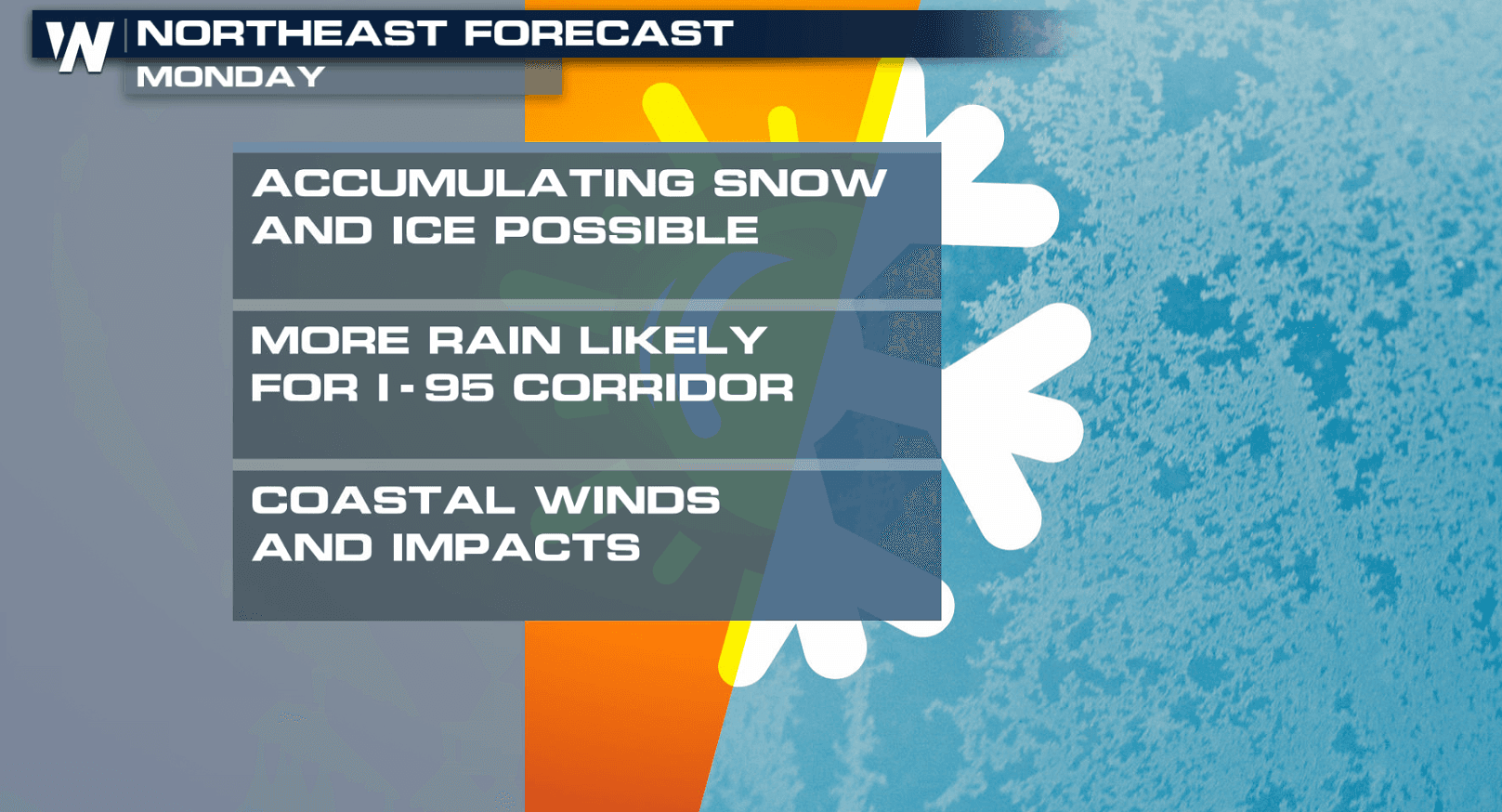
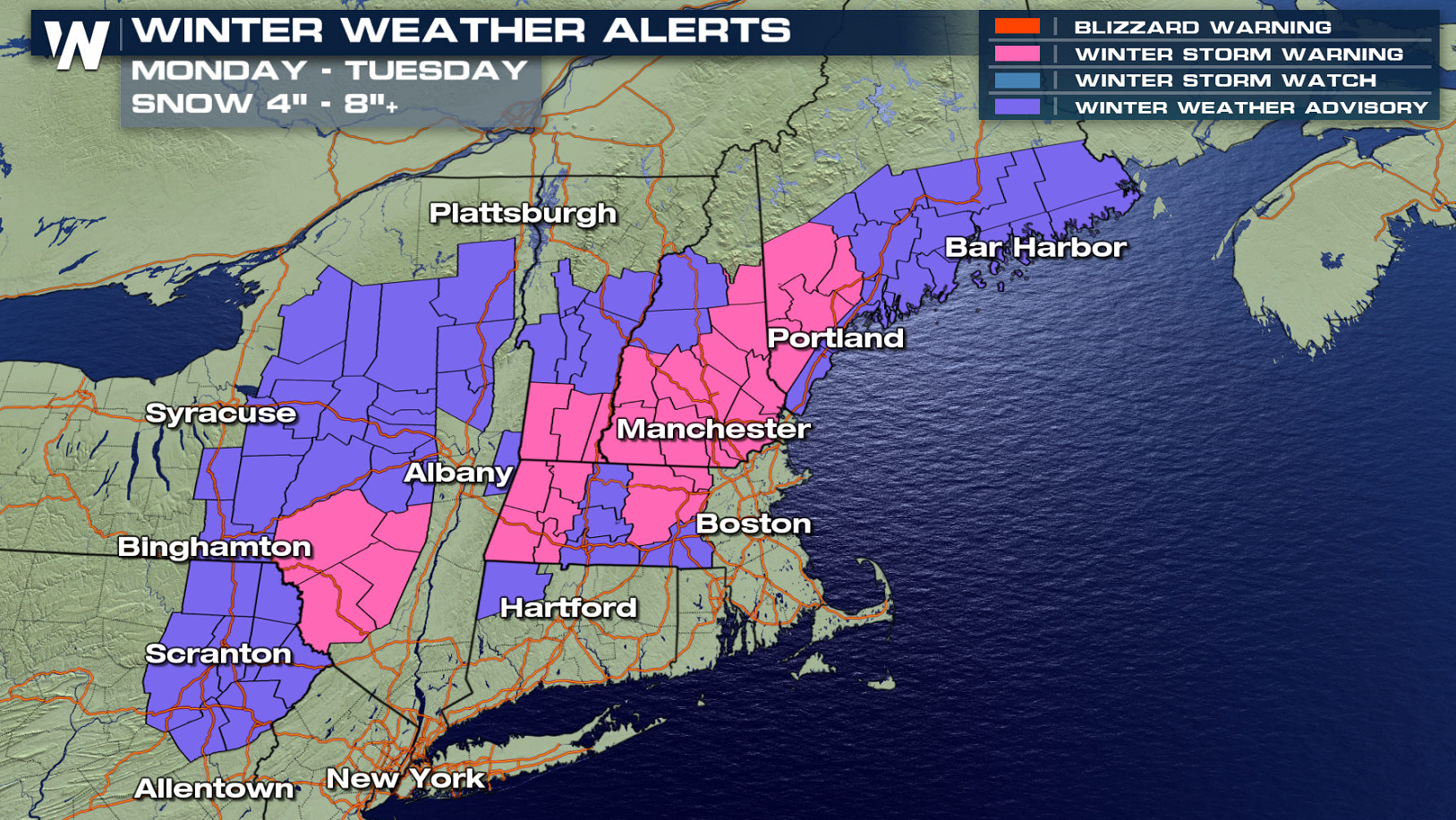
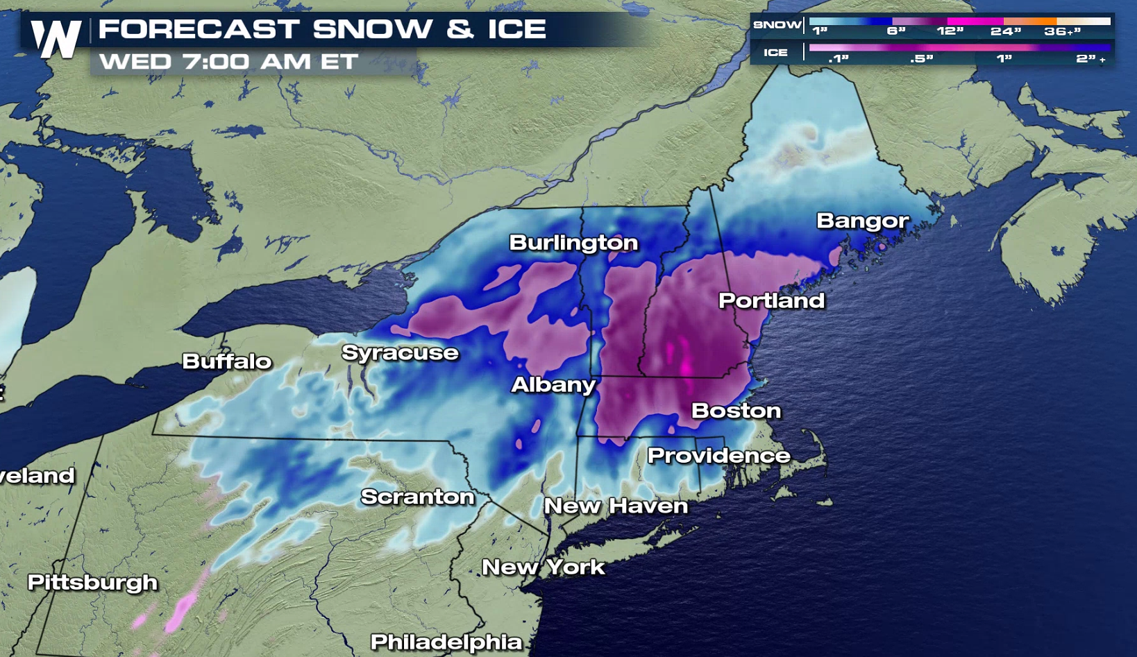
A late season winter storm is moving into New England to start the week with areas of heavy snow. Accumulations of 2” to 6” are likely for the Winter Weather Advisory region. Snowfall totals of 6" to 10" are possible for areas under Winter Storm Warnings.
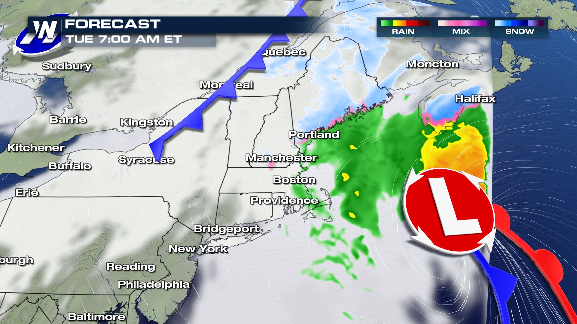
 Here’s the timing of the storm expected to drop in the Northeast today (Monday). Snow should be heaviest during the afternoon (Monday) into Tuesday morning before it’s fully out to sea.
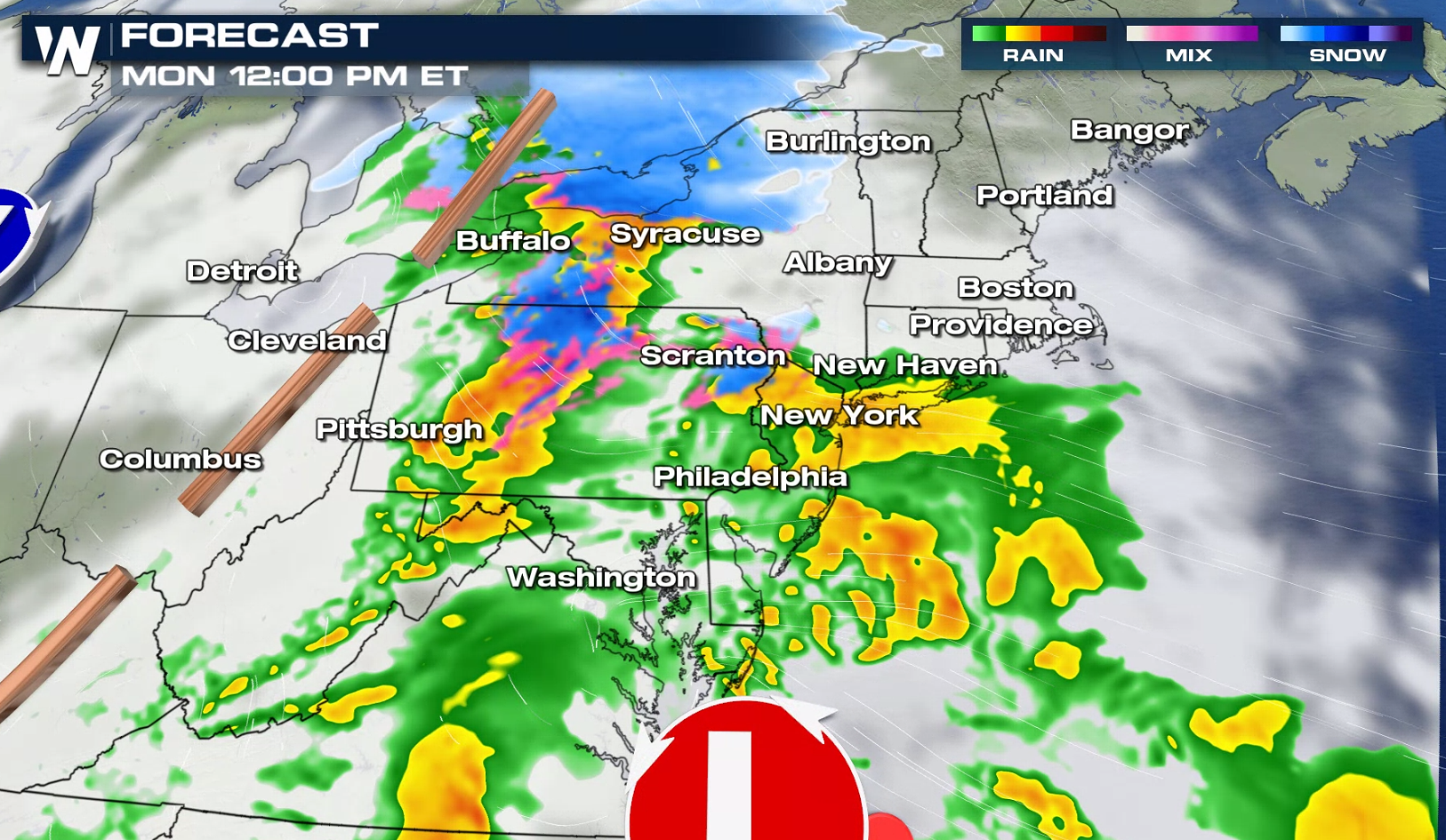
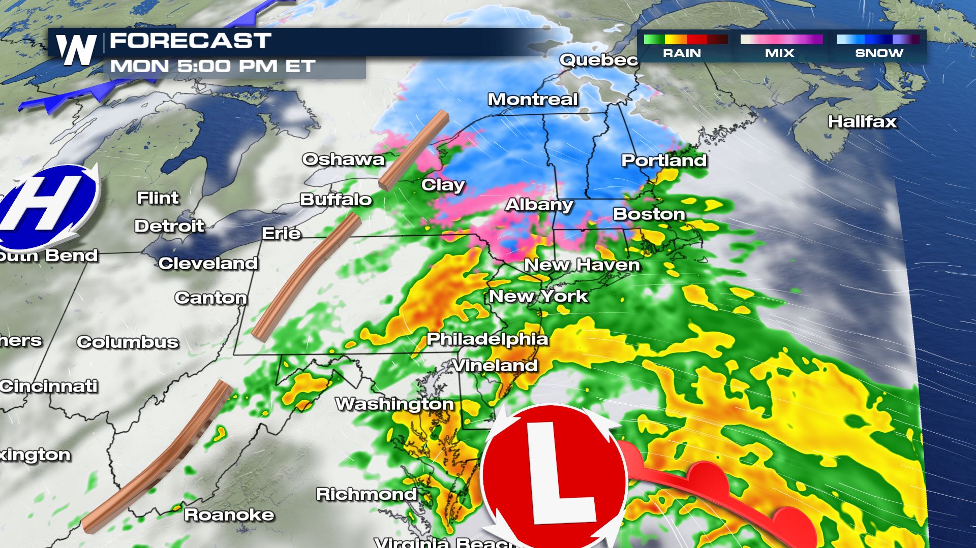
 Some of the latest information has snow totals on the lower end around a range of 2” to 6” but upwards of a 6” to 10” range on the higher end for some of the mountains.
 Keep up with the latest forecast here on https://media.weathernationtv.com/ or by downloading our app to your smart device where we’re streaming 24/7: https://media.weathernationtv.com/apps/
Here’s the timing of the storm expected to drop in the Northeast today (Monday). Snow should be heaviest during the afternoon (Monday) into Tuesday morning before it’s fully out to sea.
Some of the latest information has snow totals on the lower end around a range of 2” to 6” but upwards of a 6” to 10” range on the higher end for some of the mountains.
Keep up with the latest forecast here on https://media.weathernationtv.com/ or by downloading our app to your smart device where we’re streaming 24/7: https://media.weathernationtv.com/apps/All Weather News
More
More Storms for the East Through Monday
The threat for flooding rain continues across
3 Aug 2026 6:00 PM


After Reaching Category 5, Genevieve Weakens in the Pacific
PacificGenevieve formed last Friday south of
3 Aug 2026 12:30 AM

Flooding, Severe Storms Target the Midwest Again
After an active week of storms across the nor
1 Aug 2026 1:40 AM

Flooding Risk Increases as Heavy Rain Targets the Tri-State Area
Tuesday, heavy rainfall moved across the Nort
30 Jul 2026 12:25 AM