Snow and Ice in the Plains and Great Lakes
Special Stories
22 Jan 2019 8:32 AM
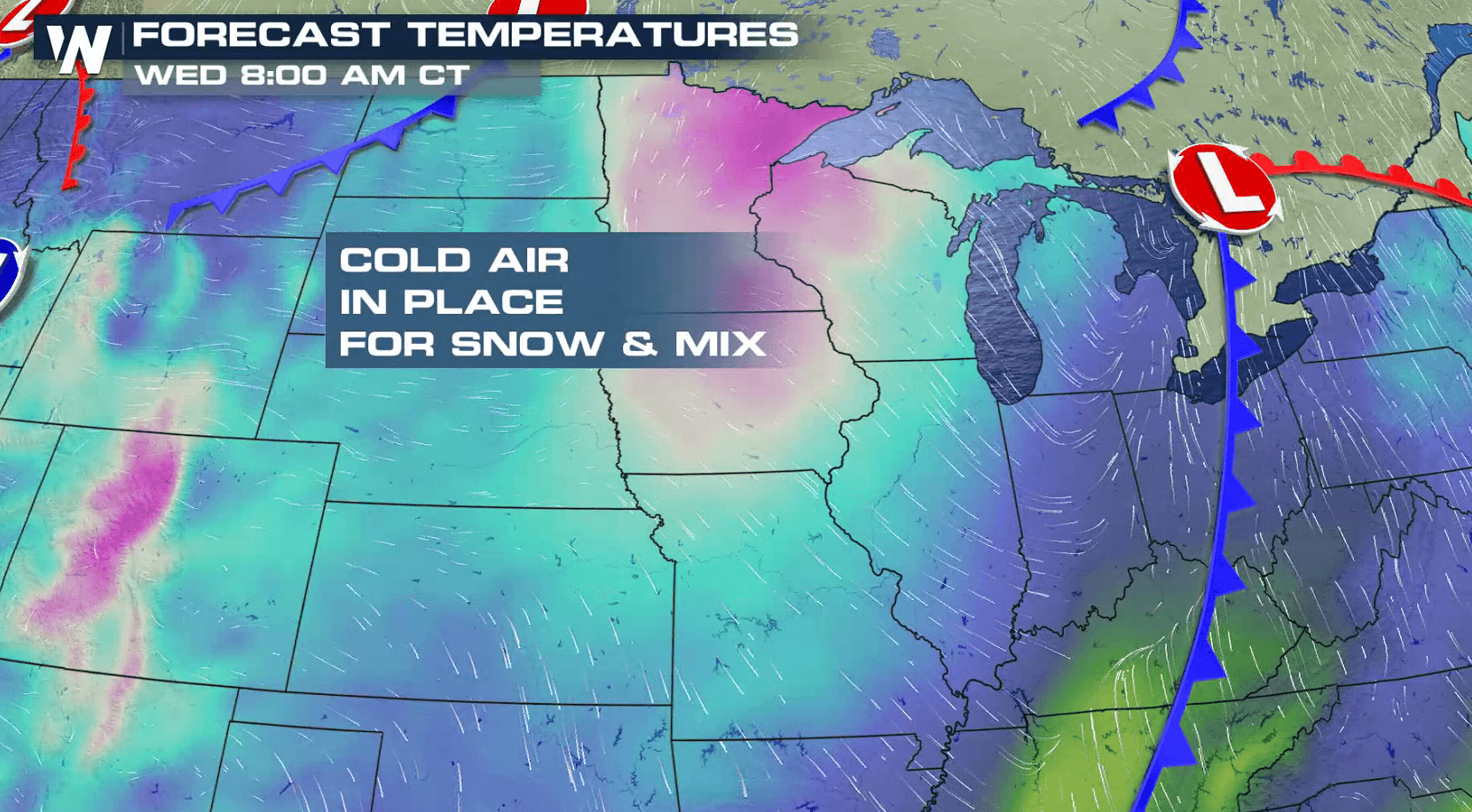
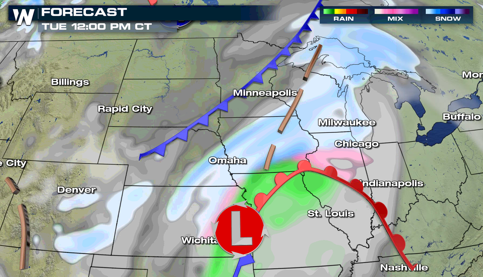
A storm system producing blizzard conditions on the Front Range will create a mess on the roadways in the Upper Midwest and Great Lakes. Ice and snow is ahead through Wednesday. Winter weather alerts are in effect from the mountains in the West to the Great Lakes. Up to a .10" of an inch of ice is possible in some areas. In the colder air, 6" to 12" of snow may accumulate.
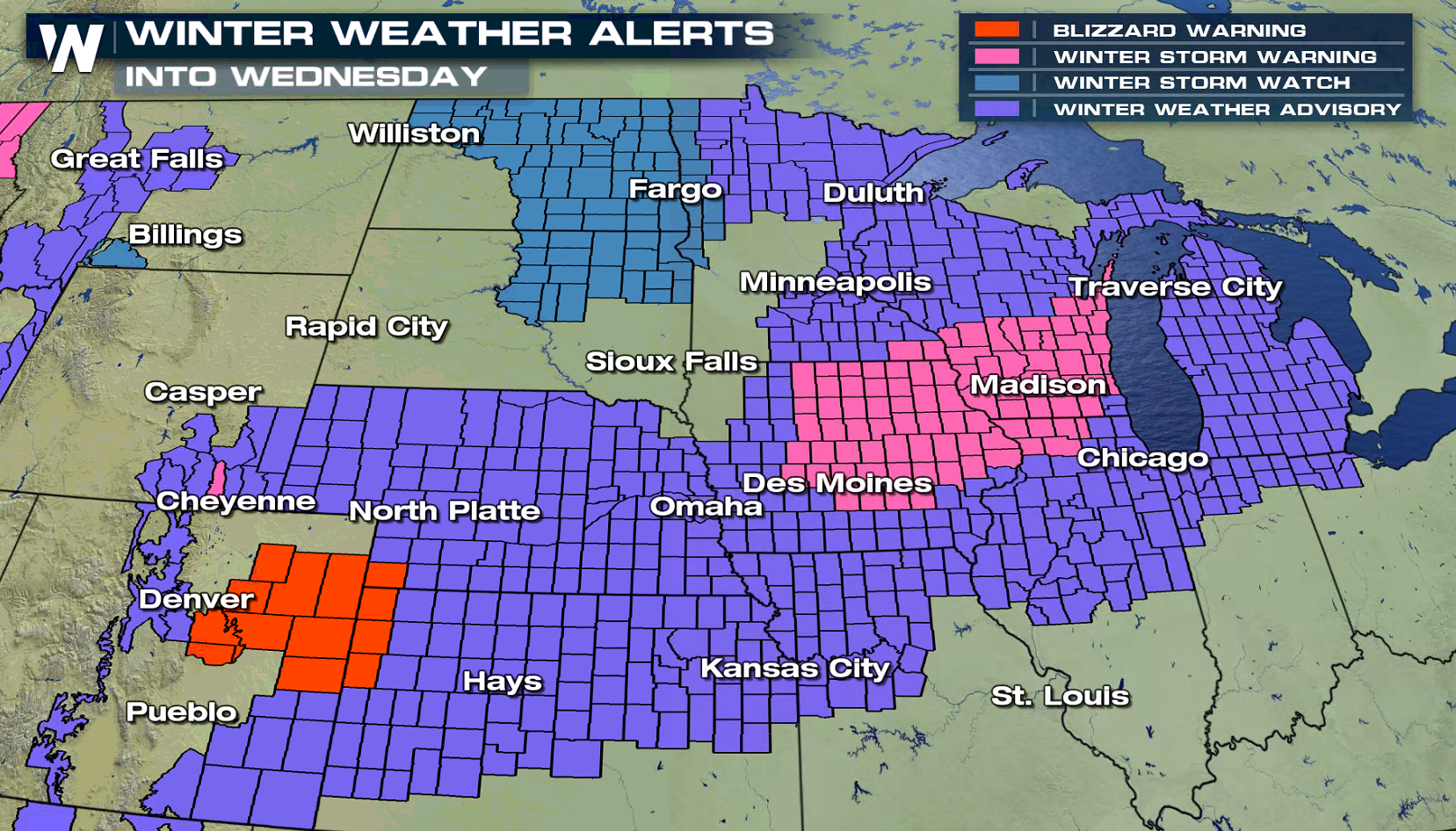
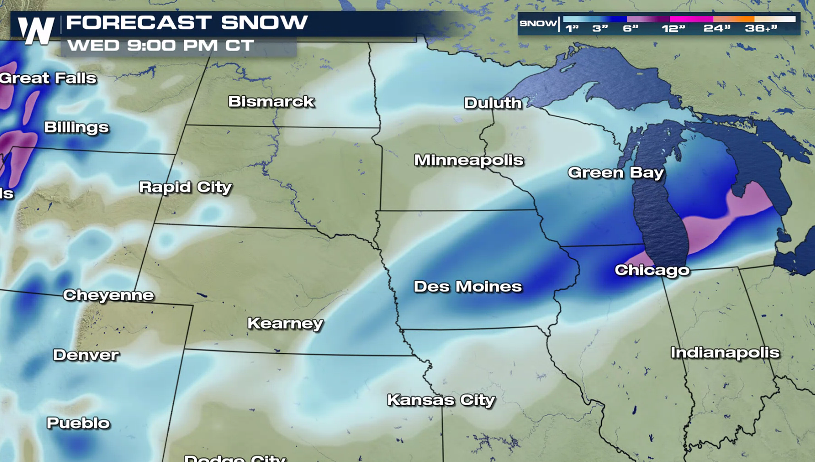
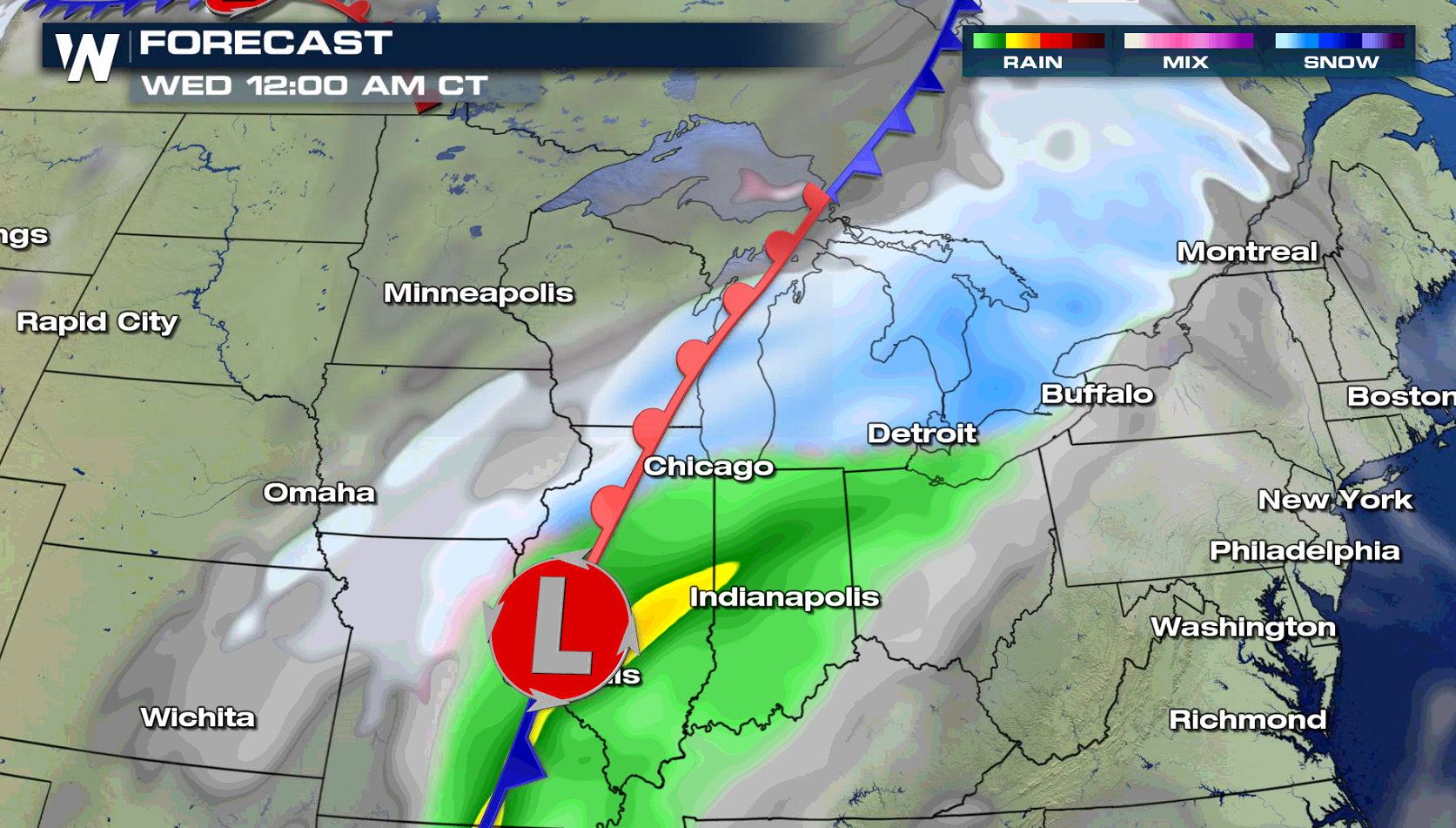
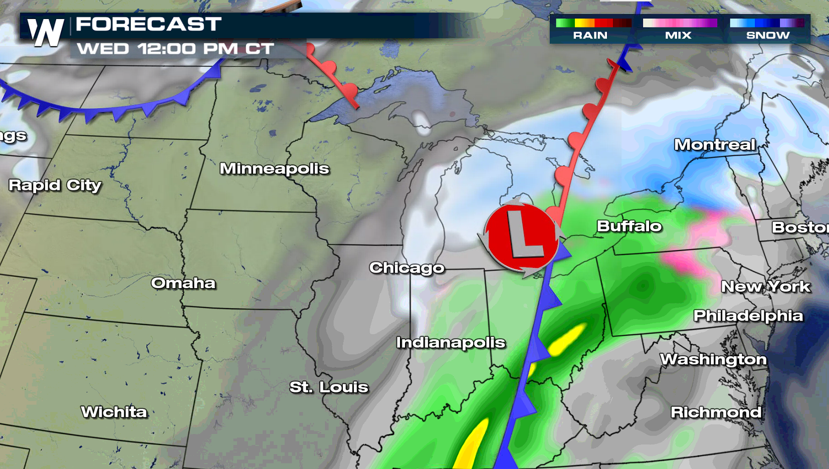
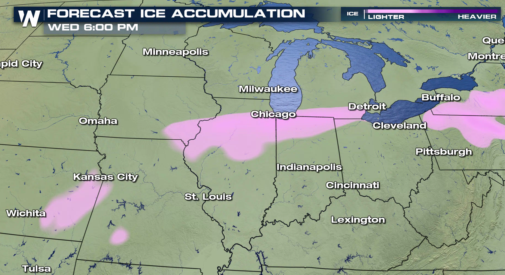 The low pressure center will push from the Front Range to the Great Lakes over the next 24 hours. Bands of heavy snow will fall further to the north, with a mix of freezing rain, sleet, and snow for locations to the south. As the system moves east by Wednesday, the wintry mixed precipitation will come to an end in the Plains but snow will continue for the Great Lakes.
 For WeatherNation: Meteorologist Mace Michaels
The low pressure center will push from the Front Range to the Great Lakes over the next 24 hours. Bands of heavy snow will fall further to the north, with a mix of freezing rain, sleet, and snow for locations to the south. As the system moves east by Wednesday, the wintry mixed precipitation will come to an end in the Plains but snow will continue for the Great Lakes.
For WeatherNation: Meteorologist Mace MichaelsAll Weather News
More
Tropical Storm Bertha Makes Landfall Along Gulf Coast
Wednesday afternoon: Bertha made landfall wit
23 Jul 2026 3:20 AM

Flash Flooding for the Carolinas This Week
Another stalled front in the Carolinas is for
23 Jul 2026 1:20 AM

Another Round of Storms Targets the Northeast
Tuesday brought severe weather again across p
23 Jul 2026 1:15 AM

Pacific Northwest Fires Bringing Down the Air Quality
Conditions have been really dry out west. We'
23 Jul 2026 1:00 AM

Another Round of Severe Weather for the Upper Midwest and Great Lakes
The upper-level low train continues to keep t
21 Jul 2026 1:45 AM

Air Quality Improvements in the Forecast
Wildfires burning in Northwestern Ontario, Ca
20 Jul 2026 7:20 PM

Monsoon Moisture Brings Weekend Flood Threat
The monsoon has returned to the southwestern
19 Jul 2026 1:30 AM