Threat for Flooding from the Jersey Shore to the Central Plains
Special Stories
18 Jun 2019 5:16 AM
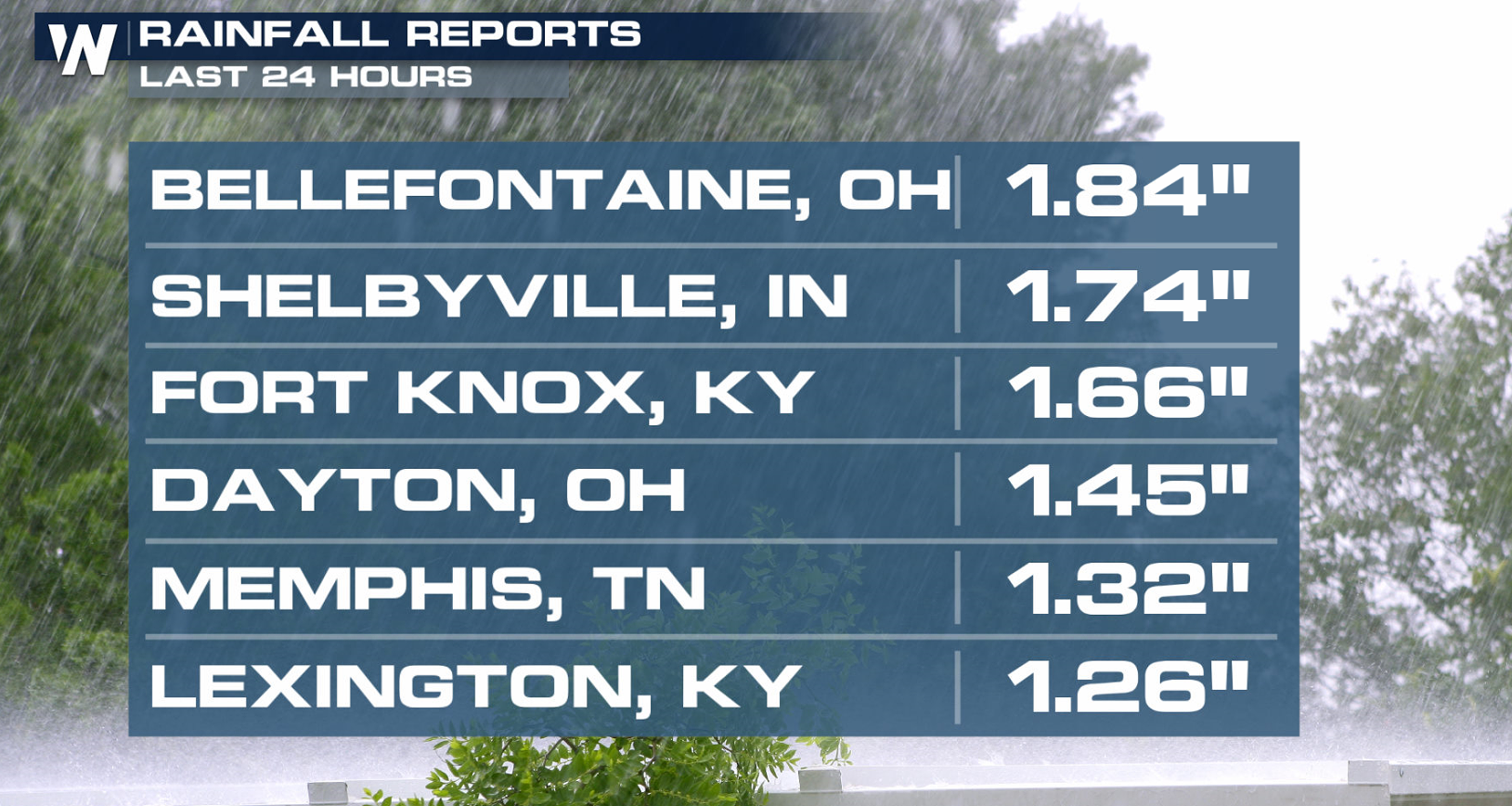
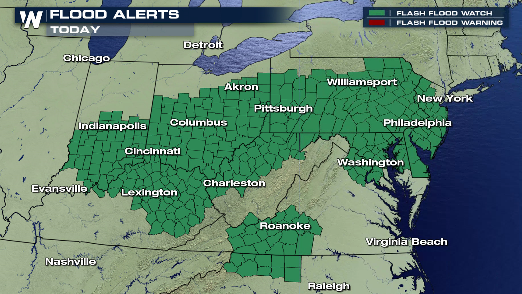
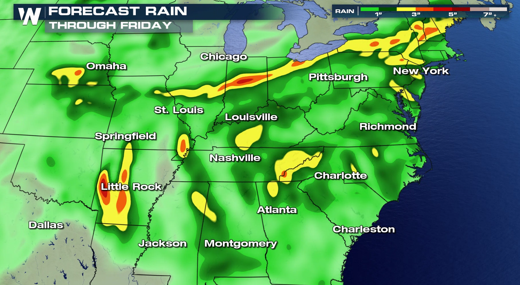
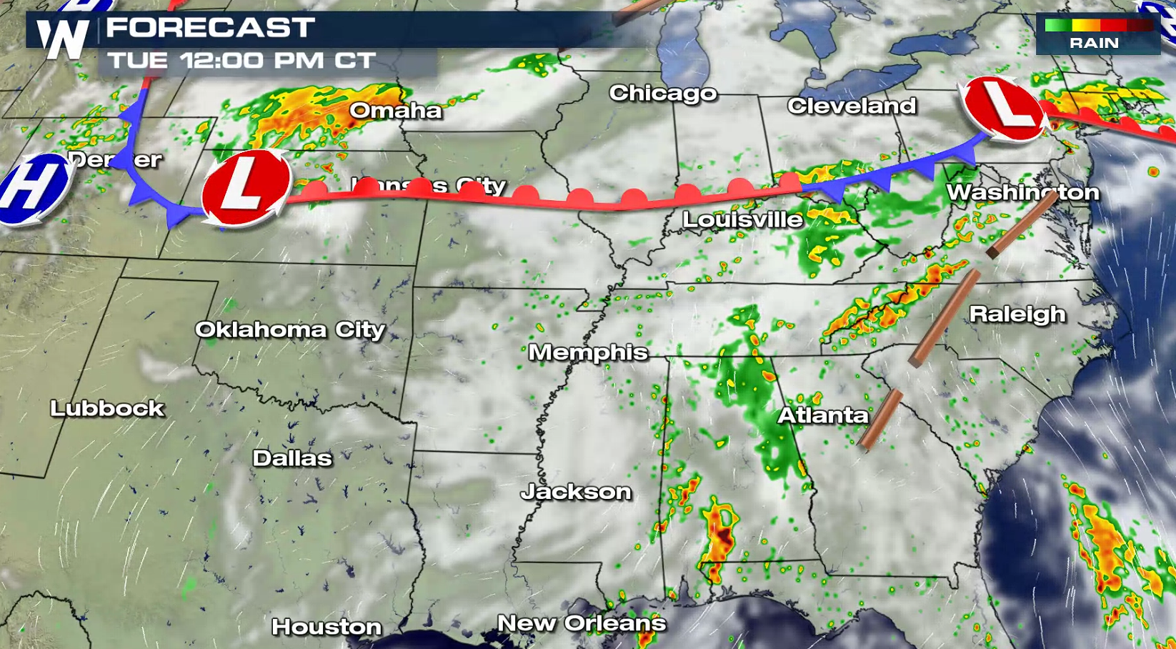
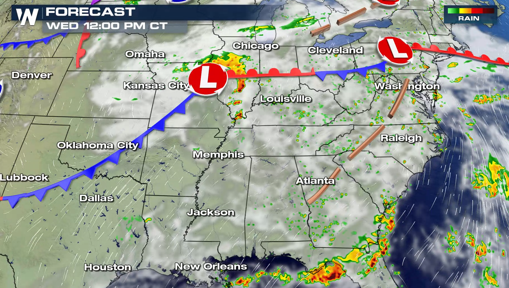
Heavy rain has been falling across the Ohio Valley and more is ahead through the middle of this week. Some areas saw more than 4" of rain on Sunday and an additional inch or two Monday. With more rain in the forecast, flooding is possible. Flash Flood Watches extend from the Jersey Shore through the Ohio Valley and into the central Plains.
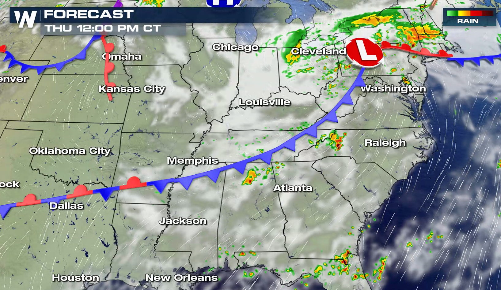
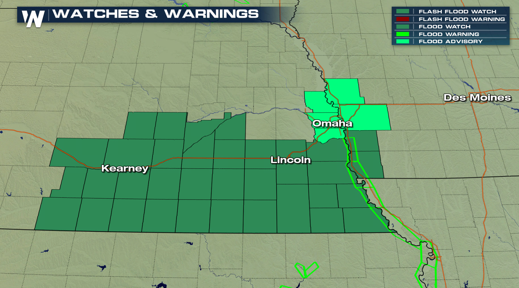 Over the next several days, more than 5" of rain could fall from the Northeast to the Plains. With the ground already saturated, additional rounds of showers and embedded thunderstorms through Friday could result in flash flooding. Some locations could have rain repeatedly move across spots which have already received up to 2 to 3 inches of rain in the past several days. This may result in flooding even with lighter rainfall amounts than would otherwise be expected.
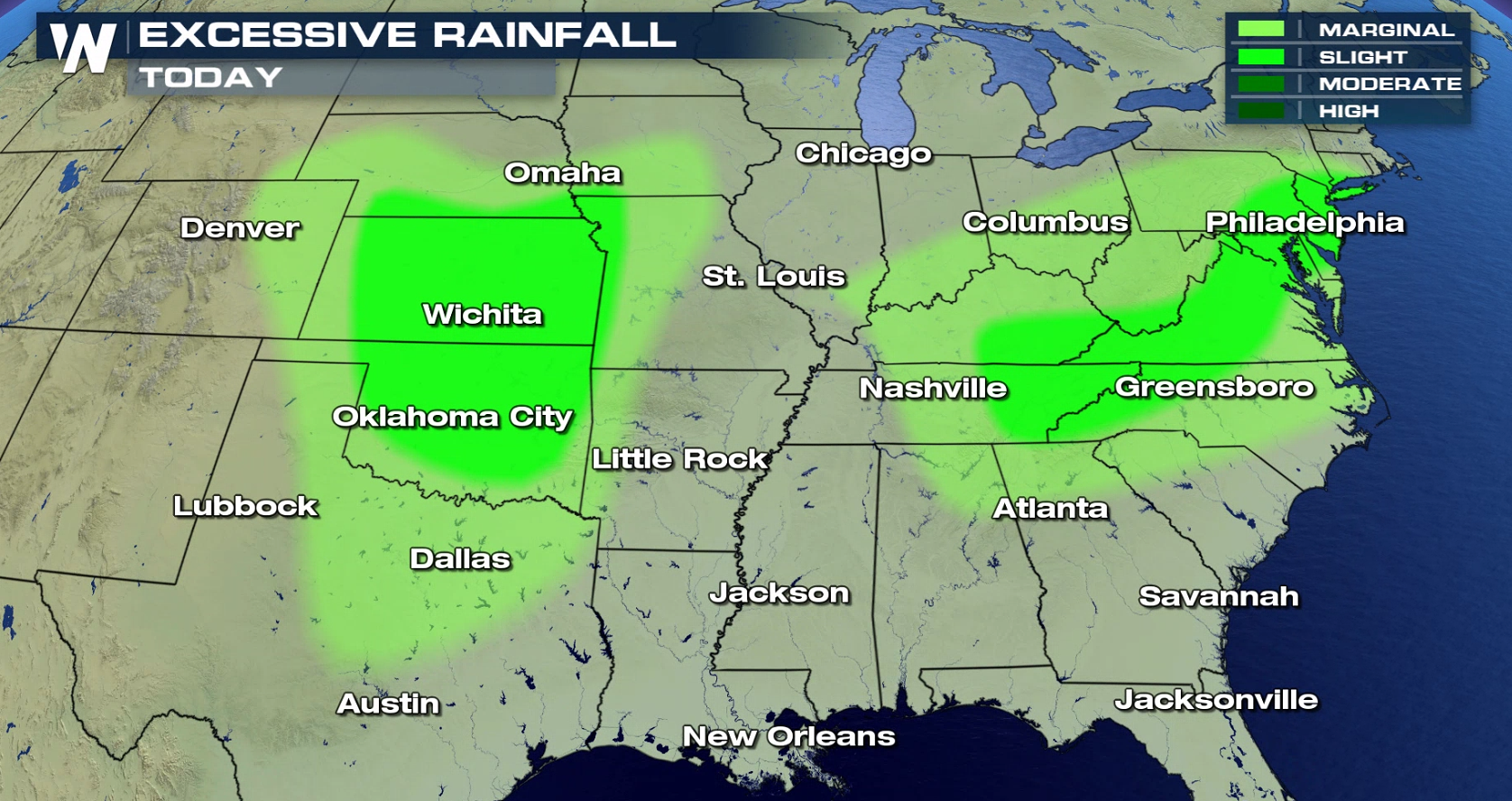
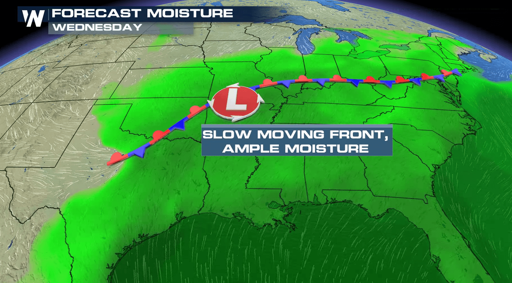
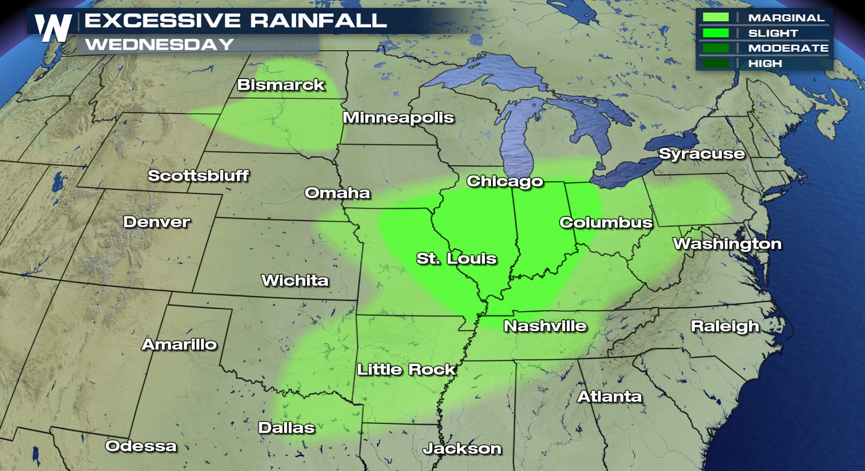 Humidity remains high across the region with southerly winds increasing dew points and moisture from the Gulf of Mexico. A stalled front will barely move through the middle of the week, aiding to produce several rounds of showers and thunderstorms. With persistent rain and pockets of heavy storms, the flooding threat will continue.
 For WeatherNation: Meteorologist Mace Michaels
Over the next several days, more than 5" of rain could fall from the Northeast to the Plains. With the ground already saturated, additional rounds of showers and embedded thunderstorms through Friday could result in flash flooding. Some locations could have rain repeatedly move across spots which have already received up to 2 to 3 inches of rain in the past several days. This may result in flooding even with lighter rainfall amounts than would otherwise be expected.
Humidity remains high across the region with southerly winds increasing dew points and moisture from the Gulf of Mexico. A stalled front will barely move through the middle of the week, aiding to produce several rounds of showers and thunderstorms. With persistent rain and pockets of heavy storms, the flooding threat will continue.
For WeatherNation: Meteorologist Mace MichaelsAll Weather News
More
Wildfire Outbreak in the Pacific Northwest
SPOKANE, WA - On Saturday, August 1st, the Ol
3 Aug 2026 1:55 AM

More Storms for the East Through Monday
A low-pressure system that moved through the
3 Aug 2026 1:50 AM


After Reaching Category 5, Genevieve Weakens in the Pacific
PacificGenevieve formed last Friday south of
3 Aug 2026 12:30 AM

Flooding, Severe Storms Target the Midwest Again
After an active week of storms across the nor
1 Aug 2026 1:40 AM

Flooding Risk Increases as Heavy Rain Targets the Tri-State Area
Tuesday, heavy rainfall moved across the Nort
30 Jul 2026 12:25 AM

Severe Weather: Energy From the Midwest Now in the Southeast
UPPER MIDWEST - Through Monday, dangerous tor
29 Jul 2026 10:30 PM