Timeline: How Catastrophic Flooding Unfolded in Texas Hill Country

TEXAS - Catastrophic flooding devastated portions of the Texas Hill Country on July 4, 2025, resulting in the tragic loss of 123 lives and 161 still missing, according to FEMA.
The following is a timeline of key events leading up to and during this deadly flash flood, compiled from the Department of Homeland Security and other official sources:
Wednesday July 2
The Texas Division of Emergency Management (TDEM) activated emergency response resources in Central Texas in anticipation of heavy rainfall and flash flooding.
Thursday July 3
TDEM increased its readiness level and mobilized additional emergency state response resources for Central and West Texas as the flood threat intensified heading into the holiday weekend.
Morning:
The National Weather Service (NWS) in Austin/San Antonio conducted a forecast briefing with emergency management officials, emphasizing the risk of flash flooding.
The National Water Center issued a Flood Hazard Outlook identifying flash flood potential for Kerrville and surrounding areas.
1:13 PM: NWS Austin/San Antonio issued a Flood Watch for Kerr County, effective through Friday morning.
6:10 PM: Weather Prediction Center (WPC) released the first of three Mesoscale Precipitation Discussions (MPD #0580, #0581, #0582), warning of excessive rainfall and flash flood potential.
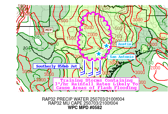
6:22 PM: National Water Center issued an alert for "considerable flooding risk" north and west of San Antonio, including Kerrville.
11:41 PM: The first Flash Flood Warning was issued for Bandera County.
Friday July 4
1:14 AM: Flash Flood Warnings with "considerable damage" tags were issued for Bandera and Kerr Counties, triggering Wireless Emergency Alerts (WEAs) and NOAA Weather Radio notifications.
4:03 AM: Flash Flood Warning is upgraded to a Flash Flood Emergency for south-central Kerr County, including Hunt.
4:35 AM: Kerr County Sheriff's Office reports flooding at the low water crossing, over three hours after the initial 1:14 AM warning.
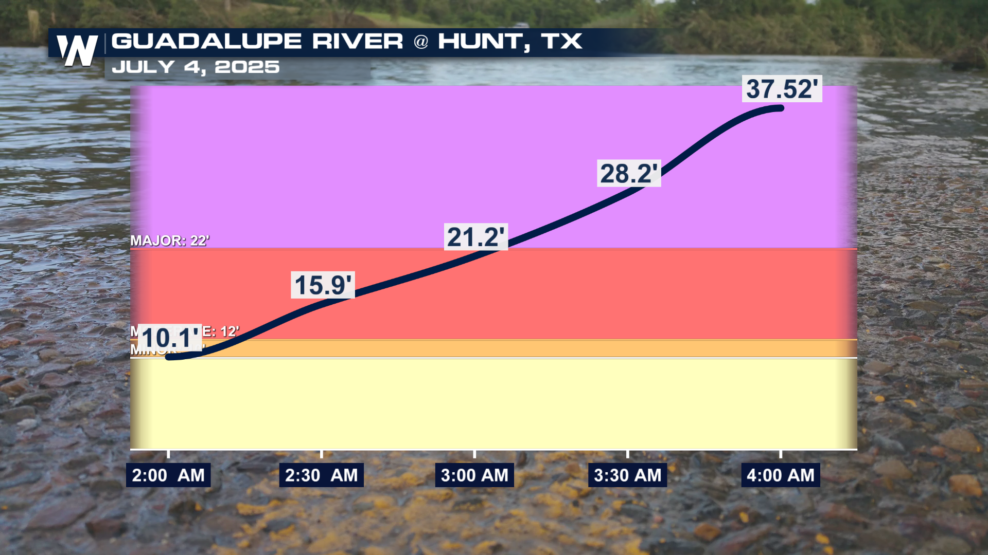
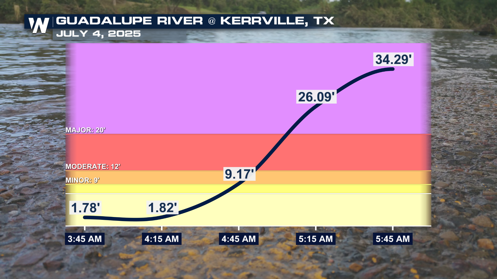
4:35 AM: A US Geological Survey (USGS) gauge on the Guadalupe River recorded a river level of 29.5 feet.
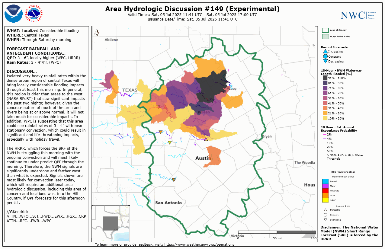
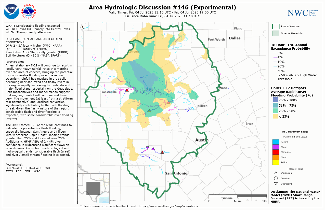
 5:10 AM: National Water Center warned of "widespread, considerable, and catastrophic flooding."
 5:34 AM: Flash Flood Emergency is issued for the Guadalupe River, signaling a "large and deadly flood wave."
5:45 AM - A USGS gauge recorded the Guadalupe River at 34.29 feet - an extreme and life-threatening level.
 The rest of the day brought devastation to communities throughout the region.
9:00 PM - Governor Greg Abbott issued a formal statement and signed a disaster declaration for the impacted areas.
For more on the unfolding aftermath and how to support those affected, visit: Ways to Help Texas Flood Victims.


