Medium Range Tropics Forecast Favors Gulf, CSU Updates Seasonal Forecast

While the Atlantic appears quiet, conditions can change quickly as waters continue to warm as we inch closer to the peak of hurricane season in mid-September.
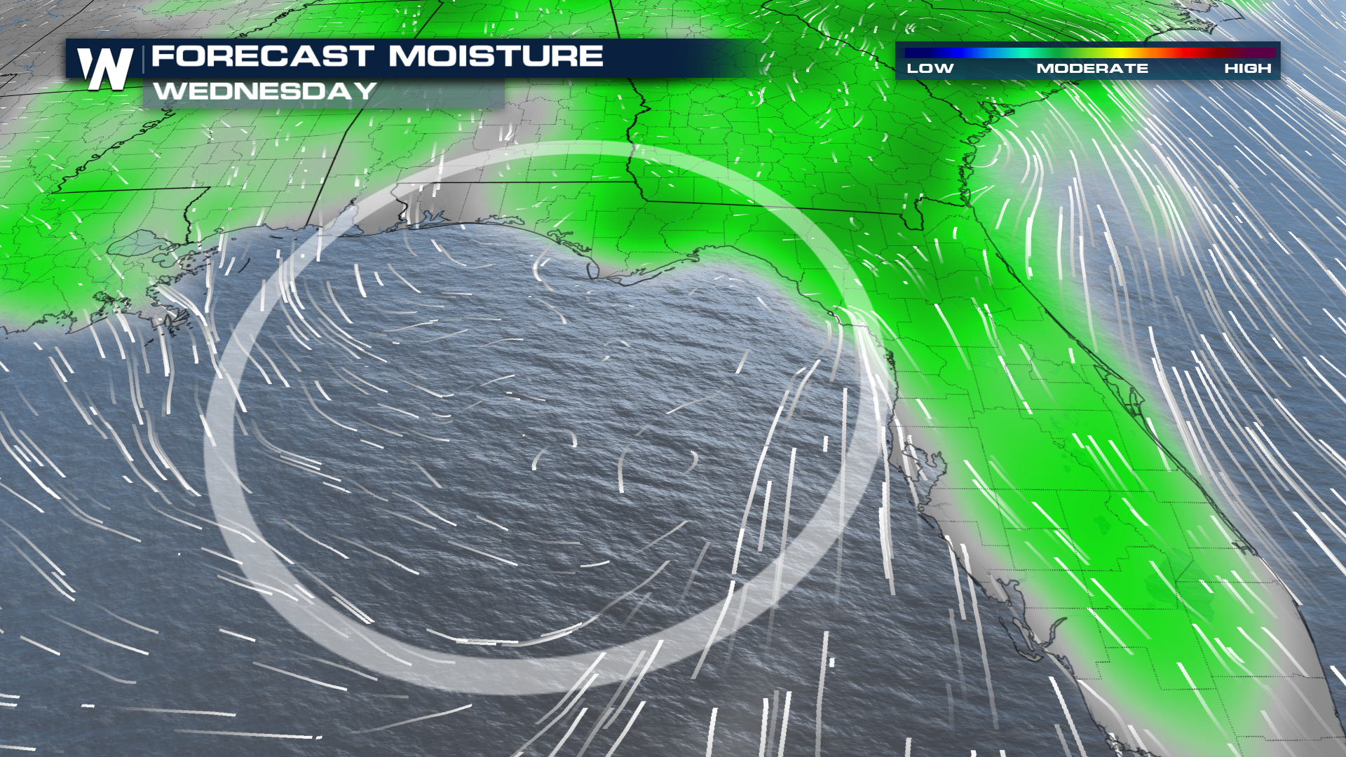
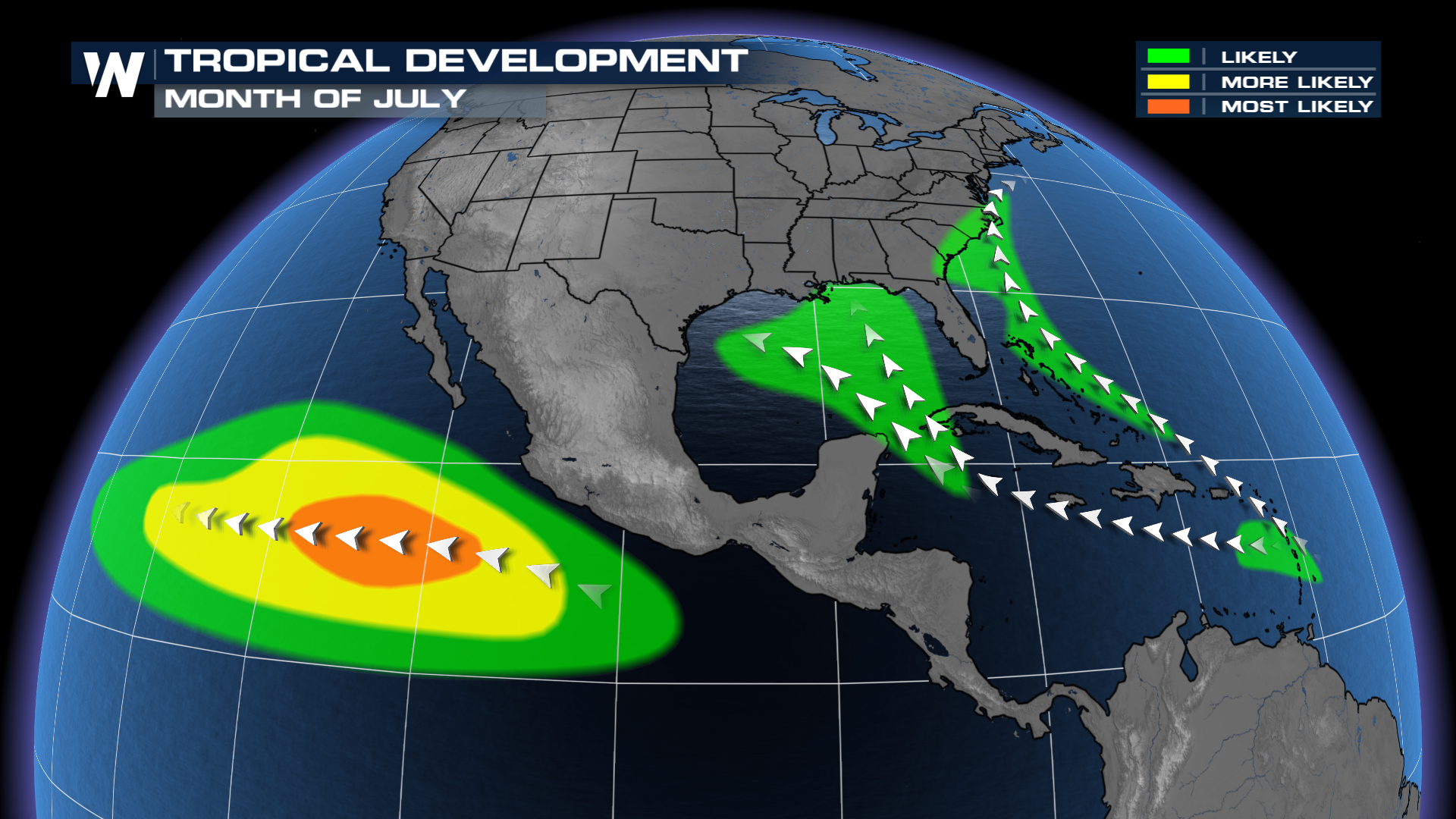
The National Hurricane Center doesn't have any areas to watch around North America this week, but toward the 2nd/3rd week of July, there will be potential for some tropical development in the Gulf. The CPC (Climate Prediction Center) is highlighting the northern Gulf for this development from July 16th-22nd, though confidence is low.
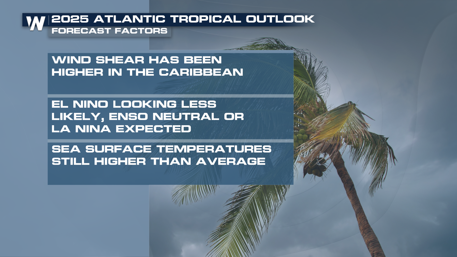
Forecast Factors
Why is the northern Gulf being highlighted for development in the middle of July? Models favor upper-level troughing to develop over the region toward the middle of the week, which is likely to spur lift and heavy rain.
 At the surface, winds could converge around several boundaries that have the potential to form. This is a process similar to conditions that created Tropical Storm Chantal, which moved onshore in the Carolinas on the July 4th weekend, spurring significant flooding in North Carolina.
 Warm water is a necessary ingredient for tropical formation, and temperatures in the Gulf are plenty warm to fuel tropical systems. Typically, sea-surface temperatures in the upper 70s are needed for tropical cyclone development.
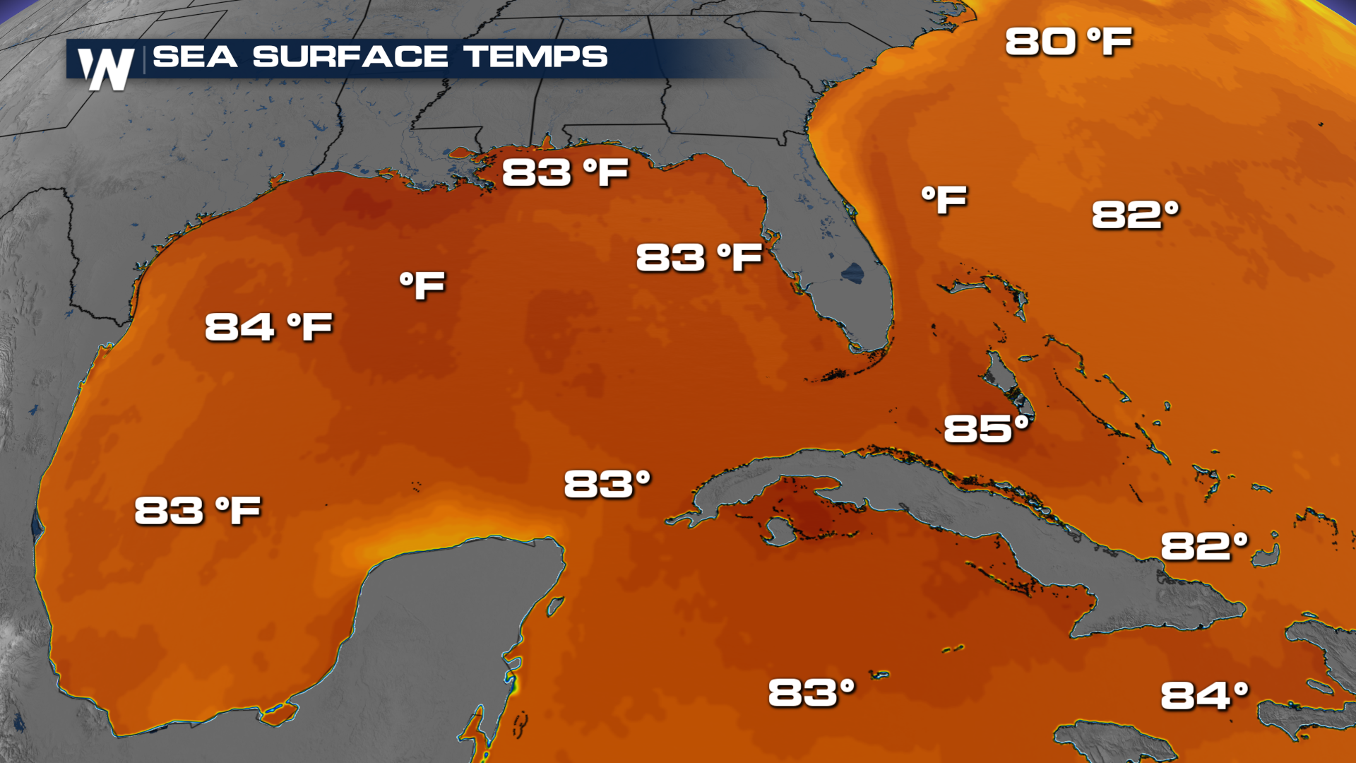 Water temperatures tend to warm more quickly early in the season in the Gulf and western Atlantic. This is more often where we see early-season development.
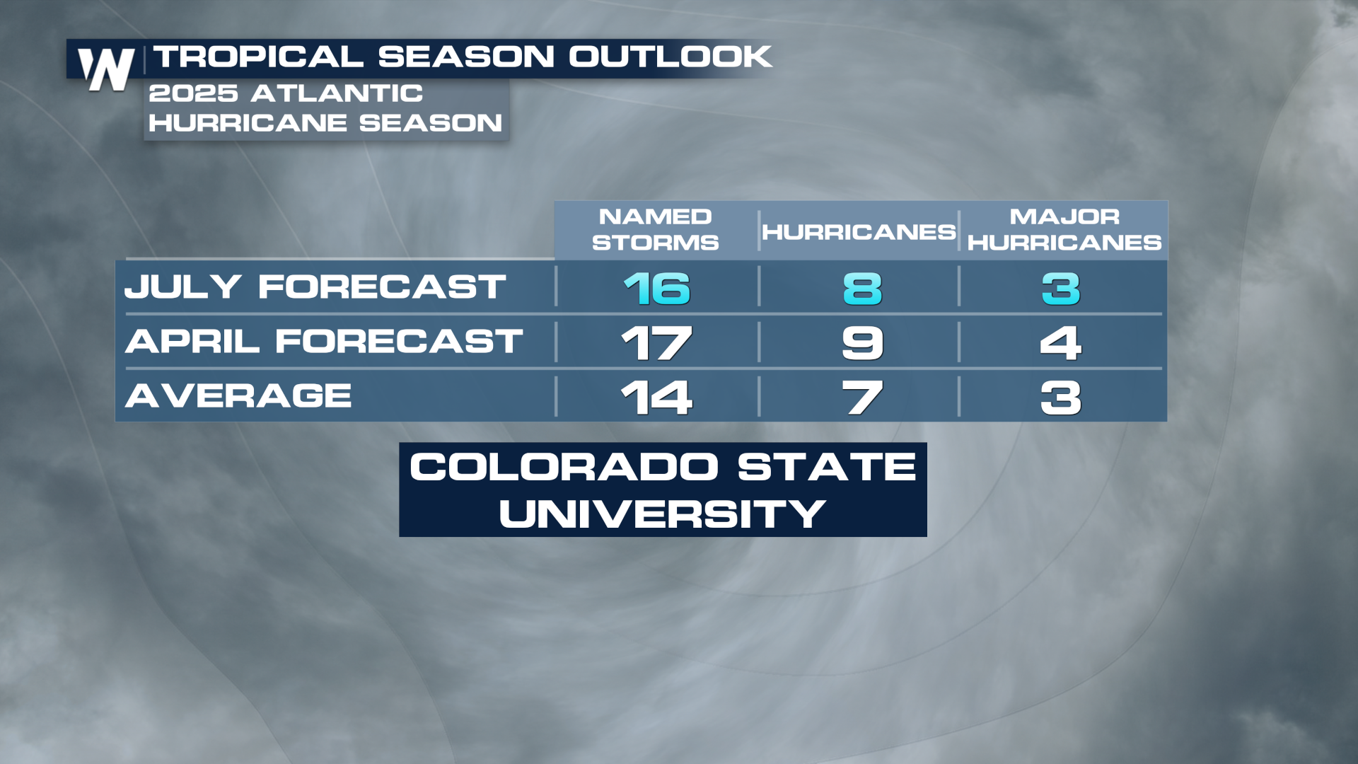
 Updated CSU Outlook
Colorado State University updated its seasonal forecast on Wednesday, July 9th.