Rounds of Severe Storms to Impact Great Plains and Midwest Through the Weekend

A dynamic summer weather pattern is setting the stage for several rounds of strong to severe thunderstorms across the northern and central Great Plains over the next couple of days. This activity is being driven by upper-level disturbances moving out of the northern Rockies, which will interact with a lifting warm front and a trough to spark widespread storm development. Each of the next 3 days will have severe storms somewhere around this area.
Thursday
A slight risk for severe weather includes the Central Plains, with an enhanced risk area added in Siouxland. The greatest threat for severe weather is expected this afternoon across the northern Plains, where storms could bring damaging wind gusts and isolated large hail. As the system progresses eastward, these thunderstorms are forecast to move into the upper Midwest, where the risk shifts toward excessive rainfall and flash flooding.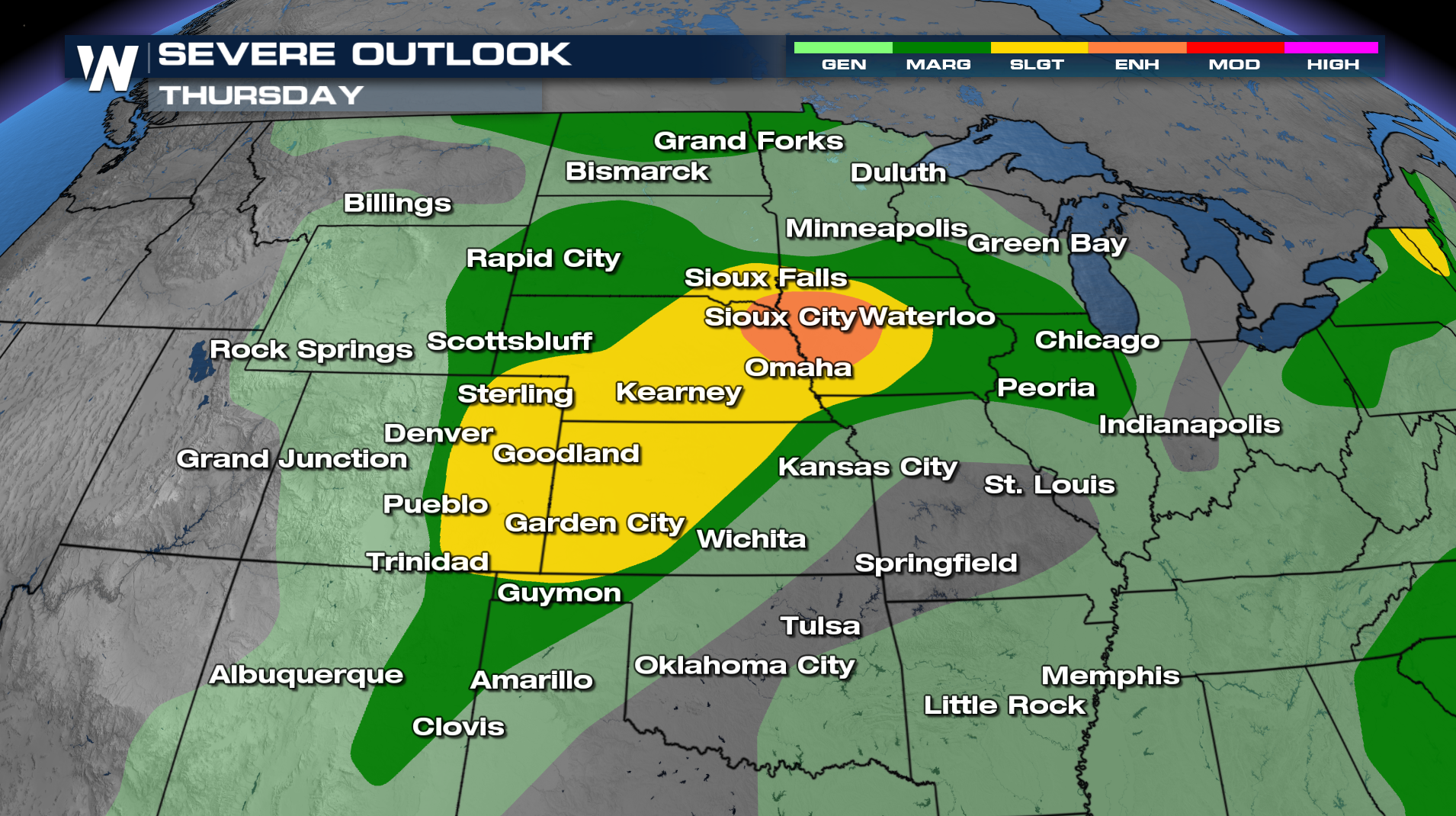
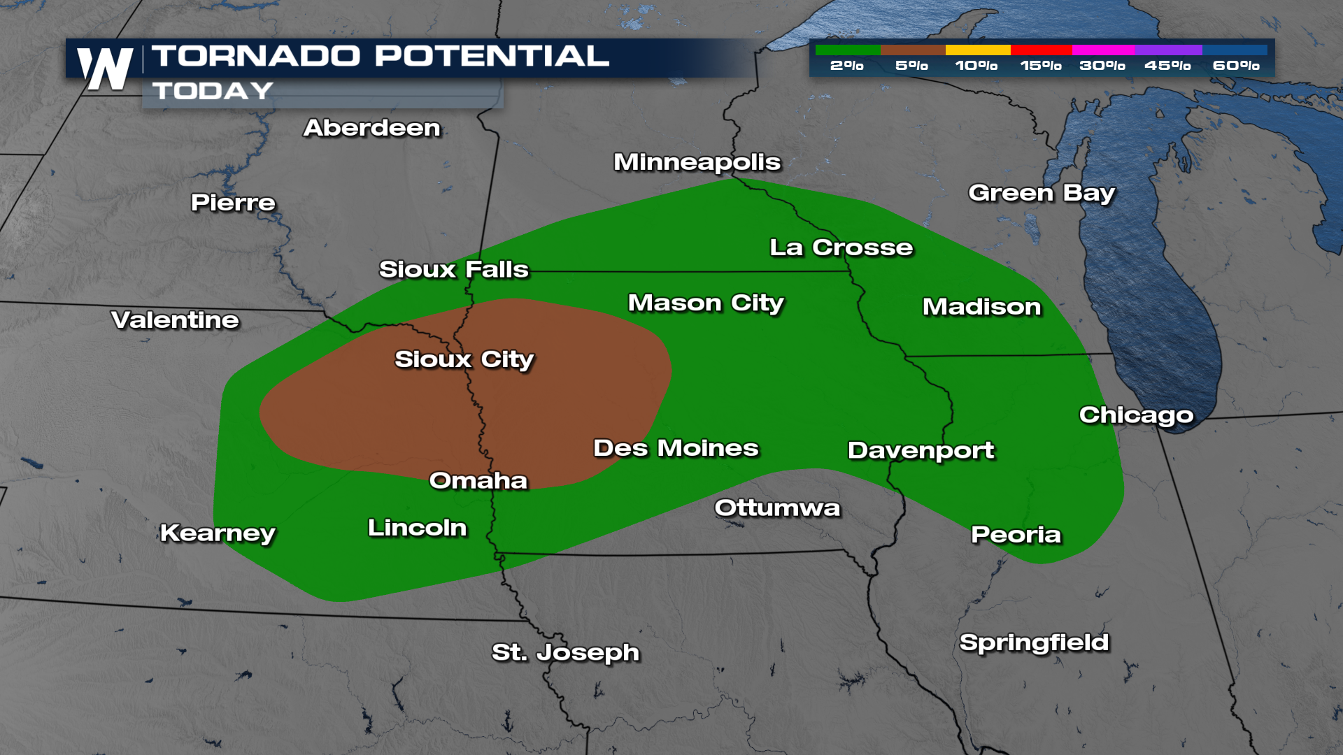
A center of low pressure will move east across Nebraska, allowing instability to build ahead of it. This is where we find the best chance at a tornado spinning up Thursday afternoon.
Timing
FRIDAY
Sensing a theme? By Friday, a reinforcing cold front will push the primary threats for severe weather and heavy rain further east, affecting the Midwest, upper Midwest, and portions of the central Plains. The overall picture won't change much: very unstable with the potential that a few storms survive from the night previous. South of those storms, we'll expect redevelopment of thunderstorms that will pose a threat.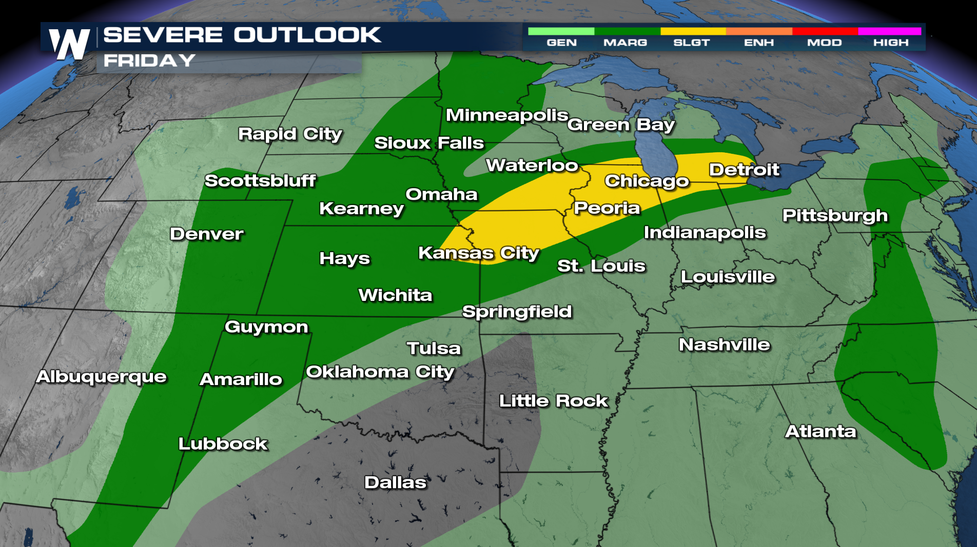
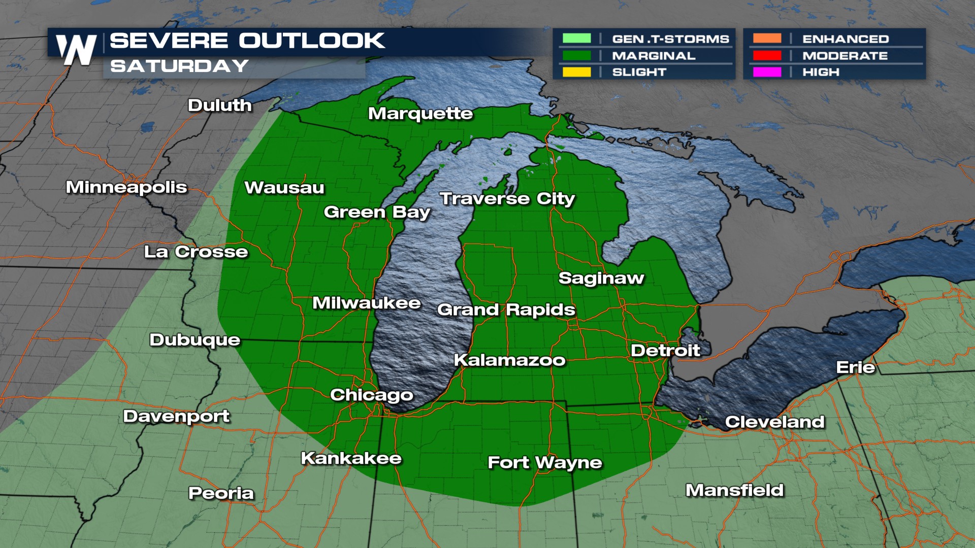
SATURDAY
As the front continues to move, strong thunderstorms may redevelop early Saturday over the central High Plains. Behind the front, a high-pressure system ushering in cooler, drier air from western Canada will settle over the northern High Plains, bringing a temporary break from the stormy conditions.
With multiple rounds of storms, flooding will be of some concern, with a few inches of rain likely. The tough thing about uncertainty in severe forecasting is that it brings uncertain rainfall amounts. This is a look at what the Weather Prediction Center is thinking.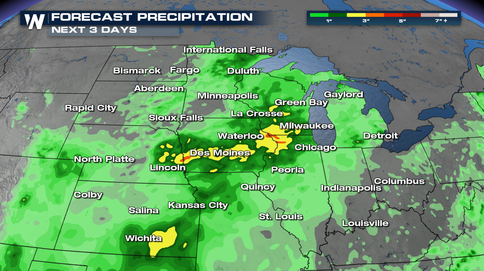
As we continue to iron out the details, check back with us if you have any interests around the Plains states.


