Atlantic Tropics: Jerry Turns North, Tropical Waves Could Develop Next Week

The 2025 Atlantic Hurricane Season has thus far been dominated by strong hurricanes, curving away from the United States with a few close calls/impacts from weaker systems. This trend looks to continue through the next week as Jerry turns east of Bermuda. Don't let your guard down! October and even November can churn out strong storms in the Gulf and Caribbean.
Jerry
Tropical Storm Jerry had become the 10th named storm of the season last week and brought tropical storm conditions to some of the Leeward Islands. Jerry continues to move to the NNE and is expected to make a right turn near Bermuda in the next few days.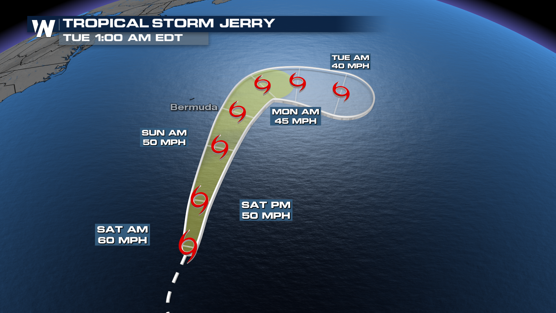
What's Next
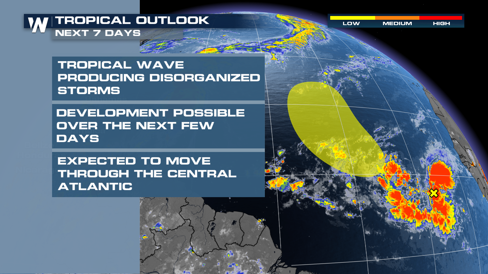
A tropical wave in the eastern Atlantic has a chance to develop this week as it churns into the central Atlantic. This storm is currently expected to stay well out into open waters.
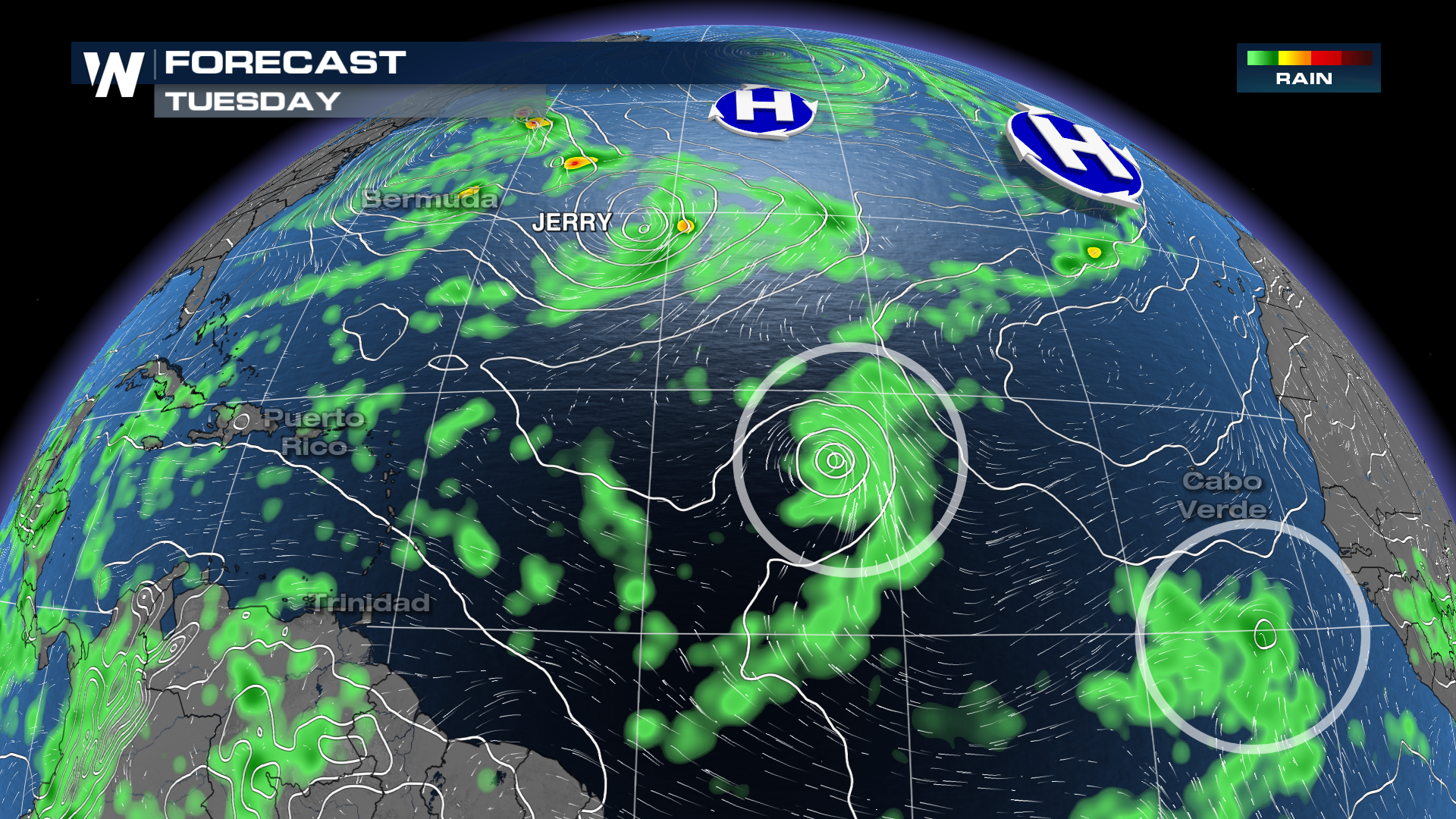
Another tropical wave is expected to emerge from Africa to start the week and could develop as it moves west across the MDR in the Atlantic. This trailing tropical wave has a better chance to move west toward the Caribbean if it's able to develop.
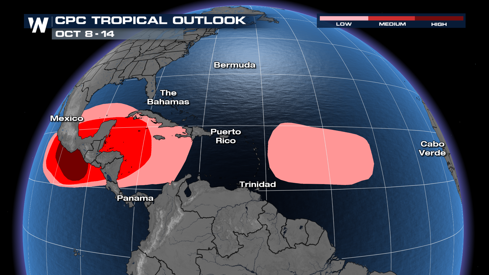
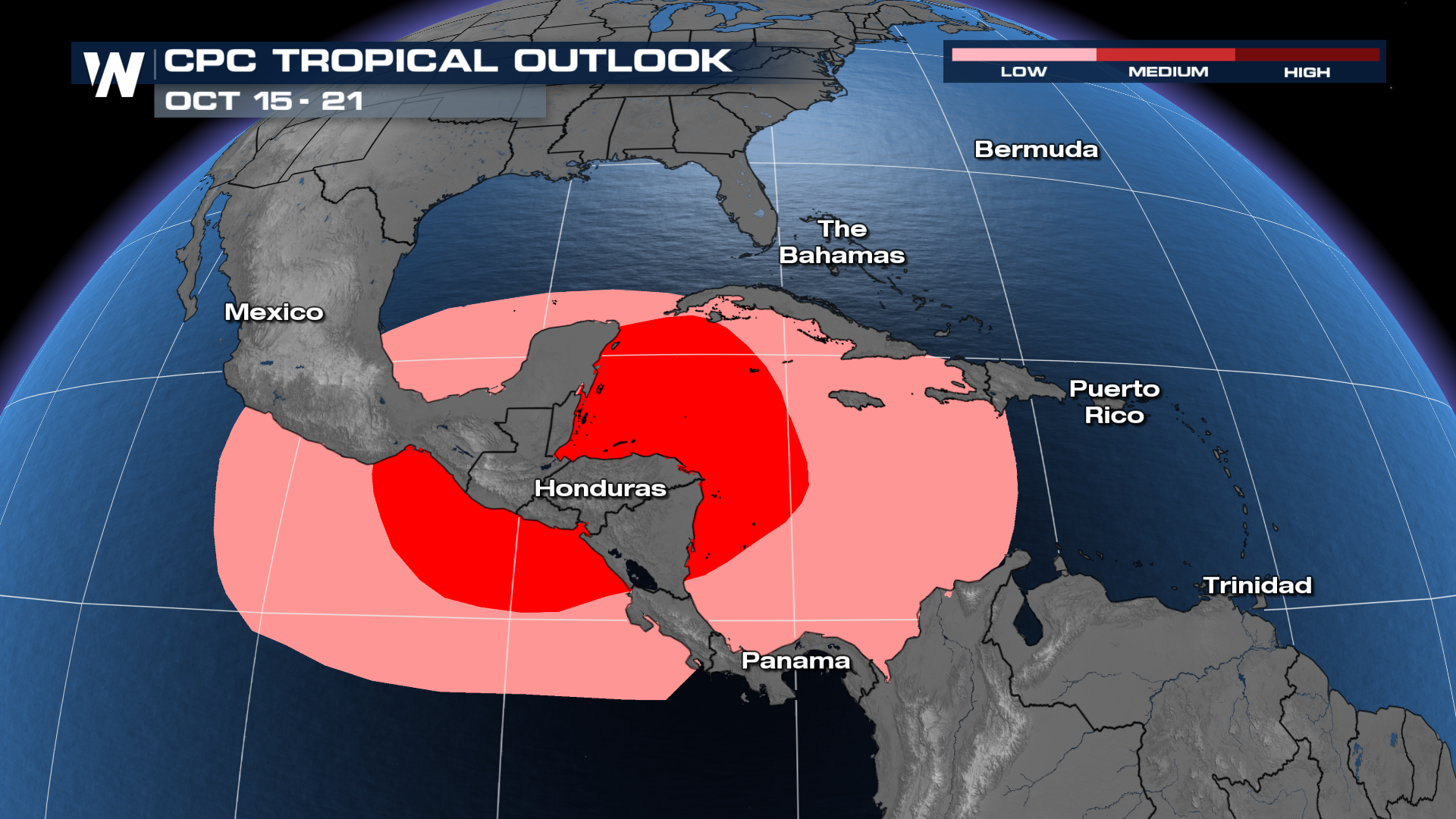
The Climate Prediction Center (CPC) has outlined a few regions with chances for tropical development through the middle/end of October.
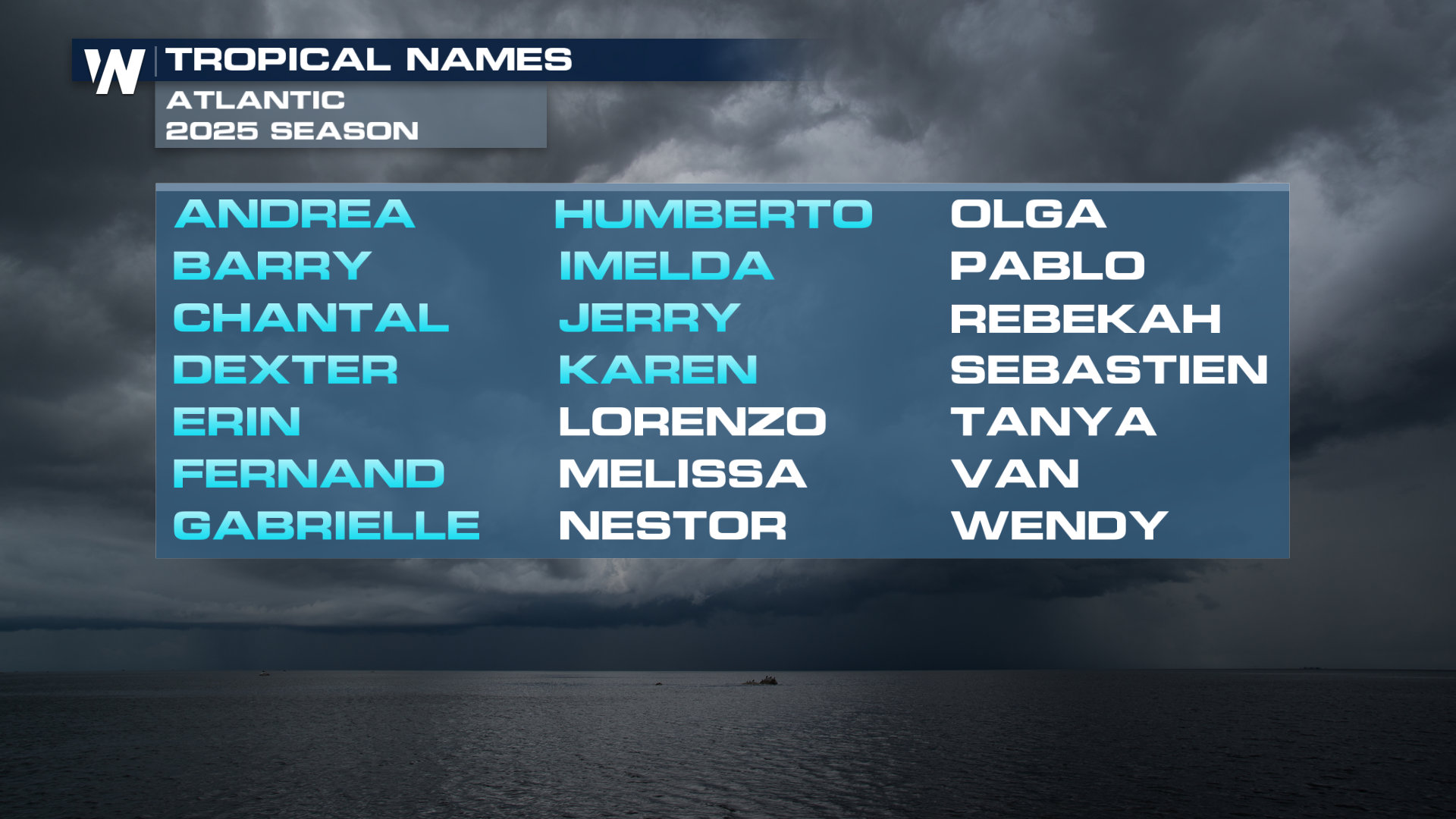
The next names on the 2025 Atlantic Hurricane list are Lorenzo and Melissa.
Make sure to stay tuned to WeatherNation for the latest on the tropics.


