October Nor'easter Wrapping Up For the Atlantic

A low-pressure system that has tracked up the East Coast continues to bring threats of coastal flooding, heavy rainfall, and strong winds. While this system has not developed, and is not expected to develop, any tropical characteristics, it’s behaving much like an early-season Nor’easter, delivering similar impacts minus the cold and snow. Areas along the shores of North Carolina to New England were impacted by this system.
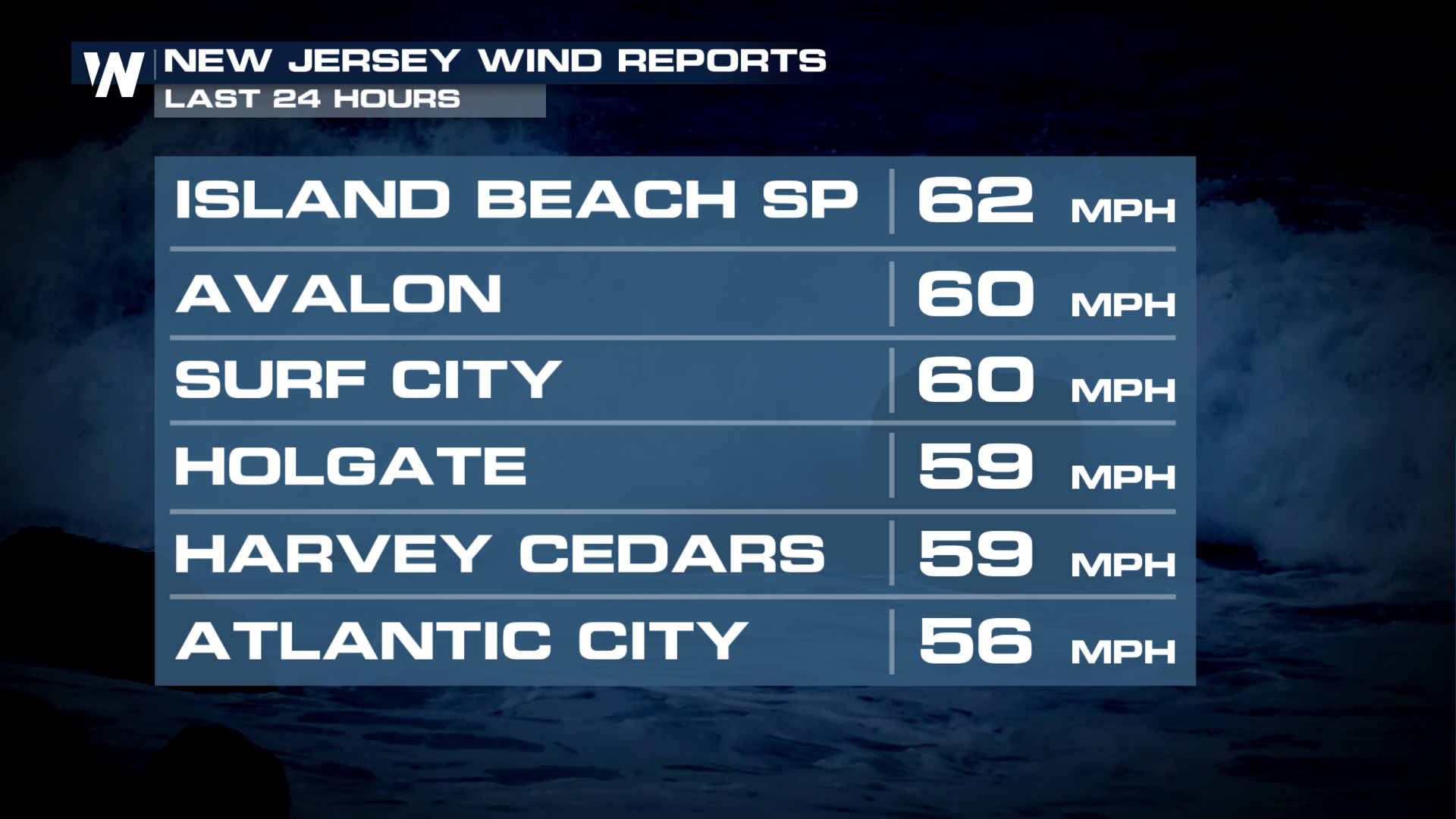
The system is expected to move away from the coast through Tuesday but New Jersey still had a handful of strong wind reports on Monday.
Rainfall
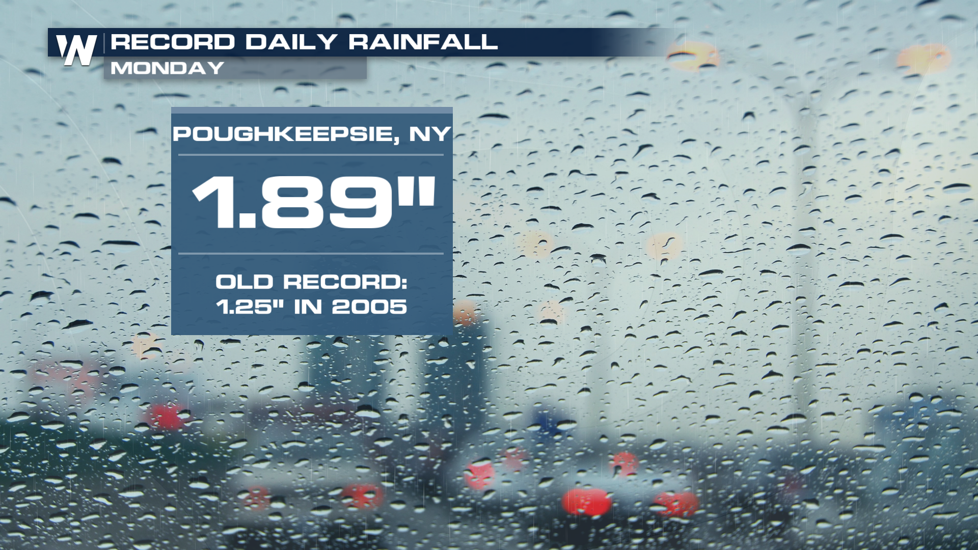
Heavy rain was very localized from this system, and will be far and few especially as it moves away from the East Coast. But a few daily rainfall records were still broken on Monday.
A few scattered rain showers still remain possible.
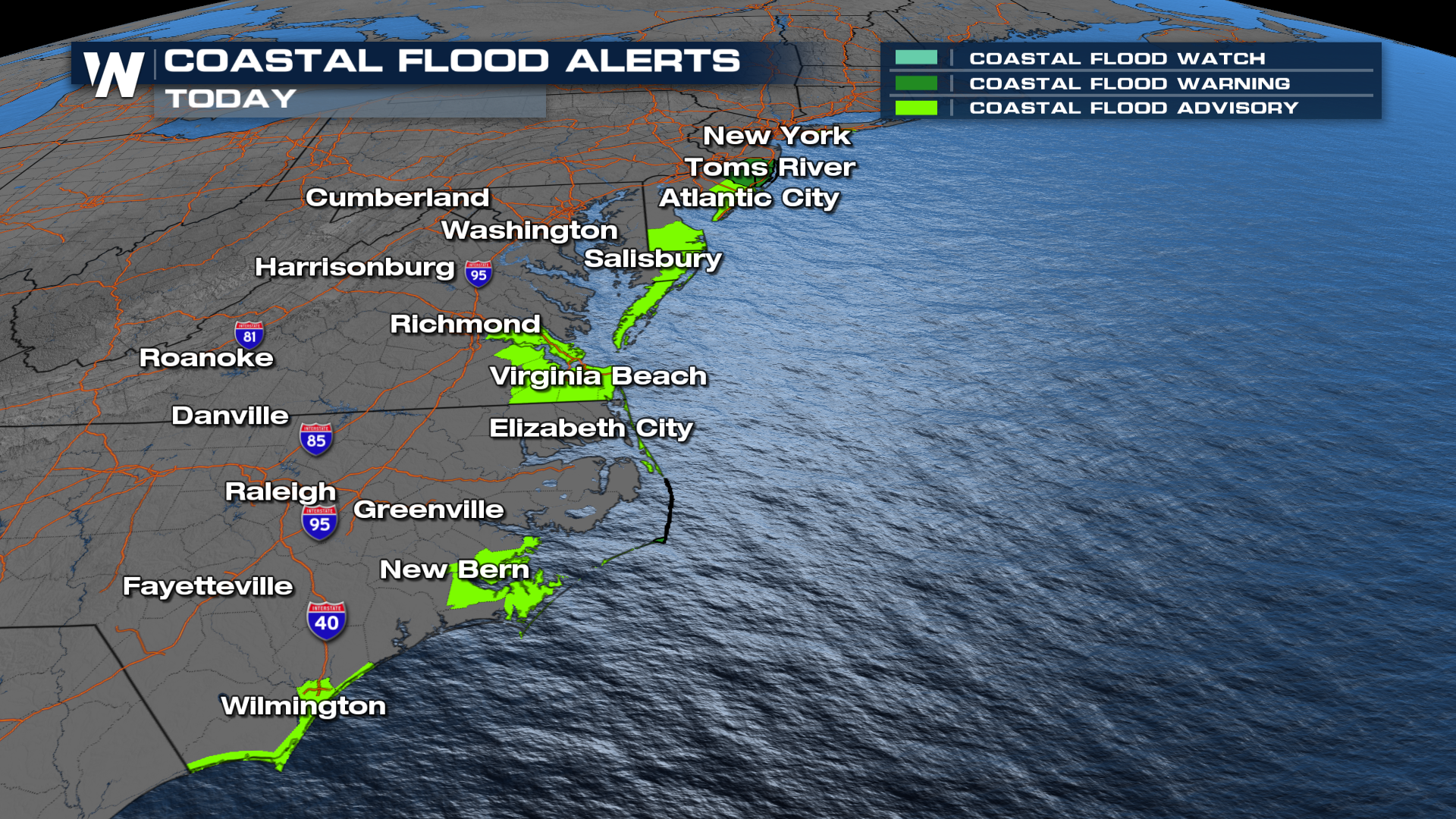
Coastal flood alerts have been slowly ending for much of the Atlantic Coast. Sea water flooding during high tides could still approach 2-3 feet of inundation in some areas (warning areas in dark green).
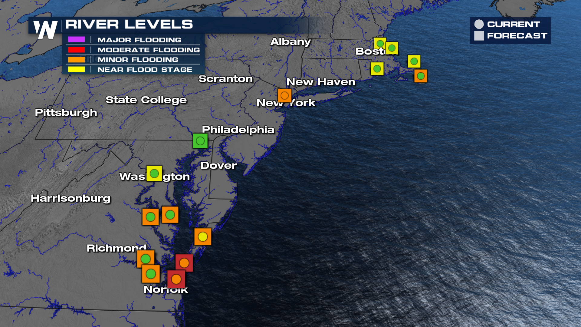
The major flood stage is expected to be reached around the southern Chesapeake, mostly during high tides. Prepare for sea water inundation to continue into Monday.
Stay with WeatherNation for the latest updates.


