Next Big Push of Moisture in the Northwest

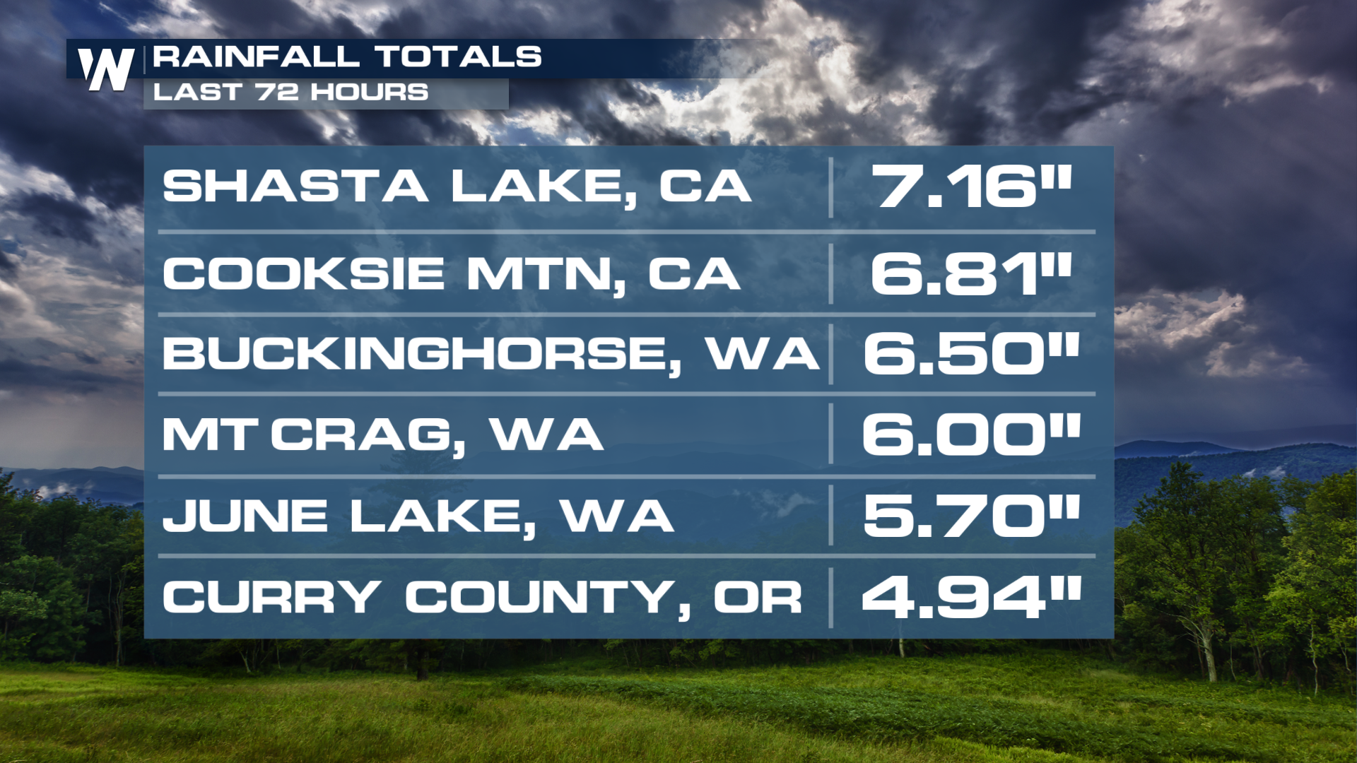
A series of atmospheric rivers has been responsible for wet, windy, and snowy weather in the northwestern U.S over the last few weeks. Our system is currently moving through Washington, Oregon, and the northern tier of California, bringing heavy rainfall and snow. Above is the forecast rainfall totals for the next several days. Gold Beach in Oregon has already picked up 2.51" of rainfall in the past 24 hours.
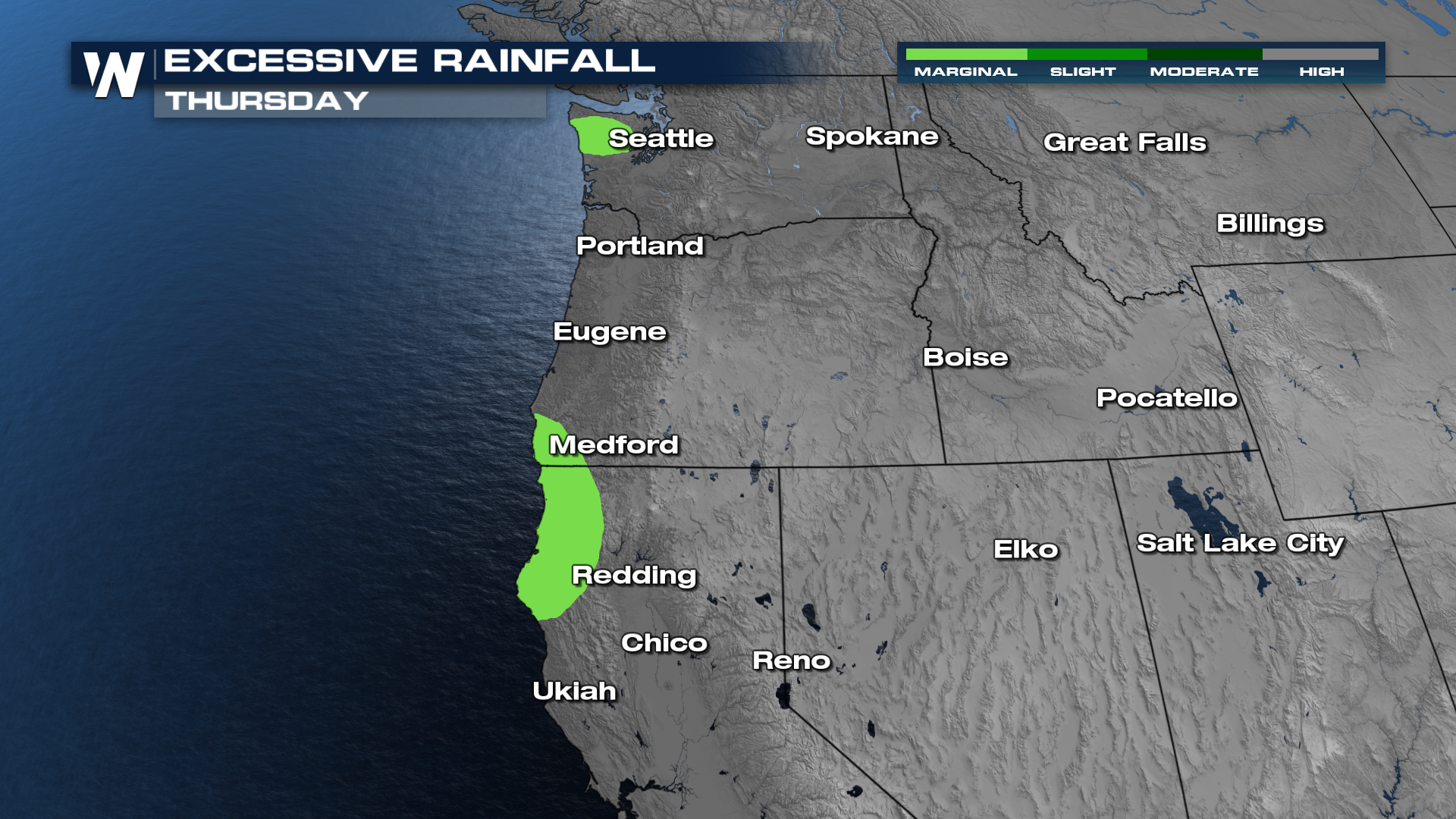
With multiple inches of rain on the way, the Weather Prediction Center is monitoring coastal areas at a level 1, MARGINAL, risk for excessive rainfall that may lead to flash flooding.
Timing
Precipitation across the Northwest should continue for the next few hours. Conditions will slowly improve Friday into the weekend before we gear up for the next round of Pacific moisture next week.
Snow
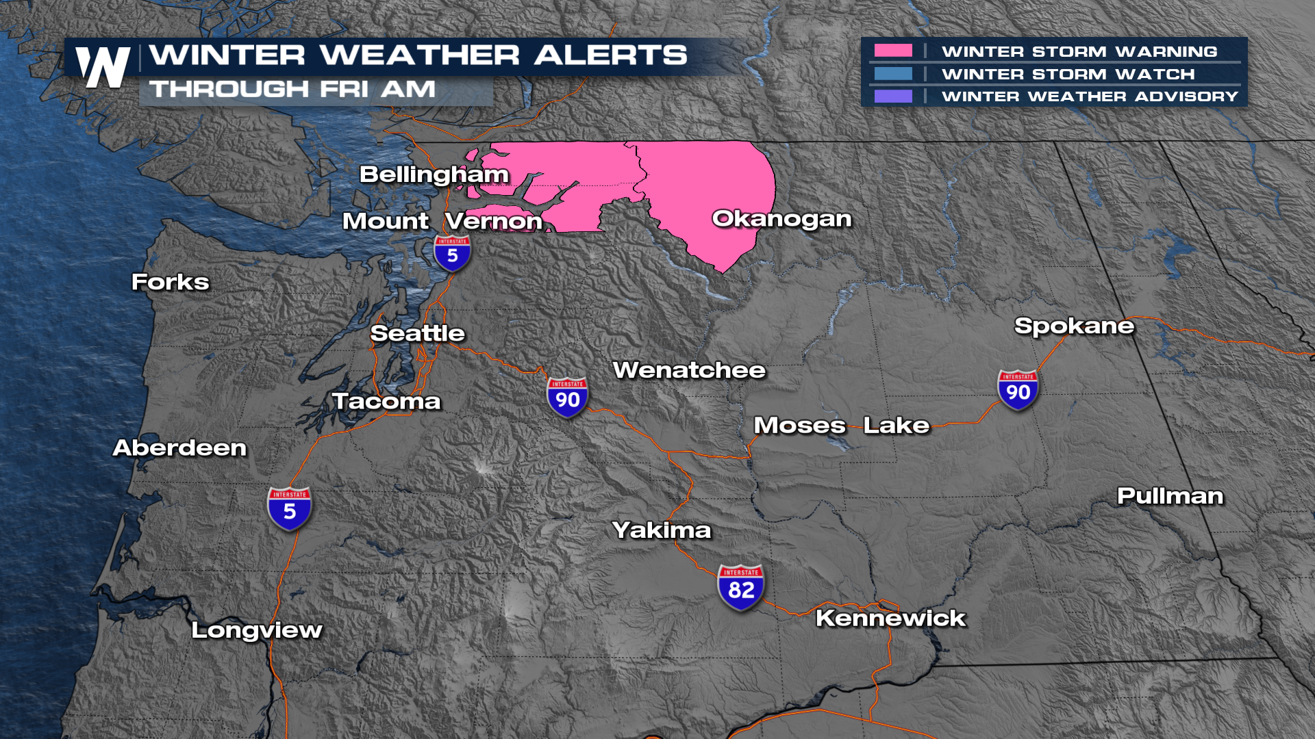
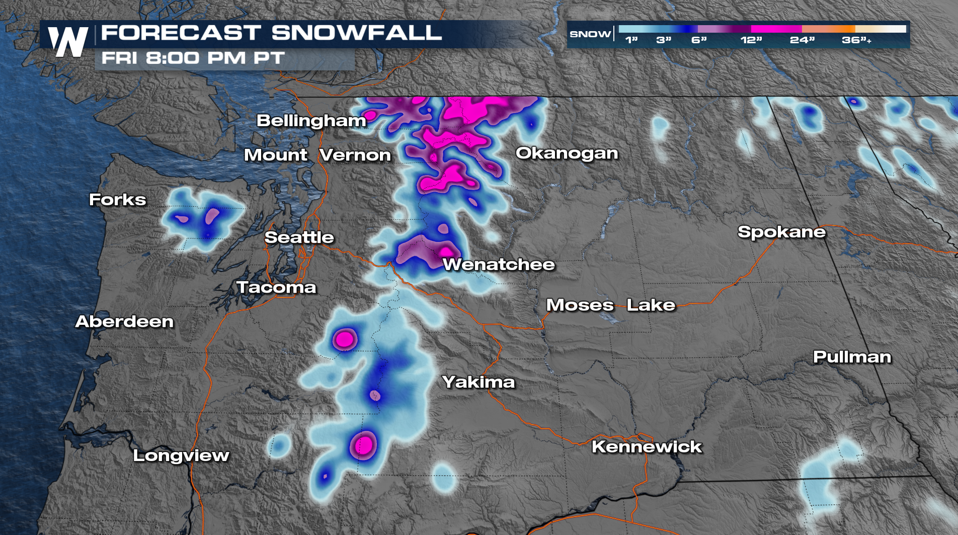
As some of that moisture makes its way into the higher elevation mountains, it will likely mean heavy snow for the mountains. Places like the Cascades and Northern Rockies are expected to get anywhere from 6" to up to a foot of snow or more!
 Be sure to join us at :50 past the hour for more details during your West Regional Forecast.


