Upgraded North Dakota Tornado Ends EF-5 Drought

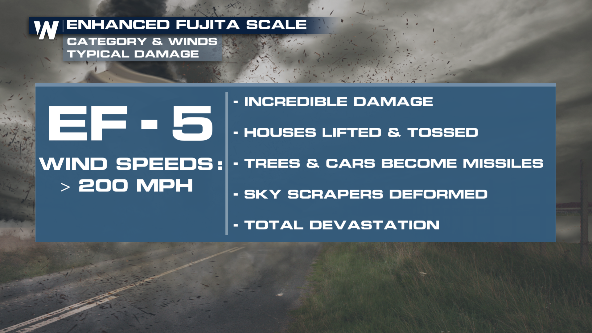
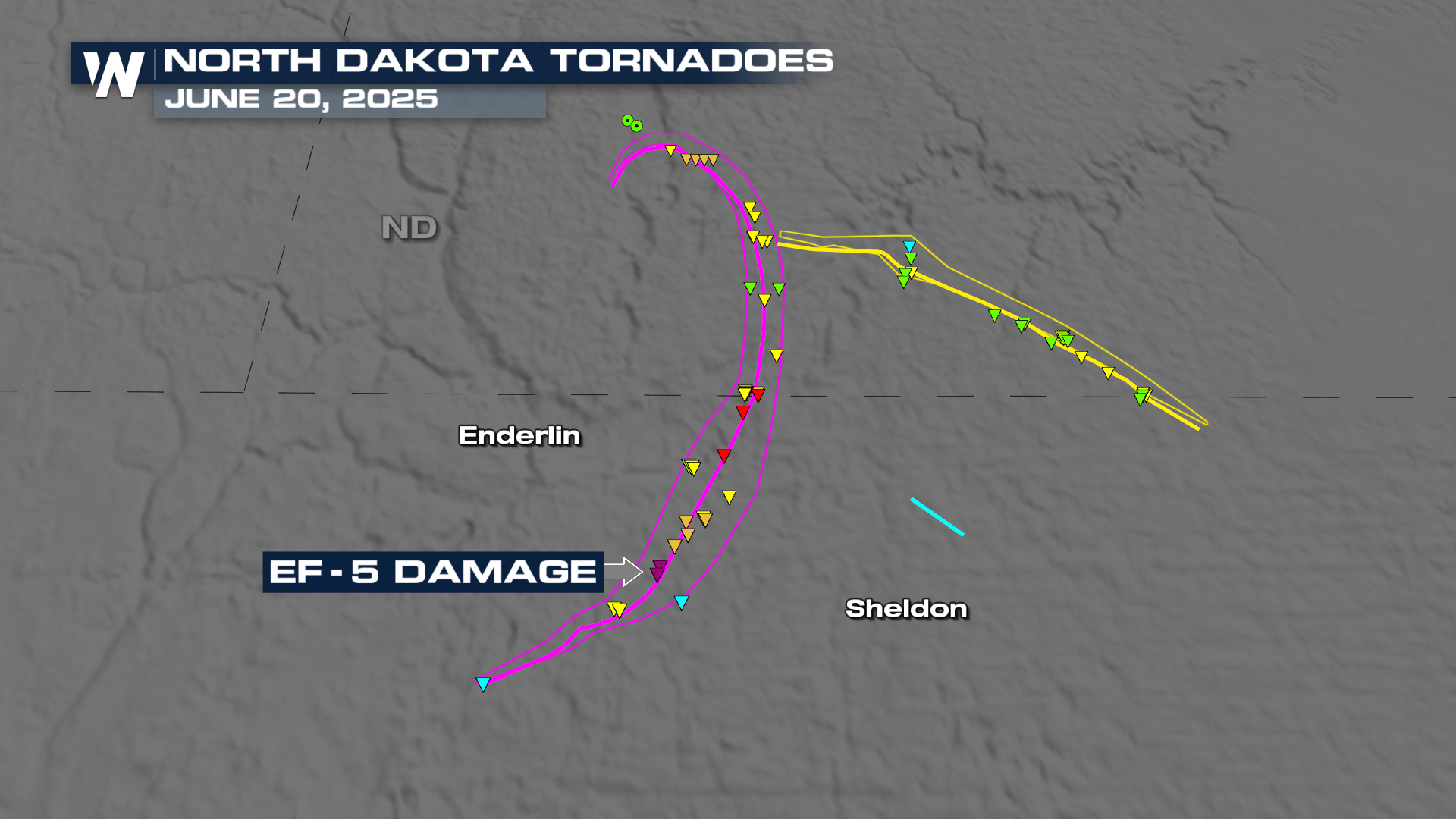
The National Weather Service in Grand Forks, ND, has ruled that a tornado near Enderlin, ND, caused EF-5 level damage upon further investigation. This marks the end of 12 years without a surveyed EF-5 tornado in the U.S. The last time EF-5 damage was reported from a tornado was in May of 2013 in Moore, OK.
The tornado is estimated to have wind speeds greater than 210 miles per hour. This tornado was on the ground for 12.1 miles with a width of just over a mile! Sadly, this storm caused three fatalities.
Here is more on what led the NWS to upgrade its survey findings:
"The National Weather Service in Grand Forks conducted additional surveys and worked extensively with wind damage experts to further investigate the 20 June 2025 Enderlin, ND tornado #1. The estimated maximum wind speed of the Enderlin, ND tornado #1 is greater than 210 mph and occurred during the time of the train derailment south of Enderlin, ND. The analysis involved forensic damage wind speed estimates for tipping several fully-loaded grain hopper cars and lofting of tanker cars, including one empty tanker car that was tossed about 475.7 ft (145 m)."
 We spoke with the National Weather Service in Grand Forks, ND, to learn more about the decision to upgrade the tornado rating and the factors that influenced the decision.
SET-UP
On June 20, 2025, a derecho brought wind gusts of 70 -105 mph to the north central U.S., spanning over 400 miles and leaving hundreds of thousands of households without power. Multiple long-track, destructive tornadoes were within this storm system.
A derecho is a long-lived severe wind event, with specific criteria about the length and width of the damaging wind swath. The SPC has a detailed page dedicated to these destructive windstorms. Several typically occur each year, though they can vary in intensity and area. A notable derecho ripped through Des Moines in 2020, producing hurricane-force winds and widespread damage.
OTHER REPORTS
Wind gusts in North Dakota and Minnesota (as well as northern South Dakota) were impressive, many over hurricane strength. A wake-low also developed behind the leading edge, producing severe strength winds (58+ mph) in some locations for over an hour!
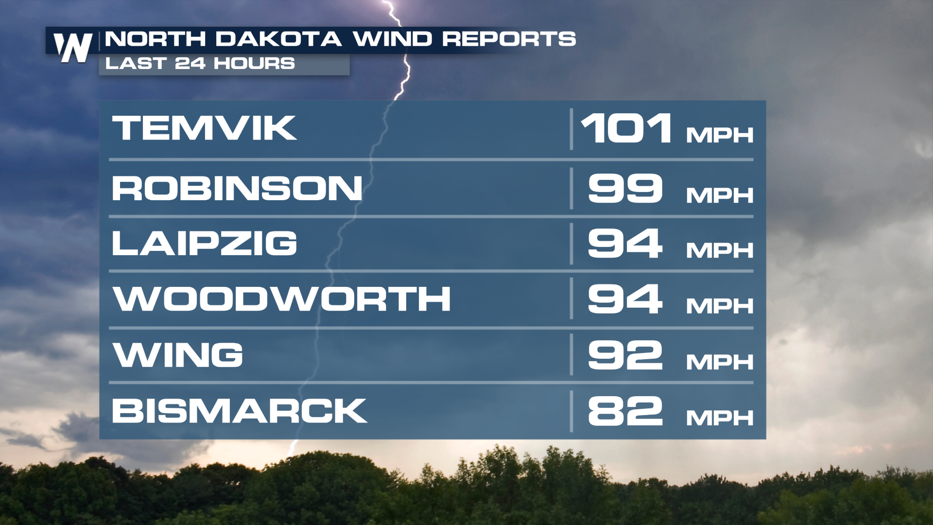 Bemidji, Minnesota, was hit particularly hard in the overnight hours as an intense bout of winds moved through the area, with a tornado potentially embedded in the circulation. The Bemidji Regional Airport reported a gust to 106 mph, with widespread damage reported in the area.
 The widely spanning severe winds have left hundreds of thousands of households in the dark the following morning, with some counties reporting well over 60-60% of customers without power. As a reminder, if you're going to run a generator to power anything, keep it at least 25 feet away from any opening in your home, like windows and doors.
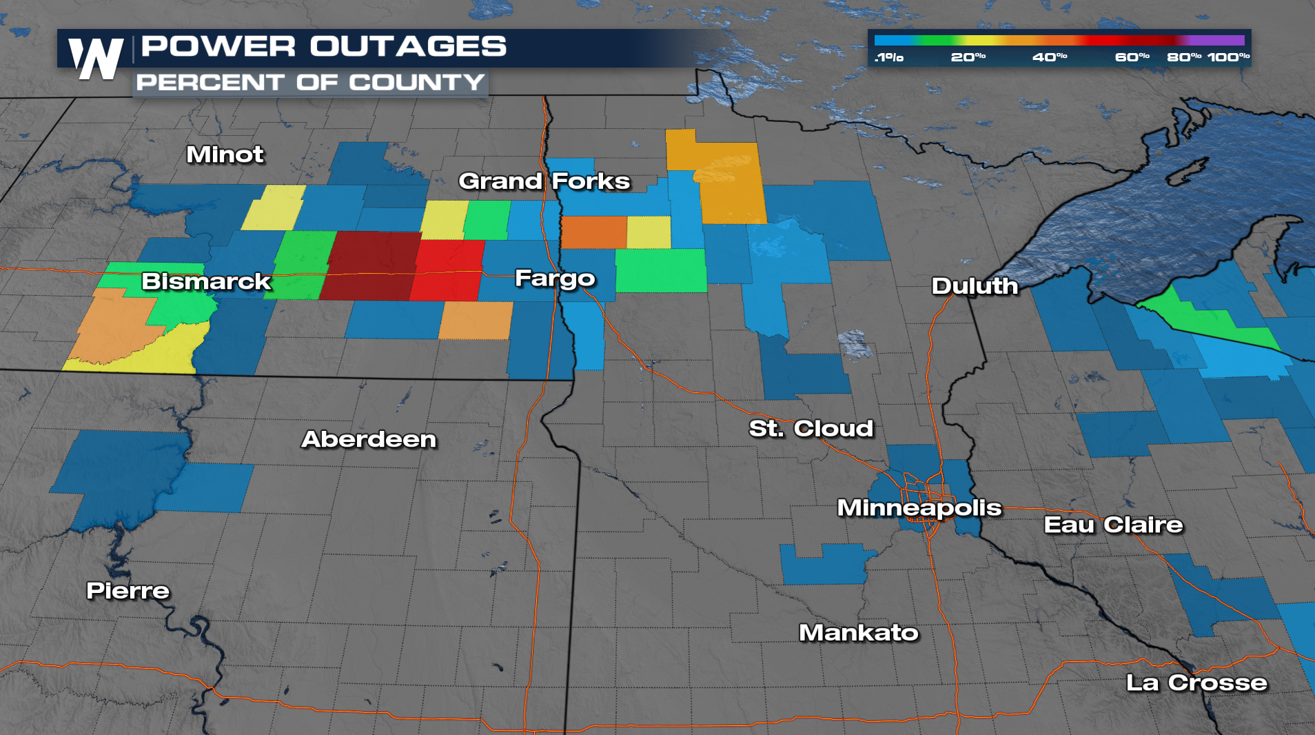
This was one of many severe weather events that pushed North Dakota to break their yearly tornado record.


